Footage of USGS streamgagers taking measurements on the Santa Cruz River in Arizona.
Videos
Explore videos related to water science and products.
Footage of USGS streamgagers taking measurements on the Santa Cruz River in Arizona.
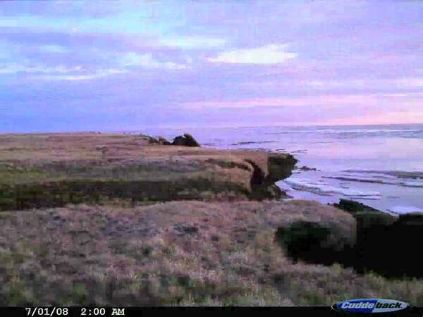
 Lake 31, NPR-A, AK Time-Lapse Photography of Lake Shore Erosion
4-week time-lapse photography of the shoreline of Lake 31 in NPR-A, coastal Arctic Alaska, demonstrates erosion mechanisms during July, 2008
4-week time-lapse photography of the shoreline of Lake 31 in NPR-A, coastal Arctic Alaska, demonstrates erosion mechanisms during July, 2008
 Drew Point, AK Time-Lapse Photography of Coastal Erosion
4-week time-lapse photography of the Arctic coast at Drew Point, AK shows mass wasting of the coastal sediments in July, 2008
4-week time-lapse photography of the Arctic coast at Drew Point, AK shows mass wasting of the coastal sediments in July, 2008
USGS streamgagers make a low flow measurement on the San Pedro River at Charleston.
USGS streamgagers make a low flow measurement on the San Pedro River at Charleston.
 Measuring Streamflow with Wading Rod Near Finchford
USGS employees using a wading rod to measure the streamflow over a road near Finchford, IA on 6/10/2008.
USGS employees using a wading rod to measure the streamflow over a road near Finchford, IA on 6/10/2008.
Video showing deer traversing flood waters and the affects on wildlife.
Video showing deer traversing flood waters and the affects on wildlife.
 Drew Point, AK Time-Lapse Photography of Coastal Erosion
4-week time-lapse photography of the Arctic coast at Drew Point, AK shows intense coastal erosion in early July, 2008
4-week time-lapse photography of the Arctic coast at Drew Point, AK shows intense coastal erosion in early July, 2008
 Monsoon-Rain Flow in an Ephemeral Channel near Sierra Vista, Arizona
As part of the assessment of the binational San Pedro aquifer, the effects of urbanization on runoff in ephemeral streams was studied. Ephemeral streams are those that flow in response to precipitation. Runoff in tributaries to the San Pedro River is important in understanding the water budget of the river.
As part of the assessment of the binational San Pedro aquifer, the effects of urbanization on runoff in ephemeral streams was studied. Ephemeral streams are those that flow in response to precipitation. Runoff in tributaries to the San Pedro River is important in understanding the water budget of the river.
USGS employees measuring flood flows on Rillito River in Tucson, Arizona.
USGS employees measuring flood flows on Rillito River in Tucson, Arizona.
USGS employees taking flood measurements using an Acoustic Doppler Current Profiler.
USGS employees taking flood measurements using an Acoustic Doppler Current Profiler.
 WRF Model Output: Cloud-top Temperature Simulation
Cloud-top temperature simulation for Arctic Alaska
Cloud-top temperature simulation for Arctic Alaska
Total precipitation simulation for Arctic Alaska
Total precipitation simulation for Arctic Alaska
Total precipitation simulation for Arctic Alaska
Total precipitation simulation for Arctic Alaska
 WRF Model Output: Surface Air Temperature Simulation
Surface air temperature simulation for Arctic Alaska
Surface air temperature simulation for Arctic Alaska
 Flood Measurement on Santa Cruz River (1993 and 2005)
Two historic flood measurements are made on the Santa Cruz River in Tucson, Arizona for the 1993 and 2005 floods.
Two historic flood measurements are made on the Santa Cruz River in Tucson, Arizona for the 1993 and 2005 floods.
 Glenwood Canyon, Colorado: Interstate 70 Rockslide of November 25, 2004
The rockslide occurred about nine miles east of Glenwood Springs in Glenwood Canyon (Colorado) at 7:42 am, November 25, 2004, according officials from the Colorado Department of Transportation (CDOT).
The rockslide occurred about nine miles east of Glenwood Springs in Glenwood Canyon (Colorado) at 7:42 am, November 25, 2004, according officials from the Colorado Department of Transportation (CDOT).
This video documents two USGS employees taking a flood measurement during the most severe flood Arizona has seen in 100 years.
This video documents two USGS employees taking a flood measurement during the most severe flood Arizona has seen in 100 years.


