
Marbled Godwit near Ugashik, Alaska.
Images
Explore our planet through photography and imagery, including climate change and water all the way back to the 1800s when the USGS was surveying the country by horse and buggy.
Filter Total Items: 21558

Marbled Godwit near Ugashik, Alaska
Marbled Godwit near Ugashik, Alaska.

Short Creek
Short Creek (a tributary of the Souris River in North Dakota) below International Boundary near Roche Percee, Saskatchewan, Canada.
Short Creek (a tributary of the Souris River in North Dakota) below International Boundary near Roche Percee, Saskatchewan, Canada.
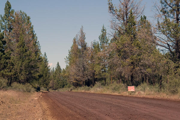
A pine forest with a dirt road running through it in Oregon
A pine forest with a dirt road running through it in Oregon. Photo taken as a part of field work during the Land Cover Trends project.
A pine forest with a dirt road running through it in Oregon. Photo taken as a part of field work during the Land Cover Trends project.

Cratered Cones in the Isidis Region
Cratered Cones in the Isidis Region, Mars. These are almost certainly not cinder cones despite their appearance. Their alignment in rows is not typical of cinder cones on Earth; more likely these are mud volcanoes formed from the shaking of an impact event.
Cratered Cones in the Isidis Region, Mars. These are almost certainly not cinder cones despite their appearance. Their alignment in rows is not typical of cinder cones on Earth; more likely these are mud volcanoes formed from the shaking of an impact event.

Landscape in Washington state with forest, mountain, and houses
A landscape photograph of a valley with a mountain in the background. The valley consists of forests and residential housing.
A landscape photograph of a valley with a mountain in the background. The valley consists of forests and residential housing.

Sage-Grouse Population Model
Changes to greater sage-grouse distribution in the American West predicted by a new scientific model based on extensive study of sage-grouse range contraction. "Likely secure populations" indicates areas where sage-grouse are present and currently stable. "Currently extirpated" indicates areas where sage-grouse are now locally extinct, as the model predicted.
Changes to greater sage-grouse distribution in the American West predicted by a new scientific model based on extensive study of sage-grouse range contraction. "Likely secure populations" indicates areas where sage-grouse are present and currently stable. "Currently extirpated" indicates areas where sage-grouse are now locally extinct, as the model predicted.

Flooding in Cedar Rapids, IA
Flooding downtown near 1st Street and A Ave.
Flooding downtown near 1st Street and A Ave.

Flooding in Cedar Rapids, IA
Flooding downtown near 1st Street and A Ave.
Flooding downtown near 1st Street and A Ave.

Flooding in Cedar Rapids, IA
Flooding downtown near 1st Street and A Ave.
Flooding downtown near 1st Street and A Ave.

Flooding in Cedar Rapids, IA
Flooding downtown near 1st Street and A Ave.
Flooding downtown near 1st Street and A Ave.

Flooding in Cedar Rapids, IA
Flooding downtown near 1st Street and A Ave.
Flooding downtown near 1st Street and A Ave.

Flooding in Cedar Rapids, IA
Flooding downtown near 1st Street and A Ave.
Flooding downtown near 1st Street and A Ave.

Flooding in Cedar Rapids, IA
Flooding downtown near 1st Street and A Ave.
Flooding downtown near 1st Street and A Ave.

Flooding in Cedar Rapids, IA
Flooding downtown near 1st Street and A Ave.
Flooding downtown near 1st Street and A Ave.

Flooding in Cedar Rapids, IA
Flooding downtown near 1st Street and A Ave.
Flooding downtown near 1st Street and A Ave.

Flooding in Cedar Rapids, IA
Flooding downtown near 1st Street and A Ave.
Flooding downtown near 1st Street and A Ave.

Gas plume rising from Halema‘uma‘u, Kīlauea, Hawai‘i
Gas plume rising from Halema‘uma‘u Crater, Kīlauea Volcano, Hawai‘i
Gas plume rising from Halema‘uma‘u Crater, Kīlauea Volcano, Hawai‘i

Laughing Gull on a Guano-Streaked Boulder
Laughing gull sitting atop a guano-streaked boulder beside a Caribbean beach. Species identification is tentative.
Laughing gull sitting atop a guano-streaked boulder beside a Caribbean beach. Species identification is tentative.

Laughing Gull on a Guano-Streaked Boulder
Laughing gull sitting atop a guano-streaked boulder beside a Caribbean beach. Species identification is tentative.
Laughing gull sitting atop a guano-streaked boulder beside a Caribbean beach. Species identification is tentative.

Rocky Coastal Cove
Rocky coastal cove and blue waters.
Rocky coastal cove and blue waters.

Rocky Coastal Cove
Rocky coastal cove and blue waters.
Rocky coastal cove and blue waters.