
Uncrewed aircraft systems (UAS) flights on October 5, 2022, allowed for aerial visual and thermal imagery to be collected of Halema‘uma‘u crater at the summit of Kīlauea. The active lake surface is limited to the western portion of the crater.
Images
Volcano Hazard Program images.
Filter Total Items: 6226

October 5, 2022—Kīlauea summit UAS thermal maps
Uncrewed aircraft systems (UAS) flights on October 5, 2022, allowed for aerial visual and thermal imagery to be collected of Halema‘uma‘u crater at the summit of Kīlauea. The active lake surface is limited to the western portion of the crater.

October 5, 2022—Kīlauea summit UAS thermal maps
Uncrewed aircraft systems (UAS) flights on October 5, 2022, allowed for aerial visual and thermal imagery to be collected of Halema‘uma‘u crater at the summit of Kīlauea. The active lake surface is limited to the western portion of the crater.
Uncrewed aircraft systems (UAS) flights on October 5, 2022, allowed for aerial visual and thermal imagery to be collected of Halema‘uma‘u crater at the summit of Kīlauea. The active lake surface is limited to the western portion of the crater.

“Noisy” InSAR interferogram examples covering the Island of Hawaiʻi
“Noisy” InSAR interferogram examples covering the Island of Hawaiʻi. (A) shows data that spans 12 days. This InSAR image show similar concentric ring patterns over both Mauna Loa and Mauna Kea.
“Noisy” InSAR interferogram examples covering the Island of Hawaiʻi. (A) shows data that spans 12 days. This InSAR image show similar concentric ring patterns over both Mauna Loa and Mauna Kea.

2022 Kīlauea GPS Campaign
In September 2022, HVO scientists set up GPS equipment at various benchmarks on Kīlauea volcano as part of routine annual deformation monitoring. USGS photo by A.P. Ellis.
In September 2022, HVO scientists set up GPS equipment at various benchmarks on Kīlauea volcano as part of routine annual deformation monitoring. USGS photo by A.P. Ellis.

Kīlauea summit eruption reference map gif of the past year
This animated gif shows one year of reference maps depicting the ongoing Kīlauea summit eruption, which began on September 29, 2021. The animated gif shows how the active lava lake has decreased in area over the past year, while the crater floor has grown in area.
This animated gif shows one year of reference maps depicting the ongoing Kīlauea summit eruption, which began on September 29, 2021. The animated gif shows how the active lava lake has decreased in area over the past year, while the crater floor has grown in area.

Kīlauea summit eruption reference maps over the past year
This animated gif shows one year of reference maps depicting the ongoing Kīlauea summit eruption, which began on September 29, 2021. The animated gif shows how the active lava lake has decreased in area over the past year, while the crater floor has grown in area.
This animated gif shows one year of reference maps depicting the ongoing Kīlauea summit eruption, which began on September 29, 2021. The animated gif shows how the active lava lake has decreased in area over the past year, while the crater floor has grown in area.

KWcam image September 29, 2022, at 11:03 a.m. HST
This image, taken from the KWcam around 11 am on September 29, 2022, shows the lava lake and ongoing eruption within Halemaʻumaʻu crater, at the summit of Kīlauea volcano.
This image, taken from the KWcam around 11 am on September 29, 2022, shows the lava lake and ongoing eruption within Halemaʻumaʻu crater, at the summit of Kīlauea volcano.

Kīlauea summit thermal maps over the past year
This animated gif shows one year of thermal maps made from aerial visual and thermal imagery collected of Halema‘uma‘u crater at the summit of Kīlauea. The animated gif shows how the active lava lake has decreased in area over the past year, while the crater floor has grown in area.
This animated gif shows one year of thermal maps made from aerial visual and thermal imagery collected of Halema‘uma‘u crater at the summit of Kīlauea. The animated gif shows how the active lava lake has decreased in area over the past year, while the crater floor has grown in area.

September 27, 2022, KWcam image of Halemaʻumaʻu crater at Kīlauea's summit
KWcam image taken on September 27, 2022. The floor of Halemaʻumaʻu has grown in area and elevation due to the ongoing eruption in crater. The island that formed on December 20, 2020, is surrounded by younger lava flows so what is seen on the surface of Halemaʻumaʻu crater floor today represents the oldest and youngest deposits from these recent eruptions!
KWcam image taken on September 27, 2022. The floor of Halemaʻumaʻu has grown in area and elevation due to the ongoing eruption in crater. The island that formed on December 20, 2020, is surrounded by younger lava flows so what is seen on the surface of Halemaʻumaʻu crater floor today represents the oldest and youngest deposits from these recent eruptions!

September 27, 2022 — Halema‘uma‘u crater floor, Kīlauea summit
B1cam webcam image taken from the east rim of Halema‘uma‘u, at the summit of Kīlauea, on September 27, 2022.
B1cam webcam image taken from the east rim of Halema‘uma‘u, at the summit of Kīlauea, on September 27, 2022.

September 23, 2022 — Slight drop in lava lake level at Kīlauea summit
Following a slight drop in the lava lake and subsidence of the crater floor on September 20, at the summit of Kīlauea, the lava lake level has remained several meters (above ten feet) below its rim. USGS photo by M. Patrick on September 23, 2022.
Following a slight drop in the lava lake and subsidence of the crater floor on September 20, at the summit of Kīlauea, the lava lake level has remained several meters (above ten feet) below its rim. USGS photo by M. Patrick on September 23, 2022.

September 23, 2022 — Kīlauea
On September 20, 2022, a slight drop in lava lake level at the summit of Kīlauea resulted in stagnation of the small lava pond that was supplied by the main lava lake. The drop in lava level left a narrow bridge of solidified lava over the pathway between these two areas USGS photo by M. Patrick.
On September 20, 2022, a slight drop in lava lake level at the summit of Kīlauea resulted in stagnation of the small lava pond that was supplied by the main lava lake. The drop in lava level left a narrow bridge of solidified lava over the pathway between these two areas USGS photo by M. Patrick.

September 23, 2022 — Kīlauea
The west vent remains active in Halema‘uma‘u, at the summit of Kīlauea. The vent area consisted of several small spatter cones with incandescent openings, along with weak, sporadic, spattering. USGS photo by M. Patrick.
The west vent remains active in Halema‘uma‘u, at the summit of Kīlauea. The vent area consisted of several small spatter cones with incandescent openings, along with weak, sporadic, spattering. USGS photo by M. Patrick.

Activity in Halema‘uma‘u September 20-21, 2022
This animated gif of images from the thermal F1cam on the west rim of Halemaʻumaʻu crater shows changes to the crater floor from September 20-21, 2022. Increased seismicity and ground deformation rates likely represented a temporary blockage in the eruption of lava at Halemaʻumaʻu, causing pressurization below the surface.
This animated gif of images from the thermal F1cam on the west rim of Halemaʻumaʻu crater shows changes to the crater floor from September 20-21, 2022. Increased seismicity and ground deformation rates likely represented a temporary blockage in the eruption of lava at Halemaʻumaʻu, causing pressurization below the surface.

September 20, 2022 — Halema‘uma‘u subsidence from B1 cam
This animated gif of images from the B1cam on the east rim of Halemaʻumaʻu crater shows changes to the crater floor during the afternoon of September 20, 2022. The lava lake level dropped 23-feet (7-meters) and the crater floor surrounding the lava lake also subsided by several yards (several meters). USGS animated gif.
This animated gif of images from the B1cam on the east rim of Halemaʻumaʻu crater shows changes to the crater floor during the afternoon of September 20, 2022. The lava lake level dropped 23-feet (7-meters) and the crater floor surrounding the lava lake also subsided by several yards (several meters). USGS animated gif.

September 15, 2022 — Beautiful morning at Kīlauea summit
As HVO geologists pulled up in the car to make measurements of the Halema‘uma‘u lava lake the morning of September 15, 2022, this was the spectacular sight that met them at the end of Crater Rim Drive. Steam rose from ground cracks across Kīlauea caldera and clouds were spilling over the eastern caldera rim.
As HVO geologists pulled up in the car to make measurements of the Halema‘uma‘u lava lake the morning of September 15, 2022, this was the spectacular sight that met them at the end of Crater Rim Drive. Steam rose from ground cracks across Kīlauea caldera and clouds were spilling over the eastern caldera rim.

September 15, 2022 — Halema‘uma‘u lava lake, Kīlauea
The steaming summit lava lake of Kīlauea in the 7 a.m. morning light of September 15. HVO geologists heard the west vent softly puffing and an insistent high-pitched hissing from the steaming northeastern embayment of the active lava pond in Halema‘uma‘u. A deeper toned hiss occasionally joined in from somewhere on the eastern side of the lake.
The steaming summit lava lake of Kīlauea in the 7 a.m. morning light of September 15. HVO geologists heard the west vent softly puffing and an insistent high-pitched hissing from the steaming northeastern embayment of the active lava pond in Halema‘uma‘u. A deeper toned hiss occasionally joined in from somewhere on the eastern side of the lake.

September 15, 2022 — Kīlauea west vent
The western vent in Halema‘uma‘u was steaming heavily the morning of September 15. A small glowing spot could be seen when looking through the laser rangefinder instrument, which is used to measure distances. This close-up view also revealed a small blanket of tephra on the slope of the cone that has been created by spattering at the vent.
The western vent in Halema‘uma‘u was steaming heavily the morning of September 15. A small glowing spot could be seen when looking through the laser rangefinder instrument, which is used to measure distances. This close-up view also revealed a small blanket of tephra on the slope of the cone that has been created by spattering at the vent.

Ahuʻailāʻau GPR Survey
The top panel shows a shaded relief map of Ahuʻailāʻau and the locations of the survey lines in black, with the radar line below highlighted in yellow. The lower panel shows an annotated radargram, noting where the GPR saw reflective boundaries in thicker black lines.
The top panel shows a shaded relief map of Ahuʻailāʻau and the locations of the survey lines in black, with the radar line below highlighted in yellow. The lower panel shows an annotated radargram, noting where the GPR saw reflective boundaries in thicker black lines.
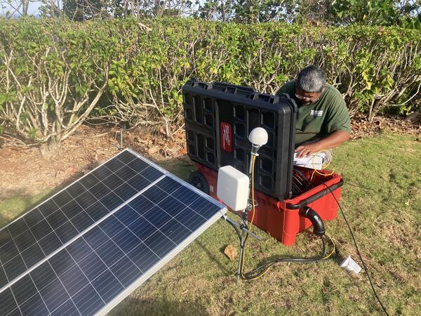
September 14, 2022 — Tutuila seismic station installation
A USGS scientist installs a seismic station on Tutuila island in American Samoa. This station joins several other stations recently installed in the Manu‘a Islands to monitor activity in American Samoa. USGS photo by A. Ellis.
A USGS scientist installs a seismic station on Tutuila island in American Samoa. This station joins several other stations recently installed in the Manu‘a Islands to monitor activity in American Samoa. USGS photo by A. Ellis.

September 13, 2022—Kīlauea summit eruption reference map
This reference map depicts the ongoing Kīlauea summit eruption on September 13, 2022. One eruptive vent (orange) is active within Halema‘uma‘u, on the western side of the crater floor. An adjacent pond (purple) is feeding lava to a larger lake (red) via a crusted-over tube.
This reference map depicts the ongoing Kīlauea summit eruption on September 13, 2022. One eruptive vent (orange) is active within Halema‘uma‘u, on the western side of the crater floor. An adjacent pond (purple) is feeding lava to a larger lake (red) via a crusted-over tube.