
Wabash River at New Harmony IN - view from bank
Images
Images intro.
Filter Total Items: 641

Wabash River at New Harmony IN - view from bank
Wabash River at New Harmony IN - view from bank

Wabash River at New Harmony IN - view of bridge
Wabash River at New Harmony IN - view of bridge
Wabash River at New Harmony IN - view of bridge

Wabash River at New Harmony IN - view from right bank
Wabash River at New Harmony IN - view from right bank
Wabash River at New Harmony IN - view from right bank

Wabash River at New Harmony IN - boat launch
Wabash River at New Harmony IN - boat launch
Wabash River at New Harmony IN - boat launch

Wabash River at New Harmony IN - view from left bank
Wabash River at New Harmony IN - view from left bank
Wabash River at New Harmony IN - view from left bank

Wabash River at New Harmony IN - flooding at museum
Wabash River at New Harmony IN - flooding at museum
Wabash River at New Harmony IN - flooding at museum

Wabash River at New Harmony IN - museum
Wabash River at New Harmony IN - museum
Wabash River at New Harmony IN - museum

Wabash River at New Harmony IN - right bank overflow with debris
Wabash River at New Harmony IN - right bank overflow with debris
Wabash River at New Harmony IN - right bank overflow with debris

Wabash River at New Harmony IN - right bank to left bank view
Wabash River at New Harmony IN - right bank to left bank view
Wabash River at New Harmony IN - right bank to left bank view

Ice rings on tree on Auglaize River
This picture was taken January 16 by Hydro Tech Tim Nicholson as he was assessing site conditions for a discharge measurement, which he determined was unsafe to make. 04191500 Auglaize River near Defiance
This picture was taken January 16 by Hydro Tech Tim Nicholson as he was assessing site conditions for a discharge measurement, which he determined was unsafe to make. 04191500 Auglaize River near Defiance

Frog liver with SPI
This photomicrograph shows a liver of a frog with a severe Perkinsea infection.
This photomicrograph shows a liver of a frog with a severe Perkinsea infection.

Monarch on Joe Pyeweed plant
Monarch butterfly on a Joe Pyeweed plant.
Monarch butterfly on a Joe Pyeweed plant.

Monarch on hairy puccoon
A monarch butterfly on a hairy puccoon plant.
A monarch butterfly on a hairy puccoon plant.

USGS scientist collecting samples of aquatic species from Pike River
USGS scientist collecting samples of aquatic species from the Pike River, Wis., for later analysis of mercury contamination
USGS scientist collecting samples of aquatic species from the Pike River, Wis., for later analysis of mercury contamination

USGS owned Unmanned Aircraft System
Photograph of USGS Kentucky WSC unmanned aircraft system.
Photograph of USGS Kentucky WSC unmanned aircraft system.

Chelonid herpesvirus 5 replication
This microscopic image shows a sun-shaped area within turtle skin cells where chelonid herpesvirus 5 replicates. The virus capsids, or protein shells, are arrayed like a corona around the circle. ChHV5 is associated with fibropapillomatosisa tumor disease affecting endangered green turtles.
This microscopic image shows a sun-shaped area within turtle skin cells where chelonid herpesvirus 5 replicates. The virus capsids, or protein shells, are arrayed like a corona around the circle. ChHV5 is associated with fibropapillomatosisa tumor disease affecting endangered green turtles.
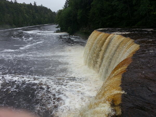
Tahquamenon River, MI Toxic Substances and areas of concern
Photo of Tahquamenon River, MI
Toxic Substances and Areas of Concer
Photo of Tahquamenon River, MI
Toxic Substances and Areas of Concer

Phragmites rhizome
A Phragmites rhizome, or a belowground stem that puts up new shoots, dug up in a coastal marsh of Lake Erie in northern Ohio. Phragmites' belowground biomass can exceed that of its aboveground biomass.
A Phragmites rhizome, or a belowground stem that puts up new shoots, dug up in a coastal marsh of Lake Erie in northern Ohio. Phragmites' belowground biomass can exceed that of its aboveground biomass.

Buoy at Put-in-Bay
Buoy at Put-in-Bay.


Flood measurement at White River near Edwardsport, IN
Flood measurement at White River near Edwardsport, IN
Flood measurement at White River near Edwardsport, IN