
USGS Hydrologic Technician Pamela Loftin looks on at the aftermath of severe flooding on Pigeon River in Newport, Tennessee. USGS crews were onsite October 1 to measure high-water marks to determine how high the flood waters reached at this location. Photo by Logan Combs, USGS.
Multimedia
Check out images, video, and audio files from across the Southeast Region.
Images

Aftermath of severe flooding on Pigeon River in Newport, Tennessee
USGS Hydrologic Technician Pamela Loftin looks on at the aftermath of severe flooding on Pigeon River in Newport, Tennessee. USGS crews were onsite October 1 to measure high-water marks to determine how high the flood waters reached at this location. Photo by Logan Combs, USGS.

USGS Responds to Tropical Storm Debby in Georgia
Andrew Robinson, a USGS hydrological technician, is making a measurement at Ebenezer Creek at Springfield, GA. This site number is 02198690. (Photo by Andrew Robinson, USGS.)
Andrew Robinson, a USGS hydrological technician, is making a measurement at Ebenezer Creek at Springfield, GA. This site number is 02198690. (Photo by Andrew Robinson, USGS.)

USGS response to Tropical Storm Debby in Georgia
Drew Robinson, a USGS hydrological technician, is putting a Rapid Deployment Gauge together for the Georgia Department of Transportation on Wednesday, August 7. He built the RDG and deployed it in Statesboro in the early evening. That RDG was used to help the local community experiencing bad floods on Lotts Creek.
Drew Robinson, a USGS hydrological technician, is putting a Rapid Deployment Gauge together for the Georgia Department of Transportation on Wednesday, August 7. He built the RDG and deployed it in Statesboro in the early evening. That RDG was used to help the local community experiencing bad floods on Lotts Creek.

U.S. Geological Survey, Caribbean Florida Water Science Center office
U.S. Geological Survey, Caribbean Florida Water Science Center main office, located in 10770 N 46th St, Tampa, FL 33617.
U.S. Geological Survey, Caribbean Florida Water Science Center main office, located in 10770 N 46th St, Tampa, FL 33617.

Lepidoptera flier.JPG
Mail in deceased butterflies, moths, and skippers and help United States Geological Survey(USGS) scientists establish a Lepidoptera Research Collection (LRC). Specimens will help USGS scientists identify contaminants and environmental factors which may be contributing to the decline of insect populations.
Mail in deceased butterflies, moths, and skippers and help United States Geological Survey(USGS) scientists establish a Lepidoptera Research Collection (LRC). Specimens will help USGS scientists identify contaminants and environmental factors which may be contributing to the decline of insect populations.

High water in the Walnut Creek watershed
High water in the Walnut Creek watershed in Raleigh, North Carolina, in 2022. Flooding can impact nearby infrastructure, including homes, businesses, roads and trails. Credit: Kristina Hopkins, USGS.
High water in the Walnut Creek watershed in Raleigh, North Carolina, in 2022. Flooding can impact nearby infrastructure, including homes, businesses, roads and trails. Credit: Kristina Hopkins, USGS.
Videos

The Animated Nitrogen Cycle
This animation of the biogeochemical nitrogen cycle illustrates the main steps of the cycle in air, water, and soils. The video explains and connects the many forms of nitrogen, such as ammonia, ammonium, hydroxylamine, nitrite, nitrate, nitrous oxide, and nitrogen dioxide, and explains the role of nitrate in nitric oxide signaling in the human body.
This animation of the biogeochemical nitrogen cycle illustrates the main steps of the cycle in air, water, and soils. The video explains and connects the many forms of nitrogen, such as ammonia, ammonium, hydroxylamine, nitrite, nitrate, nitrous oxide, and nitrogen dioxide, and explains the role of nitrate in nitric oxide signaling in the human body.
The Animated Nitrogen Cycle (AD)
This animation of the biogeochemical nitrogen cycle illustrates the main steps of the cycle in air, water, and soils. The video explains and connects the many forms of nitrogen, such as ammonia, ammonium, hydroxylamine, nitrite, nitrate, nitrous oxide, and nitrogen dioxide, and explains the role of nitrate in nitric oxide signaling in the human body.
This animation of the biogeochemical nitrogen cycle illustrates the main steps of the cycle in air, water, and soils. The video explains and connects the many forms of nitrogen, such as ammonia, ammonium, hydroxylamine, nitrite, nitrate, nitrous oxide, and nitrogen dioxide, and explains the role of nitrate in nitric oxide signaling in the human body.

USGS Journeys – RESTORED: A Hydrologist’s Story
With science centers in 13 states and two territories, the Southeast Region of the United States Geological Survey is comprised of individuals from all across the country who aid in serving the public with invaluable data about the country’s most critical ecological processes.
With science centers in 13 states and two territories, the Southeast Region of the United States Geological Survey is comprised of individuals from all across the country who aid in serving the public with invaluable data about the country’s most critical ecological processes.
")
Puerto Rico Coastal Hazards (AD)
The island of Puerto Rico is subject to numerous natural hazards including hurricanes and coastal erosion. Information on how the island’s coastal environments respond to these events is critical for bolstering coastal resilience. Dr.
The island of Puerto Rico is subject to numerous natural hazards including hurricanes and coastal erosion. Information on how the island’s coastal environments respond to these events is critical for bolstering coastal resilience. Dr.
Peligros Costeros de Puerto Rico
La isla de Puerto Rico está sujeta a numerosos peligros naturales, incluyendo huracanes y erosión costera. La información sobre cómo responden los entornos costeros de la isla a estos eventos es fundamental para reforzar la resiliencia costera. La Dra.
La isla de Puerto Rico está sujeta a numerosos peligros naturales, incluyendo huracanes y erosión costera. La información sobre cómo responden los entornos costeros de la isla a estos eventos es fundamental para reforzar la resiliencia costera. La Dra.
")
Reducing Flood Risks by Restoring Coral Reefs (AD)
The increasing risk of flooding along our coasts is driven by climate change, development and habitat loss.
The increasing risk of flooding along our coasts is driven by climate change, development and habitat loss.
Audio

USGS Outstanding in the Field, Episode 10, Bats
Welcome to the USGS Ecosystems Mission Area Outstanding in the Field podcast series that tells stories about our science, our adventures, and our efforts to better understand fish and wildlife and the ecosystems that support them.
Welcome to the USGS Ecosystems Mission Area Outstanding in the Field podcast series that tells stories about our science, our adventures, and our efforts to better understand fish and wildlife and the ecosystems that support them.

Outstanding in the Field (Ep 4): Amphibian Surveys – Call of the Frog
The USGS Ecosystems Mission Area brings you Outstanding in the Field, a series of stories about our science, our adventures, and our efforts to better understand our fish and wildlife and the ecosystems that support them. In this episode we describe the USGS’s efforts to track frog populations in the southeast United States.
The USGS Ecosystems Mission Area brings you Outstanding in the Field, a series of stories about our science, our adventures, and our efforts to better understand our fish and wildlife and the ecosystems that support them. In this episode we describe the USGS’s efforts to track frog populations in the southeast United States.

Cuban treefrog - Osteopilus septentrionalis
Can you hear the difference between the non-native Cuban treefrog and two common Louisiana native treefrogs? Cuban treefrogs’ call is distinctive. Biologist Paul Moler of the Florida Fish and Wildlife Conservation Commission recorded them in South Florida. Credit: Paul Moler, used with permission.
Can you hear the difference between the non-native Cuban treefrog and two common Louisiana native treefrogs? Cuban treefrogs’ call is distinctive. Biologist Paul Moler of the Florida Fish and Wildlife Conservation Commission recorded them in South Florida. Credit: Paul Moler, used with permission.
Green treefrog - Hyla cinerea
Green treefrogs call from their favorite habitat, rivers and lakes. They’re native to Louisiana and Florida, where these were recorded. Credit: Paul Moler, used with permission.
Green treefrogs call from their favorite habitat, rivers and lakes. They’re native to Louisiana and Florida, where these were recorded. Credit: Paul Moler, used with permission.
Squirrel treefrog - Hyla squirella (Marion)
Squirrel treefrogs are also native to Florida and Louisiana. Hear them calling from ditches, puddles and other ephemeral pools of water. Credit: Paul Moler, used with permission.
Squirrel treefrogs are also native to Florida and Louisiana. Hear them calling from ditches, puddles and other ephemeral pools of water. Credit: Paul Moler, used with permission.

Responding to Hurricanes, Floods and Droughts in North Carolina
North Carolina, like many years before, is responding to flooding in the East and drought in the West. Holly Weyers, USGS North Carolina Water Science Center Director, discusses these extreme events.
North Carolina, like many years before, is responding to flooding in the East and drought in the West. Holly Weyers, USGS North Carolina Water Science Center Director, discusses these extreme events.
Webcams
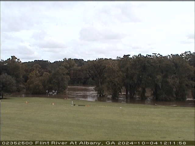
Flint River at Albany (02352500)
We have installed a webcam at the Flint River at Albany to allow you to view, in real time, the current river-stage conditions.
During periods of flooding, the South Atlantic Water Science Center - Georgia will take control of the camera.
We have installed a webcam at the Flint River at Albany to allow you to view, in real time, the current river-stage conditions.
During periods of flooding, the South Atlantic Water Science Center - Georgia will take control of the camera.

Tres Palmas Video Camera Mid-Field Bright Image, 2
Video camera bright image at Tres Palmas in Rincón, on the west coast of Puerto Rico. [Larger version]
Learn more about the cameras and how we're using them to study wave dynamics.
Video camera bright image at Tres Palmas in Rincón, on the west coast of Puerto Rico. [Larger version]
Learn more about the cameras and how we're using them to study wave dynamics.
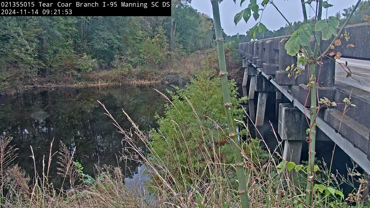
Tearcoat Branch at I-95, near Manning (021355015, Downstream)
We have installed a webcam at Tearcoat Branch at I-95, near Manning to allow you to view (in real time) the current river-stage conditions.
During periods of flooding, the South Atlantic Water Science Center will take control of the camera.
Camera is sponsored by the SC Department of Transportation.
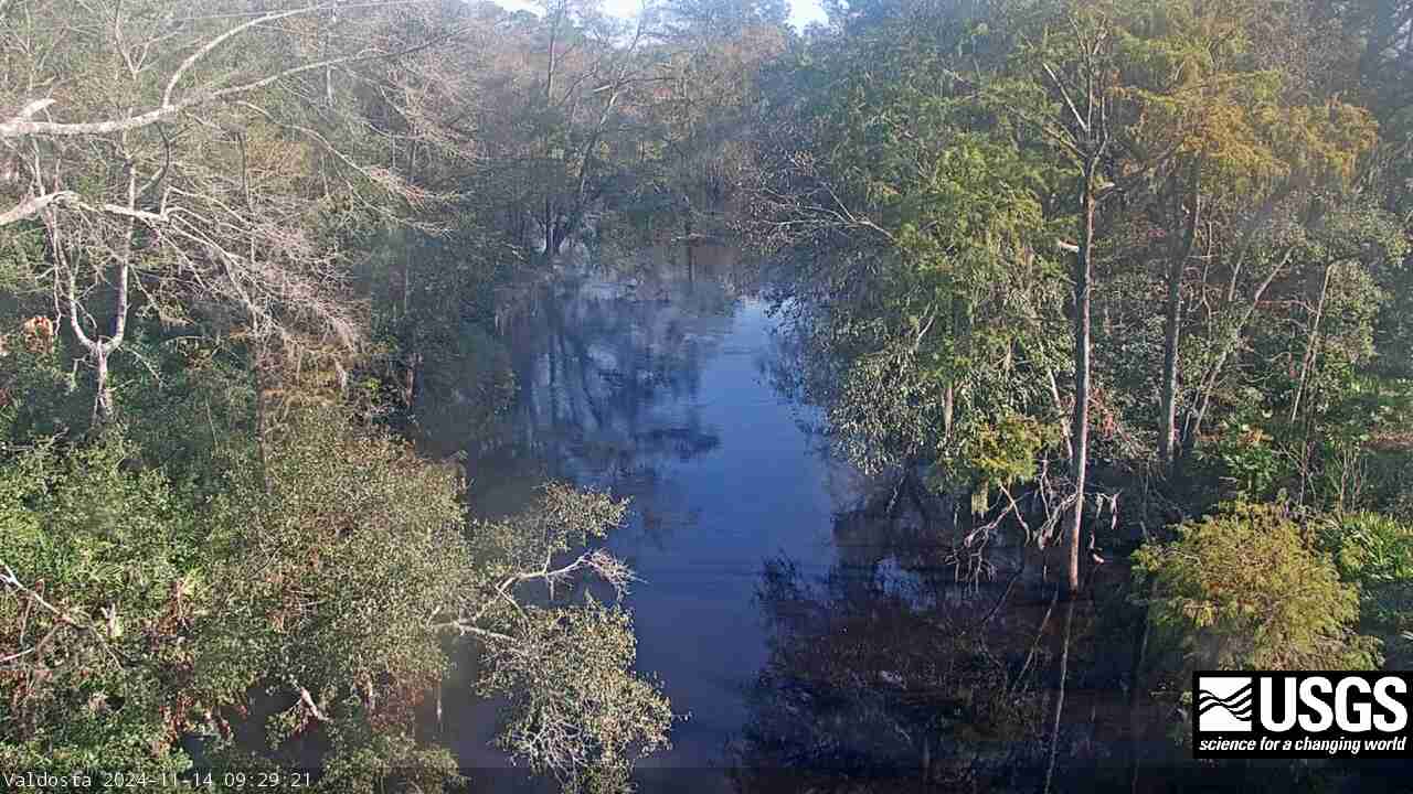
Withlacoochee River at Skipper Bridge Rd. near Bemiss (023177483)
We have installed a webcam at the Withlacoochee River at Skipper Bridge Rd. near Bemiss, GA to allow you to view, in real time, the current river-stage conditions.
During periods of flooding, the South Atlantic Water Science Center will take control of the camera.
We have installed a webcam at the Withlacoochee River at Skipper Bridge Rd. near Bemiss, GA to allow you to view, in real time, the current river-stage conditions.
During periods of flooding, the South Atlantic Water Science Center will take control of the camera.
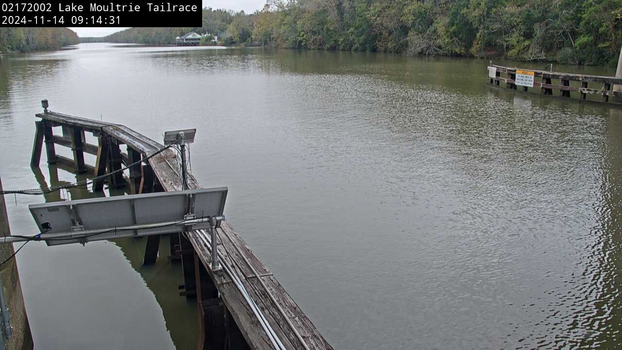
Lake Moultrie Canal at Moncks Corner, SC (02172002)
We have installed a webcam at the Lake Moultrie Tailrace Canal at Moncks Corner, SC to allow you to view, in real time, the current river-stage conditions.
During periods of flooding, the South Atlantic Water Science Center - South Carolina will take control of the camera.
We have installed a webcam at the Lake Moultrie Tailrace Canal at Moncks Corner, SC to allow you to view, in real time, the current river-stage conditions.
During periods of flooding, the South Atlantic Water Science Center - South Carolina will take control of the camera.
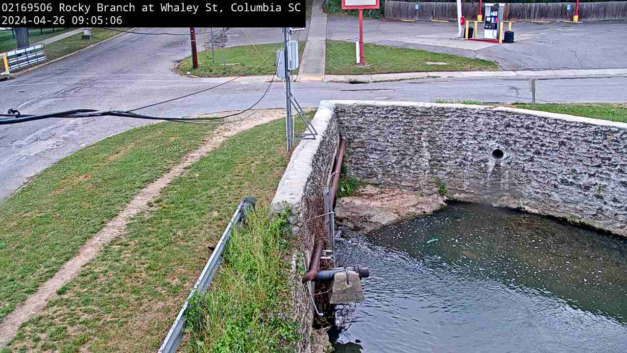
Rocky Branch at Whaley St., Columbia (02169506)
We have installed a webcam at the Rocky Branch at Whaley St. to allow you to view, in real time, the current river-stage conditions.
During periods of flooding, the South Atlantic Water Science Center - South Carolina will take control of the camera.
We have installed a webcam at the Rocky Branch at Whaley St. to allow you to view, in real time, the current river-stage conditions.
During periods of flooding, the South Atlantic Water Science Center - South Carolina will take control of the camera.