
Chesapeake Bay: A Landsat 8 Surface Reflectance Mosaic
Detailed Description
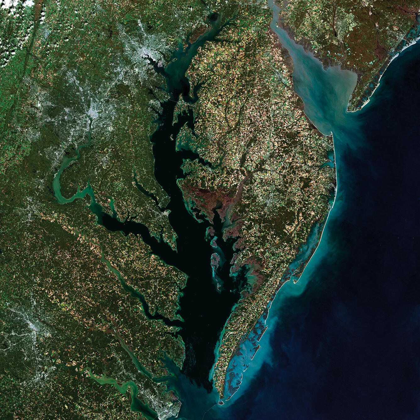
Chesapeake Bay is the Nation's largest estuary and its restoration and protection is a priority. The USGS provides scientific information to help manage this vital ecosystem. As part of that role, staff at the USGS Earth Resources Observation and Science (EROS) Center created this true color composite image. The image was created using Provisional Surface Reflectance data from five Landsat 8 scenes, acquired in October and November 2014.
Sources/Usage
Public Domain.
Related

Review of Wildlife Health Outcomes and Potentially Toxic Algal Blooms in the Chesapeake Bay
Scientists provide resources that review algal toxin data, explore links between avian mortality and toxin exposure, and identify future research needs to predict algal toxin health hazards and risks for birds and other wildlife in the Chesapeake Bay.

Bioaccumulation of Mercury in Fish Varied by Species and Location in the Chesapeake Bay Watershed—Summary of Existing Data and a Roadmap for Integrated Monitoring
Fish mercury data from State monitoring programs and research studies within the Chesapeake Bay were compiled and summarized to provide a comprehensive overview of the variation in fish mercury concentrations among species and habitats within the watershed. These data are put into context with existing health benchmarks for humans, birds, and fish. Scientists also provide a roadmap for an...
Related
Review of Wildlife Health Outcomes and Potentially Toxic Algal Blooms in the Chesapeake Bay
Scientists provide resources that review algal toxin data, explore links between avian mortality and toxin exposure, and identify future research needs to predict algal toxin health hazards and risks for birds and other wildlife in the Chesapeake Bay.
Bioaccumulation of Mercury in Fish Varied by Species and Location in the Chesapeake Bay Watershed—Summary of Existing Data and a Roadmap for Integrated Monitoring
Fish mercury data from State monitoring programs and research studies within the Chesapeake Bay were compiled and summarized to provide a comprehensive overview of the variation in fish mercury concentrations among species and habitats within the watershed. These data are put into context with existing health benchmarks for humans, birds, and fish. Scientists also provide a roadmap for an...