
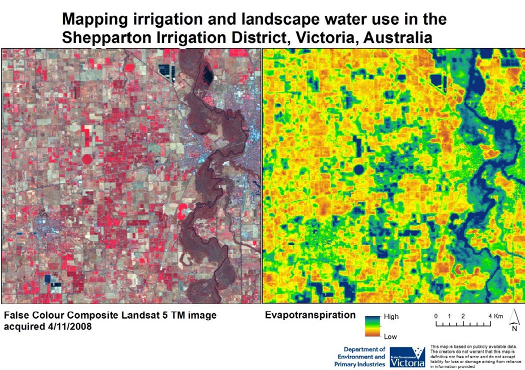
False color composite Landsat image and evapotranspiration map

Detailed Description
False color composite Landsat image and evapotranspiration map of the Shepparton Irrigation District, Victoria, Australia. Courtesy of the Victoria Department of Environment and Primary Industries.