
Landsat Economic Value Infographic
Detailed Description
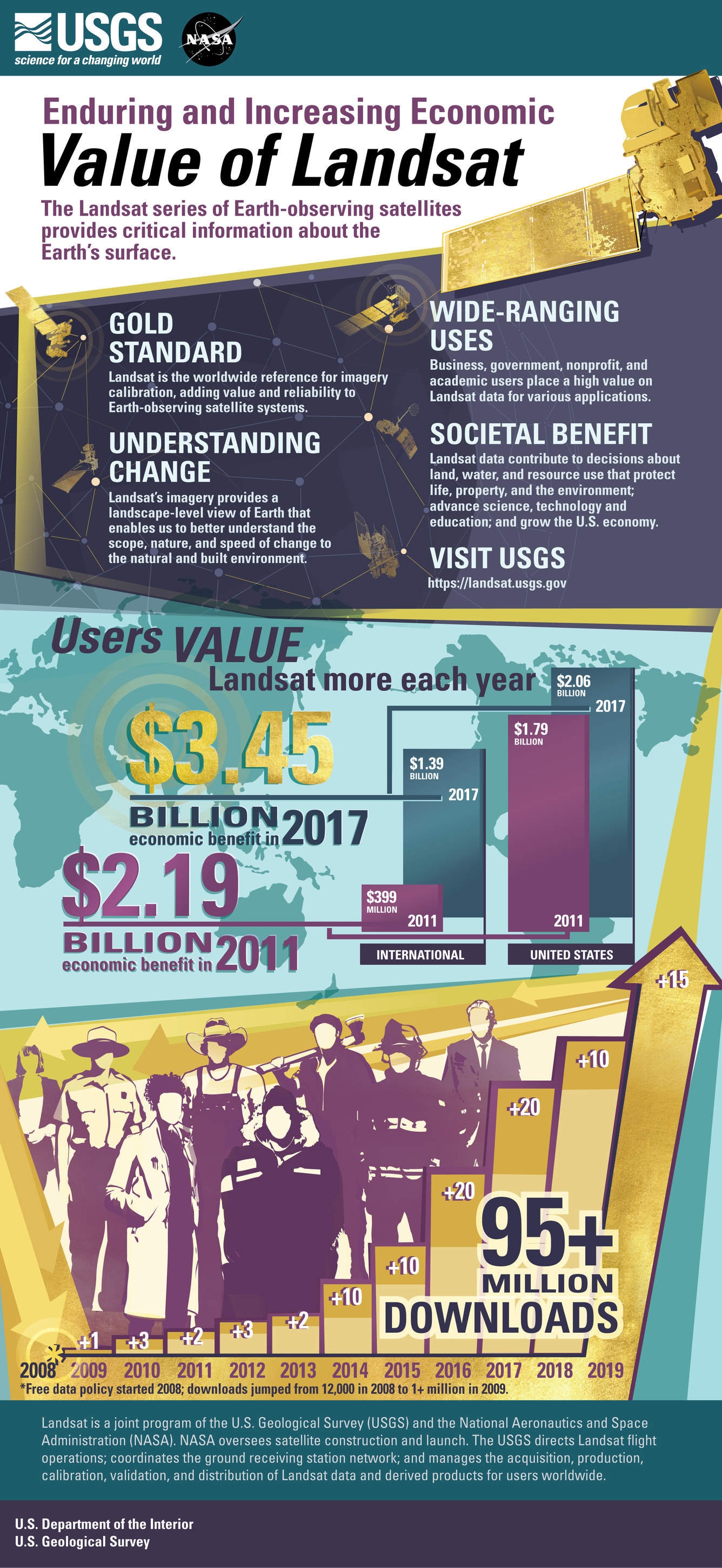
Landsat satellites have been operating since 1972, providing a continuous global record of the Earth’s land surface. Landsat’s imagery provides a landscape-level view of Earth that enables us to better understand the scope, nature, and speed of change to the natural and built environment. Business, government, nonprofit, and academic users place a high value on Landsat data for various applications. Landsat data contribute to decisions about land, water, and resource use that protect life, property, and the environment; advance science, technology, and education; and grow the U.S. economy. The imagery is currently available at no cost through the U.S. Geological Survey (USGS). A previous USGS study (2013) estimated that Landsat imagery provided users an annual benefit of $2.19 billion in 2011, with U.S. users accounting for $1.79 billion of those benefits. Since then, many changes have altered the demand for and supply of remotely sensed imagery and have made the analysis complex. The “Landsat’s Economic Value to the Nation Continues to Increase” (2019) report updates these estimates. The report discusses changes in the value per scene in 2017 when compared to 2011 and analyzes the potential consequences of charging fees. Landsat imagery provided domestic and international users an estimated $3.45 billion in benefits in 2017 compared to $2.19 billion in 2011, with U.S. users accounting for $2.06 billion of those benefits.
Sources/Usage
Public Domain.