
LS Preliminary Greenland
Detailed Description
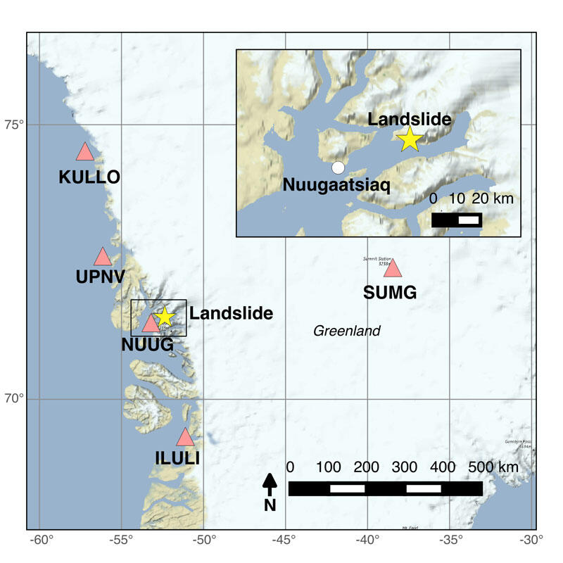
Figure 1. Overview map showing the location of the landslide (yellow star) relative to the five broadband seismic stations with openly available data within 500 km of the landslide (pink triangle). NUUG, is located in the town of Nuugaatsiaq, that was impacted by the tsunami. The black box shows the location of the inset map. The inset map shows the geometry of the fjords relative to the landslide and town of Nuugaatsiaq.
Sources/Usage
Public Domain.