
Map of Potomac River basin

Detailed Description
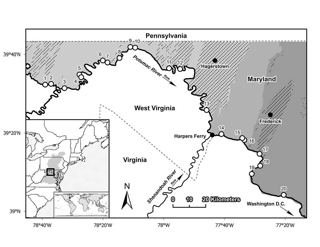
The study area within the Potomac River basin of eastern North America. Open circles show sample site locations on streams within the C&O Canal National Historical Park. Shaded areas show physiographic regions within Maryland from west to east as the Ridge and Valley, Blue Ridge, and Piedmont, and the stippled areas show regions of karst geology. The shaded region in the inset map shows the Chesapeake Bay watershed.
Sources/Usage
Public Domain.