
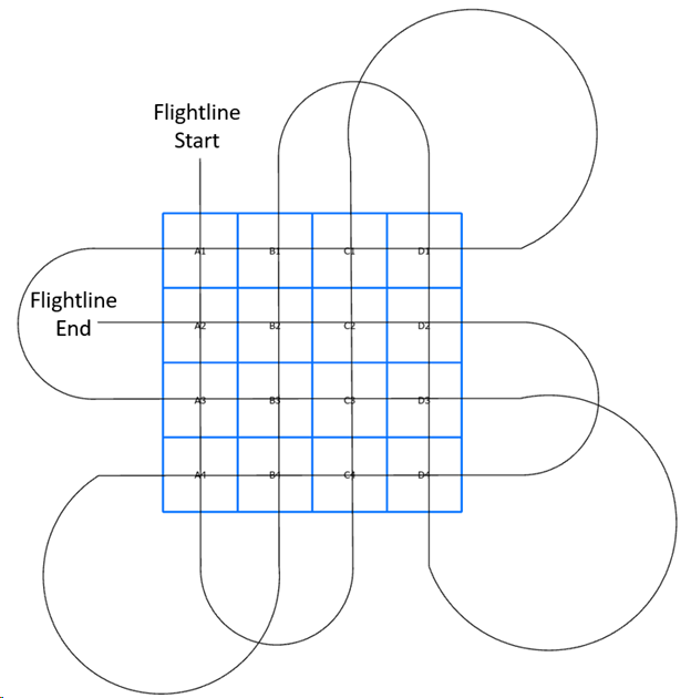
Mock-up of a boresight flight path
Detailed Description
Figure 1: A mocked-up boresight showing how an airplane with an installed aerial camera system would cover the boresight installation to collect imagery of all quadrants (A1 – D4) while also ensuring overlapping photography is gathered.
Sources/Usage
Public Domain.
Photographer - Andrew Strassman, USGS, Biologist, astrassman@usgs.gov