
R/V Sallenger Tows SQUID-5 for 3D Seafloor Mapping

Detailed Description
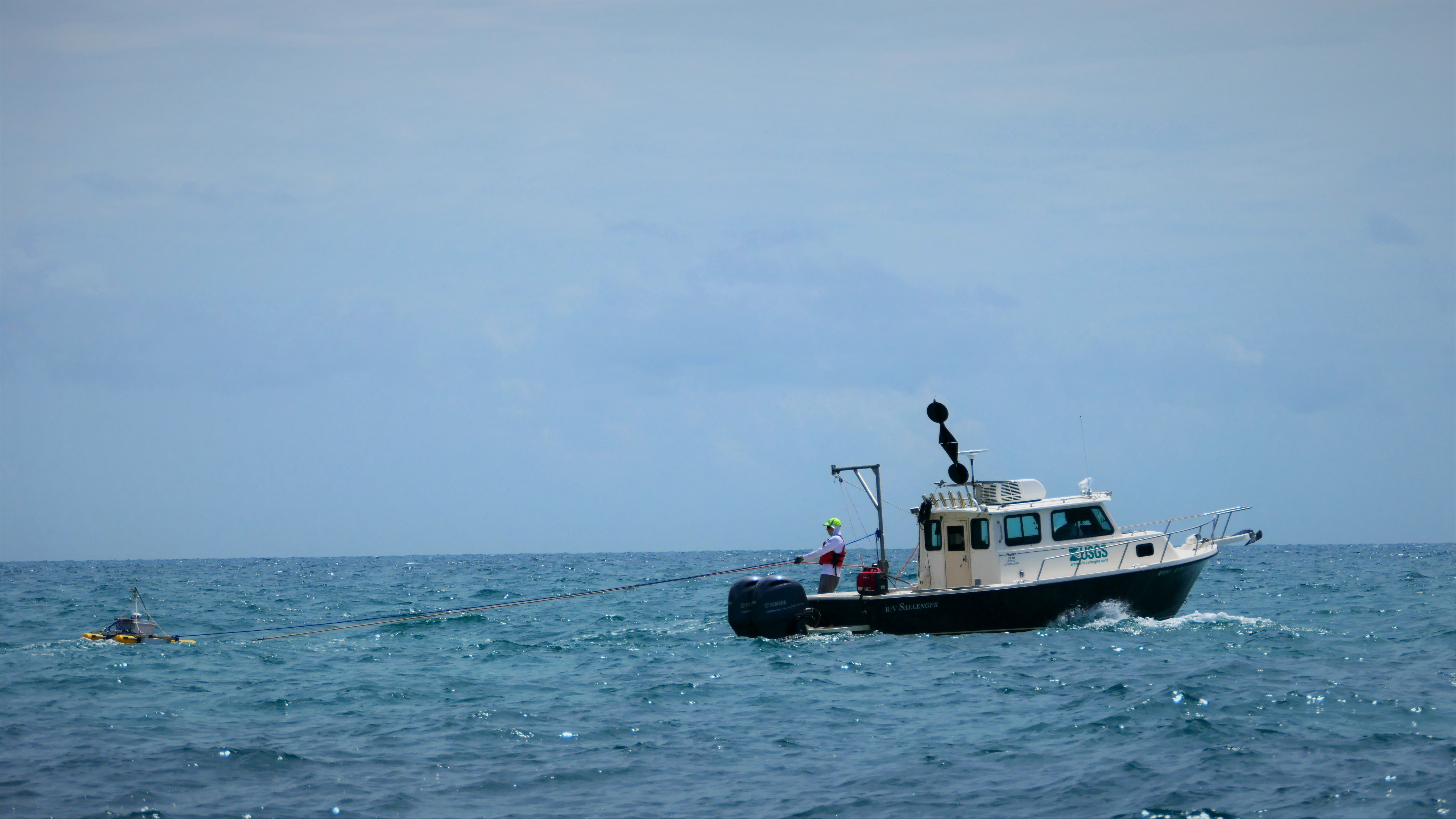
The R/V Sallenger tows the structure-from-motion quantitative underwater imaging device with 5 cameras (SQUID-5) across the water over Looe Key Reef in the Florida Keys. The images collected by SQUID-5 will be used to produce 3-dimensional maps of the seafloor to track elevation change - important information for monitoring coral restoration efforts and predicting coastal hazards.
Sources/Usage
Public Domain.
Related

SQUID-5 camera system
The SQUID-5 is a Structure-from-Motion Quantitative Underwater Imaging Device with 5 cameras.
Related
SQUID-5 camera system
The SQUID-5 is a Structure-from-Motion Quantitative Underwater Imaging Device with 5 cameras.