
About
The vision for Core Science Systems builds on core strengths of the USGS in characterizing and understanding complex Earth and biological systems through research, modeling, mapping, and the production of high quality data on the Nation’s natural resource infrastructure.
Filter Total Items: 23

Cartographic Specifications - Governmental Units
7.5-Minute OnDemand Topo cartographic specifications for governmental units including Bureau of Land Management, counties or equivalent, international, military, Native American areas, PLSS, states, Forest Service, and wildlife boundaries.
7.5-Minute OnDemand Topo Cartographic Specifications
This page and associated links define the U.S. Geological Survey (USGS) 7.5-Minute OnDemand Topo cartographic specifications including feature symbology and labels. The specifications are organized by data sets and themes listed below.

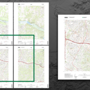
OnDemand Topo
OnDemand Topo is a digital topographic map based on a user defined area of interest (AOI) containing orthoimagery, shaded relief, and data from the geographic themes of transportation, hydrography, elevation, boundaries, geographic names, structures and land cover.

Cartographic Specifications - Transportation
7.5-Minute OnDemand Topo cartographic specifications for Transportation including airports, rails, routes, and trails.

US Topo Cartographic Specifications
This page and associated links define the U.S. Geological Survey (USGS) digital topographic map (US Topo) cartographic specifications including feature symbology and annotation. The specifications are organized by data sets and themes listed below.

What is 3DEP?
The 3D Elevation Program (3DEP) informs critical decisions that are made across our Nation every day that depend on elevation data, ranging from immediate safety of life, property, and environment to long term planning for infrastructure projects.

National Science Foundation - Ice Core Facility
The National Science Foundation Ice Core Facility (NSF-ICF) is located at the Denver Federal Center in Colorado. The Facility is managed and operated by the U.S. Geological Survey for the National Science Foundation.

Kevin Gallagher
The U.S. Geological Survey (USGS) Core Science Systems (CSS) Mission Area builds on the core strengths of the USGS in characterizing and understanding complex Earth and biological systems through research, modeling, mapping, and the production of high-quality data. CSS delivers natural science information to the Nation in support of smart decisionmaking.

History
The United States Geological Survey was established on March 3, 1879, just a few hours before the mandatory close of the final session of the 45th Congress, when President Rutherford B. Hayes signed the bill appropriating money for sundry civil expenses of the Federal Government for the fiscal year beginning July 1, 1879.

What We Do
The Core Science Systems Mission Area delivers nationally focused Earth systems and information science that provides fundamental research and data that underpins all Mission Areas of the USGS, the USGS Science Strategy, and Presidential, Secretarial, and societal priorities.

Director's Message
The U.S. Geological Survey (USGS) Core Science Systems (CSS) Mission Area builds on the core strengths of the USGS in characterizing and understanding complex Earth and biological systems through research, modeling, mapping, and the production of high-quality data. CSS delivers natural science information to the Nation in support of smart decisionmaking.