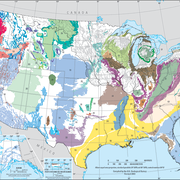
The High Plains aquifer unerlies an area of about 174,000 square miles that extends through parts of eight states of the Midwest. This aquifer is the principal source of water in one of the major agricultural areas of the United States.

The High Plains aquifer consists of one or more hydraulically connected geologic units of late Tertiary or Quaternary age, underlain by bedrock units that range in age from Permian to Tertiary. The High Plains aquifer is divided into the northern, central, and southern High Plains regions. The northern High Plains aquifer underlies parts of Colorado, Kansas, Nebraska, South Dakota, and Wyoming. The central High Plains underlies parts of Colorado, Kansas, New Mexico, Oklahoma, and Texas. The southern High Plains aquifer underlies eastern New Mexico and northwestern Texas.
A regional Soil-Water-Balance model (USGS Techniques and Methods report 6-A31) was constructed to estimate recharge for the 1940 through 1940 (predevelopment) and 2000 through 2009 time periods.
The data files listed below are supplemental to the following reports:
- Geodatabase Compilation of Hydrogeologic, Remote Sensing, and Water-Budget-Component Data for the High Plains Aquifer, 2011 (USGS Data Series 777)
- Digital Map of Aquifer Boundary for the High Plains Aquifer in Parts of Colorado, Kansas, Nebraska, New Mexico, Oklahoma, South Dakota, Texas, and Wyoming (USGS Data Series 543)
Click on the links below to download files for this aquifer. For information about the available file types, see Aquifer data: Explanation of spatial data formats.
Hydrogeologic Framework Data:
- Borehole Data (northern High Plains only): Metadata (55 KB) Shapefile (1.2 MB) Text file (532 KB)
- Extent of High Plains aquifer: Metadata (29 KB) Shapefile (1.0 MB)
Recharge Data:
- Recharge (1940 through 1949): Metadata (16 KB) Raster (101 KB)
- Recharge (2000 through 2009): Metadata (16 KB) Raster (101 KB
Below are other webpages associated with this aquifer.
Principal Aquifers of the United States
Regional Groundwater Availability Studies
Below are publications associated with this aquifer.
Geodatabase compilation of hydrogeologic, remote sensing, and water-budget-component data for the High Plains aquifer, 2011
Digital map of the aquifer boundary for the High Plains aquifer in parts of Colorado, Kansas, Nebraska, New Mexico, Oklahoma, South Dakota, Texas, and Wyoming
SWB: A modified Thornthwaite-Mather Soil-Water-Balance code for estimating groundwater recharge
Ground Water Atlas of the United States
The High Plains aquifer unerlies an area of about 174,000 square miles that extends through parts of eight states of the Midwest. This aquifer is the principal source of water in one of the major agricultural areas of the United States.

The High Plains aquifer consists of one or more hydraulically connected geologic units of late Tertiary or Quaternary age, underlain by bedrock units that range in age from Permian to Tertiary. The High Plains aquifer is divided into the northern, central, and southern High Plains regions. The northern High Plains aquifer underlies parts of Colorado, Kansas, Nebraska, South Dakota, and Wyoming. The central High Plains underlies parts of Colorado, Kansas, New Mexico, Oklahoma, and Texas. The southern High Plains aquifer underlies eastern New Mexico and northwestern Texas.
A regional Soil-Water-Balance model (USGS Techniques and Methods report 6-A31) was constructed to estimate recharge for the 1940 through 1940 (predevelopment) and 2000 through 2009 time periods.
The data files listed below are supplemental to the following reports:
- Geodatabase Compilation of Hydrogeologic, Remote Sensing, and Water-Budget-Component Data for the High Plains Aquifer, 2011 (USGS Data Series 777)
- Digital Map of Aquifer Boundary for the High Plains Aquifer in Parts of Colorado, Kansas, Nebraska, New Mexico, Oklahoma, South Dakota, Texas, and Wyoming (USGS Data Series 543)
Click on the links below to download files for this aquifer. For information about the available file types, see Aquifer data: Explanation of spatial data formats.
Hydrogeologic Framework Data:
- Borehole Data (northern High Plains only): Metadata (55 KB) Shapefile (1.2 MB) Text file (532 KB)
- Extent of High Plains aquifer: Metadata (29 KB) Shapefile (1.0 MB)
Recharge Data:
- Recharge (1940 through 1949): Metadata (16 KB) Raster (101 KB)
- Recharge (2000 through 2009): Metadata (16 KB) Raster (101 KB
Below are other webpages associated with this aquifer.
Principal Aquifers of the United States
Regional Groundwater Availability Studies
Below are publications associated with this aquifer.


