
Bent Creek Experimental Forest, North Carolina Landslide Monitoring Site
Recent Monitoring Data
Rainfall | Ground Water Pressure | Soil Water Content | Soil Temperature | Battery Voltage
Rainfall
Rainfall is measured at the monitoring site using one 8-inch-diameter tipping-bucket rain gauges that measure 0.01 inch of rainfall per tip.

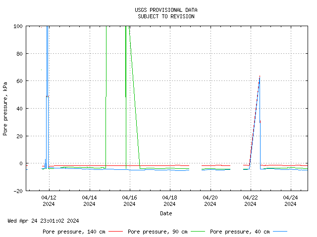
Ground Water Pressure
The monitoring site has three tensiometers (S1-S3) located at various depths. The tensiometers are connected with current transducers that can measure pore-water pressures in the range of +850 hPa to -1000 hPa. The location and depth of the porous tips of each of the tensiometers are indicated on the graphs. Pore-water pressures are reported in kiloPascals (kPa). One kiloPascal is roughly equivalent to the pressure exerted by a 10-cm-deep column of water.
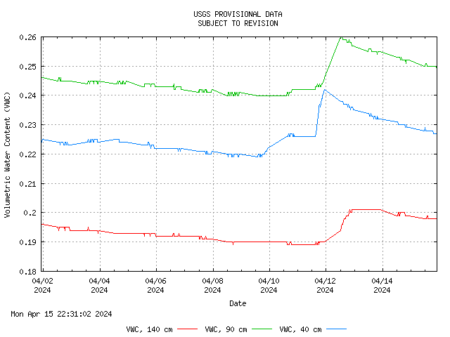
Soil Water Content
Each instrument array (M1-M3) at the monitoring site is equipped with three capacitance-based instruments to measure the volumetric water content of the soil. The location and depth of the instruments are indicated on the graphs.
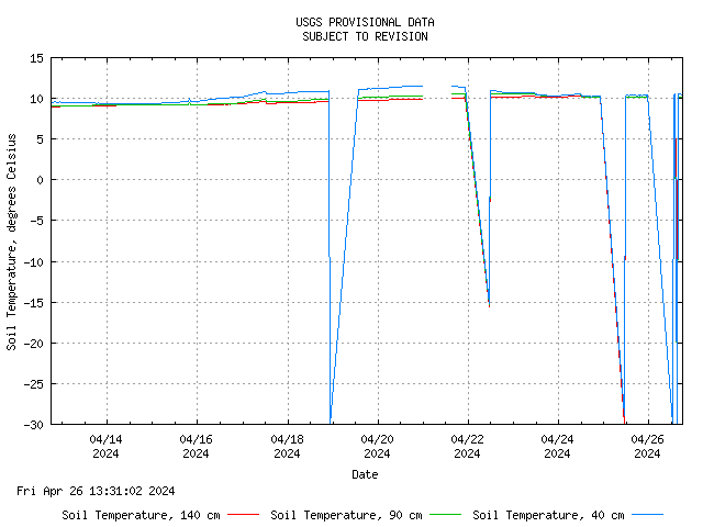
Soil Temperature
Each tensiometer has a built-in temperature sensor. Soil temperature measurements are used to correct measurements by the other instruments and to provide an indication of when the ground is frozen.
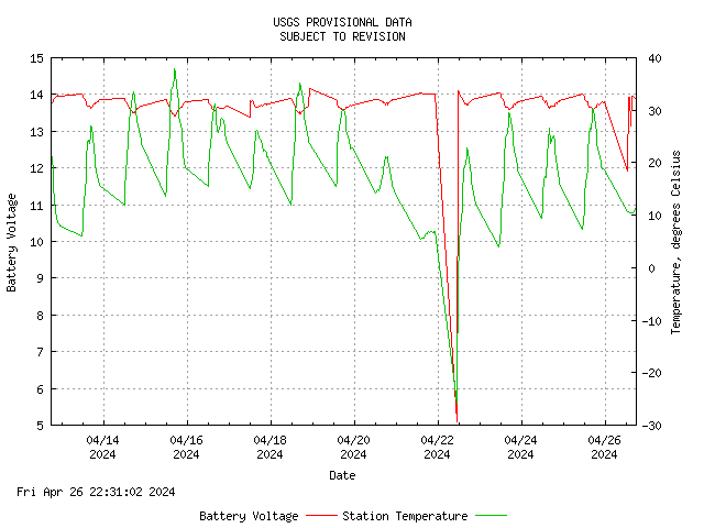
Battery Voltage
Battery voltage is monitored for identifying any problems with battery charging due to solar panel or battery failures.
Recent Monitoring Data
Rainfall | Ground Water Pressure | Soil Water Content | Soil Temperature | Battery Voltage
Rainfall
Rainfall is measured at the monitoring site using one 8-inch-diameter tipping-bucket rain gauges that measure 0.01 inch of rainfall per tip.
Ground Water Pressure
The monitoring site has three tensiometers (S1-S3) located at various depths. The tensiometers are connected with current transducers that can measure pore-water pressures in the range of +850 hPa to -1000 hPa. The location and depth of the porous tips of each of the tensiometers are indicated on the graphs. Pore-water pressures are reported in kiloPascals (kPa). One kiloPascal is roughly equivalent to the pressure exerted by a 10-cm-deep column of water.
Soil Water Content
Each instrument array (M1-M3) at the monitoring site is equipped with three capacitance-based instruments to measure the volumetric water content of the soil. The location and depth of the instruments are indicated on the graphs.
Soil Temperature
Each tensiometer has a built-in temperature sensor. Soil temperature measurements are used to correct measurements by the other instruments and to provide an indication of when the ground is frozen.
Battery Voltage
Battery voltage is monitored for identifying any problems with battery charging due to solar panel or battery failures.