A Whole New (Fiery) World
Wildfires in the West are Transforming the Landscape
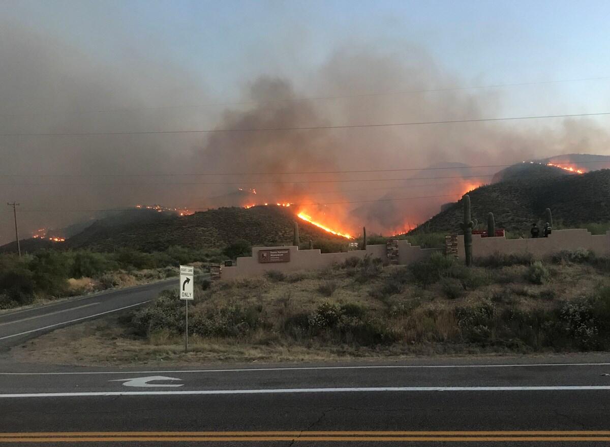
As a wildfire approached Tonto National Monument in Arizona, archaeologists and firefighters rushed to cover the park’s 700-year-old cliff dwellings with fire resistant aluminum wrapping.
The Woodbury Fire was the most severe on record and started in the nearby Superstition Wilderness on June 8, 2019. By June 23, it had burned 88 percent of the park, or 989 acres. An unknown human source started the blaze that eventually burned 123,875 acres in total before it was entirely contained.
“It’s been over two years and we can still see ash on top of the soil,” Macie Monahan, a fire restoration intern with Tonto, said. Extreme heat and prolonged drought conditions helped fuel the intensity of the fire, which torched whatever it touched. Vistas once sparsely dotted with saguaro cacti and other Sonoran Desert native vegetation are now almost completely covered by an invasive flammable grass called red brome.
Scientists describe this phenomenon – when a severe fire causes one biological community to replace another – as an “ecosystem transformation,” and lately it’s been happening throughout the southwest, from the prickly Arizona desert to the soaring California redwood forests.
"Ecosystem transformation is going to be with us for the foreseeable future,” Stephen Jackson, the director of the USGS Southwest (and South Central) Climate Adaptation Science Center, said. “Our centers support research that helps define these ecosystem changes and provide guidance to land managers.”
When good fires go bad
Although raging, intense blazes like the Woodbury Fire hurt native ecosystems, low intensity burns are vital for a fire-adapted forest to thrive. The latter help clean the forest floor of debris and smaller trees while nourishing soils so that established trees can grow stronger and healthier. In fact, sequoias rely on low intensity fires in order spread their seeds.
Based on fire scars in Sequoia National Park, researchers determined that fires used to occur there every 15 to 30 years. Fire patterns evolved over hundreds of years, allowing ecosystems to adapt to and rely on low intensity flames.
However, in the late 1800s, European settlers started to put out those fires and began a tradition of fire suppression, which meant that fuels (in the form of flammable vegetation) accumulated.
In the last century, scientists have noted new fire patterns. Fires are burning much hotter, bigger and more frequently. Warmer and drier conditions combined with accumulated fuels are helping fires become so intense they can affect the atmosphere and even create their own weather.
Transformed landscapes
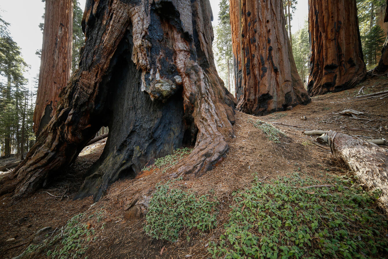
Last summer a wildfire singlehandedly obliterated at least 10% of the world’s giant sequoias. The Castle fire tore through Sequoia National Park on August 13, 2020, torching some trees that were 2,000-years-old.
Sequoias are a genus of redwood conifers that dominate coastal areas. “Sequoias are supposed to be fire resistant,” Adrian Das, an ecologist at USGS, said, “But these fires are so intense that the trees are burning.”
Phillip van Mantgem, an ecologist with USGS, is helping managers identify areas that will likely see conifer forests returning after a fire. van Mantgem and colleagues used a computer model to explore a range of possible climates five years following a fire to see how different scenarios, like wetter and drier would look.
“We expect forest regeneration after a fire to vary with climate,” van Mantgem said. As climate change brings hotter temperatures and more intense droughts, saplings will likely have a harder time germinating and growing into healthy trees.
If trees don’t take root, shrubs and invasive grasses could take up space for conifer regeneration. “It’s possible that some of these areas will bounce back to forests. However, with repeated fires, some conversions could be permanent,” van Mantgem said.
Experimental environments
Rachel Loehman, an ecologist with USGS, is working with USDA Forest Service partners to combine computer models and real life experiments to see how much stress different kinds of trees can take before they die.
“Past climates haven’t really challenged trees to their limits,” Loehman said. So, to see how trees could respond to more extreme climates, she’s looking at data from researchers in Tucson, Arizona who are forcing tree seedlings to grow under simulated harsh conditions. She’ll incorporate that data into her models to create a more accurate forecast of potential future tree growth and mortality.
Loehman and her Forest Service colleagues are striving to help identify which trees have the best chance of survival and which forests are most vulnerable to a post-fire transformation to inform land management decisions.
Restored landscapes
“There’s now a higher chance that a specific landscape will undergo a large transformation from a fire compared to recent history,” Seth Munson, a USGS ecologist, said.
Munson is helping Monahan and others at Tonto National Monument put together vegetation monitoring, invasive suppression treatments, and revegetation efforts following the disastrous Woodbury Fire and others like it throughout the Southwest.
His work helps provide science to land managers as they determine what to do with their post-fire landscapes, from Saguaro National Park to Agua Fria National Monument to the Buenos Aires National Wildlife Refuge in Arizona.
“We’re seeing a lot of invasives in places that typically don’t burn,” Munson said. Invasive plants recover more quickly after a wildfire, which means they’re able to colonize landscapes faster than native plants. Not only does that make it more difficult for native plants to come back, but it also poses another fire risk since invasive plants are more likely to catch on fire and help spread flames than native species.
Munson also helps land managers in different areas, but similar circumstances, connect and talk to each other about lessons learned after major fires. “We want to know how they perceive wildfire risks and if those perceptions and approaches to fire mitigation change after a big fire,” Munson said.
“Nothing has been done in a vacuum,” Duane Hubbard, the Superintendent of Tonto, said. “We’re working with the USGS and other partners at universities and agencies to make a plan to monitor our planting efforts and see how well the new seedlings grow,” Hubbard said.
The mentioned research projects are funded by the USGS Southwest Climate Adaptation Science Center.


