
National Geospatial Program User Engagement
NGP User Engagement Office
The NGP User Engagement Office helps users - from seasoned professionals to the general public - understand the country's vast landscapes through National Map products and applications. National Map Liaisons in the User Engagement Office communicate and connect on national topographic mapping activities and emergency response across all 50 states and U.S. territories.
Find Your Liaison
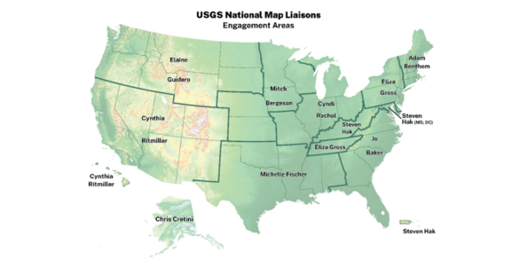
National Map Liaisons are located across the country to help you!
Recent Activities

The User Engagement Office leads and participates in many activities that support The National Map.
National Map Resources

A wide variety of National Map resources are available. These include data and maps, data visualization tools and viewers, and training videos.
Engage With Us
National Map Liaisons foster collaborations and partnerships for key initiatives of the National Geospatial Program. They represent the USGS with partners and the public, support topographic data collection, advise and provide training, and assist with emergency response geospatial needs during natural disasters all 50 states and U.S. territories.