USGS scientist Erich Peitzsch does repair on the Sperry Weather Station in Glacier National Park. Information gathered by the USGS managed Sperry Weather Station are being used by regional fire managers to forecast fire weather and future fire behavior during the 2017 fire season.
All Multimedia
Access all multimedia to include images, video, audio, webcams, before-after imagery, and more. Filter and explore with filtering options to refine search.

USGS scientist Erich Peitzsch does repair on the Sperry Weather Station in Glacier National Park. Information gathered by the USGS managed Sperry Weather Station are being used by regional fire managers to forecast fire weather and future fire behavior during the 2017 fire season.

Crews perform repairs on the Sperry Weather Station as part of Fire Operations in Glacier National Park. Information gathered by the USGS managed Sperry Weather Station are being used by regional fire managers to forecast fire weather and future fire behavior during the 2017 fire season.
Crews perform repairs on the Sperry Weather Station as part of Fire Operations in Glacier National Park. Information gathered by the USGS managed Sperry Weather Station are being used by regional fire managers to forecast fire weather and future fire behavior during the 2017 fire season.
That photo is of Atlantic Avenue in Garden City, South Carolina on September 11.
That photo is of Atlantic Avenue in Garden City, South Carolina on September 11.
USGS scientist Steve Hannes marks high water marks along the Colorado River after flooding from Hurricane Harvey in Wharton County, Texas.
USGS scientist Steve Hannes marks high water marks along the Colorado River after flooding from Hurricane Harvey in Wharton County, Texas.
USGS scientist Steve Hannes marks high water marks along the Colorado River after flooding from Hurricane Harvey in Wharton County, Texas.
USGS scientist Steve Hannes marks high water marks along the Colorado River after flooding from Hurricane Harvey in Wharton County, Texas.
USGS scientist Steve Hannes marks high water marks along the Colorado River after flooding from Hurricane Harvey in Wharton County, Texas.
USGS scientist Steve Hannes marks high water marks along the Colorado River after flooding from Hurricane Harvey in Wharton County, Texas.
USGS scientist Steve Hannes marks high water marks along the Colorado River after flooding from Harvey in Matagorda County, Texas.
USGS scientist Steve Hannes marks high water marks along the Colorado River after flooding from Harvey in Matagorda County, Texas.
Mark, Nicole, Rich, Ryan, Dean taking out the "trash" from the base of the trench.
Mark, Nicole, Rich, Ryan, Dean taking out the "trash" from the base of the trench.
The Maine Office boat, "Miss Q", is parked next to the boat launch on Verona Island, ready to begin data collection on the Penobscot River. The crew was preparing to collect ADCP data (depth and velocity) as well as conductivity, temperature and depth profiles at various locations. In the background is the Penobscot Narrows Bridge and Fort Knox.
The Maine Office boat, "Miss Q", is parked next to the boat launch on Verona Island, ready to begin data collection on the Penobscot River. The crew was preparing to collect ADCP data (depth and velocity) as well as conductivity, temperature and depth profiles at various locations. In the background is the Penobscot Narrows Bridge and Fort Knox.
Hurricane Harvey dumped over 50 inches of rain near Houston, leaving extensive flooding throughout the area.
At the USGS EROS Center, we study land change, operate the Landsat satellites, and maintain the longest, continuously acquired collection of images of the Earth's land surface.
Hurricane Harvey dumped over 50 inches of rain near Houston, leaving extensive flooding throughout the area.
At the USGS EROS Center, we study land change, operate the Landsat satellites, and maintain the longest, continuously acquired collection of images of the Earth's land surface.
Construction of the McKelvey Building, or Building 15, was completed in the mid-1990s on the USGS Western Region campus in Menlo Park, California. It houses many different USGS teams, such as Pacific Coastal and Marine Science Center, Water Science Center, and Volcano Science Center, and features many state-of-the-art laboratories.
Construction of the McKelvey Building, or Building 15, was completed in the mid-1990s on the USGS Western Region campus in Menlo Park, California. It houses many different USGS teams, such as Pacific Coastal and Marine Science Center, Water Science Center, and Volcano Science Center, and features many state-of-the-art laboratories.
USGS scientist David Rodriguez records high water marks from storm surge near Corpus Christi, Texas.
USGS scientist David Rodriguez records high water marks from storm surge near Corpus Christi, Texas.
USGS scientist David Rodriguez records high water marks from storm surge following Harvey near Corpus Christi, Texas.
USGS scientist David Rodriguez records high water marks from storm surge following Harvey near Corpus Christi, Texas.
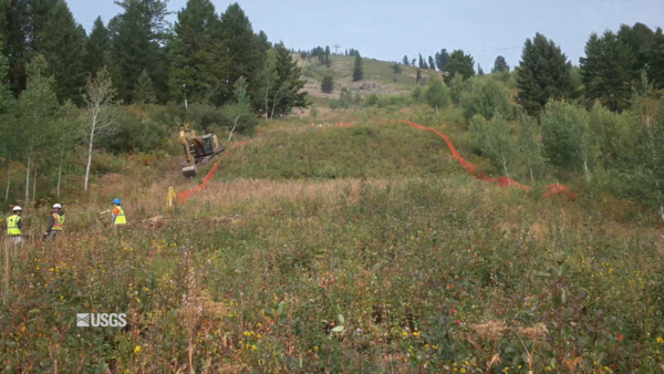
 Excavating the Teton Trench September 2017 - Day 2
USGS scientists Rich Briggs, Ryan Gold, Chris DuRoss, and Jaime Delano spent September 5-21, 2017 outside of Jackson, Wyoming doing fieldwork at a site to collect paleoseismology data on a segment of the Teton Fault. This video shows the second day of the site excavation inside the flagged the boundaries set up by the group.
USGS scientists Rich Briggs, Ryan Gold, Chris DuRoss, and Jaime Delano spent September 5-21, 2017 outside of Jackson, Wyoming doing fieldwork at a site to collect paleoseismology data on a segment of the Teton Fault. This video shows the second day of the site excavation inside the flagged the boundaries set up by the group.
 Excavating the Teton Trench September 2017 - Day 1
USGS scientists Rich Briggs, Ryan Gold, Chris DuRoss, and Jaime Delano spent September 5-21, 2017 outside of Jackson, Wyoming doing fieldwork at a site to collect paleoseismology data on a segment of the Teton Fault. This video shows the first day of the site excavation inside the flagged the boundaries set up by the group.
USGS scientists Rich Briggs, Ryan Gold, Chris DuRoss, and Jaime Delano spent September 5-21, 2017 outside of Jackson, Wyoming doing fieldwork at a site to collect paleoseismology data on a segment of the Teton Fault. This video shows the first day of the site excavation inside the flagged the boundaries set up by the group.
USGS scientist Alec McDonald surveying high water marks from storm surge from Hurricane Harvey at Packery Channel near Corpus Christi, Texas.
USGS scientist Alec McDonald surveying high water marks from storm surge from Hurricane Harvey at Packery Channel near Corpus Christi, Texas.

In early September 2017, Landsat 8 captured this image of what looked like an oil spill off the coast of Brazil, near Sao Paulo. The "oil" turned out to be a vast algal bloom that covered more than 100 km. This bloom was the result of a species of tiny dinoflagellate that multiplied quickly to produce astronomical numbers -- enough to color the ocean water.
In early September 2017, Landsat 8 captured this image of what looked like an oil spill off the coast of Brazil, near Sao Paulo. The "oil" turned out to be a vast algal bloom that covered more than 100 km. This bloom was the result of a species of tiny dinoflagellate that multiplied quickly to produce astronomical numbers -- enough to color the ocean water.
Location 4. Sand dunes along this stretch of coast in Sargent, Texas, were overwashed by large waves during the storm. Sand from the beach and dunes is covering the roadway behind the dunes and which may be impassable. The predicted probability of overwash in this area was 94%.
Location 4. Sand dunes along this stretch of coast in Sargent, Texas, were overwashed by large waves during the storm. Sand from the beach and dunes is covering the roadway behind the dunes and which may be impassable. The predicted probability of overwash in this area was 94%.
USGS scientist Vidal Mendoza surveying high water marks from storm surge from Hurricane Harvey near Port Aransas, Texas.
USGS scientist Vidal Mendoza surveying high water marks from storm surge from Hurricane Harvey near Port Aransas, Texas.

Jim Duda, USGS hydrologic technician, installs a Rapid-Deployment Gauge near the Elizabeth River in Norfolk, Virginia, to monitor elevated water levels caused by Hurricane Jose. An RDG is a fully functional streamgage designed to be quickly deployed for real-time data monitoring of a stream or river in emergency situations.
Jim Duda, USGS hydrologic technician, installs a Rapid-Deployment Gauge near the Elizabeth River in Norfolk, Virginia, to monitor elevated water levels caused by Hurricane Jose. An RDG is a fully functional streamgage designed to be quickly deployed for real-time data monitoring of a stream or river in emergency situations.
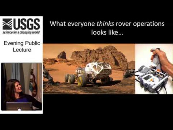
 2017 August Evening Public Lecture — Roving on Mars
Roving on Mars: Curiosity's exploration of Gale Crater
* Overview of the Mars Science Laboratory Mission
* Highlights from 5 years of exploring sedimentary environments
* Preview of next steps in Curiosity's climb up Aeolis Mons
Roving on Mars: Curiosity's exploration of Gale Crater
* Overview of the Mars Science Laboratory Mission
* Highlights from 5 years of exploring sedimentary environments
* Preview of next steps in Curiosity's climb up Aeolis Mons


