This edition of the GeoHEALTH—USGS Newsletter features recent research from the Environmental Health Toxic Substances Hydrology and Contaminant Biology Programs.
Featured Articles
Emerging Avian Influenza Viruses Highlight the Importance of Wild Bird Surveillance
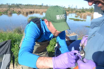
On March 31, 2013, China announced that a novel strain of avian influenza virus [A(H7N9)] was causing severe illness and death in humans, but was not causing illness in the few birds found to be infected by the virus. Because some birds migrate between continents, a concern was raised that wild birds infected with this virus in China might migrate to the United States and bring this virus with them. This influenza virus is new and very unusual because it does not cause disease in chickens (low pathogenic avian influenza virus - LPAIV) but the respiratory disease it causes in humans can be severe, often fatal. Not enough is known about the virus to answer all of the questions, but U.S. Geological Survey (USGS) science was used to build a model showing that the risk of this virus moving to the United States by migratory birds was low at this time.
Recent studies by USGS scientists are helping provide some understanding of the movement and genetic mixing of avian influenza (AI) viruses in birds in Asia and North America. The studies listed here conclude that AI viruses from Asia likely change their genetic makeup either as they move in their avian hosts from Asia to North America or upon arrival in North America. No completely Asian-origin AI viruses have been detected in North American birds, but numerous viruses of mixed genetic backgrounds, both Asian and North American, have been identified. These studies illustrate the significant role that migratory bird breeding grounds in Russia and Alaska play in this important family of viruses. The breeding grounds are mixing areas not only for bird populations but also for the AI viruses they may carry.
- Antibodies to Avian Influenza Viruses among Wild Waterfowl in Alaska — Scientists from the USGS and the U.S. Fish and Wildlife Service showed that 60 percent of the 4,485 wild waterfowl from 11 species they studied over 14 years in Alaska had antibodies from infection with an AI virus. Once infected, a bird usually sheds AI virus for only a few days, making it difficult to isolate the virus. However antibodies developed in response to viral infection can be found in the blood from months to years after infection providing a history of exposure. Not all waterfowl species are equally susceptible to AI viruses so species with high levels of AI virus antibodies and those with high AI viral infection rates are likely species to target for LPAIV and HPAIV surveillance programs.
This study was funded by the USGS Wildlife: Terrestrial and Endangered Resources Program, the U.S. Fish and Wildlife Service, and the National Institutes of Health. For more information contact Paul Flint (USGS Alaska Science Center).
- Annual Patterns of Movement Influence Exposure of Wild Birds to Influenza Viruses — USGS scientists reported 47 to 96 percent of geese in late summer on the Yukon-Kuskokwim Delta of western Alaska had detectible antibodies to AI viruses, indicating previous infection with the virus. Over 95 percent of emperor geese (Chen canagica) sampled had detectible AI virus antibodies, compared to 40 to 60 percent in other species of geese in the study. Emperor geese spend winters in the Aleutian Islands of Alaska, moving to western Alaska for breeding and Russia for molting in late summer. Why emperor geese exhibit higher exposure to AI viruses is unknown. However, the restricted distribution of emperor geese when compared to other species in the Bering Sea region may contribute to their higher exposure to AI.
This study was funded by the USGS Wildlife: Terrestrial and Endangered Resources Program, the U.S. Fish and Wildlife Service, and the National Institutes of Health. For more information contact USGS Alaska Science Center.
-
 Sources/Usage: Public Domain. View Media Details
Dabbling ducks, such as pintails (Anas acuta) and mallards (Anas platyrhynchos), feed mainly from the surface rather than diving for aquatic plants. Transmission of Avian Influenza Viruses Among Alaskan Dabbling Ducks — Scientists from the USGS and the Institute of Arctic Biology at the University of Alaska Fairbanks used the genetics of LPAIV in dabbling ducks to examine how frequently genetically similar AI viruses are found across different timeframes and geographical distances in Alaska. Many AI virus genes can be identified as either Asian or North American because of their unique characteristics. The results suggest that highly similar AI viruses are more often found in birds that are in the same place at the same time; within days of each other and across short geographic distances (kilometers). Highly similar AI viruses were less frequently observed across larger distances (hundreds of kilometers) and longer time periods (years).
These results provide an initial perspective into how frequently avian influenza viruses change over time and space and support the observation that no completely Eurasian viruses have ever been detected in Alaska. Such information is useful in forecasting the movement of avian influenza viruses from Asia and other continents into North America.
This study was funded by the USGS Wildlife: Terrestrial and Endangered Resources Program and the U.S. Fish and Wildlife Service. For more information contact Andrew Reeves (USGS Alaska Science Center).
-
 Sources/Usage: Public Domain. View Media Details
A mallard in flight. Mallards are a principal host of avian influenza viruses in nature. Avian Influenza Viruses Differ among Migrating and Resident Mallards (Anas platyrhynchos) in Northern California Wetlands — Mallards contribute differently to avian influenza virus gene pools depending on their migration strategy according to USGS scientists and their collaborators from Massachusetts Institute of Technology, University of California, Davis, Environment Canada, and University of Minnesota. Looking at stable isotopes in the flight feathers of wintering populations of mallards in northern California wetlands, scientists identified those birds that had migrated and those that hadn't (residents).
They then looked closely at the AI viruses isolated from these two groups. Migrants introduced viruses with genes from northern breeding grounds (Alaska and the northwest Pacific rim) into the wintering population, facilitating gene flow of viruses at continental scales. However, circulation of imported viruses in the wintering population of mallards appeared to be limited. Mallards that stayed in the wetlands year-round facilitated persistent circulation of a limited number of AI virus subtypes. Characterizing the more genetically stable AI viruses in the resident mallards and the contribution of novel viruses from afar, offers scientists an AI model of "virus exchange in temperate regions driven by the convergence of wild populations with separate geographic origins and exposure histories."
This study was funded by the USGS Wildlife: Terrestrial and Endangered Resources Program, the National Institutes of Health's National Institute of Allergy and Infectious Diseases (NIAID), and the U.S. Fish and Wildlife Service. For more information contact Nichola Hill (USGS Western Ecological Research Center) and John Takekawa (USGS Western Ecological Research Center).
"We're trying to determine the factors that affect wildlife disease transmission," says USGS ecologist John Takekawa. "There is more to learn about how waterfowl migration relates to disease spread and about the environmental or human factors that shape these migration strategies."
Low Pathogenic and Highly Pathogenic Avian Influenza Viruses—What's the difference?
Tests for pathogenicity are done in chickens and are not necessarily relevant to other birds or people.
- Low pathogenicity (LPAI) means that infected chickens, do not get sick from the virus.
- High pathogenicity (HPAI) means chickens die from being infected with the virus.
USGS Response to Hurricane Sandy
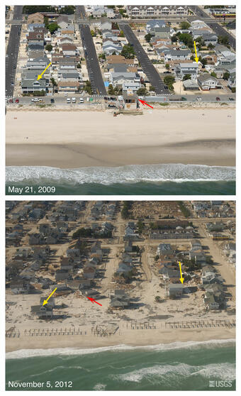
In late October 2012, Hurricane Sandy came ashore during a spring high tide on the New Jersey coastline, delivering hurricane-force winds, storm tides exceeding 19 feet, driving rain, and plummeting temperatures. Hurricane Sandy resulted in 72 direct fatalities in the mid-Atlantic and northeastern United States, and widespread and substantial physical, environmental, ecological, social, and economic impacts estimated at near $50 billion. Before the landfall of Hurricane Sandy, the USGS provided forecasts of potential coastal change; collected oblique aerial photography of pre-storm coastal morphology; deployed storm-surge sensors, rapid-deployment streamgages, wave sensors, and barometric pressure sensors; conducted Light Detection and Ranging (LIDAR) aerial topographic surveys of coastal areas; and issued a landslide alert for landslide prone areas. During the storm, Tidal Telemetry Networks provided real-time water-level information along the coast. Long-term network and rapid-deployment real-time streamgages and water-quality monitors reported on river levels and changes in water quality. Immediately after the storm, the USGS serviced real-time instrumentation, retrieved data from over 140 storm-surge sensors, and collected other essential environmental data, including more than 830 high-water marks mapping the extent and elevation of the storm surge. Post-storm lidar surveys documented storm impacts to coastal barriers, informing response and recovery and providing a new baseline to assess vulnerability of the reconfigured coast. The USGS Hazard Data Distribution System served storm-related information from many agencies on the Internet on a daily basis.
Immediately following Hurricane Sandy, the USGS developed a science plan to coordinate continuing USGS activities with other agencies and to guide continued data collection and analysis to ensure support for recovery and restoration efforts. The plan is titled "Meeting the Science Needs of the Nation in the Wake of Hurricane Sandy—A U.S. Geological Survey Science Plan for Support of Restoration and Recovery". Data, information, and tools produced by implementing this plan will: (1) further characterize impacts and changes, (2) guide mitigation and restoration of impacted communities and ecosystems, (3) inform a redevelopment strategy aimed at developing resilient coastal communities and ecosystems, (4) improve preparedness and responsiveness to the next hurricane or similar coastal disaster, and (5) enable improved hazard assessment, response, and recovery for future storms along the hurricane prone shoreline of the United States.
The activities outlined in this plan are organized in five themes.
- Coastal topography and bathymetry.
- Impacts to coastal beaches and barriers.
- Impacts of storm surge and estuarine and bay hydrology.
- Impacts on environmental quality and persisting contaminant exposures.
- Impacts to coastal ecosystems, habitats, and fish and wildlife.
A major emphasis for implementation of the plan is interacting with stakeholders to better understand their specific data and information needs; this understanding will help define the best way to make information available and also support the application of USGS science and expertise to decision making.
More Information
- The USGS Hurricane Sandy Response
New Hampshire Groundwater Used for Drinking Water Contains Arsenic: What's the Risk?
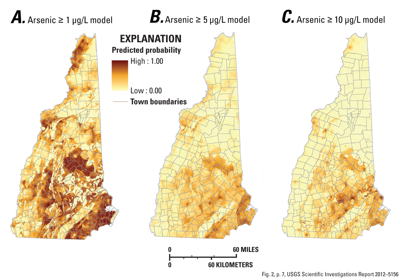
USGS scientists have developed a new approach for helping people understand the risk of exposure to arsenic, a common drinking-water contaminant in New Hampshire. The approach consists of a set of models that predict the probability of arsenic occurring in the groundwater within bedrock aquifers at concentrations of 1, 5, and 10 micrograms per liter (µg/L). The U.S Environmental Protection Agency has set the standard for arsenic in public drinking water to 10 µg/L—known as the Maximum Contaminant Level (MCL)—to protect people served by public-water systems from the effects of long-term exposure to arsenic. The new models were developed for the New Hampshire Environmental Public Health Tracking Program, a Centers for Disease Control and Prevention (CDC) funded program designed to help connect the dots between environmental hazards and health outcomes. The models are available to the public, public health scientists, and others. to. The models can help identify parts of the State at risk for high levels of arsenic in drinking water, and support studies related to human health. The statewide maps generated from the models are not designed to predict arsenic concentration in any single well, but they are expected to provide useful information in areas of the State that currently contain little to no data on arsenic concentration.
USGS scientists estimate that approximately 39 percent of groundwater in New Hampshire bedrock has at least a 50-percent chance of containing an arsenic concentration greater than or equal to 1 µg/L. This compares to about 5 percent of the State having at least a 50-percent chance of having an arsenic concentration at or above 10 µg/L. Not surprisingly, significant predictors of arsenic in groundwater from bedrock aquifers included geology, water chemistry, land use, hydrology, topography, and demographic factors. The models predict that the probability of arsenic greater than 1 µg/L is widespread throughout the State.
The scientists used more than 1,700 measurements of arsenic concentration from a combination of public and private water-supply wells to develop the models. The approach may aid public health officials determine the risk of human exposure and potential health effects of exposure to arsenic from private drinking-water wells.
More Information
- For more information contact Joseph D. Ayotte (USGS New Hampshire/Vermont Water Science Center)
- Estimated probability of arsenic in groundwater from bedrock aquifers in New Hampshire, 2011: USGS Scientific Investigations Report 2012-5156
Natural Attenuation Accelerating Pump-and-Treat Cleanup of TCE in Fractured Rock
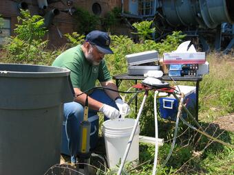
USGS scientists find that the natural attenuation of trichloroethylene (TCE) in a contaminated fractured rock aquifer in New Jersey significantly adds to the effectiveness of site cleanup operations. An active pump-and-treat cleanup system is presently removing about 630 kilograms of TCE per year (kg/yr) at the site. Naturally occurring biodegradation processes remove an additional 500 kg/yr. Natural TCE biodegradation is a welcome addition to overall cleanup operations at this site because it does not incur the economic costs of a pump-and-treat system, and will accelerate cleanup.
A team of USGS scientists working at the Naval Air Warfare Center (NAWC) Research Site in West Trenton, New Jersey, estimated TCE biodegradation rates by combining 20-years worth of data on the concentrations of two degradation products of TCE and chloride from observation wells with estimates of rock porosities and groundwater residence times. The methodology that the scientists used to estimate the natural attenuation of TCE in fractured rock is now available to be applied at other fractured bedrock sites. Fractured bedrock is widely regarded by environmental professionals as being particularly difficult to clean up because residual pure TCE can be distributed in fractures and TCE diffuses from the fractures into the surrounding rock. Once the TCE is in the surrounding rock it only diffuses back out very slowly. Therefore, this new methodology has the potential to help assess the role of natural attenuation at fractured bedrock contamination sites.
The USGS Toxic Substances Hydrology Program and the U.S. Navy provided funding for this study.
More Information
- For more information contact the USGS South Carolina Water Science Center
- Estimated trichloroethene transformation rates due to naturally occurring biodegradation in a fractured rock aquifer: Remediation Journal, v. 22, no. 2, p. 7-20, doi:10.1002/rem.21307
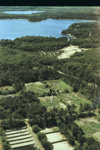
Groundwater Restoration Slowed by Organic Materials on Sediments
The amount of organic material stored on an aquifer's sediments can slow down natural processes that are often relied on to restore groundwater quality in a wastewater-contaminated aquifer. A team of USGS scientists found that analysis of sediment cores is an important part of developing reliable predictions for how long groundwater restoration will take. This observation resulted from a long-term study of a wastewater plume on Cape Cod, Massachusetts that is taking much longer to return to cleaner conditions than the scientists initially predicted. The ability to predict how long restoration will take is often the basis for decisions about whether or not to rely on monitored natural attenuation to remediate contaminated sites.
The scientists conducted long-term detailed sampling of groundwater and sediment from the wastewater plume. In the 15 years since wastewater disposal was stopped, the dissolved oxygen concentration has not returned to pristine levels near the disposal site, even though conservative chemicals in the wastewater such as chloride and boron have been flushed from the area. The scientists estimate that the return of dissolved oxygen to the aquifer, even near the disposal site, could take decades depending on the amount of biodegradable organic compounds that remain stored on the sediments from past disposal.
The USGS Toxic Substances Hydrology and Hydrologic Research and Development Programs funded this study.
Assessing Acid Mine Drainage Mitigation Strategies
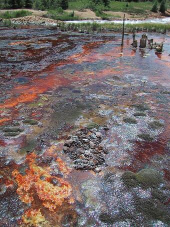
Field-based approaches developed by a team of USGS scientists have been used to evaluate strategies for the mitigation of acid mine drainage. The approaches were used to estimate post-cleanup water quality in two streams impacted by abandoned mines in Colorado and to identify the major sources of contamination in another Colorado stream. The approaches include prescribed field studies that are analyzed and interpreted using computer simulation models.
- In Mineral Creek, USGS scientists used a computer model to accurately predict water quality in the stream after cleanup. A comparison of model predictions and water-quality data before and after cleanup showed that the model accurately predicted attainment (or non-attainment) of water-quality standards in most of the scenarios tested.
- In Cement Creek, best management practices were evaluated for their ability to meet regulatory standards known as Total Maximum Daily Loads (TMDLs). The contributions to stream-water quality from groundwater sources and the effects of chemical transformations within the stream were found to decrease the effectiveness of the planned best management practices.
- In Peru Creek, the scientists applied a new approach for identifying the major sources of contamination to a mining-impacted stream. The approach includes determining the uncertainty in estimated contaminant loads associated with (1) natural variation in concentration of contaminants caused by daily cycles, (2) variability in laboratory analyses of constituent and tracer concentrations, and (3) variations introduced by field sampling. The measure of uncertainty is made possible by collecting replicate water-quality samples at key points along the stream. Consideration of uncertainty allowed cleanup managers to evaluate contaminant sources in light of potential errors, thereby lessening the potential for the misidentification of sources.
Funding for these studies was provided by the USGS Toxic Substances Hydrology Program, the Colorado Department of Public Health and Environment, and the U.S. Environmental Protection Agency. Cooperation with the Animas River Stakeholders Group, San Juan County, Colorado, and the San Juan Resource Conservation and Development Program helped make the studies possible.
Aquatic Organisms Absorb Metals From Ingested Mineral Particles
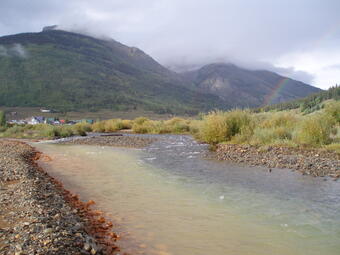
Aquatic organisms, such as insect larva and snails, living on the bottom of streams can directly absorb copper in mineral particles that are in the food they eat. Scientists have known that some organisms absorb metals from their food. Now it seems that the mineral particles in stream water and sediment are a potentially important source of metals to sediment dwellers and the food web.
USGS scientists developed methods to investigate how the chemical properties of mineral particles consumed by aquatic organisms affect the absorption of metals. The new methods use isotopically enriched metals as tracers to measure metal absorption during feeding experiments with freshwater organisms, such as the larva of mayflies (Serratella tibialis). The scientists developed a novel reverse labeling technique, which involves artificially enriching the test organisms with a rare isotope of the metal under study rather than adding the tracer to the natural mineral particles to be tested. Subsequent exposure to the element from the natural source particles shifts the isotopic ratio of the element in the test organism from the rare isotope to the natural isotope as the natural isotope is absorbed. The scientists can then measure the absorption of the metals from natural particles by measuring how much of the natural isotope replaces the rare isotope in the organism. This eliminates the need to alter the natural particles for the test.
This new technique will provide important information for regulators, resource managers, and scientists addressing contamination with metals in streams affected by acid mine drainage.
This study was funded by the USGS Toxic Substances Hydrology Program and Hydrologic Research and Development Program.
Potential Migration of Radionuclides from Active Uranium Mill
USGS scientists assessed the potential for offsite migration of radionuclides from an active uranium mill site near White Mesa, Utah. The mill site is currently the only conventional uranium mill operating in the United States. The scientists sampled groundwater, stream sediments, and plants to determine what the implications might be for offsite migration of contaminants from the mill site.
Uranium concentrations in sediment from three intermittent (ephemeral) streams east of the mill boundary exceeded natural background levels. Wind-blown dusts are a potential source of uranium contamination in two springs. Elevated concentrations of uranium and vanadium in sagebrush samples collected north-northeast, east, and south of the mill site also were suspected to be the result of wind-blown dust deposited on the pants and/or from dust transported to soil near the plants where it's taken up by the plants.
Measuring uranium concentrations in various environmental media provided added insights into uranium sources and exposure pathways. Based on the results of their study, the scientists proposed potential monitoring strategies to stakeholders.
The USGS conducted the study at the request of the Ute Mountain Ute Tribe. Funding for the study was provided by the U.S. Environmental Protection Agency, Ute Mountain Ute Tribe, and USGS Cooperative Water Program.
Improving Uranium Cleanup Methods
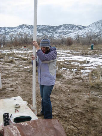
Scientists studying the transformation of uranium in subsurface sediments at a site with uranium contamination have discovered multiple pathways for the chemical reactions that transform hexavalent uranium [U(VI)], which is soluble and mobile in groundwater, to more insoluble forms of tetravalent uranium [U(IV)]. The multiple reaction pathways can take place concurrently. Unfortunately, some forms of U(IV) are not as insoluble as others, and it is important for cleanup professionals to know which forms are present at contamination sites. This information could lead to improved cleanup methods that involve the transformation of soluble U(VI) to insoluble forms of U(IV), such as the mineral uraninite (UO2). The objective of such remediation is to stabilize uranium plumes or to immobilize uranium in place.
A team of scientists from the SLAC National Accelerator Laboratory; Lawrence Berkeley National Laboratory; U.S. Geological Survey (USGS); Ecole Polytechnique Fédérale de Lausanne, Switzerland; and Washington University in St. Louis, Missouri, showed that transformations of U(VI) to U(IV) in subsurface sediments can result in the formation of more than one form of U(IV)—at the same time and in the same location. The most desired from of U(IV) is the mineral uraninite, because it is insoluble and is less likely to move in groundwater, which makes it the preferred end point for groundwater cleanup. Other forms of U(IV) the scientists studied are more soluble than uraninite, and could conceivably be re-dissolved if the chemistry of the groundwater changes in the future, which could undo cleanup actions. The study findings also have direct implications not only for our understanding of uranium cleanup approaches (such as bioremediation systems) but for our understanding of the geology of uranium ore formation and our understanding of global geochemical processes.
This study was funded by the U.S. Department of Energy, USGS National Research Council Postdoctoral Fellowship Program, Swiss National Science Foundation, Marie Curie Grant Program, and National Institutes of Health.
Soil in Ukraine Contaminated with Mercury and Arsenic

USGS scientists, collaborating with U.S. and Ukrainian scientists, found high concentrations of mercury and arsenic in soils from the Donets Basin, a metal-rich coal-mining region in eastern Ukraine. Soils near mines and mining areas can become contaminated, and humans can be exposed to contaminants in a number of ways. For example, leaching of contaminants into groundwater used for drinking water, uptake contaminants by crop plants, and unintentional ingestion of contaminated soils. The scientists collected soils from industrial areas as well as playgrounds and public spaces. Analysis confirmed that more than 90 percent of the soils collected from Ukrainian residential areas exceeded the U.S. Environmental Protection Agency soil screening level for arsenic. Leaching studies predicted that the arsenic in the soil had potentially more potential to be absorbed or ingested by humans than mercury.
Mercury in local soil and dust vacuumed from carpets in homes were both good predictors of blood and urinary mercury. The results of this study show the extent of environmental contamination in this region and how exposure to the contaminated soil could impact the residents. This study was supported, in part, by a U.S. Civilian Research and Development Foundation Cooperative Grant and the USGS Toxic Substances Hydrology, Hydrologic Research and Development, and Energy Resources Programs.
Mercury Levels in Tree Swallows and Loons Controlled by Lake pH
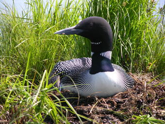
Tree swallows accumulate higher concentrations of mercury in their blood when they live on lakes with low pH than on lakes with more neutral-pH water. A team of USGS, Wisconsin Department of Natural Resources, and U.S. Environmental Protection Agency scientists came to this conclusion after studying tree swallows (Tachycineta bicolor) on eleven northern Wisconsin lakes with differing pH levels. The study was designed to assess the effects of lake pH on the accumulation of mercury and other trace elements in tree swallows and common loons (Gavia immer). Predictions of mercury exposure to wildlife based on water-quality and other nonbiological data are difficult because of complicated chemical and biological processes affecting how mercury is absorbed and processed by wildlife.
The scientists also gathered data on mercury exposure in loons and used the data to determine whether mercury exposure in swallows could be used to predict loon mercury exposure. Predictions, rather than direct sampling of loons, may be desirable because loons may not nest on all lakes where data are needed or they may be difficult to sample.
Although mercury exposure was approximately 15 times higher in loon eggs than in swallow eggs, there was a reasonably good association between the two species. Sampling the blood of tree swallows in addition to loons may enhance the assessment of the relative risk of mercury exposure to common loons, allowing wildlife scientists to cover a greater area with less cost. Mercury continues to be a contaminant of concern because source control remains difficult.
The USGS Contaminant Biology Program, Wisconsin Department of Natural Resources, and the U.S. Environmental Protection Agency provided funding for this study.
Is it Safe to Swim Today? New Models for Small Lakes Help Provide Answers
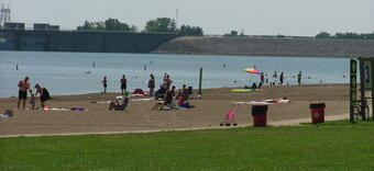
For more than a decade, predictive models have been used by public-health agencies for water-quality assessments of coastal recreational waters (such as swimming beaches on Lake Erie), but the effectiveness of the models has not been studied in inland waters. These new models address small inland lakes for the first time.
USGS scientists have developed predictive models that provide daily estimates of recreational water quality for swimming beaches on small lakes in Ohio. Traditionally, swim advisories or closings are issued by beach managers based on counts of indicator bacteria in water samples. This method takes at least 18 to 24 hours to complete and recreational water-quality may change during this time, leading to errors in assessments of public-health risk. The new predictive models use easily measured environmental and water-quality variables to estimate bacterial-indicator concentrations or the probability of exceeding target concentrations.
To develop the models, USGS scientists collected data from eight lakes during the recreational seasons of 2010 and 2011. They then constructed computer models for 13 swimming beaches. Some of the variables included in models at inland lake beach sites were rainfall, wind direction and speed, turbidity (a measure of the clarity of the water), and water temperature.
Predictive models at lakes with high swimmer densities provided better estimates of public health risk than the bacterial count methods currently used. Model results were not effective at some beaches because different climatic conditions occurred during the model development (very moist and moderate drought). Additional years of data collection during seasons with a variety of weather conditions may remedy this. These models will be a valuable resource for beach managers and the public.
The Ohio Water Development Authority, USGS Cooperative Water Program, and U.S. Environmental Protection Agency through its Office of Research and Development provided support for this study. The Muskingum Watershed Conservancy District, Clark County Combined Health District, Ohio Department of Natural Resources, and City of Celina Water Plant provided services that helped advance the study.
Restoring Historic Wetlands May Take Years
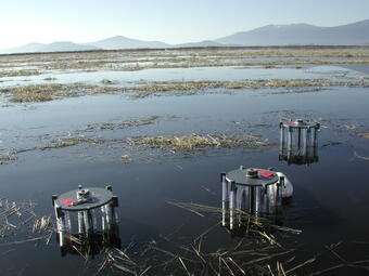
Despite being restored for over 5 years, the chemistry and biology of a historic wetland between the Upper Klamath and Agency Lakes in Oregon is still in transition. Scientists from the USGS and U.S. Bureau of Reclamation say the study area has not yet returned to the more natural state of a nearby wetland refuge.
The wetland had been drained and was used for agricultural production for seven decades. Explosive charges were used to remove large sections of multiple levees, which reconnected the former wetlands to the lakes and allowed water to flow into the wetlands again. One of the goals for the reconnection was to create additional habitat for wildlife, including two endangered fish species. Wildlife and water-resource managers were concerned about how long the recovery of the historic wetland would take.
Scientists monitored the water quality of the new wetland and also tracked the amount of nutrients (nitrate, ammonia, phosphorus) and metals (iron, manganese) moving in and out of the wetland sediments. They also monitored colonizing organisms, such as worms, leeches, and insect larvae that live on the bottom of the wetland. After 3 years, they found some things, such as dissolved organic matter and the community of organisms living on the bottom, had returned to levels and populations seen in much of Upper Klamath Lake. However, other essential elements, such as phosphorus, nitrogen, iron, and manganese, will take more time, perhaps even decades to return to a natural state.
The information provided by the scientists on the timescales and the interdependent processes involved in the restoration of the wetland will help resource managers develop appropriate management plans, as well as set appropriate expectations for the chemical, physical, and biological transitions associated with wetland restoration.
This study is being followed by an extended 5-year study of the entire Upper Klamath Lake to continue to look at how conditions on the bottom of the lake affect overall lake water quality. The USGS Toxic Substances Hydrology and Hydrologic Research and Development Programs and the U.S. Bureau of Reclamation funded this study.
Complex Mixture of Contaminants in Streams Found Miles from the Source
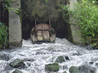
Natural processes such as dilution, chemical transformations, and microbial degradation are known to reduce concentrations of some contaminants from streams to below levels that can cause harm to aquatic organisms. USGS scientists, however, have shown that some chemicals discharged from municipal wastewater treatment facilities persist for miles downstream at levels known, or suspected, to cause adverse health effects in aquatic organisms—including endocrine disruption in fish. The scientists also found that these persistent chemicals occur in complex mixtures. The effect of these complex mixtures on the health of aquatic animals is unknown.
The scientists tracked water on two streams (Boulder Creek, Colorado, and Fourmile Creek, Iowa) as it flowed downstream from the point of wastewater discharge. The scientists then collected water samples from the same water as it moved downstream for analysis of a wide range of organic chemicals common in wastewater. Many of the chemicals showed little decrease in concentration downstream, other than that caused by dilution, as they flowed down the 6- to 8-mile segments of the two streams studied. Significantly, some of these contaminants persisted at concentrations that are known, or suspected, to cause sublethal health effects in exposed organisms.
Chemicals, such as steroidal hormones that mimic estrogen and could have additive effects were found in the chemical mixtures. The estrogen mimics and other chemicals could have multiple health effects that are additive.
The USGS Toxic Substances Hydrology and Hydrologic Research and Development Programs funded this study. Additional support was received by the U.S. Environmental Protection Agency.
Contaminants Impact Wildlife and Fish in the Chesapeake Bay

Legacy contaminants (chemicals no longer approved for use) and contaminants of emerging concern that persist in the environment are affecting the health of wildlife and fish in the Chesapeake Bay and its watershed. Many State agencies in the Chesapeake Bay watershed continue to report impaired water resources due to the persistence and toxicity of some previously banned pollutants. In addition, other contaminants of emerging concern are released to the environment at levels known, or suspected, to harm the health of fish and wildlife. These findings are documented in a recent report on toxic contaminants in the Chesapeake Bay and its watershed. The report is the result of an assessment of the Bay done by a team of scientists and managers from the U.S. Environmental Protection Agency, U.S. Fish and Wildlife Service, Hampton Roads Sanitation District of Virginia, and U.S. Geological Survey (USGS). The team reviewed State water-quality assessment reports, agency documents, and the peer-reviewed literature to summarize the state of knowledge about contaminants in the Chesapeake Bay watershed. This study is the first review of a comprehensive group of contaminants (including polychlorinated biphenyls (PCBs), dioxins, polycyclic aromatic hydrocarbons (PAHs), metals, pharmaceuticals, pesticides, personal-care products, hormones, and others) that were scientifically evaluated for the watershed. The report will be used to help the Chesapeake Bay Program partnership make decisions about strategies to minimize the impact of contaminants on the environmental health of the Chesapeake Bay watershed.
USGS participation in creating the report was sponsored in part by the USGS Priority Ecosystems Science, Toxic Substances Hydrology, and Contaminant Biology Programs.
Evidence of Little-Studied Class of Steroid Hormones in U.S. Streams
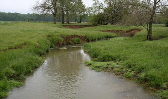
The National Cancer Institute (NCI), Laboratory of Receptor Biology and Gene Expression in collaboration with the USGS, looked for evidence of glucocorticoid and androgenic activity in streams. Glucocoricoids and androgens are both potential endocrine disruptors. Scientists tested water samples using a new cell-based bioassay that identified molecular responses triggered by the presence of glucocorticoids and androgens in natural stream water. They found glucocorticoid and androgen activity in 27 and 35 percent of the water samples, respectively, potentially indicating the widespread occurrence of these hormones in U.S. streams.
Glucocorticoids are steroid hormones commonly referred to as "stress hormones," are known for their potential to decrease immune responses. Glucocorticoid-based pharmaceuticals (prednisone and hydrocortisone, for example) are widely prescribed to relieve inflammation. Androgens are anabolic steroids that affect the development and maintenance of male characteristics as well as other physiological functions. Depending on the timing of exposure, these glucocorticoids and androgens can have significant endocrine-disrupting effects, but unlike estrogenic chemicals, not much is known about their occurrence in the environment.
USGS scientists provided extracts for testing from more than 100 water samples from streams and rivers located in 14 States. The testing method the NCI researchers developed allowed them to detect the activation of cell receptors or genes that respond specifically to glucocorticoids or androgens. Activation of the fluorescently tagged cell receptors led visual evidence of the presence of glucocorticoids or androgens in the samples of stream water. Other molecular methods were used to confirm that specific genes were turned on.
Considering that both glucocorticoids and androgens influence body development and metabolism, and have the potential to influence normal reproductive, endocrine, and immune system function, their presence in the environment has potential implications for wildlife and human health.
Intersex Fish and Contaminant Mixtures Found at Smallmouth Bass Nests

Contaminants including hormones, pesticides, and pharmaceuticals have been detected at fish nesting sites in the Potomac River watershed where smallmouth bass (Micropterus dolomieu) were found with evidence of endocrine disruption, such as intersex (having both female and male characteristics). Although these contaminants are known to originate from a variety of animal and human-waste sources, results of a recent USGS study support previous studies suggesting that seasonal runoff from agricultural activities could be an important source of exposure to endocrine disrupting chemicals by smallmouth bass during their early life stages, including eggs, larvae, and hatchlings (fry).
USGS scientists collected bed sediment and water samples from sites where smallmouth bass spawn and build nests in the Potomac River watershed. The samples were analyzed for a wide range of chemicals including those that are suspected endocrine disruptors. The scientists also studied adult fish collected from the nesting sites. This study and others will help resource managers and others determine factors contributing to abnormal fish health, such as intersex, observed in this region.
The Toxic Substances Hydrology, Contaminant Biology, Priority Ecosystems Science, and Fisheries: Aquatic and Endangered Resources Programs of the USGS supported this study. Funding was also provided by the West Virginia Division of Natural Resources, West Virginia Department of Environmental Protection, Virginia Departments of Game and Inland Fisheries and Environmental Quality, and Maryland Department of Natural Resources.
Fungicides Found in Streams and Groundwater in High-Use Agricultural Settings
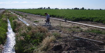
USGS scientists have documented the occurrence of several previously unreported fungicides in water and sediment in streams located near farm fields. Fungicides are used to control the outbreak of persistent plant diseases, which are a concern across the Nation because they can significantly reduce crop yields. Although more than 3,600 pesticide products containing fungicides are currently registered with the U.S. Environmental Protection Agency, few studies have investigated the occurrence or potential effects of fungicides in the environment.
A recent USGS study has shown that many fungicides are transported from areas of intense use to nearby streams and groundwater. In many case the fungicides are found at concentrations that may be a concern for environmental health. Currently, limited toxicological information is available on the effects of fungicides on beneficial fungi, which are important to stream ecosystems. USGS scientists tested water and sediment from three geographic areas (Presque Isle, Maine; Parma, Idaho; and Hancock, Wisconsin) where fungicides are used intensively. They found at least one fungicide in 75 percent of the surface waters sampled and in 58 percent of the groundwater wells sampled. They also found at least two fungicides in 55 percent of the bed sediment samples and in 83 percent of the suspended sediment samples that were collected.
The results of this study indicate the importance of including fungicides in pesticide-monitoring programs, particularly in areas where crops are grown that require frequent treatments to prevent fungal diseases. This study will provide additional information to regulators and water-resource managers about the occurrence of fungicides in the environment across the Nation.
The USGS Toxic Substances Hydrology Program provided the funding for this study.
EPA Award for Tracking Contaminant Exposure and Effects in Food Webs
USGS scientist David Walters and his U.S. Environmental Protection Agency (EPA) collaborators won a Level 1 Scientific and Technological Achievement Award (STAA)—the highest research award given out by EPA. Criteria for these annual awards include scientific or technological research of exceptionally high quality, of national significance, of high impact on a broad area of science/technology, and recognizable as a major scientific/technological achievement within its field of study.
Results of the study "Identifying Mechanisms of Contaminant Bioaccumulation and Developing Indicators of Ecosystem Recovery" were published in Environmental Science and Technology and in Ecological Applications. The scientists identified mechanisms of contaminant exposure in aquatic organisms and then explored how this exposure propagates into food webs via the emergence of adult insects from contaminated aquatic ecosystems. Insects emerging from aquatic habitats affect the distribution, abundance, production, and diversity of predators. Contaminants, aquatic insects, and their predators interact in two important ways:
- Aquatic insects accumulate compounds and elements in their tissues as larvae, which are transferred to predators, such as birds, when they emerge from the water; and
- Toxic contaminants like metals limit insect emergence, thereby severing the ecological linkage between aquatic and land based ecosystems.

The U.S. Environmental Protection Agency provided the funds for the team's study.
This edition of the GeoHEALTH—USGS Newsletter features recent research from the Environmental Health Toxic Substances Hydrology and Contaminant Biology Programs.
Featured Articles
Emerging Avian Influenza Viruses Highlight the Importance of Wild Bird Surveillance

On March 31, 2013, China announced that a novel strain of avian influenza virus [A(H7N9)] was causing severe illness and death in humans, but was not causing illness in the few birds found to be infected by the virus. Because some birds migrate between continents, a concern was raised that wild birds infected with this virus in China might migrate to the United States and bring this virus with them. This influenza virus is new and very unusual because it does not cause disease in chickens (low pathogenic avian influenza virus - LPAIV) but the respiratory disease it causes in humans can be severe, often fatal. Not enough is known about the virus to answer all of the questions, but U.S. Geological Survey (USGS) science was used to build a model showing that the risk of this virus moving to the United States by migratory birds was low at this time.
Recent studies by USGS scientists are helping provide some understanding of the movement and genetic mixing of avian influenza (AI) viruses in birds in Asia and North America. The studies listed here conclude that AI viruses from Asia likely change their genetic makeup either as they move in their avian hosts from Asia to North America or upon arrival in North America. No completely Asian-origin AI viruses have been detected in North American birds, but numerous viruses of mixed genetic backgrounds, both Asian and North American, have been identified. These studies illustrate the significant role that migratory bird breeding grounds in Russia and Alaska play in this important family of viruses. The breeding grounds are mixing areas not only for bird populations but also for the AI viruses they may carry.
- Antibodies to Avian Influenza Viruses among Wild Waterfowl in Alaska — Scientists from the USGS and the U.S. Fish and Wildlife Service showed that 60 percent of the 4,485 wild waterfowl from 11 species they studied over 14 years in Alaska had antibodies from infection with an AI virus. Once infected, a bird usually sheds AI virus for only a few days, making it difficult to isolate the virus. However antibodies developed in response to viral infection can be found in the blood from months to years after infection providing a history of exposure. Not all waterfowl species are equally susceptible to AI viruses so species with high levels of AI virus antibodies and those with high AI viral infection rates are likely species to target for LPAIV and HPAIV surveillance programs.
This study was funded by the USGS Wildlife: Terrestrial and Endangered Resources Program, the U.S. Fish and Wildlife Service, and the National Institutes of Health. For more information contact Paul Flint (USGS Alaska Science Center).
- Annual Patterns of Movement Influence Exposure of Wild Birds to Influenza Viruses — USGS scientists reported 47 to 96 percent of geese in late summer on the Yukon-Kuskokwim Delta of western Alaska had detectible antibodies to AI viruses, indicating previous infection with the virus. Over 95 percent of emperor geese (Chen canagica) sampled had detectible AI virus antibodies, compared to 40 to 60 percent in other species of geese in the study. Emperor geese spend winters in the Aleutian Islands of Alaska, moving to western Alaska for breeding and Russia for molting in late summer. Why emperor geese exhibit higher exposure to AI viruses is unknown. However, the restricted distribution of emperor geese when compared to other species in the Bering Sea region may contribute to their higher exposure to AI.
This study was funded by the USGS Wildlife: Terrestrial and Endangered Resources Program, the U.S. Fish and Wildlife Service, and the National Institutes of Health. For more information contact USGS Alaska Science Center.
-
 Sources/Usage: Public Domain. View Media Details
Dabbling ducks, such as pintails (Anas acuta) and mallards (Anas platyrhynchos), feed mainly from the surface rather than diving for aquatic plants. Transmission of Avian Influenza Viruses Among Alaskan Dabbling Ducks — Scientists from the USGS and the Institute of Arctic Biology at the University of Alaska Fairbanks used the genetics of LPAIV in dabbling ducks to examine how frequently genetically similar AI viruses are found across different timeframes and geographical distances in Alaska. Many AI virus genes can be identified as either Asian or North American because of their unique characteristics. The results suggest that highly similar AI viruses are more often found in birds that are in the same place at the same time; within days of each other and across short geographic distances (kilometers). Highly similar AI viruses were less frequently observed across larger distances (hundreds of kilometers) and longer time periods (years).
These results provide an initial perspective into how frequently avian influenza viruses change over time and space and support the observation that no completely Eurasian viruses have ever been detected in Alaska. Such information is useful in forecasting the movement of avian influenza viruses from Asia and other continents into North America.
This study was funded by the USGS Wildlife: Terrestrial and Endangered Resources Program and the U.S. Fish and Wildlife Service. For more information contact Andrew Reeves (USGS Alaska Science Center).
-
 Sources/Usage: Public Domain. View Media Details
A mallard in flight. Mallards are a principal host of avian influenza viruses in nature. Avian Influenza Viruses Differ among Migrating and Resident Mallards (Anas platyrhynchos) in Northern California Wetlands — Mallards contribute differently to avian influenza virus gene pools depending on their migration strategy according to USGS scientists and their collaborators from Massachusetts Institute of Technology, University of California, Davis, Environment Canada, and University of Minnesota. Looking at stable isotopes in the flight feathers of wintering populations of mallards in northern California wetlands, scientists identified those birds that had migrated and those that hadn't (residents).
They then looked closely at the AI viruses isolated from these two groups. Migrants introduced viruses with genes from northern breeding grounds (Alaska and the northwest Pacific rim) into the wintering population, facilitating gene flow of viruses at continental scales. However, circulation of imported viruses in the wintering population of mallards appeared to be limited. Mallards that stayed in the wetlands year-round facilitated persistent circulation of a limited number of AI virus subtypes. Characterizing the more genetically stable AI viruses in the resident mallards and the contribution of novel viruses from afar, offers scientists an AI model of "virus exchange in temperate regions driven by the convergence of wild populations with separate geographic origins and exposure histories."
This study was funded by the USGS Wildlife: Terrestrial and Endangered Resources Program, the National Institutes of Health's National Institute of Allergy and Infectious Diseases (NIAID), and the U.S. Fish and Wildlife Service. For more information contact Nichola Hill (USGS Western Ecological Research Center) and John Takekawa (USGS Western Ecological Research Center).
"We're trying to determine the factors that affect wildlife disease transmission," says USGS ecologist John Takekawa. "There is more to learn about how waterfowl migration relates to disease spread and about the environmental or human factors that shape these migration strategies."
Low Pathogenic and Highly Pathogenic Avian Influenza Viruses—What's the difference?
Tests for pathogenicity are done in chickens and are not necessarily relevant to other birds or people.
- Low pathogenicity (LPAI) means that infected chickens, do not get sick from the virus.
- High pathogenicity (HPAI) means chickens die from being infected with the virus.
USGS Response to Hurricane Sandy

In late October 2012, Hurricane Sandy came ashore during a spring high tide on the New Jersey coastline, delivering hurricane-force winds, storm tides exceeding 19 feet, driving rain, and plummeting temperatures. Hurricane Sandy resulted in 72 direct fatalities in the mid-Atlantic and northeastern United States, and widespread and substantial physical, environmental, ecological, social, and economic impacts estimated at near $50 billion. Before the landfall of Hurricane Sandy, the USGS provided forecasts of potential coastal change; collected oblique aerial photography of pre-storm coastal morphology; deployed storm-surge sensors, rapid-deployment streamgages, wave sensors, and barometric pressure sensors; conducted Light Detection and Ranging (LIDAR) aerial topographic surveys of coastal areas; and issued a landslide alert for landslide prone areas. During the storm, Tidal Telemetry Networks provided real-time water-level information along the coast. Long-term network and rapid-deployment real-time streamgages and water-quality monitors reported on river levels and changes in water quality. Immediately after the storm, the USGS serviced real-time instrumentation, retrieved data from over 140 storm-surge sensors, and collected other essential environmental data, including more than 830 high-water marks mapping the extent and elevation of the storm surge. Post-storm lidar surveys documented storm impacts to coastal barriers, informing response and recovery and providing a new baseline to assess vulnerability of the reconfigured coast. The USGS Hazard Data Distribution System served storm-related information from many agencies on the Internet on a daily basis.
Immediately following Hurricane Sandy, the USGS developed a science plan to coordinate continuing USGS activities with other agencies and to guide continued data collection and analysis to ensure support for recovery and restoration efforts. The plan is titled "Meeting the Science Needs of the Nation in the Wake of Hurricane Sandy—A U.S. Geological Survey Science Plan for Support of Restoration and Recovery". Data, information, and tools produced by implementing this plan will: (1) further characterize impacts and changes, (2) guide mitigation and restoration of impacted communities and ecosystems, (3) inform a redevelopment strategy aimed at developing resilient coastal communities and ecosystems, (4) improve preparedness and responsiveness to the next hurricane or similar coastal disaster, and (5) enable improved hazard assessment, response, and recovery for future storms along the hurricane prone shoreline of the United States.
The activities outlined in this plan are organized in five themes.
- Coastal topography and bathymetry.
- Impacts to coastal beaches and barriers.
- Impacts of storm surge and estuarine and bay hydrology.
- Impacts on environmental quality and persisting contaminant exposures.
- Impacts to coastal ecosystems, habitats, and fish and wildlife.
A major emphasis for implementation of the plan is interacting with stakeholders to better understand their specific data and information needs; this understanding will help define the best way to make information available and also support the application of USGS science and expertise to decision making.
More Information
- The USGS Hurricane Sandy Response
New Hampshire Groundwater Used for Drinking Water Contains Arsenic: What's the Risk?
USGS scientists have developed a new approach for helping people understand the risk of exposure to arsenic, a common drinking-water contaminant in New Hampshire. The approach consists of a set of models that predict the probability of arsenic occurring in the groundwater within bedrock aquifers at concentrations of 1, 5, and 10 micrograms per liter (µg/L). The U.S Environmental Protection Agency has set the standard for arsenic in public drinking water to 10 µg/L—known as the Maximum Contaminant Level (MCL)—to protect people served by public-water systems from the effects of long-term exposure to arsenic. The new models were developed for the New Hampshire Environmental Public Health Tracking Program, a Centers for Disease Control and Prevention (CDC) funded program designed to help connect the dots between environmental hazards and health outcomes. The models are available to the public, public health scientists, and others. to. The models can help identify parts of the State at risk for high levels of arsenic in drinking water, and support studies related to human health. The statewide maps generated from the models are not designed to predict arsenic concentration in any single well, but they are expected to provide useful information in areas of the State that currently contain little to no data on arsenic concentration.
USGS scientists estimate that approximately 39 percent of groundwater in New Hampshire bedrock has at least a 50-percent chance of containing an arsenic concentration greater than or equal to 1 µg/L. This compares to about 5 percent of the State having at least a 50-percent chance of having an arsenic concentration at or above 10 µg/L. Not surprisingly, significant predictors of arsenic in groundwater from bedrock aquifers included geology, water chemistry, land use, hydrology, topography, and demographic factors. The models predict that the probability of arsenic greater than 1 µg/L is widespread throughout the State.
The scientists used more than 1,700 measurements of arsenic concentration from a combination of public and private water-supply wells to develop the models. The approach may aid public health officials determine the risk of human exposure and potential health effects of exposure to arsenic from private drinking-water wells.

More Information
- For more information contact Joseph D. Ayotte (USGS New Hampshire/Vermont Water Science Center)
- Estimated probability of arsenic in groundwater from bedrock aquifers in New Hampshire, 2011: USGS Scientific Investigations Report 2012-5156
Natural Attenuation Accelerating Pump-and-Treat Cleanup of TCE in Fractured Rock

USGS scientists find that the natural attenuation of trichloroethylene (TCE) in a contaminated fractured rock aquifer in New Jersey significantly adds to the effectiveness of site cleanup operations. An active pump-and-treat cleanup system is presently removing about 630 kilograms of TCE per year (kg/yr) at the site. Naturally occurring biodegradation processes remove an additional 500 kg/yr. Natural TCE biodegradation is a welcome addition to overall cleanup operations at this site because it does not incur the economic costs of a pump-and-treat system, and will accelerate cleanup.
A team of USGS scientists working at the Naval Air Warfare Center (NAWC) Research Site in West Trenton, New Jersey, estimated TCE biodegradation rates by combining 20-years worth of data on the concentrations of two degradation products of TCE and chloride from observation wells with estimates of rock porosities and groundwater residence times. The methodology that the scientists used to estimate the natural attenuation of TCE in fractured rock is now available to be applied at other fractured bedrock sites. Fractured bedrock is widely regarded by environmental professionals as being particularly difficult to clean up because residual pure TCE can be distributed in fractures and TCE diffuses from the fractures into the surrounding rock. Once the TCE is in the surrounding rock it only diffuses back out very slowly. Therefore, this new methodology has the potential to help assess the role of natural attenuation at fractured bedrock contamination sites.
The USGS Toxic Substances Hydrology Program and the U.S. Navy provided funding for this study.
More Information
- For more information contact the USGS South Carolina Water Science Center
- Estimated trichloroethene transformation rates due to naturally occurring biodegradation in a fractured rock aquifer: Remediation Journal, v. 22, no. 2, p. 7-20, doi:10.1002/rem.21307

Groundwater Restoration Slowed by Organic Materials on Sediments
The amount of organic material stored on an aquifer's sediments can slow down natural processes that are often relied on to restore groundwater quality in a wastewater-contaminated aquifer. A team of USGS scientists found that analysis of sediment cores is an important part of developing reliable predictions for how long groundwater restoration will take. This observation resulted from a long-term study of a wastewater plume on Cape Cod, Massachusetts that is taking much longer to return to cleaner conditions than the scientists initially predicted. The ability to predict how long restoration will take is often the basis for decisions about whether or not to rely on monitored natural attenuation to remediate contaminated sites.
The scientists conducted long-term detailed sampling of groundwater and sediment from the wastewater plume. In the 15 years since wastewater disposal was stopped, the dissolved oxygen concentration has not returned to pristine levels near the disposal site, even though conservative chemicals in the wastewater such as chloride and boron have been flushed from the area. The scientists estimate that the return of dissolved oxygen to the aquifer, even near the disposal site, could take decades depending on the amount of biodegradable organic compounds that remain stored on the sediments from past disposal.
The USGS Toxic Substances Hydrology and Hydrologic Research and Development Programs funded this study.
Assessing Acid Mine Drainage Mitigation Strategies

Field-based approaches developed by a team of USGS scientists have been used to evaluate strategies for the mitigation of acid mine drainage. The approaches were used to estimate post-cleanup water quality in two streams impacted by abandoned mines in Colorado and to identify the major sources of contamination in another Colorado stream. The approaches include prescribed field studies that are analyzed and interpreted using computer simulation models.
- In Mineral Creek, USGS scientists used a computer model to accurately predict water quality in the stream after cleanup. A comparison of model predictions and water-quality data before and after cleanup showed that the model accurately predicted attainment (or non-attainment) of water-quality standards in most of the scenarios tested.
- In Cement Creek, best management practices were evaluated for their ability to meet regulatory standards known as Total Maximum Daily Loads (TMDLs). The contributions to stream-water quality from groundwater sources and the effects of chemical transformations within the stream were found to decrease the effectiveness of the planned best management practices.
- In Peru Creek, the scientists applied a new approach for identifying the major sources of contamination to a mining-impacted stream. The approach includes determining the uncertainty in estimated contaminant loads associated with (1) natural variation in concentration of contaminants caused by daily cycles, (2) variability in laboratory analyses of constituent and tracer concentrations, and (3) variations introduced by field sampling. The measure of uncertainty is made possible by collecting replicate water-quality samples at key points along the stream. Consideration of uncertainty allowed cleanup managers to evaluate contaminant sources in light of potential errors, thereby lessening the potential for the misidentification of sources.
Funding for these studies was provided by the USGS Toxic Substances Hydrology Program, the Colorado Department of Public Health and Environment, and the U.S. Environmental Protection Agency. Cooperation with the Animas River Stakeholders Group, San Juan County, Colorado, and the San Juan Resource Conservation and Development Program helped make the studies possible.
Aquatic Organisms Absorb Metals From Ingested Mineral Particles

Aquatic organisms, such as insect larva and snails, living on the bottom of streams can directly absorb copper in mineral particles that are in the food they eat. Scientists have known that some organisms absorb metals from their food. Now it seems that the mineral particles in stream water and sediment are a potentially important source of metals to sediment dwellers and the food web.
USGS scientists developed methods to investigate how the chemical properties of mineral particles consumed by aquatic organisms affect the absorption of metals. The new methods use isotopically enriched metals as tracers to measure metal absorption during feeding experiments with freshwater organisms, such as the larva of mayflies (Serratella tibialis). The scientists developed a novel reverse labeling technique, which involves artificially enriching the test organisms with a rare isotope of the metal under study rather than adding the tracer to the natural mineral particles to be tested. Subsequent exposure to the element from the natural source particles shifts the isotopic ratio of the element in the test organism from the rare isotope to the natural isotope as the natural isotope is absorbed. The scientists can then measure the absorption of the metals from natural particles by measuring how much of the natural isotope replaces the rare isotope in the organism. This eliminates the need to alter the natural particles for the test.
This new technique will provide important information for regulators, resource managers, and scientists addressing contamination with metals in streams affected by acid mine drainage.
This study was funded by the USGS Toxic Substances Hydrology Program and Hydrologic Research and Development Program.
Potential Migration of Radionuclides from Active Uranium Mill
USGS scientists assessed the potential for offsite migration of radionuclides from an active uranium mill site near White Mesa, Utah. The mill site is currently the only conventional uranium mill operating in the United States. The scientists sampled groundwater, stream sediments, and plants to determine what the implications might be for offsite migration of contaminants from the mill site.
Uranium concentrations in sediment from three intermittent (ephemeral) streams east of the mill boundary exceeded natural background levels. Wind-blown dusts are a potential source of uranium contamination in two springs. Elevated concentrations of uranium and vanadium in sagebrush samples collected north-northeast, east, and south of the mill site also were suspected to be the result of wind-blown dust deposited on the pants and/or from dust transported to soil near the plants where it's taken up by the plants.
Measuring uranium concentrations in various environmental media provided added insights into uranium sources and exposure pathways. Based on the results of their study, the scientists proposed potential monitoring strategies to stakeholders.
The USGS conducted the study at the request of the Ute Mountain Ute Tribe. Funding for the study was provided by the U.S. Environmental Protection Agency, Ute Mountain Ute Tribe, and USGS Cooperative Water Program.
Improving Uranium Cleanup Methods

Scientists studying the transformation of uranium in subsurface sediments at a site with uranium contamination have discovered multiple pathways for the chemical reactions that transform hexavalent uranium [U(VI)], which is soluble and mobile in groundwater, to more insoluble forms of tetravalent uranium [U(IV)]. The multiple reaction pathways can take place concurrently. Unfortunately, some forms of U(IV) are not as insoluble as others, and it is important for cleanup professionals to know which forms are present at contamination sites. This information could lead to improved cleanup methods that involve the transformation of soluble U(VI) to insoluble forms of U(IV), such as the mineral uraninite (UO2). The objective of such remediation is to stabilize uranium plumes or to immobilize uranium in place.
A team of scientists from the SLAC National Accelerator Laboratory; Lawrence Berkeley National Laboratory; U.S. Geological Survey (USGS); Ecole Polytechnique Fédérale de Lausanne, Switzerland; and Washington University in St. Louis, Missouri, showed that transformations of U(VI) to U(IV) in subsurface sediments can result in the formation of more than one form of U(IV)—at the same time and in the same location. The most desired from of U(IV) is the mineral uraninite, because it is insoluble and is less likely to move in groundwater, which makes it the preferred end point for groundwater cleanup. Other forms of U(IV) the scientists studied are more soluble than uraninite, and could conceivably be re-dissolved if the chemistry of the groundwater changes in the future, which could undo cleanup actions. The study findings also have direct implications not only for our understanding of uranium cleanup approaches (such as bioremediation systems) but for our understanding of the geology of uranium ore formation and our understanding of global geochemical processes.
This study was funded by the U.S. Department of Energy, USGS National Research Council Postdoctoral Fellowship Program, Swiss National Science Foundation, Marie Curie Grant Program, and National Institutes of Health.
Soil in Ukraine Contaminated with Mercury and Arsenic

USGS scientists, collaborating with U.S. and Ukrainian scientists, found high concentrations of mercury and arsenic in soils from the Donets Basin, a metal-rich coal-mining region in eastern Ukraine. Soils near mines and mining areas can become contaminated, and humans can be exposed to contaminants in a number of ways. For example, leaching of contaminants into groundwater used for drinking water, uptake contaminants by crop plants, and unintentional ingestion of contaminated soils. The scientists collected soils from industrial areas as well as playgrounds and public spaces. Analysis confirmed that more than 90 percent of the soils collected from Ukrainian residential areas exceeded the U.S. Environmental Protection Agency soil screening level for arsenic. Leaching studies predicted that the arsenic in the soil had potentially more potential to be absorbed or ingested by humans than mercury.
Mercury in local soil and dust vacuumed from carpets in homes were both good predictors of blood and urinary mercury. The results of this study show the extent of environmental contamination in this region and how exposure to the contaminated soil could impact the residents. This study was supported, in part, by a U.S. Civilian Research and Development Foundation Cooperative Grant and the USGS Toxic Substances Hydrology, Hydrologic Research and Development, and Energy Resources Programs.
Mercury Levels in Tree Swallows and Loons Controlled by Lake pH

Tree swallows accumulate higher concentrations of mercury in their blood when they live on lakes with low pH than on lakes with more neutral-pH water. A team of USGS, Wisconsin Department of Natural Resources, and U.S. Environmental Protection Agency scientists came to this conclusion after studying tree swallows (Tachycineta bicolor) on eleven northern Wisconsin lakes with differing pH levels. The study was designed to assess the effects of lake pH on the accumulation of mercury and other trace elements in tree swallows and common loons (Gavia immer). Predictions of mercury exposure to wildlife based on water-quality and other nonbiological data are difficult because of complicated chemical and biological processes affecting how mercury is absorbed and processed by wildlife.
The scientists also gathered data on mercury exposure in loons and used the data to determine whether mercury exposure in swallows could be used to predict loon mercury exposure. Predictions, rather than direct sampling of loons, may be desirable because loons may not nest on all lakes where data are needed or they may be difficult to sample.
Although mercury exposure was approximately 15 times higher in loon eggs than in swallow eggs, there was a reasonably good association between the two species. Sampling the blood of tree swallows in addition to loons may enhance the assessment of the relative risk of mercury exposure to common loons, allowing wildlife scientists to cover a greater area with less cost. Mercury continues to be a contaminant of concern because source control remains difficult.
The USGS Contaminant Biology Program, Wisconsin Department of Natural Resources, and the U.S. Environmental Protection Agency provided funding for this study.
Is it Safe to Swim Today? New Models for Small Lakes Help Provide Answers

For more than a decade, predictive models have been used by public-health agencies for water-quality assessments of coastal recreational waters (such as swimming beaches on Lake Erie), but the effectiveness of the models has not been studied in inland waters. These new models address small inland lakes for the first time.
USGS scientists have developed predictive models that provide daily estimates of recreational water quality for swimming beaches on small lakes in Ohio. Traditionally, swim advisories or closings are issued by beach managers based on counts of indicator bacteria in water samples. This method takes at least 18 to 24 hours to complete and recreational water-quality may change during this time, leading to errors in assessments of public-health risk. The new predictive models use easily measured environmental and water-quality variables to estimate bacterial-indicator concentrations or the probability of exceeding target concentrations.
To develop the models, USGS scientists collected data from eight lakes during the recreational seasons of 2010 and 2011. They then constructed computer models for 13 swimming beaches. Some of the variables included in models at inland lake beach sites were rainfall, wind direction and speed, turbidity (a measure of the clarity of the water), and water temperature.
Predictive models at lakes with high swimmer densities provided better estimates of public health risk than the bacterial count methods currently used. Model results were not effective at some beaches because different climatic conditions occurred during the model development (very moist and moderate drought). Additional years of data collection during seasons with a variety of weather conditions may remedy this. These models will be a valuable resource for beach managers and the public.
The Ohio Water Development Authority, USGS Cooperative Water Program, and U.S. Environmental Protection Agency through its Office of Research and Development provided support for this study. The Muskingum Watershed Conservancy District, Clark County Combined Health District, Ohio Department of Natural Resources, and City of Celina Water Plant provided services that helped advance the study.
Restoring Historic Wetlands May Take Years

Despite being restored for over 5 years, the chemistry and biology of a historic wetland between the Upper Klamath and Agency Lakes in Oregon is still in transition. Scientists from the USGS and U.S. Bureau of Reclamation say the study area has not yet returned to the more natural state of a nearby wetland refuge.
The wetland had been drained and was used for agricultural production for seven decades. Explosive charges were used to remove large sections of multiple levees, which reconnected the former wetlands to the lakes and allowed water to flow into the wetlands again. One of the goals for the reconnection was to create additional habitat for wildlife, including two endangered fish species. Wildlife and water-resource managers were concerned about how long the recovery of the historic wetland would take.
Scientists monitored the water quality of the new wetland and also tracked the amount of nutrients (nitrate, ammonia, phosphorus) and metals (iron, manganese) moving in and out of the wetland sediments. They also monitored colonizing organisms, such as worms, leeches, and insect larvae that live on the bottom of the wetland. After 3 years, they found some things, such as dissolved organic matter and the community of organisms living on the bottom, had returned to levels and populations seen in much of Upper Klamath Lake. However, other essential elements, such as phosphorus, nitrogen, iron, and manganese, will take more time, perhaps even decades to return to a natural state.
The information provided by the scientists on the timescales and the interdependent processes involved in the restoration of the wetland will help resource managers develop appropriate management plans, as well as set appropriate expectations for the chemical, physical, and biological transitions associated with wetland restoration.
This study is being followed by an extended 5-year study of the entire Upper Klamath Lake to continue to look at how conditions on the bottom of the lake affect overall lake water quality. The USGS Toxic Substances Hydrology and Hydrologic Research and Development Programs and the U.S. Bureau of Reclamation funded this study.
Complex Mixture of Contaminants in Streams Found Miles from the Source

Natural processes such as dilution, chemical transformations, and microbial degradation are known to reduce concentrations of some contaminants from streams to below levels that can cause harm to aquatic organisms. USGS scientists, however, have shown that some chemicals discharged from municipal wastewater treatment facilities persist for miles downstream at levels known, or suspected, to cause adverse health effects in aquatic organisms—including endocrine disruption in fish. The scientists also found that these persistent chemicals occur in complex mixtures. The effect of these complex mixtures on the health of aquatic animals is unknown.
The scientists tracked water on two streams (Boulder Creek, Colorado, and Fourmile Creek, Iowa) as it flowed downstream from the point of wastewater discharge. The scientists then collected water samples from the same water as it moved downstream for analysis of a wide range of organic chemicals common in wastewater. Many of the chemicals showed little decrease in concentration downstream, other than that caused by dilution, as they flowed down the 6- to 8-mile segments of the two streams studied. Significantly, some of these contaminants persisted at concentrations that are known, or suspected, to cause sublethal health effects in exposed organisms.
Chemicals, such as steroidal hormones that mimic estrogen and could have additive effects were found in the chemical mixtures. The estrogen mimics and other chemicals could have multiple health effects that are additive.
The USGS Toxic Substances Hydrology and Hydrologic Research and Development Programs funded this study. Additional support was received by the U.S. Environmental Protection Agency.
Contaminants Impact Wildlife and Fish in the Chesapeake Bay

Legacy contaminants (chemicals no longer approved for use) and contaminants of emerging concern that persist in the environment are affecting the health of wildlife and fish in the Chesapeake Bay and its watershed. Many State agencies in the Chesapeake Bay watershed continue to report impaired water resources due to the persistence and toxicity of some previously banned pollutants. In addition, other contaminants of emerging concern are released to the environment at levels known, or suspected, to harm the health of fish and wildlife. These findings are documented in a recent report on toxic contaminants in the Chesapeake Bay and its watershed. The report is the result of an assessment of the Bay done by a team of scientists and managers from the U.S. Environmental Protection Agency, U.S. Fish and Wildlife Service, Hampton Roads Sanitation District of Virginia, and U.S. Geological Survey (USGS). The team reviewed State water-quality assessment reports, agency documents, and the peer-reviewed literature to summarize the state of knowledge about contaminants in the Chesapeake Bay watershed. This study is the first review of a comprehensive group of contaminants (including polychlorinated biphenyls (PCBs), dioxins, polycyclic aromatic hydrocarbons (PAHs), metals, pharmaceuticals, pesticides, personal-care products, hormones, and others) that were scientifically evaluated for the watershed. The report will be used to help the Chesapeake Bay Program partnership make decisions about strategies to minimize the impact of contaminants on the environmental health of the Chesapeake Bay watershed.
USGS participation in creating the report was sponsored in part by the USGS Priority Ecosystems Science, Toxic Substances Hydrology, and Contaminant Biology Programs.
Evidence of Little-Studied Class of Steroid Hormones in U.S. Streams

The National Cancer Institute (NCI), Laboratory of Receptor Biology and Gene Expression in collaboration with the USGS, looked for evidence of glucocorticoid and androgenic activity in streams. Glucocoricoids and androgens are both potential endocrine disruptors. Scientists tested water samples using a new cell-based bioassay that identified molecular responses triggered by the presence of glucocorticoids and androgens in natural stream water. They found glucocorticoid and androgen activity in 27 and 35 percent of the water samples, respectively, potentially indicating the widespread occurrence of these hormones in U.S. streams.
Glucocorticoids are steroid hormones commonly referred to as "stress hormones," are known for their potential to decrease immune responses. Glucocorticoid-based pharmaceuticals (prednisone and hydrocortisone, for example) are widely prescribed to relieve inflammation. Androgens are anabolic steroids that affect the development and maintenance of male characteristics as well as other physiological functions. Depending on the timing of exposure, these glucocorticoids and androgens can have significant endocrine-disrupting effects, but unlike estrogenic chemicals, not much is known about their occurrence in the environment.
USGS scientists provided extracts for testing from more than 100 water samples from streams and rivers located in 14 States. The testing method the NCI researchers developed allowed them to detect the activation of cell receptors or genes that respond specifically to glucocorticoids or androgens. Activation of the fluorescently tagged cell receptors led visual evidence of the presence of glucocorticoids or androgens in the samples of stream water. Other molecular methods were used to confirm that specific genes were turned on.
Considering that both glucocorticoids and androgens influence body development and metabolism, and have the potential to influence normal reproductive, endocrine, and immune system function, their presence in the environment has potential implications for wildlife and human health.
Intersex Fish and Contaminant Mixtures Found at Smallmouth Bass Nests

Contaminants including hormones, pesticides, and pharmaceuticals have been detected at fish nesting sites in the Potomac River watershed where smallmouth bass (Micropterus dolomieu) were found with evidence of endocrine disruption, such as intersex (having both female and male characteristics). Although these contaminants are known to originate from a variety of animal and human-waste sources, results of a recent USGS study support previous studies suggesting that seasonal runoff from agricultural activities could be an important source of exposure to endocrine disrupting chemicals by smallmouth bass during their early life stages, including eggs, larvae, and hatchlings (fry).
USGS scientists collected bed sediment and water samples from sites where smallmouth bass spawn and build nests in the Potomac River watershed. The samples were analyzed for a wide range of chemicals including those that are suspected endocrine disruptors. The scientists also studied adult fish collected from the nesting sites. This study and others will help resource managers and others determine factors contributing to abnormal fish health, such as intersex, observed in this region.
The Toxic Substances Hydrology, Contaminant Biology, Priority Ecosystems Science, and Fisheries: Aquatic and Endangered Resources Programs of the USGS supported this study. Funding was also provided by the West Virginia Division of Natural Resources, West Virginia Department of Environmental Protection, Virginia Departments of Game and Inland Fisheries and Environmental Quality, and Maryland Department of Natural Resources.
Fungicides Found in Streams and Groundwater in High-Use Agricultural Settings

USGS scientists have documented the occurrence of several previously unreported fungicides in water and sediment in streams located near farm fields. Fungicides are used to control the outbreak of persistent plant diseases, which are a concern across the Nation because they can significantly reduce crop yields. Although more than 3,600 pesticide products containing fungicides are currently registered with the U.S. Environmental Protection Agency, few studies have investigated the occurrence or potential effects of fungicides in the environment.
A recent USGS study has shown that many fungicides are transported from areas of intense use to nearby streams and groundwater. In many case the fungicides are found at concentrations that may be a concern for environmental health. Currently, limited toxicological information is available on the effects of fungicides on beneficial fungi, which are important to stream ecosystems. USGS scientists tested water and sediment from three geographic areas (Presque Isle, Maine; Parma, Idaho; and Hancock, Wisconsin) where fungicides are used intensively. They found at least one fungicide in 75 percent of the surface waters sampled and in 58 percent of the groundwater wells sampled. They also found at least two fungicides in 55 percent of the bed sediment samples and in 83 percent of the suspended sediment samples that were collected.
The results of this study indicate the importance of including fungicides in pesticide-monitoring programs, particularly in areas where crops are grown that require frequent treatments to prevent fungal diseases. This study will provide additional information to regulators and water-resource managers about the occurrence of fungicides in the environment across the Nation.
The USGS Toxic Substances Hydrology Program provided the funding for this study.
EPA Award for Tracking Contaminant Exposure and Effects in Food Webs
USGS scientist David Walters and his U.S. Environmental Protection Agency (EPA) collaborators won a Level 1 Scientific and Technological Achievement Award (STAA)—the highest research award given out by EPA. Criteria for these annual awards include scientific or technological research of exceptionally high quality, of national significance, of high impact on a broad area of science/technology, and recognizable as a major scientific/technological achievement within its field of study.
Results of the study "Identifying Mechanisms of Contaminant Bioaccumulation and Developing Indicators of Ecosystem Recovery" were published in Environmental Science and Technology and in Ecological Applications. The scientists identified mechanisms of contaminant exposure in aquatic organisms and then explored how this exposure propagates into food webs via the emergence of adult insects from contaminated aquatic ecosystems. Insects emerging from aquatic habitats affect the distribution, abundance, production, and diversity of predators. Contaminants, aquatic insects, and their predators interact in two important ways:
- Aquatic insects accumulate compounds and elements in their tissues as larvae, which are transferred to predators, such as birds, when they emerge from the water; and
- Toxic contaminants like metals limit insect emergence, thereby severing the ecological linkage between aquatic and land based ecosystems.

The U.S. Environmental Protection Agency provided the funds for the team's study.

