
USGS remote pilot Todd Burton powers on UAS in White Sands National Park, April 2023
Lance Brady at the "White House Roundtable on Emerging Technologies for Preventing Health Emergencies"
Convened by the White House Office of Science & Technology Policy (OSTP), Patricia Bright, Senior Science Advisor for the USGS Ecosystems Environmental Health Program, was also in attendance.
Convened by the White House Office of Science & Technology Policy (OSTP), Patricia Bright, Senior Science Advisor for the USGS Ecosystems Environmental Health Program, was also in attendance.
UAS 3D Model of Marsh-Felch Quarry in Colorado
UAS Hyperspectral Imaging during the Missouri River Dye-Trace Study
UAS 3D Scan of the Perry’s Victory and International Peace Memorial
The U.S. Geological Survey (USGS) National Uncrewed Systems Office (NUSO) leads the research activities needed to make Uncrewed Aircraft Systems (UAS) data collection an efficient, safe, and cost-effective remote sensing tool for Department of the Interior (DOI) and USGS scientists.
Technology Research
Technology Research
Technology Research
Research Missions
Research Missions
Research Missions
UAS Supports Science
UAS Supports Science
UAS Supports Science
New and Noteworthy
Aerial imagery and other remotely-sensed data from a UAS survey of Pepperwood Preserve, Sonoma County, CA (USGS Data Release)
Filter Total Items: 82

USGS remote pilot powers on UAS in White Sands National Park, April 2023
USGS remote pilot Todd Burton powers on UAS in White Sands National Park, April 2023

Drone-captured group photo of UAS Mapping of Pleistocene Fossilized Trackways
Drone-captured group photo with USGS remote pilots, White Sands National Park personnel, and USGS geologists standing in and next to a study area with fossilized tracks.
Drone-captured group photo with USGS remote pilots, White Sands National Park personnel, and USGS geologists standing in and next to a study area with fossilized tracks.

UAS acquired image of the team at the DOE-LM Calibration Pads at the Grand Junction Regional Airport
linkDrone selfie captured using a Skydio X2D UAS of the team standing in front of the DOE-LM Calibration Pads at the Grand Junction Regional Airport in Colorado. From left to right: Joel Doebele (DOE-LM contractor), Anji Shah (USGS), Chelsea Amaral (USGS), Brandon Mittan (GJT), Matt Burgess (USGS), and Joe Adams (USGS).

Mapping biocrust with UAS technology in Moab, Utah
USGS researchers teamed up for a biological soil crust (biocrust) remote sensing and field data campaign near Moab, Utah in February of 2022.
USGS researchers teamed up for a biological soil crust (biocrust) remote sensing and field data campaign near Moab, Utah in February of 2022.

USGS scientists conduct a UAS lidar data collection flight at the Vicksburg National Military Park
linkUSGS scientists Joe Adams and Matt Burgess conduct a UAS lidar data collection flight at the Vicksburg National Military Park
NUSO scientists, along with USGS landslide researchers, in December 2022 undertook a topographic analysis of slide-prone areas of the National Park Service Vicksburg National Military Park near Vicksburg, Mississippi.

USGS employee positions a UAS over a calibration panel to capture a multispectral image
USGS employee Joe Adams positions a UAS over a calibration panel to capture a multispectral image with the attached MicaSense Dual multispectral sensor. This calibration image will be used to post-process the imagery in support of radiometric calibration research conducted at the Denver Federal Center in Colorado.
USGS employee Joe Adams positions a UAS over a calibration panel to capture a multispectral image with the attached MicaSense Dual multispectral sensor. This calibration image will be used to post-process the imagery in support of radiometric calibration research conducted at the Denver Federal Center in Colorado.

USGS employees from the USGS National Uncrewed Systems Office (NUSO) and the USGS EROS CalVal Center of Excellence (ECCOE) during a UAS test in a Denver Federal Center parking lot
linkUSGS employees from the USGS National Uncrewed Systems Office (NUSO) and the USGS EROS CalVal Center of Excellence (ECCOE) during a UAS test in a Denver Federal Center parking lot.

USGS NUSO scientists act as a visual observer (left) and a UAS remote pilot (right) during a UAS flight at the Denver Federal Center
linkUSGS NUSO scientists act as a visual observer (Joe Adams left) and a UAS remote pilot (Matt Burgess right) during a UAS flight at the Denver Federal Center
USGS NUSO scientists act as a visual observer (left) and a UAS remote pilot (right) during a UAS flight at the Denver Federal Center
linkUSGS NUSO scientists act as a visual observer (Joe Adams left) and a UAS remote pilot (Matt Burgess right) during a UAS flight at the Denver Federal Center

Measuring natural methane emissions from bogs using drones in Alaska B-Roll
Permafrost is ground that has been frozen for at least two years. With the warming climate, permafrost across Alaska is thawing and greenhouse gases such as methane are released as a result. Ecologist Kristen Manies of the U.S.
Permafrost is ground that has been frozen for at least two years. With the warming climate, permafrost across Alaska is thawing and greenhouse gases such as methane are released as a result. Ecologist Kristen Manies of the U.S.

USGS researcher checks the image quality of photos captured using a UAS over a bog in Alaska
USGS researcher Victoria Scholl (NUSO) checks the image quality of photos captured using the Mavic Pro UAS over a bog in Alaska. These photos will be used to generate a Structure from Motion photogrammetry orthomosaic.
USGS researcher Victoria Scholl (NUSO) checks the image quality of photos captured using the Mavic Pro UAS over a bog in Alaska. These photos will be used to generate a Structure from Motion photogrammetry orthomosaic.
UAS carrying the methane sensor (left) and a smaller UAS used to collect videos and photos (right) in Alaska
linkUAS carrying the methane sensor (left) and a smaller UAS used to collect videos and photos (right) in Alaska. Both UAS are resting on wooden pallets that the team set onto the bog for a dry and flat takeoff/landing location.

Victoria Scholl (NUSO), Kristen Manies (GMEG Science Center), and Joe Adams (NUSO)
Victoria Scholl (NUSO), Kristen Manies (GMEG Science Center), and Joe Adams (NUSO) hiked the UAS gear through the woods and across a network of boardwalks to access the bog site at the BNZ LTER.
Victoria Scholl (NUSO), Kristen Manies (GMEG Science Center), and Joe Adams (NUSO) hiked the UAS gear through the woods and across a network of boardwalks to access the bog site at the BNZ LTER.

Image from a UAS acquired natural color video showing the UAS-mounted Kolibri sensor being flown in Alaska
linkImage from a UAS acquired natural color video showing the UAS-mounted Kolibri sensor being flown through the smoke plume during one of the in-situ oil burns at a Poker Flat Research Range retention pond in Alaska.

USGS researcher tacking down a calibration tarp at the Eastern Ecological Science Center - Leetown Research Laboratory
linkUSGS researcher Joe Adams tacking down a calibration tarp at the Eastern Ecological Science Center - Leetown Research Laboratory.
USGS researcher tacking down a calibration tarp at the Eastern Ecological Science Center - Leetown Research Laboratory
linkUSGS researcher Joe Adams tacking down a calibration tarp at the Eastern Ecological Science Center - Leetown Research Laboratory.

USGS researcher pilots a UAS at Berthoud Pass
USGS researcher Matt Burgess remotely pilots a UAS collecting lidar data during the April 2022 USGS UASnow project at Berthoud Pass, Colorado.
USGS researcher Matt Burgess remotely pilots a UAS collecting lidar data during the April 2022 USGS UASnow project at Berthoud Pass, Colorado.

UAS collecting natural color video over a Winter Park study site
A UAS collecting natural color video over one of the study sites during a joint NUSO and USGS Water Resources Mission Area snow mapping project in Winter Park, Colorado.
A UAS collecting natural color video over one of the study sites during a joint NUSO and USGS Water Resources Mission Area snow mapping project in Winter Park, Colorado.

USGS researcher setting up a GPS base station during a UAS mission at Winter Park
USGS researcher Joe Adams (NUSO) setting up a GPS base station at one of the study sites for a snow mapping project in Winter Park, Colorado. GPS base station data is used in post-processing to improve the geospatial accuracy of UAS collected data.
USGS researcher Joe Adams (NUSO) setting up a GPS base station at one of the study sites for a snow mapping project in Winter Park, Colorado. GPS base station data is used in post-processing to improve the geospatial accuracy of UAS collected data.

USGS NUSO researchers take a moment to enjoy the scenery during a UAS mission in Colorado
USGS NUSO researchers Victoria Scholl and Mark Bauer take a moment to enjoy the scenery during a UAS data collection for the snow water equivalent (SWE) project at the Berthoud Pass Colorado study site.
USGS NUSO researchers Victoria Scholl and Mark Bauer take a moment to enjoy the scenery during a UAS data collection for the snow water equivalent (SWE) project at the Berthoud Pass Colorado study site.

Photograph of biological soil crusts (biocrusts) taken during a UAS mission in Utah
Please don’t walk on the biocrust!
Drone's eye view of a USGS remote pilot during a biocrust mission near Moab, UT
Drone's eye view of a USGS remote pilot during a biocrust mission near Moab, UT
NUSO UAS pilot Matt Burgess captures an image of himself while landing a UAS after a flight over a biocrust site near Moab, Utah.
Drone's eye view of a USGS remote pilot during a biocrust mission near Moab, UT
NUSO UAS pilot Matt Burgess captures an image of himself while landing a UAS after a flight over a biocrust site near Moab, Utah.
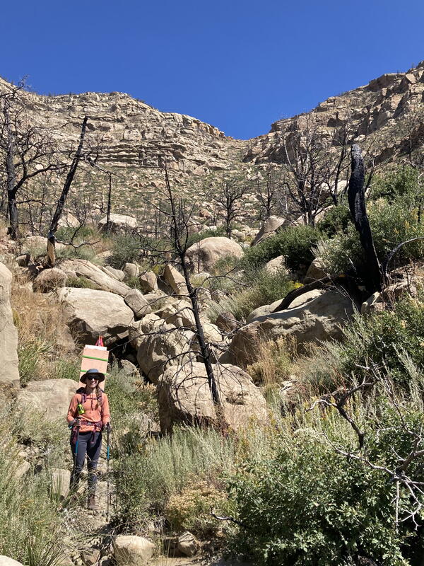
USGS researcher returns after collecting previously deployed UAS ground targets in the Cimarron Canyon in New Mexico
linkUSGS researcher Victoria Scholl (NUSO) returns after collecting previously deployed scale bar and ground control point survey targets along the Paleocene Poison Canyon Formation in the Cimarron Canyon, New Mexico.
Filter Total Items: 82
USGS remote pilot powers on UAS in White Sands National Park, April 2023
USGS remote pilot Todd Burton powers on UAS in White Sands National Park, April 2023
USGS remote pilot Todd Burton powers on UAS in White Sands National Park, April 2023
Drone-captured group photo of UAS Mapping of Pleistocene Fossilized Trackways
Drone-captured group photo with USGS remote pilots, White Sands National Park personnel, and USGS geologists standing in and next to a study area with fossilized tracks.
Drone-captured group photo with USGS remote pilots, White Sands National Park personnel, and USGS geologists standing in and next to a study area with fossilized tracks.
UAS acquired image of the team at the DOE-LM Calibration Pads at the Grand Junction Regional Airport
linkDrone selfie captured using a Skydio X2D UAS of the team standing in front of the DOE-LM Calibration Pads at the Grand Junction Regional Airport in Colorado. From left to right: Joel Doebele (DOE-LM contractor), Anji Shah (USGS), Chelsea Amaral (USGS), Brandon Mittan (GJT), Matt Burgess (USGS), and Joe Adams (USGS).
Mapping biocrust with UAS technology in Moab, Utah
USGS researchers teamed up for a biological soil crust (biocrust) remote sensing and field data campaign near Moab, Utah in February of 2022.
USGS researchers teamed up for a biological soil crust (biocrust) remote sensing and field data campaign near Moab, Utah in February of 2022.
USGS scientists conduct a UAS lidar data collection flight at the Vicksburg National Military Park
linkUSGS scientists Joe Adams and Matt Burgess conduct a UAS lidar data collection flight at the Vicksburg National Military Park
NUSO scientists, along with USGS landslide researchers, in December 2022 undertook a topographic analysis of slide-prone areas of the National Park Service Vicksburg National Military Park near Vicksburg, Mississippi.
USGS employee positions a UAS over a calibration panel to capture a multispectral image
USGS employee Joe Adams positions a UAS over a calibration panel to capture a multispectral image with the attached MicaSense Dual multispectral sensor. This calibration image will be used to post-process the imagery in support of radiometric calibration research conducted at the Denver Federal Center in Colorado.
USGS employee Joe Adams positions a UAS over a calibration panel to capture a multispectral image with the attached MicaSense Dual multispectral sensor. This calibration image will be used to post-process the imagery in support of radiometric calibration research conducted at the Denver Federal Center in Colorado.
USGS employees from the USGS National Uncrewed Systems Office (NUSO) and the USGS EROS CalVal Center of Excellence (ECCOE) during a UAS test in a Denver Federal Center parking lot
linkUSGS employees from the USGS National Uncrewed Systems Office (NUSO) and the USGS EROS CalVal Center of Excellence (ECCOE) during a UAS test in a Denver Federal Center parking lot.
USGS NUSO scientists act as a visual observer (left) and a UAS remote pilot (right) during a UAS flight at the Denver Federal Center
linkUSGS NUSO scientists act as a visual observer (Joe Adams left) and a UAS remote pilot (Matt Burgess right) during a UAS flight at the Denver Federal Center
USGS NUSO scientists act as a visual observer (left) and a UAS remote pilot (right) during a UAS flight at the Denver Federal Center
linkUSGS NUSO scientists act as a visual observer (Joe Adams left) and a UAS remote pilot (Matt Burgess right) during a UAS flight at the Denver Federal Center
Measuring natural methane emissions from bogs using drones in Alaska B-Roll
Permafrost is ground that has been frozen for at least two years. With the warming climate, permafrost across Alaska is thawing and greenhouse gases such as methane are released as a result. Ecologist Kristen Manies of the U.S.
Permafrost is ground that has been frozen for at least two years. With the warming climate, permafrost across Alaska is thawing and greenhouse gases such as methane are released as a result. Ecologist Kristen Manies of the U.S.
USGS researcher checks the image quality of photos captured using a UAS over a bog in Alaska
USGS researcher Victoria Scholl (NUSO) checks the image quality of photos captured using the Mavic Pro UAS over a bog in Alaska. These photos will be used to generate a Structure from Motion photogrammetry orthomosaic.
USGS researcher Victoria Scholl (NUSO) checks the image quality of photos captured using the Mavic Pro UAS over a bog in Alaska. These photos will be used to generate a Structure from Motion photogrammetry orthomosaic.
UAS carrying the methane sensor (left) and a smaller UAS used to collect videos and photos (right) in Alaska
linkUAS carrying the methane sensor (left) and a smaller UAS used to collect videos and photos (right) in Alaska. Both UAS are resting on wooden pallets that the team set onto the bog for a dry and flat takeoff/landing location.
UAS carrying the methane sensor (left) and a smaller UAS used to collect videos and photos (right) in Alaska
linkUAS carrying the methane sensor (left) and a smaller UAS used to collect videos and photos (right) in Alaska. Both UAS are resting on wooden pallets that the team set onto the bog for a dry and flat takeoff/landing location.
Victoria Scholl (NUSO), Kristen Manies (GMEG Science Center), and Joe Adams (NUSO)
Victoria Scholl (NUSO), Kristen Manies (GMEG Science Center), and Joe Adams (NUSO) hiked the UAS gear through the woods and across a network of boardwalks to access the bog site at the BNZ LTER.
Victoria Scholl (NUSO), Kristen Manies (GMEG Science Center), and Joe Adams (NUSO) hiked the UAS gear through the woods and across a network of boardwalks to access the bog site at the BNZ LTER.
Image from a UAS acquired natural color video showing the UAS-mounted Kolibri sensor being flown in Alaska
linkImage from a UAS acquired natural color video showing the UAS-mounted Kolibri sensor being flown through the smoke plume during one of the in-situ oil burns at a Poker Flat Research Range retention pond in Alaska.
USGS researcher tacking down a calibration tarp at the Eastern Ecological Science Center - Leetown Research Laboratory
linkUSGS researcher Joe Adams tacking down a calibration tarp at the Eastern Ecological Science Center - Leetown Research Laboratory.
USGS researcher tacking down a calibration tarp at the Eastern Ecological Science Center - Leetown Research Laboratory
linkUSGS researcher Joe Adams tacking down a calibration tarp at the Eastern Ecological Science Center - Leetown Research Laboratory.
USGS researcher pilots a UAS at Berthoud Pass
USGS researcher Matt Burgess remotely pilots a UAS collecting lidar data during the April 2022 USGS UASnow project at Berthoud Pass, Colorado.
USGS researcher Matt Burgess remotely pilots a UAS collecting lidar data during the April 2022 USGS UASnow project at Berthoud Pass, Colorado.
UAS collecting natural color video over a Winter Park study site
A UAS collecting natural color video over one of the study sites during a joint NUSO and USGS Water Resources Mission Area snow mapping project in Winter Park, Colorado.
A UAS collecting natural color video over one of the study sites during a joint NUSO and USGS Water Resources Mission Area snow mapping project in Winter Park, Colorado.
USGS researcher setting up a GPS base station during a UAS mission at Winter Park
USGS researcher Joe Adams (NUSO) setting up a GPS base station at one of the study sites for a snow mapping project in Winter Park, Colorado. GPS base station data is used in post-processing to improve the geospatial accuracy of UAS collected data.
USGS researcher Joe Adams (NUSO) setting up a GPS base station at one of the study sites for a snow mapping project in Winter Park, Colorado. GPS base station data is used in post-processing to improve the geospatial accuracy of UAS collected data.
USGS NUSO researchers take a moment to enjoy the scenery during a UAS mission in Colorado
USGS NUSO researchers Victoria Scholl and Mark Bauer take a moment to enjoy the scenery during a UAS data collection for the snow water equivalent (SWE) project at the Berthoud Pass Colorado study site.
USGS NUSO researchers Victoria Scholl and Mark Bauer take a moment to enjoy the scenery during a UAS data collection for the snow water equivalent (SWE) project at the Berthoud Pass Colorado study site.
Photograph of biological soil crusts (biocrusts) taken during a UAS mission in Utah
Please don’t walk on the biocrust!
Drone's eye view of a USGS remote pilot during a biocrust mission near Moab, UT
Drone's eye view of a USGS remote pilot during a biocrust mission near Moab, UT
NUSO UAS pilot Matt Burgess captures an image of himself while landing a UAS after a flight over a biocrust site near Moab, Utah.
Drone's eye view of a USGS remote pilot during a biocrust mission near Moab, UT
NUSO UAS pilot Matt Burgess captures an image of himself while landing a UAS after a flight over a biocrust site near Moab, Utah.
USGS researcher returns after collecting previously deployed UAS ground targets in the Cimarron Canyon in New Mexico
linkUSGS researcher Victoria Scholl (NUSO) returns after collecting previously deployed scale bar and ground control point survey targets along the Paleocene Poison Canyon Formation in the Cimarron Canyon, New Mexico.