
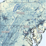
Groundwater and Streamflow Information
Surface-water Monitoring, Groundwater monitoring, and Flood Hazards
Surface-water Monitoring, Groundwater monitoring, and Flood Hazards
Water Use and Availability
Surface-water Modeling, Groundwater-flow Modeling, Hydrogeologic Characterization, Water Use, Flood Science, Climate Change
Surface-water Modeling, Groundwater-flow Modeling, Hydrogeologic Characterization, Water Use, Flood Science, Climate Change
Water Quality
Surface-water-quality Monitoring, Groundwater-quality Monitoring, Water-quality Modeling, Wetlands, Ecosystem Health
Surface-water-quality Monitoring, Groundwater-quality Monitoring, Water-quality Modeling, Wetlands, Ecosystem Health
Coastal Science
Beach and Barrier Dynamics, Flood Hazards, Nearshore Environmental Health, Tide and Wave Hydrodynamics, Wetlands, Climate and Land-Use Change
Beach and Barrier Dynamics, Flood Hazards, Nearshore Environmental Health, Tide and Wave Hydrodynamics, Wetlands, Climate and Land-Use Change
Ecosystem Health
Aquatic Community Health, Biogeochemical and Hydrologic Assessment, Climate Change, Ecological Assessment of Human and Natural Impacts
Aquatic Community Health, Biogeochemical and Hydrologic Assessment, Climate Change, Ecological Assessment of Human and Natural Impacts
New York Water Science Center
The New York Water Science Center will provide the hydrologic observations, research, and modeling needed for full integration of hydrogeologic, physiochemical, biological, and landscape processes across the freshwater to marine continuum.


NY WSC Quick Links
NY WSC Quick Links
Explore some of our most popular science topics, data, and tools
News
USGS Satellites and Test Tubes Meet to Ensure Safe Drinking Water
USGS Satellites and Test Tubes Meet to Ensure Safe Drinking Water
Advanced Quantitative Precipitation Information System Enhances Flood Prediction in San Francisco Bay Area
Advanced Quantitative Precipitation Information System Enhances Flood Prediction in San Francisco Bay Area
Native American Research Assistantship Student Learns USGS Water Science
Native American Research Assistantship Student Learns USGS Water Science
Publications
Bacterial community diversity and potential eco-physiological roles in toxigenic blooms composed of Microcystis, Aphanizomenon or Planktothrix Bacterial community diversity and potential eco-physiological roles in toxigenic blooms composed of Microcystis, Aphanizomenon or Planktothrix
Cyanobacterial toxicity, cyanotoxins, and their impact on aquatic ecosystems and human health are well documented. In comparison, less is known about bloom-associated bacterial communities. Co-occurring bacteria can influence bloom development, physiology and collapse, and may also provide a niche for pathogenic bacteria. Existing research focuses on the cyanosphere of Microcystis...
Multi-scale geophysical mapping of the brine and bedrock surfaces along the Dolores River, Paradox Valley, Colorado, December 2023 Multi-scale geophysical mapping of the brine and bedrock surfaces along the Dolores River, Paradox Valley, Colorado, December 2023
Total dissolved solids derived from salt dome–sourced brine in the underlying alluvial aquifer substantially increase with distance in the reach of the Dolores River that passes through Paradox Valley in southwestern Colorado. The area has been the site of salinity control operations since the 1990s to reduce salt loading to the downstream Colorado River. Previous airborne and ground...
From sample to sonde to Sentinel-2: Insights from a multi-scale chlorophyll-a monitoring effort in the Hudson River, New York From sample to sonde to Sentinel-2: Insights from a multi-scale chlorophyll-a monitoring effort in the Hudson River, New York
Monitoring cyanobacteria and other nuisance phytoplankton in the Hudson River is of great interest given its societal and ecological importance. Satellite remote sensing provides a cost-effective method to monitor chlorophyll-a (chl-a), a common proxy for algal biomass; however, the dynamic nature of rivers complicates approaches traditionally applied to lakes and oceans. During 2021...
Science
Evaluating the Risks of Tire-Derived Compounds to Fish in the Chesapeake Bay Watershed
Tires contain a chemical known as 6PPD which prevents them from quickly breaking down. Microscopic tire particles, generated mainly from the friction of tires on roads, release 6PPD-quinone (6PPDQ) when they come into contact with oxygen. During precipitation events, 6PPDQ can be washed off roads, harming fish in nearby waterways. In response to requests from fishery managers, the USGS is studying...
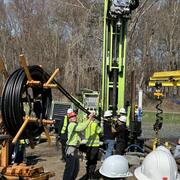
Interactive Products to Assist with Geothermal Drilling
Geothermal energy is a clean and renewable source of heat derived from the Earth's natural thermal resources. Geothermal borefields are utilized to extract this thermal energy, providing heating for buildings in the winter and cooling in the summer. In New York, the adoption of geothermal energy at both residential and community scales is on the rise and is expected to see significant growth in...
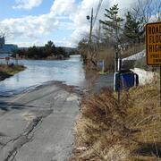
Regional Assessment of Compound Flood Hazard from the Combined Effects of Coastal, Stormwater and Groundwater Emergence Flooding
Compound flooding is flooding that results from a co-occurrence of multiple flood drivers. In this project we consider precipitation (pluvial flooding, overland flow of stormwater), coastal storm surge and tidal flooding (coastal flooding), and flooding that occurs as a shallow water table intersects the land surface or critical infrastructure (groundwater emergence flooding). These flooding...