
Underwater Photogrammetry Reaches New Depths
Discover research that is advancing deep-sea modeling in the face of challenges posed by the marine environment
The USGS developed a workflow for creating 3D models of the deep seafloor from archived video images. The study, “Photogrammetry of the Deep Seafloor from Archived Unmanned Submersible Exploration Dives,” was recently published in the Journal of Marine Science and Engineering.
A recent study from the U.S. Geological Survey offers a workflow for generating virtual maps of the deep seafloor from archived exploration dives. This work can help advance exploration of the deep-sea frontier and extends into other fields.
In this study, coauthors Claudia Flores and Dr. Uri ten Brink demonstrate innovative thinking for modeling the seafloor, as well as reliable troubleshooting research practices in this field.
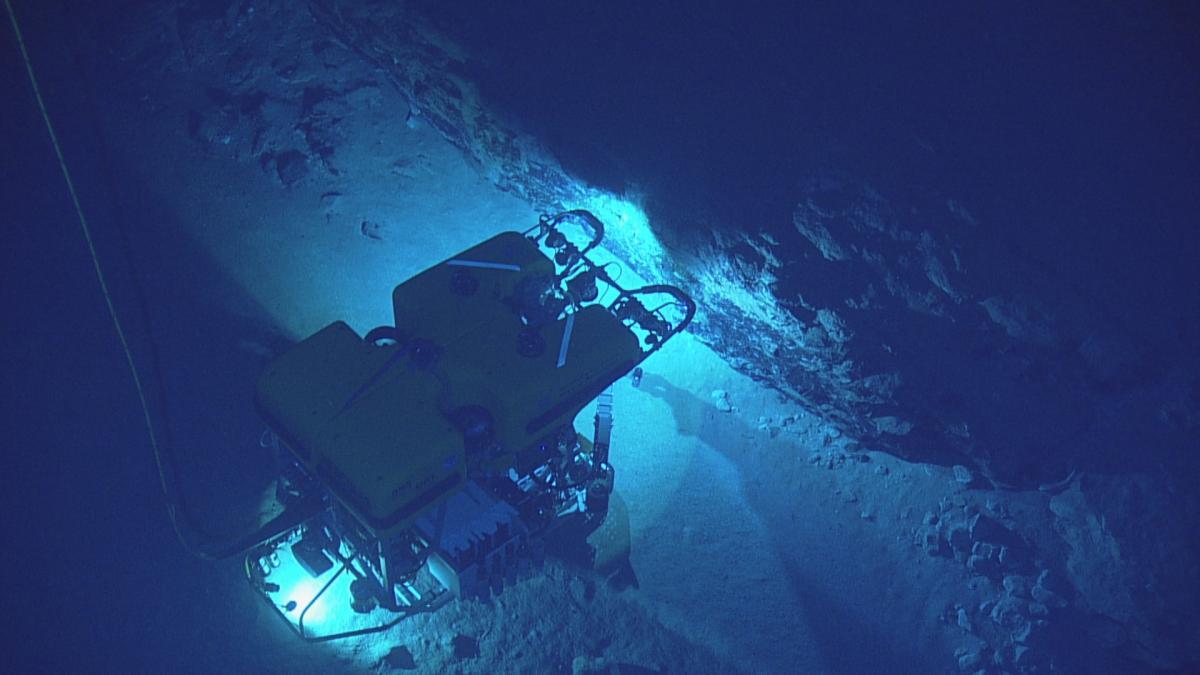
To develop this workflow, two remotely operated vehicles (ROVs) collected underwater images of the Mona Rift seafloor, located northwest of Puerto Rico. The approach placed emphasis on human-data interaction to overcome the quality of captured footage. Adjusting components of the ROV and video apparatus addressed the challenges that occur when taking videos of the seafloor at depths larger than 1,000 meters, such as poor navigation and inconsistent lighting, color attenuation and distortion, and camera orientation with respect to the vehicle. Using their workflow, archived footage can be processed and modeled in three months.
Flores and Dr. ten Brink also present an opportunity for education of the younger generation. During the study, the pair hosted two undergraduate summer students. The students quickly learned the workflow, and ultimately helped inform the process for the dives. Both students went on to present their work at a geological meeting at their schools and co-authored scientific papers.


The photogrammetry workflow is being used in other studies.
The work presented in “Photogrammetry of the Deep Seafloor from Archived Unmanned Submersible Exploration Dives” is instrumental to marine geohazard science. A study published in 2023 used this workflow to investigate the source of the devastating October 11, 1918 tsunami in Puerto Rico. Scientists previously believed a particular submarine landslide was the source of the tsunami and as such, this tsunami was used as an example of an earthquake-induced landslide tsunami hazard. However, after developing a 3D model of the seafloor using the photogrammetry workflow, scientists determined the landslide scar, the mark left behind by the landslide, predated the 1918 tsunami. Sediment samples confirmed this result.
Dive footage remains vital to understanding more about the ocean, the earth, assessing hazards, and beyond. This case study showcases the value of using the photogrammetry workflow to create a 3D model of the deep seafloor. The insights derived from using the workflow can improve understanding of past and recent natural hazards and help long-term planners better prepare for these events.
What is Photogrammetry? Why is it Important?
Photogrammetry is the process that generates 3D models by combining several video images. The practice captures photos of a targeted surface at different angles, enabling the surface to be processed in 3D later. When rendering virtual maps, photogrammetry allows for important details and measurements to be extracted from still images. Proper 3D maps of the seafloor can inform geological knowledge of the deep sea, provide context for natural events, and more.

Get Our News
These items are in the RSS feed format (Really Simple Syndication) based on categories such as topics, locations, and more. You can install and RSS reader browser extension, software, or use a third-party service to receive immediate news updates depending on the feed that you have added. If you click the feed links below, they may look strange because they are simply XML code. An RSS reader can easily read this code and push out a notification to you when something new is posted to our site.