
Measuring streamflow in slushy Sun River at Simms, MT, station 06085800
Images
Some collected images in Wyoming and Montana.
Filter Total Items: 420

Measuring streamflow in slushy Sun River at Simms, MT, station 0608580
Measuring streamflow in slushy Sun River at Simms, MT, station 06085800

Cheyenne Wyoming office
Cheyenne Wyoming office

Measuring streamflow on the Yaak River near Troy, MT, station 12304500
Measuring streamflow on the Yaak River near Troy, MT, station 12304500
Measuring streamflow on the Yaak River near Troy, MT, station 12304500

Reading stream stage at Bull Lake Creek above Bull Lake streamgage
The wire weight is lowered to determine stage of Bull Lake Creek above Bull Lake
The wire weight is lowered to determine stage of Bull Lake Creek above Bull Lake
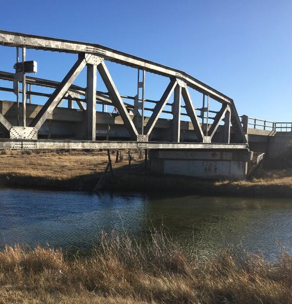
Wire weight mounted on bridge crossing Blacks Fork, streamgage 0921920
Wire weight mounted on bridge crossing Blacks Fork, streamgage 09219200
Wire weight mounted on bridge crossing Blacks Fork, streamgage 09219200

Setting up to measure streamflow, Muddy Creek near Dad
Setting up to measure streamflow, Muddy Creek near Dad
Setting up to measure streamflow, Muddy Creek near Dad

Channel measurement section locations for Ruby River above Reservoir
Channel measurement section locations for Ruby River above Reservoir.
Channel measurement section locations for Ruby River above Reservoir.

Installing new radar sensor and staff plate, Big Sandy River
Installing new radar sensor and staff plate, Big Sandy River
Installing new radar sensor and staff plate, Big Sandy River

Surveying water surface along with other methods to describe scour
Surveying water surface to tie into bathymetry measurments on Bitterroot River near Hamilton, MT to describe scour near the bridge.
Surveying water surface to tie into bathymetry measurments on Bitterroot River near Hamilton, MT to describe scour near the bridge.

Pipetting for DNA analysis - loop-mediated isothermal amplification
Pipetting for DNA analysis using loop-mediated isothermal amplification
Pipetting for DNA analysis using loop-mediated isothermal amplification

Testing the feasibility of real-time eDNA monitoring
Elk are not concerned with our work. USGS and the Monterey Bay Aquarium Research Institute conducted tests of the feasibility of real-time eDNA monitoring at USGS streamgage 06190540 Boiling River at Mammoth,YNP, September 13, 2017.
Elk are not concerned with our work. USGS and the Monterey Bay Aquarium Research Institute conducted tests of the feasibility of real-time eDNA monitoring at USGS streamgage 06190540 Boiling River at Mammoth,YNP, September 13, 2017.

Establishing a survey base station in Lame Deer, Montana
Establishing a survey base station in Lame Deer, Montana
Establishing a survey base station in Lame Deer, Montana
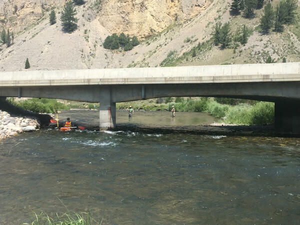
Measuring cross-sectional depth and water surface of Gallatin River
Using kayak to measure cross-sectional depth and water surface of Gallatin River
Using kayak to measure cross-sectional depth and water surface of Gallatin River

Collecting sample for pesticide analyses, Big Horn River near Kane, WY
Sample collection from cableway above Big Horn River near Kane, Wyoming as part of project evaluating pesticides in Wyoming.
Sample collection from cableway above Big Horn River near Kane, Wyoming as part of project evaluating pesticides in Wyoming.

Measuring the groundwater level in a well near Lame Deer, Montana
Measuring the groundwater level in a well near Lame Deer, Montana
Measuring the groundwater level in a well near Lame Deer, Montana

Measuring discharge of Lame Deer Creek near Lame Deer, Montana
Measuring discharge of Lame Deer Creek near Lame Deer, Montana
Measuring discharge of Lame Deer Creek near Lame Deer, Montana

Chad Reese and Sean Lawlor measuring channel width
Chad Reese and Chuck Parrett of the Wyoming-Montana Water Science Center measure channel width for a small stream near Helena, Montana. Streams of this size are often measured using an instrument called a flume designed to constrain all flow to an artificial channel with a known mathematical relationship between water level and streamflow.
Chad Reese and Chuck Parrett of the Wyoming-Montana Water Science Center measure channel width for a small stream near Helena, Montana. Streams of this size are often measured using an instrument called a flume designed to constrain all flow to an artificial channel with a known mathematical relationship between water level and streamflow.

Taking water-quality equipment to Fogarty Creek
Taking water-quality equipment to Fogarty Creek
Taking water-quality equipment to Fogarty Creek

Real-time well at Five Springs Creek southeast of Lovell, Wyoming
Real-time well at Five Springs Creek southeast of Lovell, Wyoming
Real-time well at Five Springs Creek southeast of Lovell, Wyoming

Using a GPS station to get highly precise streamflow measurement
Using a GPS station to get highly precise streamflow measurement
Using a GPS station to get highly precise streamflow measurement

Measuring streamflow using bridge crane, Powder River at Sussex
Measuring streamflow using bridge crane and AA meter, Powder River at Sussex
Measuring streamflow using bridge crane and AA meter, Powder River at Sussex