
Two swans swim in a wetland with agricultural buildings and farmland in the background in Iowa.
Images
Images intro.
Filter Total Items: 413

Two swans swim in a wetland in Iowa
Two swans swim in a wetland with agricultural buildings and farmland in the background in Iowa.

Water sampling at DeSoto National Wildlife Refuge
Microbiologist Erin Stelzer samples a wetland for infectious avian influenza virus at DeSoto National Wildlife Refuge, Iowa.
Microbiologist Erin Stelzer samples a wetland for infectious avian influenza virus at DeSoto National Wildlife Refuge, Iowa.

Microbiologist filters wetland water from a park in Iowa
USGS Microbiologist Erin Stelzer filters wetland water from a park in Iowa on a gray spring day.
USGS Microbiologist Erin Stelzer filters wetland water from a park in Iowa on a gray spring day.

Bonno, Lund and Burdett collecting suspended sediment samples in Michigan
Hydrologic Technicians Doug Bonno and Dean Burdett and Hydrologist Will Lund collect suspended sediment samples from a bridge in Michigan on April 8, 2022.
Hydrologic Technicians Doug Bonno and Dean Burdett and Hydrologist Will Lund collect suspended sediment samples from a bridge in Michigan on April 8, 2022.

MI-BaRL research team displaying laboratory equipment used in developing avian influenza research methods
linkThe Michigan Bacteriological Research Laboratory (MI-BaRL) research team (L to R) Laura Hubbard, Erin Stelzer, Alexei Rose, Molly Richard and Anlin Larson displaying essential tools used in developing laboratory methods to detect infectious avian influenza virus (AIV) in freshwater. The team will deploy these methods for environmental surveillance.

Mineral production lifecycle from exploration through reclamation
Artistic rendition of the mineral lifecycle from a natural state through to exploration, permitting, mining, and reclamation. Designed for the Minerals Lifecycle Integrated Science Team to depict one aspect of their science focus.
Artistic rendition of the mineral lifecycle from a natural state through to exploration, permitting, mining, and reclamation. Designed for the Minerals Lifecycle Integrated Science Team to depict one aspect of their science focus.

Erin Stelzer arriving to MI-BaRL lab with truck carrying over 1100 liters of wetland water prepped for avian influenza study
linkErin Stelzer collected and transported over 1100 liters of wetland water to the Michigan Bacteriological Research Laboratory (MI-BaRL; Lansing, MI) as part of work to finalize laboratory methods to detect infectious avian influenza virus (AIV) in freshwater. The methods will test how biotic factors and water chemistry influenced the recovery of a known con

Helicopter towing hoop for airborne electromagnetic (AEM) survey 2022
Photo of helicopter with geophysical equipment loop deployed below it via slingload. Technician on ground for scale. In March 2022, a helicopter carried an airborne electromagnetic induction sensor over parts of southeast and southwest Wisconsin as part of a USGS study to map the aquifers in the region.
Photo of helicopter with geophysical equipment loop deployed below it via slingload. Technician on ground for scale. In March 2022, a helicopter carried an airborne electromagnetic induction sensor over parts of southeast and southwest Wisconsin as part of a USGS study to map the aquifers in the region.

Helicopter starting liftoff towing hoop for airborne electromagnetic (AEM) survey 2022
Helicopter lifting off with geophysical equipment loop on ground below attached via slingload. Technician on ground for scale. In March 2022, a helicopter carried an airborne electromagnetic induction sensor over parts of southeast and southwest Wisconsin as part of a USGS study to map the aquifers in the region.
Helicopter lifting off with geophysical equipment loop on ground below attached via slingload. Technician on ground for scale. In March 2022, a helicopter carried an airborne electromagnetic induction sensor over parts of southeast and southwest Wisconsin as part of a USGS study to map the aquifers in the region.

Helicopter liftoff towing hoop for airborne electromagnetic (AEM) survey 2022
Helicopter lifting off with geophysical equipment loop below attached via slingload. Technician on ground for scale. In March 2022, a helicopter carried an airborne electromagnetic induction sensor over parts of southeast and southwest Wisconsin as part of a USGS study to map the aquifers in the region.
Helicopter lifting off with geophysical equipment loop below attached via slingload. Technician on ground for scale. In March 2022, a helicopter carried an airborne electromagnetic induction sensor over parts of southeast and southwest Wisconsin as part of a USGS study to map the aquifers in the region.

Airborne electromagnetic (AEM) survey hoop on snowy ground with technician walking by for scale
linkGeophysical equipment loop for airborne electromagnetic (AEM) survey on ground prior to liftoff. Technician on ground for scale. In March 2022, a helicopter carried an airborne electromagnetic induction sensor over parts of southeast and southwest Wisconsin as part of a USGS study to map the aquifers in the region.

Burke Minsley speaking to group of USGS employees and Cooperators at AEM survey in southwest Wisconsin 2022
linkResearch geophysicist Burke Minsley discussing aerial electromagnetic (AEM) survey equipment with group of USGS employees and Cooperators at AEM survey in southwest Wisconsin 2022. In March 2022, a helicopter carried an airborne electromagnetic induction sensor over parts of southeast and southwest Wisconsin as part of a USGS study to map the aquifers in t

Airborne electromagnetic (AEM) survey hoop on snowy ground with technician preparing for liftoff
linkGeophysical equipment loop for airborne electromagnetic (AEM) survey on ground prior to liftoff. Technician on ground for scale. In March 2022, a helicopter carried an airborne electromagnetic induction sensor over parts of southeast and southwest Wisconsin as part of a USGS study to map the aquifers in the region.

USGS employees and Cooperators watching AEM survey helicopter towing hoop liftoff
USGS employees and cooperators watching and photographing helicopter lifting off with geophysical equipment loop below attached via slingload. In March 2022, a helicopter carried an airborne electromagnetic induction sensor over parts of southeast and southwest Wisconsin as part of a USGS study to map the aquifers in the region.
USGS employees and cooperators watching and photographing helicopter lifting off with geophysical equipment loop below attached via slingload. In March 2022, a helicopter carried an airborne electromagnetic induction sensor over parts of southeast and southwest Wisconsin as part of a USGS study to map the aquifers in the region.

Sun shining over group of USGS employees and Cooperators at AEM survey in southwest Wisconsin 2022
linkResearch geophysicist Burke Minsley discussing aerial electromagnetic (AEM) survey equipment with group of USGS employees and Cooperators at AEM survey in southwest Wisconsin 2022. In March 2022, a helicopter carried an airborne electromagnetic induction sensor over parts of southeast and southwest Wisconsin as part of a USGS study to map the aquifers in t

Burke Minsley speaking to group of USGS employees and SkyTEM employees about AEM survey
Research geophysicist Burke Minsley discussing aerial electromagnetic (AEM) survey equipment with group of USGS employees and Cooperators at AEM survey in southwest Wisconsin 2022. In March 2022, a helicopter carried an airborne electromagnetic induction sensor over parts of southeast and southwest Wisconsin as part of a USGS study to map the aquifers in t
Research geophysicist Burke Minsley discussing aerial electromagnetic (AEM) survey equipment with group of USGS employees and Cooperators at AEM survey in southwest Wisconsin 2022. In March 2022, a helicopter carried an airborne electromagnetic induction sensor over parts of southeast and southwest Wisconsin as part of a USGS study to map the aquifers in t

Burke Minsley explaining AEM technology to group of USGS employees and Cooperators at AEM survey in southwest Wisconsin 2022
linkResearch geophysicist Burke Minsley discussing aerial electromagnetic (AEM) survey equipment with group of USGS employees and Cooperators at AEM survey in southwest Wisconsin 2022. In March 2022, a helicopter carried an airborne electromagnetic induction sensor over parts of southeast and southwest Wisconsin as part of a USGS study to map the aquifers in t

Group of USGS employees and Cooperators gathered at AEM survey in southwest Wisconsin 2022
Research geophysicist Burke Minsley discussing aerial electromagnetic (AEM) survey equipment with group of USGS employees and Cooperators at AEM survey in southwest Wisconsin 2022. In March 2022, a helicopter carried an airborne electromagnetic induction sensor over parts of southeast and southwest Wisconsin as part of a USGS study to map the aquifers in t
Research geophysicist Burke Minsley discussing aerial electromagnetic (AEM) survey equipment with group of USGS employees and Cooperators at AEM survey in southwest Wisconsin 2022. In March 2022, a helicopter carried an airborne electromagnetic induction sensor over parts of southeast and southwest Wisconsin as part of a USGS study to map the aquifers in t
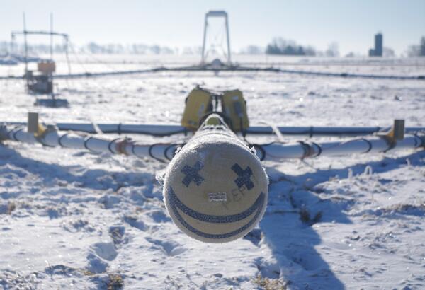
Smiley face on front of AEM survey equipment southern Wisconsin 2022
Smiley face on front of electromagnetic (AEM) survey equipment at AEM survey in southwest Wisconsin 2022. In March 2022, a helicopter carried an airborne electromagnetic induction sensor over parts of southeast and southwest Wisconsin as part of a USGS study to map the aquifers in the region.
Smiley face on front of electromagnetic (AEM) survey equipment at AEM survey in southwest Wisconsin 2022. In March 2022, a helicopter carried an airborne electromagnetic induction sensor over parts of southeast and southwest Wisconsin as part of a USGS study to map the aquifers in the region.

Helicopter for AEM survey southern Wisconsin 2022
Helicopter used to tow electromagnetic (AEM) survey equipment at AEM survey in southwest Wisconsin 2022. In March 2022, a helicopter carried an airborne electromagnetic induction sensor over parts of southeast and southwest Wisconsin as part of a USGS study to map the aquifers in the region.
Helicopter used to tow electromagnetic (AEM) survey equipment at AEM survey in southwest Wisconsin 2022. In March 2022, a helicopter carried an airborne electromagnetic induction sensor over parts of southeast and southwest Wisconsin as part of a USGS study to map the aquifers in the region.

Burke Minsley pointing to equipment while speaking to group of USGS employees and Cooperators at AEM survey in southwest Wisconsin 2022
linkResearch geophysicist Burke Minsley discussing aerial electromagnetic (AEM) survey equipment with group of USGS employees and Cooperators at AEM survey in southwest Wisconsin 2022. In March 2022, a helicopter carried an airborne electromagnetic induction sensor over parts of southeast and southwest Wisconsin as part of a USGS study to map the aquifers in t