
Geophysical equipment loop with sensor from SKYTEM for electromagnetic (AEM) survey in southwest Wisconsin 2022. In March 2022, a helicopter carried an airborne electromagnetic induction sensor over parts of southeast and southwest Wisconsin as part of a USGS study to map the aquifers in the region.
Images
Images intro.
Filter Total Items: 413

Sensor on back of geophysical equipment hoop for AEM survey southern Wisconsin 2022
Geophysical equipment loop with sensor from SKYTEM for electromagnetic (AEM) survey in southwest Wisconsin 2022. In March 2022, a helicopter carried an airborne electromagnetic induction sensor over parts of southeast and southwest Wisconsin as part of a USGS study to map the aquifers in the region.
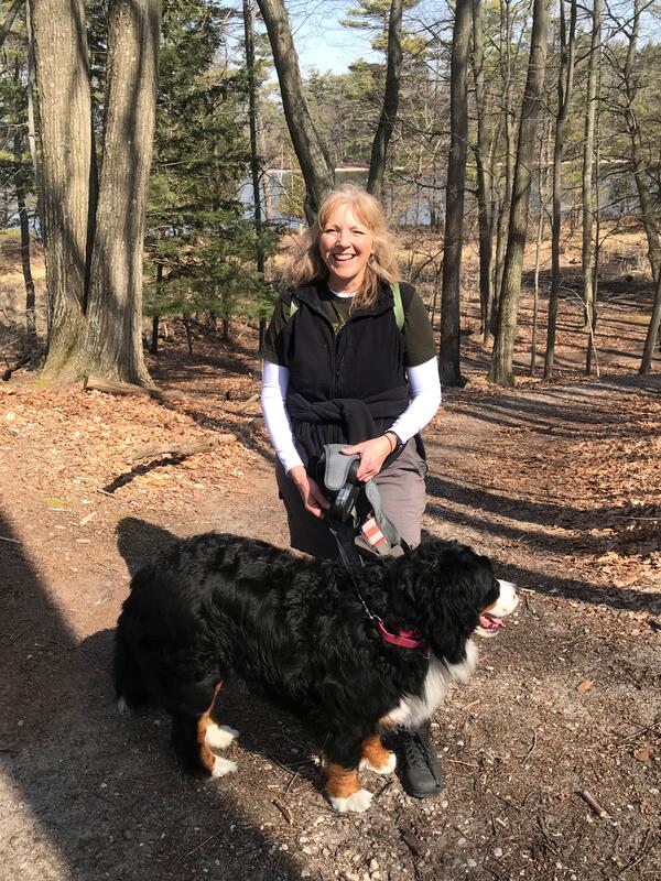
Faith Fitzpatrick hiking with her Bernese Mountain Dog
Faith Fitzpatrick taking her Bernese Mountain dog on a hike to check out rock outcrops around southern Wisconsin.
Faith Fitzpatrick taking her Bernese Mountain dog on a hike to check out rock outcrops around southern Wisconsin.

Elk
Part of a series of small inset drawings, this is quite simply, an Elk. The backdrop is that of pinion pine and Red Butte.
Part of a series of small inset drawings, this is quite simply, an Elk. The backdrop is that of pinion pine and Red Butte.

The Long Haul
This is a small inset drawing of a truck traveling a haul road from a mine site. It is a southwestern landscape, and depicts dust kicked from the road and becoming airborne over the surrounding vegetation and landscape.
This is a small inset drawing of a truck traveling a haul road from a mine site. It is a southwestern landscape, and depicts dust kicked from the road and becoming airborne over the surrounding vegetation and landscape.

Where to Go Next
This is a loosely drawn illustration of two hikers on the trail. It was drawn for the final page of a fact sheet and intended for text overlay. The text primarily indicates avenues of further study and next steps of the project.
This is a loosely drawn illustration of two hikers on the trail. It was drawn for the final page of a fact sheet and intended for text overlay. The text primarily indicates avenues of further study and next steps of the project.

Multi-parameter meter with FDOM, Tryptophan, Turbidity, and Temperature sensors and central wiper
linkClose up view of a Turner C3 submersible fluorometer sensors. Multi-parameter meter with FDOM, Tryptophan, Turbidity, and Temperature sensors and central wiper.
Multi-parameter meter with FDOM, Tryptophan, Turbidity, and Temperature sensors and central wiper
linkClose up view of a Turner C3 submersible fluorometer sensors. Multi-parameter meter with FDOM, Tryptophan, Turbidity, and Temperature sensors and central wiper.
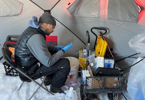
Colin Livdahl sampling groundwater in winter at Twin Cities Army Ammunition Plant
Hydrologist Colin Livdahl conducting quarterly groundwater sampling at Twin Cities Army Ammunition Plant in mid-February, 2022.
Hydrologist Colin Livdahl conducting quarterly groundwater sampling at Twin Cities Army Ammunition Plant in mid-February, 2022.

Luke Loken staff profile photo
Luke C. Loken is a Hydrologist with the Upper Midwest Water Science Center in Madison, Wisconsin.
Luke C. Loken is a Hydrologist with the Upper Midwest Water Science Center in Madison, Wisconsin.

Electromagnetic geophysical survey hoop on ground
Geophysical survey equipment hoop on ground with people learning from SkyTEM member. In January 2021 a helicopter carried an airborne electromagnetic induction sensor over parts of northeastern Wisconsin as part of a USGS study to map the aquifers in the region.
Geophysical survey equipment hoop on ground with people learning from SkyTEM member. In January 2021 a helicopter carried an airborne electromagnetic induction sensor over parts of northeastern Wisconsin as part of a USGS study to map the aquifers in the region.

Drilling a hole in the ice of the Pecatonica River, Wisconsin
Hydrologist Brendan Hallmark drilling a hole in the ice of the Pecatonica River, Wisconsin. USGS sticker unfocused on pole in foreground. Location is at Marintown, WI streamgage 05434500.
Hydrologist Brendan Hallmark drilling a hole in the ice of the Pecatonica River, Wisconsin. USGS sticker unfocused on pole in foreground. Location is at Marintown, WI streamgage 05434500.

Pecatonica River at Martintown, Wisconsin streamgage in winter
Pecatonica River at Martintown, Wisconsin streamgage in winter.
https://waterdata.usgs.gov/monitoring-location/05434500/
The path cleared of snow on the river contains drilled holes that are used to measure streamflow under the ice.
Pecatonica River at Martintown, Wisconsin streamgage in winter.
https://waterdata.usgs.gov/monitoring-location/05434500/
The path cleared of snow on the river contains drilled holes that are used to measure streamflow under the ice.

Scientist reflected in water in hole drilled in frozen river ice
Scientist holding cell phone reflected in water in hole drilled in the frozen Pecatonica River, Wisconsin.
Scientist holding cell phone reflected in water in hole drilled in the frozen Pecatonica River, Wisconsin.

Drilling hole in frozen Pecatonica River at Martintown, Wisconsin streamgage in winter
Hydrologic technician Brendan Hallmark drills a hole in the frozen Pecatonica River at the Martintown, Wisconsin streamgage in winter.
Hydrologic technician Brendan Hallmark drills a hole in the frozen Pecatonica River at the Martintown, Wisconsin streamgage in winter.

Hydrologic technician drills through frozen river with ice auger
Hydrologic technician Brendan Hallmark uses an ice auger to drill a hole in the frozen Pecatonica River at the Martintown, Wisconsin streamgage in winter.
Hydrologic technician Brendan Hallmark uses an ice auger to drill a hole in the frozen Pecatonica River at the Martintown, Wisconsin streamgage in winter.

Water sample bottle at Wilson Park Creek in winter
James Romano holds a water sample collected at the end of Wilson Park Creek in Milwaukee, Wisconsin. The creek drains into the Kinnickinnic River, which eventually reaches the Milwaukee Estuary and Lake Michigan. Samples there are analyzed for same parameters as all the other sites.
James Romano holds a water sample collected at the end of Wilson Park Creek in Milwaukee, Wisconsin. The creek drains into the Kinnickinnic River, which eventually reaches the Milwaukee Estuary and Lake Michigan. Samples there are analyzed for same parameters as all the other sites.

HIVIS webcam at Jones Island Milwaukee with Hoan Memorial Bridge in background
Hydrologic Imagery Visualization and Information System (HIVIS) webcam at Jones' Island Milwaukee, Wisconsin with Hoan Memorial Bridge in background.
Hydrologic Imagery Visualization and Information System (HIVIS) webcam at Jones' Island Milwaukee, Wisconsin with Hoan Memorial Bridge in background.

Map showing locations of test and control watersheds for the determination of watershed response to green infrastructure in Milwaukee, Wisconsin
linkMap showing locations of test and control watersheds for the determination of watershed response to green infrastructure in Milwaukee, Wisconsin.
Map showing locations of test and control watersheds for the determination of watershed response to green infrastructure in Milwaukee, Wisconsin
linkMap showing locations of test and control watersheds for the determination of watershed response to green infrastructure in Milwaukee, Wisconsin.

Phosphorus Loading and Water Quality in Green Lake
Green Lake is the deepest natural lake in Wisconsin. The drawing relates the water-quality response of Green Lake, with emphasis on the Metalimnetic Oxygen Minima, to total phosphorus loading from its watershed. The drawing depicts data collection, analysis, modeling, and real-time monitoring.
Green Lake is the deepest natural lake in Wisconsin. The drawing relates the water-quality response of Green Lake, with emphasis on the Metalimnetic Oxygen Minima, to total phosphorus loading from its watershed. The drawing depicts data collection, analysis, modeling, and real-time monitoring.

Phosphorus Loading in Shallow Lakes
Illustration depicting phosphorus loading in shallow lakes represented by Lake Winnebago, Wisconsin.
Illustration depicting phosphorus loading in shallow lakes represented by Lake Winnebago, Wisconsin.

Havasupai Falls
Part of a series of small inset drawings, this is a top view of Havasupai Falls, its aquamarine colored water is highly recognizable and it is a site of tribal, cultural, and recreational significance to the greater Grand Canyon region.
Part of a series of small inset drawings, this is a top view of Havasupai Falls, its aquamarine colored water is highly recognizable and it is a site of tribal, cultural, and recreational significance to the greater Grand Canyon region.

Horn Creek Sign
Part of a series of small inset drawings, this is of a sign located near Horn Creek. The Creek is contaminated with high levels of Uranium. Sign states: "Horn Creek, Danger, Contaminated Water, Do Not Drink! Water in Horn Creek exceeds EPA health standards for radioactivity"
Part of a series of small inset drawings, this is of a sign located near Horn Creek. The Creek is contaminated with high levels of Uranium. Sign states: "Horn Creek, Danger, Contaminated Water, Do Not Drink! Water in Horn Creek exceeds EPA health standards for radioactivity"