
Roanoke VA Precipitation Station Garden City Elementary School.
Images
Explore our planet and learn more about our work through photographs and imagery from scientists and support staff.
Filter Total Items: 223

Roanoke VA Precipitation Station Garden City Elementary School.
Roanoke VA Precipitation Station Garden City Elementary School.

Roanoke VA Precipitation Station at Mill Mountain Park
Roanoke VA Precipitation Station at Mill Mountain Park
Roanoke VA Precipitation Station at Mill Mountain Park

Roanoke VA Precipitation Station at Shrine Hill Park
Roanoke VA Precipitation Station at Shrine Hill Park
Roanoke VA Precipitation Station at Shrine Hill Park

Roanoke VA Precipitation Station at Roanoke Center for Industry and Te
Roanoke VA Precipitation Station at Roanoke Center for Industry and Technology at Blue Hills Drive
Roanoke VA Precipitation Station at Roanoke Center for Industry and Technology at Blue Hills Drive

Virginia Multi Parameter Sonde Relay Station
Virginia Multi Parameter Sonde Relay Station
Virginia Multi Parameter Sonde Relay Station

Image of a new monitoring benchmark
Occupying a surveying benchmark.
Occupying a surveying benchmark.

R10-bipod.
Occupying a surveying benchmark.
Occupying a surveying benchmark.

Hampton Roads Benchmark Monitoring: Occupying Benchmark 2
Occupying a surveying benchmark.

Hampton Roads Benchmark Monitoring: Occupying a Benchmark
Hampton Roads Benchmark Monitoring: Occupying a Benchmark
Hampton Roads Benchmark Monitoring: Occupying a Benchmark

Roanoke River Valley
A photo of the Roanoke River Valley at Sunset.
A photo of the Roanoke River Valley at Sunset.

Cowpasture river looking downstream.
Looking downstream along the cowpasture river.
Looking downstream along the cowpasture river.

Cowpasture river monitoring at Route 627 near Williamsville, VA
Cowpasture river monitoring at Route 627 near Williamsville, VA
Cowpasture river monitoring at Route 627 near Williamsville, VA

Monitoring at Little Stony Creek above Archer Trail near Pembroke, VA
Water monitoring at Little Stony Creek above Archer Trail near Pembroke, VA
Water monitoring at Little Stony Creek above Archer Trail near Pembroke, VA
Monitoring Ramseys Draft at Route 716 near West Augusta
Monitoring Ramseys Draft at Route 716 near West Augusta
Monitoring Ramseys Draft at Route 716 near West Augusta

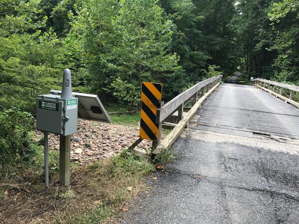
Monitoring Roanoke River along Route 626 at Lafayette, VA
Monitoring Roanoke River along Route 626 at Lafayette, VA
Monitoring Roanoke River along Route 626 at Lafayette, VA
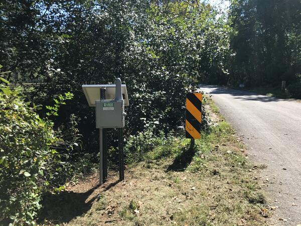
Monitoring Spruce Creek at Route 627 near Nellysford, VA
Monitoring Spruce Creek at Route 627 near Nellysford, VA
Monitoring Spruce Creek at Route 627 near Nellysford, VA

Sunset at Big Meadows in Shenandoah National Park
Sunset at Big Meadows in Shenandoah National Park, Virginia with tree silhouettes.
Sunset at Big Meadows in Shenandoah National Park, Virginia with tree silhouettes.

A USGS hydrologic technician installs a Rapid-Deployment Gauge
Jim Duda, USGS hydrologic technician, installs a Rapid-Deployment Gauge near the Elizabeth River in Norfolk, Virginia, to monitor elevated water levels caused by Hurricane Jose. An RDG is a fully functional streamgage designed to be quickly deployed for real-time data monitoring of a stream or river in emergency situations.
Jim Duda, USGS hydrologic technician, installs a Rapid-Deployment Gauge near the Elizabeth River in Norfolk, Virginia, to monitor elevated water levels caused by Hurricane Jose. An RDG is a fully functional streamgage designed to be quickly deployed for real-time data monitoring of a stream or river in emergency situations.

Stormwater Runoff
When rainwater rapidly collects on the land surface, it can cause flooding. In order to prevent flooding, which could pose a hazard to human residents, storm drains are constructed to drain rainwater away from urban areas as quickly as possible during storm events.
When rainwater rapidly collects on the land surface, it can cause flooding. In order to prevent flooding, which could pose a hazard to human residents, storm drains are constructed to drain rainwater away from urban areas as quickly as possible during storm events.

Virginia Science Office
Virginia and West Virginia Water Science Center: Virginia Science Office, Richmond.
Virginia and West Virginia Water Science Center: Virginia Science Office, Richmond.

A dock, water, and reflected sunshine.
A photo of the edge of a dock with pier and surrounding water and reflected sunshine. Photo taken by Hayley Austin.
A photo of the edge of a dock with pier and surrounding water and reflected sunshine. Photo taken by Hayley Austin.