
Meagan Eagle, Research Physical Scientist with the U.S. Geological Survey, Woods Hole Coastal and Marine Science Center, talking about USGS contributions to the Herring River Restoration Project with Congressman Bill Keating at the groundbreaking event.
Images
Woods Hole Coastal and Marine Science Center images
Filter Total Items: 1090

Herring River Restoration Project Groundbreaking Event
Meagan Eagle, Research Physical Scientist with the U.S. Geological Survey, Woods Hole Coastal and Marine Science Center, talking about USGS contributions to the Herring River Restoration Project with Congressman Bill Keating at the groundbreaking event.

Herring River Restoration Project Groundbreaking Event
Kevin Kroeger, Research Chemist with the U.S. Geological Survey, Woods Hole Coastal and Marine Science Center, talking about blue carbon research with Congressman Bill Keating at the Herring River Restoration Project groundbreaking event.
Kevin Kroeger, Research Chemist with the U.S. Geological Survey, Woods Hole Coastal and Marine Science Center, talking about blue carbon research with Congressman Bill Keating at the Herring River Restoration Project groundbreaking event.

Herring River Restoration Project Groundbreaking Event
Kevin Kroeger, Marcel Belaval, and Rob Thieler of the U.S. Geological Survey talking with other collaborators involved in the Herring River Restoration Project.
Kevin Kroeger, Marcel Belaval, and Rob Thieler of the U.S. Geological Survey talking with other collaborators involved in the Herring River Restoration Project.

Herring River Restoration Project Groundbreaking Event
Marcel Belaval (Deputy Director, USGS New England Water Science Center), Rob Thieler (Center Director, USGS Woods Hole Coastal and Marine Science Center), Brian Carlstrom (Superintendent, Cape Cod National Seashore, U.S.
Marcel Belaval (Deputy Director, USGS New England Water Science Center), Rob Thieler (Center Director, USGS Woods Hole Coastal and Marine Science Center), Brian Carlstrom (Superintendent, Cape Cod National Seashore, U.S.

Herring River Bridge
The Chequessett Neck bridge in Wellfleet, Massachusetts, the construction site of the first and largest infrastructure component of the Herring River Restoration Project.
The Chequessett Neck bridge in Wellfleet, Massachusetts, the construction site of the first and largest infrastructure component of the Herring River Restoration Project.

Herring River Restoration Project Groundbreaking Event
The USGS celebrating the groundbreaking of the Herring River restoration!
The USGS celebrating the groundbreaking of the Herring River restoration!

Herring River Restoration Project
A sign at the Herring River Restoration Project Groundbreaking Event detailing restoration plans.
A sign at the Herring River Restoration Project Groundbreaking Event detailing restoration plans.

Herring River Restoration Project Groundbreaking Event
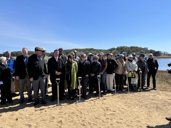
State and Federal officials joined partners involved in the Herring River Restoration Project for a group photo at the groundbreaking event at Chequessett Neck bridge in Wellfleet, Massachusetts.
State and Federal officials joined partners involved in the Herring River Restoration Project for a group photo at the groundbreaking event at Chequessett Neck bridge in Wellfleet, Massachusetts.

Herring River Restoration Project Groundbreaking Event
State and Federal officials joined partners involved in the Herring River Restoration Project for a group photo at the groundbreaking event at Chequessett Neck bridge in Wellfleet, Massachusetts.
State and Federal officials joined partners involved in the Herring River Restoration Project for a group photo at the groundbreaking event at Chequessett Neck bridge in Wellfleet, Massachusetts.

Herring River Restoration Project Groundbreaking Event
The USGS celebrating the groundbreaking of the Herring River restoration!
The USGS celebrating the groundbreaking of the Herring River restoration!

Herring River Restoration Project Groundbreaking Event
The USGS attendees of the Herring River Restoration Project groundbreaking event standing proudly next to a sign detailing the project.
The USGS attendees of the Herring River Restoration Project groundbreaking event standing proudly next to a sign detailing the project.

Herring River Restoration Project Groundbreaking Event
Rob Thieler, Meagan Eagle, and Sophie Kuhl of the U.S. Geological Survey, Woods Hole Coastal and Marine Science Center posing with the “Salt Marshes: A Carbon Bank in Our Backyard” sign near the Herring River.
Rob Thieler, Meagan Eagle, and Sophie Kuhl of the U.S. Geological Survey, Woods Hole Coastal and Marine Science Center posing with the “Salt Marshes: A Carbon Bank in Our Backyard” sign near the Herring River.

Ellen Lalk
Ellen Lalk is a stable isotope biogeochemist who focuses on the sources and fates of methane in marine and freshwater environments. At the USGS she is using analytical chemistry methods (e.g., laser spectroscopy, mass spectrometry, and gas chromatography) and fieldwork to better understand the transformation of methane-derived organic matter.
Ellen Lalk is a stable isotope biogeochemist who focuses on the sources and fates of methane in marine and freshwater environments. At the USGS she is using analytical chemistry methods (e.g., laser spectroscopy, mass spectrometry, and gas chromatography) and fieldwork to better understand the transformation of methane-derived organic matter.

CCL
Map showing the maximum coastal change likelihood value derived from support vector machine supervised learning that combines the fabric data with the event and perpetual hazards and selects the maximum outcome of that combination for A, the northeastern United States and B, detail for an area along the Delmarva Peninsula that is characterized by developed and undev
Map showing the maximum coastal change likelihood value derived from support vector machine supervised learning that combines the fabric data with the event and perpetual hazards and selects the maximum outcome of that combination for A, the northeastern United States and B, detail for an area along the Delmarva Peninsula that is characterized by developed and undev

CCL Hazards
Map showing the hazards type layer, which highlights the hazard type (event or perpetual) that may be most influential in coastal change for A, the northeastern United States and B, detail for the outer extent of Cape Cod in eastern Massachusetts.
Map showing the hazards type layer, which highlights the hazard type (event or perpetual) that may be most influential in coastal change for A, the northeastern United States and B, detail for the outer extent of Cape Cod in eastern Massachusetts.

Hurricane Florence Numerical Modeling Geonarrative
The USGS partnered with North Carolina State University, Louisiana State University, and University Corporation for Atmospheric Research to investigate hurricane-induced compound flooding and sediment dispersal using coupled hydrology and ocean models.
The USGS partnered with North Carolina State University, Louisiana State University, and University Corporation for Atmospheric Research to investigate hurricane-induced compound flooding and sediment dispersal using coupled hydrology and ocean models.

Bathymetry of Cape Cod Bay, MA
Bathymetry of Cape Cod Bay, MA collected in 2019. Warmer colors indicate shallow depths while cool colors indicate deeper depths.
Bathymetry of Cape Cod Bay, MA collected in 2019. Warmer colors indicate shallow depths while cool colors indicate deeper depths.

Coastal Change Likelihood - Fabric Data
The CCL assessment integrates data describing coastal characteristics, landscape composition, and the level of resistance to change, with data defining the drivers of change that impact the coast, such as waves and flooding. These data types are known as fabric and hazards, respectively.
The CCL assessment integrates data describing coastal characteristics, landscape composition, and the level of resistance to change, with data defining the drivers of change that impact the coast, such as waves and flooding. These data types are known as fabric and hazards, respectively.