
This cemetery was included in the review queue because the address field was blank. The editor was correct by leaving the field blank due to the cemetery not having an address nor being near any roads.
Images
Images intro.
Filter Total Items: 567

Example of Cemetery Point Without an Address
This cemetery was included in the review queue because the address field was blank. The editor was correct by leaving the field blank due to the cemetery not having an address nor being near any roads.

Example of Post Office Point with Incorrect and Correct Zip Code Formatting
The left image shows the full zip code that the application flagged and placed in the review queue. When including zip codes be sure to use the 5-digit format shown in the right image.
The left image shows the full zip code that the application flagged and placed in the review queue. When including zip codes be sure to use the 5-digit format shown in the right image.

Example of Cemetery Point with Incorrect and Correct Hyphen Formatting
The left image shows the address without spaces surrounding the hyphen that caused the application to flag the edit. The image on the right with spaces included is what will prevent an edit from entering the review queue.
The left image shows the address without spaces surrounding the hyphen that caused the application to flag the edit. The image on the right with spaces included is what will prevent an edit from entering the review queue.

TNMCorps Points with no Edit History - All Feature Types
A map showing edited points with no edit history for all feature types.
A map showing edited points with no edit history for all feature types.

TNMCorps Points with no Edit History - Fire Stations
A map showing all the edited fire station points with no edit history. Points are clustered in states along the Atlantic and Pacific coasts along with a few inland states (e.g., Utah, South Dakota, West Virginia, etc.).
A map showing all the edited fire station points with no edit history. Points are clustered in states along the Atlantic and Pacific coasts along with a few inland states (e.g., Utah, South Dakota, West Virginia, etc.).

Gateway Arch in Saint Louis Missouri
Image of the Gateway Arch monument in Saint Louis, Missouri. Image accessed from https://www.britannica.com/topic/Gateway-Arch
Image of the Gateway Arch monument in Saint Louis, Missouri. Image accessed from https://www.britannica.com/topic/Gateway-Arch

Future City Hall Challenges April 2022
Map of the United States showing future city hall challenge states and incorporated places with a population greater than 500 without a city hall.
Map of the United States showing future city hall challenge states and incorporated places with a population greater than 500 without a city hall.

Examples of a Deletion and a Creation in the Review Queue
Screenshot of two edits in the review queue. The edit on the left is a deletion (i.e., all volunteer deletions go to the review queue regardless of user role or reason). The edit on the right is a new cemetery that was created near another cemetery. Edits in the review queue can either be approved as-is, reviewed and resaved with adjustments, or rejected.
Screenshot of two edits in the review queue. The edit on the left is a deletion (i.e., all volunteer deletions go to the review queue regardless of user role or reason). The edit on the right is a new cemetery that was created near another cemetery. Edits in the review queue can either be approved as-is, reviewed and resaved with adjustments, or rejected.

Citizen Science Month Logo
Official Citizen Science Month logo from SciStarter on a blue background. Logo downloaded from the SciStarter website for citizen science month, April 2022.
Official Citizen Science Month logo from SciStarter on a blue background. Logo downloaded from the SciStarter website for citizen science month, April 2022.

Citizen Science Month Banner
Official Citizen Science Month logo banner from SciStarter on a white background. Logo banner downloaded from the SciStarter website for citizen science month, April 2022.
Official Citizen Science Month logo banner from SciStarter on a white background. Logo banner downloaded from the SciStarter website for citizen science month, April 2022.

Landsat Dashboard.png
Image showing number of Landsat scenes available by location globally over 50 years. Can search by spacecraft identification, sensor identification, year acquired, processing level, and collection category. Maps are interactive and highlight spatial and temporal distribution of the Landsat archive.
Image showing number of Landsat scenes available by location globally over 50 years. Can search by spacecraft identification, sensor identification, year acquired, processing level, and collection category. Maps are interactive and highlight spatial and temporal distribution of the Landsat archive.

Landsat Update March 2022
The latest Landsat Update is available for the public. Text on image reads: "Landsat Update: March 2022. Learn the latest Landsat information and news. What's inside? Pecora 22 upcoming meeting, Landsat 9 mission status, Landsat 9 data available, Collection 2 Level 3 products available, Archive reaches 10 million scenes, Landsat Science Team meeting.
The latest Landsat Update is available for the public. Text on image reads: "Landsat Update: March 2022. Learn the latest Landsat information and news. What's inside? Pecora 22 upcoming meeting, Landsat 9 mission status, Landsat 9 data available, Collection 2 Level 3 products available, Archive reaches 10 million scenes, Landsat Science Team meeting.

February Landsat Social Media Posts
Social media posts from February for the March 2022 Landsat Update. Available via Landsat Missions.
Social media posts from February for the March 2022 Landsat Update. Available via Landsat Missions.

PECORA award
Pecora 2022 award flyer announcing call for nominations, due April 15, 2022.
Pecora 2022 award flyer announcing call for nominations, due April 15, 2022.

Pecora 2022 Award Call for Nominations
Pecora 2022 award flyer announcing call for nominations. Nominations due April 15, 2022.
Pecora 2022 award flyer announcing call for nominations. Nominations due April 15, 2022.

Flyer 2 Pecora 2022 Award Call for Nominations
Description of the Pecora Award. This image details the procedure for nominations, eligibility, and privacy statement.
Description of the Pecora Award. This image details the procedure for nominations, eligibility, and privacy statement.

Fire near Uljin-eup, South Korea (Natural Color)
Landsat 9 captured this natural color image of the ongoing fire in Uljin county on South Korea’s west coast.
Landsat 9 captured this natural color image of the ongoing fire in Uljin county on South Korea’s west coast.

Fire near Uljin-eup, South Korea (False Color)
Landsat 9 captured an image of the ongoing fire in Uljin county on South Korea’s west coast. The false color image looks beneath the smoke and shows the burn scar as reddish-brown and the heat signature from the fire as bright red.
Landsat 9 captured an image of the ongoing fire in Uljin county on South Korea’s west coast. The false color image looks beneath the smoke and shows the burn scar as reddish-brown and the heat signature from the fire as bright red.
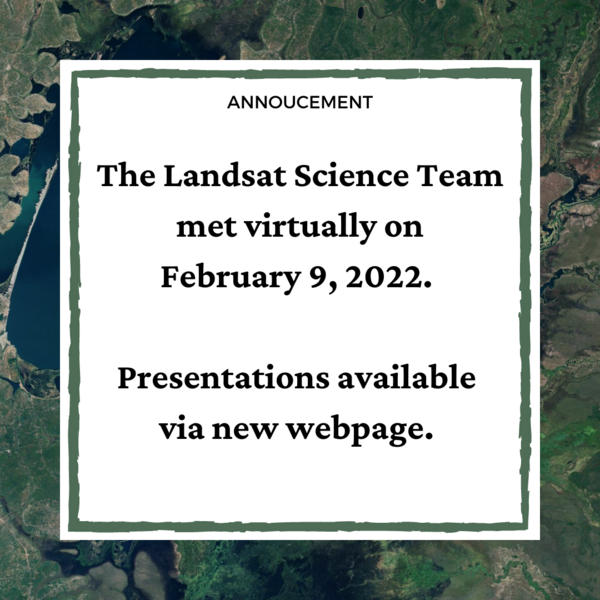
Landsat Science Team Meeting Presentations Available
The Landsat Science Team met virtually on February 9, 2022. Topics included, but were not limited to, Landsat 9 operations, calibration, and data release plans; Landsat 7 mission status; Landsat and Sentinel harmonization; and the future of land imaging.
The Landsat Science Team met virtually on February 9, 2022. Topics included, but were not limited to, Landsat 9 operations, calibration, and data release plans; Landsat 7 mission status; Landsat and Sentinel harmonization; and the future of land imaging.

Using Satellite-derived Maps in Rangeland Management
Rangeland management has used Landsat imagery for 50 years. Satellite imagery can provide a more comprehensive view of native pastures and prairies that cover swaths of Western America.
A new paper in Elsevier provides four guiding principles for ranges:
1. Use maps within a decision-making framework

topoBuilder Infographic
topoBuilder & OnDemand Topo Capabilities
topoBuilder & OnDemand Topo Capabilities