This video demonstrates how to import a metadata file and/or associated contact metadata for a collection in the USGS Registry of Scientific Collections (ReSciColl) into the mdEditor tool, so it can be revised and updated when necessary.
Videos
 ReSciColl & mdEditor Training: mdEditor Import Collections/Contacts
This video demonstrates how to import a metadata file and/or associated contact metadata for a collection in the USGS Registry of Scientific Collections (ReSciColl) into the mdEditor tool, so it can be revised and updated when necessary.
 ReSciColl & mdEditor Training: mdEditor Export Collections/Contacts
This video demonstrates for USGS Registry of Scientific Collections (ReSciColl) users how to export a metadata file and/or associated contact metadata from the mdEditor tool for sharing or backup.
This video demonstrates for USGS Registry of Scientific Collections (ReSciColl) users how to export a metadata file and/or associated contact metadata from the mdEditor tool for sharing or backup.
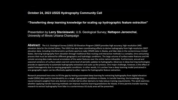
 Transferring Deep Learning Knowledge for Scaling Up Hydrographic Feature Extraction
The U.S. Geological Survey (USGS) 3D Elevation Program (3DEP) provides high accuracy, high-resolution (HR) elevation data for the United States.
The U.S. Geological Survey (USGS) 3D Elevation Program (3DEP) provides high accuracy, high-resolution (HR) elevation data for the United States.
 Image of the Week: No Place for Flamingos on Fuente de Piedra
No Place for Flamingos on Fuente de Piedra.
Fuente de Piedra, a saltwater lagoon in southern Spain, is an important breeding site for thousands of flamingos. In 2023, the shallow wetland nearly completely dried up, leaving little space for the birds. Only a few dozen birds were seen on the lagoon this year, a situation that could impact tourism.
The presenter is Dave Blodgett. Dave is a Civil Engineer with the USGS Water Mission Area and is also on assignment to NGTOC's Topographic Applied Research Team.
The presenter is Dave Blodgett. Dave is a Civil Engineer with the USGS Water Mission Area and is also on assignment to NGTOC's Topographic Applied Research Team.
 USGS using drones to measure methane escaping Arctic permafrost - Aug 2023
As permafrost soils in the Arctic warm and thaw, greenhouse gases including methane are released into the atmosphere. USGS Ecologist Kristen Manies of the USGS Geology, Minerals, Energy, and Geophysics Science Center (GMEGSC) is researching low-cost ways to measure methane emissions across these changing ecosystems.
As permafrost soils in the Arctic warm and thaw, greenhouse gases including methane are released into the atmosphere. USGS Ecologist Kristen Manies of the USGS Geology, Minerals, Energy, and Geophysics Science Center (GMEGSC) is researching low-cost ways to measure methane emissions across these changing ecosystems.
For 50 years, the people of EROS have overcome difficulties and celebrated triumphs together, always centered on providing a perspective of the Earth that helps us better understand its condition. This video, timed with the 50th anniversary celebration at EROS in August of 2023, explores the center's history.
For 50 years, the people of EROS have overcome difficulties and celebrated triumphs together, always centered on providing a perspective of the Earth that helps us better understand its condition. This video, timed with the 50th anniversary celebration at EROS in August of 2023, explores the center's history.
Landsat satellites move in a polar orbit from north to south at over 27,000 kilometers per hour. For the ten meter antenna at EROS, a typical flyover, also known as a pass, lasts 14 minutes from horizon to horizon.
Landsat satellites move in a polar orbit from north to south at over 27,000 kilometers per hour. For the ten meter antenna at EROS, a typical flyover, also known as a pass, lasts 14 minutes from horizon to horizon.
 Drone-based hyperspectral mapping of agricultural crop fields in California's Central Valley
In August 2023, the USGS National Uncrewed Systems Office (NUSO) participated in a collaborative field campaign to collect remote sensing data over agricultural crop fields in California's Central Valley.
In August 2023, the USGS National Uncrewed Systems Office (NUSO) participated in a collaborative field campaign to collect remote sensing data over agricultural crop fields in California's Central Valley.
 The 3D Hydrography Program – transition status July 25, 2023
Agenda:
 Florida Bonneted Bat Data Submission Workshop (Part 1 - Introduction)
Recording of the Florida Bonneted Bat Data Submission Workshop: Part 1 - Introduction
Introduction contains background information on NABat and Florida Bonneted Bat surveys.
Spreaker: Roxanne Pourshoushtari (USGS)
Presentation contributors and moderators: Laura D’Acunto (USGS) and Sandra Sneckenberger (FWS)
 Florida Bonneted Bat Data Submission Workshop (Part 3 - External Roost Surveys)
Recording of the Florida Bonneted Bat Data Submission Workshop (Part - 3 External Roost Surveys)
Speaker: Roxanne Pourshoushtari (USGS)
Presentation contributors and moderators: Laura D’Acunto (USGS) and Sandra Sneckenberger (FWS)
Recording of the Florida Bonneted Bat Data Submission Workshop (Part - 3 External Roost Surveys)
Speaker: Roxanne Pourshoushtari (USGS)
Presentation contributors and moderators: Laura D’Acunto (USGS) and Sandra Sneckenberger (FWS)
Smoke filled the skies over western Canada and even much of the United States in May 2023. The source was several wildfires in Alberta and British Columbia.
Near the end of May, rain and cooler temperatures finally brought some relief for the out-of-control fires.
Smoke filled the skies over western Canada and even much of the United States in May 2023. The source was several wildfires in Alberta and British Columbia.
Near the end of May, rain and cooler temperatures finally brought some relief for the out-of-control fires.
 What’s Happening with National Hydrography – USGS at AWRA Geospatial Water Technology Conference May 2022
What’s Happening with National Hydrography – USGS at AWRA Geospatial Water Technology Conference May 2022
linkOur material is taken from the "USGS National Hydrography Datasets – What’s Happening Now?" session previously held at the recent American Water Resources Association (AWRA) Geospatial Water Technology Conference earlier in May. We will cover:
A winter of heavy rain causes flooding in California's Tulare Basin, threatening cropland. The basin was once the site of a large lake that appeared naturally every winter as rainfall and snowmelt from the nearby Sierra Nevada mountain range flowed down and filled the basin. It was even known as the largest lake west of the Mississippi River.
A winter of heavy rain causes flooding in California's Tulare Basin, threatening cropland. The basin was once the site of a large lake that appeared naturally every winter as rainfall and snowmelt from the nearby Sierra Nevada mountain range flowed down and filled the basin. It was even known as the largest lake west of the Mississippi River.
Topic is “The NHD to 3DHP – midyear update”
Agenda:
- 00:00 – Start
- 1:57 - The NHD to 3DHP – midyear update (section1 - Steve Aichele)
- 28:13 - The NHD to 3DHP – midyear update (section2 – Sue Buto)
- 43:05 - Closing remarks
Links:
Topic is “The NHD to 3DHP – midyear update”
Agenda:
- 00:00 – Start
- 1:57 - The NHD to 3DHP – midyear update (section1 - Steve Aichele)
- 28:13 - The NHD to 3DHP – midyear update (section2 – Sue Buto)
- 43:05 - Closing remarks
Links:
 Using the EarthExplorer Bulk Download Web Application (BDWA)
This video covers the Bulk Download Web Application or BDWA, which allows you to download large quantities of satellite imagery and geospatial data. The BDWA is web based and compatible with Google Chrome and Microsoft Edge. No additional downloads are required to use the BDWA.
This video covers the Bulk Download Web Application or BDWA, which allows you to download large quantities of satellite imagery and geospatial data. The BDWA is web based and compatible with Google Chrome and Microsoft Edge. No additional downloads are required to use the BDWA.
An iceberg the size of Houston broke from the Brunt Ice Shelf Antarctica on January 22nd, 2023. Landsat images show the area one day before the break and several days after. A feature named Chasm One had been lengthening for years, and it finally reached all the way across the shelf.
An iceberg the size of Houston broke from the Brunt Ice Shelf Antarctica on January 22nd, 2023. Landsat images show the area one day before the break and several days after. A feature named Chasm One had been lengthening for years, and it finally reached all the way across the shelf.
The HydroAdd tool is a web application built by USGS that allows collaborative addressing (or linear referencing) of diverse datasets to the NHD. HydroAdd also provides tools that allow users to migrate datasets that have been previously addressed to the NHD.
The HydroAdd tool is a web application built by USGS that allows collaborative addressing (or linear referencing) of diverse datasets to the NHD. HydroAdd also provides tools that allow users to migrate datasets that have been previously addressed to the NHD.
Cheyenne Bottoms is the largest inland wetland in the United States. Water normally diverts from rivers into the vast marshland. The wetland water level changes with precipitation and surface flows. For example, 2007 was a wet year. And 2013 was a dry year.
Cheyenne Bottoms is the largest inland wetland in the United States. Water normally diverts from rivers into the vast marshland. The wetland water level changes with precipitation and surface flows. For example, 2007 was a wet year. And 2013 was a dry year.
 Mapping biocrust with UAS technology in Moab, Utah
USGS researchers teamed up for a biological soil crust (biocrust) remote sensing and field data campaign near Moab, Utah in February of 2022.
USGS researchers teamed up for a biological soil crust (biocrust) remote sensing and field data campaign near Moab, Utah in February of 2022.


