
Greenhouse study comparing plant performance during drought will help land managers choose plant species for restoring degraded lands. To find out more, follow the Restoration Assessment and Monitoring Program of the Southwest, housed at the Southwest Biolobigical Science Center. www.ugs.gov/sbsc/ramps
Images
Explore our planet through photography and imagery, including climate change and water all the way back to the 1800s when the USGS was surveying the country by horse and buggy.
Filter Total Items: 21557

Greenhouse study comparing plant performance during drought.
Greenhouse study comparing plant performance during drought will help land managers choose plant species for restoring degraded lands. To find out more, follow the Restoration Assessment and Monitoring Program of the Southwest, housed at the Southwest Biolobigical Science Center. www.ugs.gov/sbsc/ramps

Kīlauea summit on June 11, 2021
A view of Halema‘uma‘u on June 11, 2021, at 12:20 p.m. HST. Although eruptive activity has paused at the Kīlauea summit, HVO geologists still monitor the lava lake and summit area regularly. They make observations to note any physical changes in the landscape or visual changes in gas emissions.
A view of Halema‘uma‘u on June 11, 2021, at 12:20 p.m. HST. Although eruptive activity has paused at the Kīlauea summit, HVO geologists still monitor the lava lake and summit area regularly. They make observations to note any physical changes in the landscape or visual changes in gas emissions.

Comparison of Porkchop Geyser in Sep 1984 (left) and Aug 1986 (right)
Comparison of Porkchop Geyser in September 1984 (left) and August 1986 (right). The Geyser entered a period of near-constant eruption in 1985, and the pool disappeared; it exploded on September 5, 1989.
Comparison of Porkchop Geyser in September 1984 (left) and August 1986 (right). The Geyser entered a period of near-constant eruption in 1985, and the pool disappeared; it exploded on September 5, 1989.

Employee Photo Challenge Collage
A collage of images taken by UGS-GLSC employees during the 2020 field season.
A collage of images taken by UGS-GLSC employees during the 2020 field season.

Map of Yellowstone showing major rivers and continental divide
Map of Yellowstone National Park showing the major rivers and the continental divide (red dashed). Yellowstone Caldera is oulined by purple dashed line. Water flowing south and west of the divide ends up in the Pacific Ocean, whereas water north and east of the divide ends up in the Gulf of Mexico.
Map of Yellowstone National Park showing the major rivers and the continental divide (red dashed). Yellowstone Caldera is oulined by purple dashed line. Water flowing south and west of the divide ends up in the Pacific Ocean, whereas water north and east of the divide ends up in the Gulf of Mexico.

Rat snake museum specimen
This rat snake is a preserved museum specimen with snake fungal disease that was collected in Tennessee in 1973. The photo was taken at the USGS National Wildlife Health Center in 2017 as part of a study.
This rat snake is a preserved museum specimen with snake fungal disease that was collected in Tennessee in 1973. The photo was taken at the USGS National Wildlife Health Center in 2017 as part of a study.

Various paths of taken by water originating in Yellowstone
Upper map shows the flow path of hot spring water from the Old Faithful area through the Firehole, Madison, Missouri and Mississippi Rivers to the Gulf of Mexico. Lower map shows the flow path of hot spring water from south of the continental divide through the Lewis, Snake and Columbia Rivers to the Pacific Ocean.
Upper map shows the flow path of hot spring water from the Old Faithful area through the Firehole, Madison, Missouri and Mississippi Rivers to the Gulf of Mexico. Lower map shows the flow path of hot spring water from south of the continental divide through the Lewis, Snake and Columbia Rivers to the Pacific Ocean.

Downstream view of North Canadian River at Britton Rd at Oklahoma City
View downstream from the bridge at USGS site 07241520, North Canadian River at Britton Rd at Oklahoma City, OK
View downstream from the bridge at USGS site 07241520, North Canadian River at Britton Rd at Oklahoma City, OK

I Am A...Wildlife Biologist coloring page
I Am A...Wildlife Biologist coloring page
I Am A...Wildlife Biologist coloring page

Kīlauea summit on June 8, 2021
On June 8, 2021, the USGS Hawaiian Volcano Observatory conducted a routine helicopter overflight and fieldwork at the summit of Kīlauea. Here, a geophysicist returns to the helicopter after making Global Positioning Systems (GPS) measurements. These surveys measure small changes in the ground surface caused by subsurface magma movement.
On June 8, 2021, the USGS Hawaiian Volcano Observatory conducted a routine helicopter overflight and fieldwork at the summit of Kīlauea. Here, a geophysicist returns to the helicopter after making Global Positioning Systems (GPS) measurements. These surveys measure small changes in the ground surface caused by subsurface magma movement.

Kīlauea summit on June 8, 2021
A view of the crusted over lava lake within Halema‘uma‘u at Kīlauea summit, taken during a helicopter overflight on June 8, 2021. No incandescence (red lava) has been visible on the solidified lava lake surface for over two weeks. Light degassing continues in a few areas around the margin of the lava lake, mainly along the north crater wall (bottom left).
A view of the crusted over lava lake within Halema‘uma‘u at Kīlauea summit, taken during a helicopter overflight on June 8, 2021. No incandescence (red lava) has been visible on the solidified lava lake surface for over two weeks. Light degassing continues in a few areas around the margin of the lava lake, mainly along the north crater wall (bottom left).

Kīlauea summit on June 8, 2021
No eruptive activity or major changes were observed during a USGS Hawaiian Volcano Observatory Kīlauea summit monitoring shift on June 8, 2021. An area near the north wall of Halema‘uma‘u continues to visibly emit gases, though the eruption has paused. The most recent sulfur dioxide emission rate, measured on June 4, remains slightly elevated at 54 tonnes per day.
No eruptive activity or major changes were observed during a USGS Hawaiian Volcano Observatory Kīlauea summit monitoring shift on June 8, 2021. An area near the north wall of Halema‘uma‘u continues to visibly emit gases, though the eruption has paused. The most recent sulfur dioxide emission rate, measured on June 4, remains slightly elevated at 54 tonnes per day.

Kīlauea summit on June 8, 2021
Portions of Crater Rim Drive, which was damaged during the 2018 Kīlauea summit collapse, are visible from the south rim of Halema‘uma‘u. The lava lake within Halema‘uma‘u and the east wall of Halema‘uma‘u crater are visible in the background. This area of Hawai‘i Volcanoes National Park remains closed to the public due to hazardous conditions.
Portions of Crater Rim Drive, which was damaged during the 2018 Kīlauea summit collapse, are visible from the south rim of Halema‘uma‘u. The lava lake within Halema‘uma‘u and the east wall of Halema‘uma‘u crater are visible in the background. This area of Hawai‘i Volcanoes National Park remains closed to the public due to hazardous conditions.

Maktablar uchun suv aylanishi - Water Cycle for Schools, Uzbek (JPEG)
AQSh Geologiya xizmati va Birlashgan Millatlar Tashkilotining Oziq-ovqat va qishloq xo'jaligi tashkiloti (FAO) maktablar uchun suv aylanishining sxemasini ishlab chiqdi.
Shahriyor Toshevning tarjimasi Geologiya fanlari universiteti magistranti
AQSh Geologiya xizmati va Birlashgan Millatlar Tashkilotining Oziq-ovqat va qishloq xo'jaligi tashkiloti (FAO) maktablar uchun suv aylanishining sxemasini ishlab chiqdi.
Shahriyor Toshevning tarjimasi Geologiya fanlari universiteti magistranti

Yer suvi qayerda?
332,5 million kub mil suvning 96 foizdan ko'prog'ini sho'r suv bilan ta'minlaydigan dunyoning umumiy suv ta'minoti qanday ekanligiga e'tibor bering. Umumiy chuchuk suvlarning 68 foizdan ko'prog'i muz va muzliklarda yashiringan. Chuchuk suvning yana 30 foizi er ostidadir.
332,5 million kub mil suvning 96 foizdan ko'prog'ini sho'r suv bilan ta'minlaydigan dunyoning umumiy suv ta'minoti qanday ekanligiga e'tibor bering. Umumiy chuchuk suvlarning 68 foizdan ko'prog'i muz va muzliklarda yashiringan. Chuchuk suvning yana 30 foizi er ostidadir.

Magicicada cassinii, super rare Blue eyed variant
Photo Contest Winner | June 2021 | Honorable Mention
USGS Natiave Bee Lab, Magicicada cassinii, super rare Blue eyed variant
Photo Contest Winner | June 2021 | Honorable Mention
USGS Natiave Bee Lab, Magicicada cassinii, super rare Blue eyed variant

Marcus G. Langseth departs Newport, Oregon
Photo Contest Winner | June 2021 | Where We Work
Marcus G. Langseth departs Newport, Oregon (Yaquina Bay) for Cascadia Project OBS Deployment Leg
Photo Contest Winner | June 2021 | Where We Work
Marcus G. Langseth departs Newport, Oregon (Yaquina Bay) for Cascadia Project OBS Deployment Leg

UAS photo of the inactive western fissure — Halema‘uma‘u, June 3, 2021
This close-up Unoccupied Aircraft Systems (UAS) photo of the inactive western fissure within Halema‘uma‘u was captured on Thursday, June 3, 2021, at the summit of Kīlauea. The recent pause in the eruption has allowed the USGS Hawaiian Volcano Observatory (HVO) UAS pilots to safely photograph the eruptive features from new angles.
This close-up Unoccupied Aircraft Systems (UAS) photo of the inactive western fissure within Halema‘uma‘u was captured on Thursday, June 3, 2021, at the summit of Kīlauea. The recent pause in the eruption has allowed the USGS Hawaiian Volcano Observatory (HVO) UAS pilots to safely photograph the eruptive features from new angles.

UAS view into inactive western fissure — Halema‘uma‘u, June 3, 2021
This Unoccupied Aircraft Systems (UAS) photo, looking straight down into the inactive western fissure within Halema‘uma‘u at the summit of Kīlauea, was captured on Thursday, June 3, 2021. One of the objectives of the UAS mission was to get a close-up look into the fissure to see if any incandescent lava was still visible.
This Unoccupied Aircraft Systems (UAS) photo, looking straight down into the inactive western fissure within Halema‘uma‘u at the summit of Kīlauea, was captured on Thursday, June 3, 2021. One of the objectives of the UAS mission was to get a close-up look into the fissure to see if any incandescent lava was still visible.
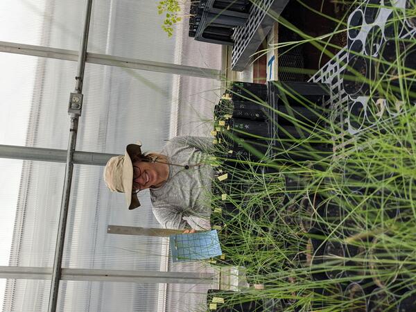
Drought experiments shed light on plant responses to climate change.
Greenhouse study comparing plant performance during drought will help land managers choose plant species for restoring degraded lands. To find out more, follow the Restoration Assessment and Monitoring Program of the Southwest, housed at the Southwest Biolobigical Science Center. www.ugs.gov/sbsc/ramps
Greenhouse study comparing plant performance during drought will help land managers choose plant species for restoring degraded lands. To find out more, follow the Restoration Assessment and Monitoring Program of the Southwest, housed at the Southwest Biolobigical Science Center. www.ugs.gov/sbsc/ramps

Halema‘uma‘u crater at dusk on June 2
During a Kīlauea summit monitoring field shift on the evening of June 2, HVO geologists observed no eruptive activity or any major changes at the Halema‘uma‘u crater lava lake. No incandescence was visible anywhere on the lake surface or around the vents.
During a Kīlauea summit monitoring field shift on the evening of June 2, HVO geologists observed no eruptive activity or any major changes at the Halema‘uma‘u crater lava lake. No incandescence was visible anywhere on the lake surface or around the vents.