
Using remote sensing through the ice to determine how much water was in the Nome River in the winter.
Images
Explore our planet through photography and imagery, including climate change and water all the way back to the 1800s when the USGS was surveying the country by horse and buggy.
Filter Total Items: 21558

Drilling a hole in the ice on the Nome River, Alaska
Using remote sensing through the ice to determine how much water was in the Nome River in the winter.

Landsat: Mt. Redoubt
Landsat 5 image of the Mt. Redoubt area on March 26, 2009 at 1:07 PM AKDT. The false color image shows the large brown ash cloud extending over the Cook Inlet and the western Kenai peninsula (right sid of image). The image also shows a whiter steam and gas plume rising from the summit of Redoubt Volcano (near upper center).
Landsat 5 image of the Mt. Redoubt area on March 26, 2009 at 1:07 PM AKDT. The false color image shows the large brown ash cloud extending over the Cook Inlet and the western Kenai peninsula (right sid of image). The image also shows a whiter steam and gas plume rising from the summit of Redoubt Volcano (near upper center).

National Atmospheric Deposition site at Brooklyn Lake, WY
National Atmospheric Deposition site near snowpack-sampling site at Brooklyn Lake, WY.
National Atmospheric Deposition site near snowpack-sampling site at Brooklyn Lake, WY.

USGS Stream gage 5053000 Wild Rice River nr Abercrombie, ND

Workers access site at Divide Peak, Wyoming via snowmobile.
Workers access site at Divide Peak, Wyoming via snowmobile.
Workers access site at Divide Peak, Wyoming via snowmobile.

Worker in snowpack-sampling pit at Old Battle, Wyoming
Worker in snowpack-sampling pit at Old Battle, Wyoming
Worker in snowpack-sampling pit at Old Battle, Wyoming

Flood Aftermath
2009 flood aftermath near Antelope Creek, Carson, North Dakota.
2009 flood aftermath near Antelope Creek, Carson, North Dakota.

A Diversity of Corals Growing in the Mangroves Within Virgin Islands Coral Reef National Monument
linkThis photo shows a mangrove ecosystem that may be unique in the Caribbean in terms of the abundance and diversity of corals.
A Diversity of Corals Growing in the Mangroves Within Virgin Islands Coral Reef National Monument
linkThis photo shows a mangrove ecosystem that may be unique in the Caribbean in terms of the abundance and diversity of corals.

A Diversity of Corals Growing in the Mangroves Within Virgin Islands Coral Reef National Monument
linkThis photo shows a mangrove ecosystem that may be unique in the Caribbean in terms of the abundance and diversity of corals.
A Diversity of Corals Growing in the Mangroves Within Virgin Islands Coral Reef National Monument
linkThis photo shows a mangrove ecosystem that may be unique in the Caribbean in terms of the abundance and diversity of corals.

The Ice Piston, Redoubt Volcano
The Ice Piston with Ash, Redoubt Volcano, Alaska. This photo was taken on March 21, 2009, the day before Redoubt first erupted. The glacier that filled the crater was collapsing because of the increase in ground temperature underneath.
The Ice Piston with Ash, Redoubt Volcano, Alaska. This photo was taken on March 21, 2009, the day before Redoubt first erupted. The glacier that filled the crater was collapsing because of the increase in ground temperature underneath.

Flooding on the Knife River
2009 flooding on the Knife River near Hazen, North Dakota.
2009 flooding on the Knife River near Hazen, North Dakota.

Worker prepares snowpack-sampling pit near Hopewell, New Mexico
Worker prepares snowpack-sampling pit near Hopewell, New Mexico.
Worker prepares snowpack-sampling pit near Hopewell, New Mexico.

Thermal Image of Halema'uma'u Crater
This thermal image (white is hot, dark blue is cold), taken during today's helicopter overflight, shows the current vent configuration at Halema`uma`u crater. The vent cavity is about 130 meters (430 ft) wide, and has consumed portions of the wall and floor of Halema`uma`u crater.
This thermal image (white is hot, dark blue is cold), taken during today's helicopter overflight, shows the current vent configuration at Halema`uma`u crater. The vent cavity is about 130 meters (430 ft) wide, and has consumed portions of the wall and floor of Halema`uma`u crater.

Workers collect snow sample at Apgar Lookout sampling site, Montana.
Workers collect snow sample at Apgar Lookout sampling site, Montana.
Workers collect snow sample at Apgar Lookout sampling site, Montana.
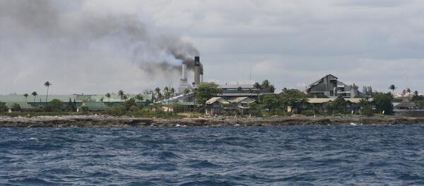
Smoke Stack - Air Pollution
An example of human activities that impact the earth's atmosphere.
An example of human activities that impact the earth's atmosphere.

Underwood Farm
Discovery Farms Underwood farm, located west of Underwood, North Dakota. Farm is owned and operated by Doyle and Patsy Johannes and their family since 1904.
Discovery Farms Underwood farm, located west of Underwood, North Dakota. Farm is owned and operated by Doyle and Patsy Johannes and their family since 1904.

Worker prepares snowpack-sampling pit at Brumley, Colorado
Worker prepares snowpack-sampling pit at Brumley, Colorado.
Worker prepares snowpack-sampling pit at Brumley, Colorado.

Precipitation collectors near snowpack-sampling site at Elk River, CO
Precipitation collectors near snowpack-sampling site at Elk River, Colorado
Precipitation collectors near snowpack-sampling site at Elk River, Colorado

National Atmospheric Deposition site near Gypsum Creek, Wyoming.
National Atmospheric Deposition site near Gypsum Creek, Wyoming.
National Atmospheric Deposition site near Gypsum Creek, Wyoming.

Collecting bathymetry on R/V Parke Snavely
Eric Grossman and Rob Wyland reviewing bathymetry data as it's being collected, on R/V Parke Snavely.
Eric Grossman and Rob Wyland reviewing bathymetry data as it's being collected, on R/V Parke Snavely.

Colony of Boulder Brain Coral (Colpophyllia natans)
A large colony of Boulder Brain Coral (Colpophyllia natans) has grown almost completely around a prop root.
A large colony of Boulder Brain Coral (Colpophyllia natans) has grown almost completely around a prop root.