
An optimal opportunity for in-flight cross-calibration occurred when Landsat 9 flew underneath Landsat 8 while moving into its final orbit. Since the two satellites nearly identical imaging systems, the underfly event offered ideal cross-calibration conditions.
Images
The National Land Imaging Program supports a variety of geospatial data programs and projects, including the USGS Landsat Program. Browse the images below to see some of the imagery produced using NLI-supported data sources.
Filter Total Items: 401

How Do You Landsat Overfly
An optimal opportunity for in-flight cross-calibration occurred when Landsat 9 flew underneath Landsat 8 while moving into its final orbit. Since the two satellites nearly identical imaging systems, the underfly event offered ideal cross-calibration conditions.

Latest in Landsat June Newsletter
In this June 2022 issue read highlights from an international partner meeting, explore published Landsat articles, and dive into new interactive tools. Find the newsletter here: https://www.usgs.gov/latest-landsat-newsletter/latest-landsat-newslette…
In this June 2022 issue read highlights from an international partner meeting, explore published Landsat articles, and dive into new interactive tools. Find the newsletter here: https://www.usgs.gov/latest-landsat-newsletter/latest-landsat-newslette…

Landsat: Celebrating 50 Years
Thumbnail for USGS Earth Resources Observation and Science (EROS) Center video "Landsat: Celebrating 50 Years."
Thumbnail for USGS Earth Resources Observation and Science (EROS) Center video "Landsat: Celebrating 50 Years."

Earthshots Image
Image featuring Earthshot cards that are used for outreach purposes. Earthshots can be viewed digitally here: https://eros.usgs.gov/image-gallery/earthshots.
Image featuring Earthshot cards that are used for outreach purposes. Earthshots can be viewed digitally here: https://eros.usgs.gov/image-gallery/earthshots.

Landsat 8 image of Karymsky volcano, April 20, 2022
Karymsky volcano, one of the most active volcanoes of Kamchatka's eastern volcanic zone, erupted on April 20, 2022. This pan-sharpened Landsat 8 image captured the event. Overlaying the infrared data over the natural color image highlights the heat signature of the active flows.
Landsat ID: LC08_L1TP_098022_20220420_20220420_02_RT

HDYL Great Barrier Reef
The largest coral reef ecosystem in the world, the Great Barrier Reef (GBR), is threatened by many human-made impacts. Due to the size of the GBR and limited accessibility, mapping and monitoring has always been a challenging task. Remote Sensing is an effective technique that provides valuable information for the GBR ecosystem.
The largest coral reef ecosystem in the world, the Great Barrier Reef (GBR), is threatened by many human-made impacts. Due to the size of the GBR and limited accessibility, mapping and monitoring has always been a challenging task. Remote Sensing is an effective technique that provides valuable information for the GBR ecosystem.

HDYL Boreal Forest Biome
The boreal forest biome is projected to shift northward due to continued climate change over the coming century. Researchers evaluated early indicators of a boreal forest biome shift using four decades of Landsat observation datasets.
The boreal forest biome is projected to shift northward due to continued climate change over the coming century. Researchers evaluated early indicators of a boreal forest biome shift using four decades of Landsat observation datasets.

Landsat Dashboard.png
Image showing number of Landsat scenes available by location globally over 50 years. Can search by spacecraft identification, sensor identification, year acquired, processing level, and collection category. Maps are interactive and highlight spatial and temporal distribution of the Landsat archive.
Image showing number of Landsat scenes available by location globally over 50 years. Can search by spacecraft identification, sensor identification, year acquired, processing level, and collection category. Maps are interactive and highlight spatial and temporal distribution of the Landsat archive.

Landsat Update March 2022
The latest Landsat Update is available for the public. Text on image reads: "Landsat Update: March 2022. Learn the latest Landsat information and news. What's inside? Pecora 22 upcoming meeting, Landsat 9 mission status, Landsat 9 data available, Collection 2 Level 3 products available, Archive reaches 10 million scenes, Landsat Science Team meeting.
The latest Landsat Update is available for the public. Text on image reads: "Landsat Update: March 2022. Learn the latest Landsat information and news. What's inside? Pecora 22 upcoming meeting, Landsat 9 mission status, Landsat 9 data available, Collection 2 Level 3 products available, Archive reaches 10 million scenes, Landsat Science Team meeting.

February Landsat Social Media Posts
Social media posts from February for the March 2022 Landsat Update. Available via Landsat Missions.
Social media posts from February for the March 2022 Landsat Update. Available via Landsat Missions.

PECORA award
Pecora 2022 award flyer announcing call for nominations, due April 15, 2022.
Pecora 2022 award flyer announcing call for nominations, due April 15, 2022.

Pecora 2022 Award Call for Nominations
Pecora 2022 award flyer announcing call for nominations. Nominations due April 15, 2022.
Pecora 2022 award flyer announcing call for nominations. Nominations due April 15, 2022.

Flyer 2 Pecora 2022 Award Call for Nominations
Description of the Pecora Award. This image details the procedure for nominations, eligibility, and privacy statement.
Description of the Pecora Award. This image details the procedure for nominations, eligibility, and privacy statement.

Fire near Uljin-eup, South Korea (Natural Color)
Landsat 9 captured this natural color image of the ongoing fire in Uljin county on South Korea’s west coast.
Landsat 9 captured this natural color image of the ongoing fire in Uljin county on South Korea’s west coast.

Fire near Uljin-eup, South Korea (False Color)
Landsat 9 captured an image of the ongoing fire in Uljin county on South Korea’s west coast. The false color image looks beneath the smoke and shows the burn scar as reddish-brown and the heat signature from the fire as bright red.
Landsat 9 captured an image of the ongoing fire in Uljin county on South Korea’s west coast. The false color image looks beneath the smoke and shows the burn scar as reddish-brown and the heat signature from the fire as bright red.
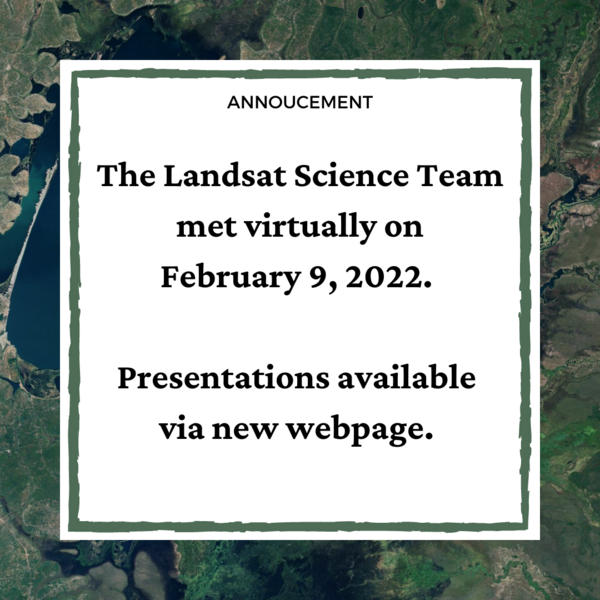
Landsat Science Team Meeting Presentations Available
The Landsat Science Team met virtually on February 9, 2022. Topics included, but were not limited to, Landsat 9 operations, calibration, and data release plans; Landsat 7 mission status; Landsat and Sentinel harmonization; and the future of land imaging.
The Landsat Science Team met virtually on February 9, 2022. Topics included, but were not limited to, Landsat 9 operations, calibration, and data release plans; Landsat 7 mission status; Landsat and Sentinel harmonization; and the future of land imaging.

Using Satellite-derived Maps in Rangeland Management
Rangeland management has used Landsat imagery for 50 years. Satellite imagery can provide a more comprehensive view of native pastures and prairies that cover swaths of Western America.
A new paper in Elsevier provides four guiding principles for ranges:
1. Use maps within a decision-making framework

Pecora Abstract & Special Session Deadline Extended
The deadline for Special Sessions and Abstracts has been extended to March 15, 2022.
The deadline for Special Sessions and Abstracts has been extended to March 15, 2022.

How Do You Landsat with Chinese Forests.png
Landscape ecologists are increasingly researching change processes with regards to spatial patterns.
Landscape ecologists are increasingly researching change processes with regards to spatial patterns.

Landsat 9 Image of Western Guinea-Bissau
The Geba River on the west coast of Guinea-Bissau is seen in this natural color Landsat 9 image from February 8, 2022. Silt carried by the river into the Atlantic Ocean creates intricate patterns as it moves around the Bissagos (or Bijagós) Islands. The country’s capital, Bissau, can be seen on the north side of the estuary and appears as light brown.
The Geba River on the west coast of Guinea-Bissau is seen in this natural color Landsat 9 image from February 8, 2022. Silt carried by the river into the Atlantic Ocean creates intricate patterns as it moves around the Bissagos (or Bijagós) Islands. The country’s capital, Bissau, can be seen on the north side of the estuary and appears as light brown.

Landsat Collection 2 Fractional Snow Covered Area (fSCA) Grid Map
This map shows where Landsat Collection 2 fractional Snow Covered Area (fSCA) and Canopy Adjusted fSCA data is available for the conterminous United States (top) and Alaska (below). To learn more visit the Landsat Collection 2 fSCA science products web page.
This map shows where Landsat Collection 2 fractional Snow Covered Area (fSCA) and Canopy Adjusted fSCA data is available for the conterminous United States (top) and Alaska (below). To learn more visit the Landsat Collection 2 fSCA science products web page.