Fissures opened on the Cumbre Vieja volcano on September 19. It's the first time it has erupted since 1971.
Videos
The USGS National Land Imaging Program supports a variety of geospatial data programs and projects, including the USGS Landsat Program. Browse the videos below to learn more about imagery and science supported through NLI.
 Image of the Week - Volcano on Spain's La Palma Island
Fissures opened on the Cumbre Vieja volcano on September 19. It's the first time it has erupted since 1971.
Social scientists at the U.S. Geological Survey (USGS) Fort Collins Science Center – in collaboration with the USGS National Land Imaging Program – conduct Earth observation user case studies using qualitative research methods.
Social scientists at the U.S. Geological Survey (USGS) Fort Collins Science Center – in collaboration with the USGS National Land Imaging Program – conduct Earth observation user case studies using qualitative research methods.
 Earth Observation User Case: Speaking a New Language of Landsat
Social scientists at the U.S. Geological Survey (USGS) Fort Collins Science Center – in collaboration with the USGS National Land Imaging Program – conduct Earth observation user case studies using qualitative research methods.
Social scientists at the U.S. Geological Survey (USGS) Fort Collins Science Center – in collaboration with the USGS National Land Imaging Program – conduct Earth observation user case studies using qualitative research methods.
The Earth As Art project began in the early 2000s, and its original intent remains the same: to produce images that do not look like satellite images at first glance.
The Earth As Art project began in the early 2000s, and its original intent remains the same: to produce images that do not look like satellite images at first glance.
The Earth As Art project began in the early 2000s, and its original intent remains the same: to produce images that do not look like satellite images at first glance.
The Earth As Art project began in the early 2000s, and its original intent remains the same: to produce images that do not look like satellite images at first glance.
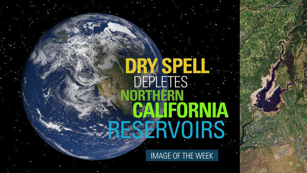
 Image of the Week - Dry Spell Depletes Northern California Reservoirs
A prolonged dry spell has sparked woes over water availability and wildfire in the western United States.
A prolonged dry spell has sparked woes over water availability and wildfire in the western United States.
If you're watching this video, you're probably using a lithium battery. Smartphones, tablets and laptops all rely on lithium metal to store energy. It comes from surface mines or brine ponds, found in places like Australia, China and the United States. One of the leading sources for this increasingly valuable resource is the South American nation of Chile.
If you're watching this video, you're probably using a lithium battery. Smartphones, tablets and laptops all rely on lithium metal to store energy. It comes from surface mines or brine ponds, found in places like Australia, China and the United States. One of the leading sources for this increasingly valuable resource is the South American nation of Chile.
 Image of the Week - Wildfires Burn in the Shadow of Mount Rushmore
In late March of 2021, just four miles from the edge of South Dakota's second-largest city, two wildfires sparked by human activity burned through a section of the Black Hills.
In late March of 2021, just four miles from the edge of South Dakota's second-largest city, two wildfires sparked by human activity burned through a section of the Black Hills.
A small watershed restoration project proves that land farmed for half a century can be returned to a previous state. In 2002, Mike Osterholm bought 98 acres in northeastern Iowa, most of it annually tilled cropland. The land included the confluence of Duck Creek and Waterloo Creek.
A small watershed restoration project proves that land farmed for half a century can be returned to a previous state. In 2002, Mike Osterholm bought 98 acres in northeastern Iowa, most of it annually tilled cropland. The land included the confluence of Duck Creek and Waterloo Creek.
The Bay of Fundy in Canada has a unique geography funneling the Atlantic Ocean into some of the world's highest tides. At some points the water level can rise and fall over forty feet. The water's edge at Minas Basin shown in these Landsat 8 images changes dramatically depending on the day and time.
The Bay of Fundy in Canada has a unique geography funneling the Atlantic Ocean into some of the world's highest tides. At some points the water level can rise and fall over forty feet. The water's edge at Minas Basin shown in these Landsat 8 images changes dramatically depending on the day and time.
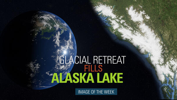
 Image of the Week: Glacial Retreat Fills Alaska Lake
The visible impact of climate change on the Earth’s surface is often clearest in the Arctic’s receding glaciers and swelling glacial lakes. Southeastern Alaska’s Harlequin Lake is one of the fastest-growing in North America. These false color Landsat images show the rapidly-retreating Yakutat Glacier, which feeds the lake.
The visible impact of climate change on the Earth’s surface is often clearest in the Arctic’s receding glaciers and swelling glacial lakes. Southeastern Alaska’s Harlequin Lake is one of the fastest-growing in North America. These false color Landsat images show the rapidly-retreating Yakutat Glacier, which feeds the lake.
On December 26th, 2004, a massive 9.1 magnitude earthquake struck off the west coast of northern Sumatra, Indonesia. The third largest earthquake ever recorded lifted the sea floor several meters, causing tsunami waves to ripple out in all directions and race across the ocean. Banda Aceh bore the brunt of the waves just 15 to 20 minutes after the earthquake.
On December 26th, 2004, a massive 9.1 magnitude earthquake struck off the west coast of northern Sumatra, Indonesia. The third largest earthquake ever recorded lifted the sea floor several meters, causing tsunami waves to ripple out in all directions and race across the ocean. Banda Aceh bore the brunt of the waves just 15 to 20 minutes after the earthquake.
 Image of the Week - Fires Tear Through Former Cane Fields
The waves of sugar cane that once defined the Hawaiian island landscape of Maui, have slowly given way to non-native annual grasses in recent decades. Those grasses have become a fire hazard along the way.
The waves of sugar cane that once defined the Hawaiian island landscape of Maui, have slowly given way to non-native annual grasses in recent decades. Those grasses have become a fire hazard along the way.
 Earth Observation User Case: Using Landsat to Connect Space to Village
Social scientists at the U.S. Geological Survey (USGS) Fort Collins Science Center – in collaboration with the USGS National Land Imaging Program – conduct Earth observation user case studies using qualitative research methods.
Social scientists at the U.S. Geological Survey (USGS) Fort Collins Science Center – in collaboration with the USGS National Land Imaging Program – conduct Earth observation user case studies using qualitative research methods.
 Earth Observation Case Study: Landsat to Map Ag. Yields and Irrigation
Social scientists at the U.S. Geological Survey (USGS) Fort Collins Science Center – in collaboration with the USGS National Land Imaging Program – conduct Earth observation user case studies using qualitative research methods.
Social scientists at the U.S. Geological Survey (USGS) Fort Collins Science Center – in collaboration with the USGS National Land Imaging Program – conduct Earth observation user case studies using qualitative research methods.
 Value of Land Change Monitoring, Assessment, Projection Collection 1
The USGS Land Change Monitoring, Assessment, and Projection (LCMAP) Initiative scientist Jennifer Rover offers examples of LCMAP Science Product uses at the 2020 American Geophysical Union (AGU) Winter Meeting.
The USGS Land Change Monitoring, Assessment, and Projection (LCMAP) Initiative scientist Jennifer Rover offers examples of LCMAP Science Product uses at the 2020 American Geophysical Union (AGU) Winter Meeting.
The western wall of Uzbekistan's Sardoba Reservoir breached on May 1st, 2020 after a week of heavy rain. Thousands were evacuated as water rushed north into farmland and villages across the central Asian country and into neighboring Kazakhstan. Imagery from Europe's Copernicus Sentinel-2 satellite shows water pooling across a wide area.
The western wall of Uzbekistan's Sardoba Reservoir breached on May 1st, 2020 after a week of heavy rain. Thousands were evacuated as water rushed north into farmland and villages across the central Asian country and into neighboring Kazakhstan. Imagery from Europe's Copernicus Sentinel-2 satellite shows water pooling across a wide area.
 Earth Observation User Case Study: Ladies of Landsat
Social scientists at the U.S. Geological Survey (USGS) Fort Collins Science Center – in collaboration with the USGS National Land Imaging Program – conduct Earth observation user case studies using qualitative research methods.
Social scientists at the U.S. Geological Survey (USGS) Fort Collins Science Center – in collaboration with the USGS National Land Imaging Program – conduct Earth observation user case studies using qualitative research methods.
 Using Landsat and Machine Learning to Map Urban Change
Social scientists at the U.S. Geological Survey (USGS) Fort Collins Science Center – in collaboration with the USGS National Land Imaging Program – conduct Earth observation user case studies using qualitative research methods.
Social scientists at the U.S. Geological Survey (USGS) Fort Collins Science Center – in collaboration with the USGS National Land Imaging Program – conduct Earth observation user case studies using qualitative research methods.
Petermann Glacier in northwestern Greenland is known to generate large icebergs, most notably in 2010 and 2012. Another large iceberg may be forming now. A new rift was spotted on the glacier in 2017. Since then, imagery from both Landsat and Europe's Copernicus Sentinel-2 satellites show the rift lengthening and meeting up with and older crack.
Petermann Glacier in northwestern Greenland is known to generate large icebergs, most notably in 2010 and 2012. Another large iceberg may be forming now. A new rift was spotted on the glacier in 2017. Since then, imagery from both Landsat and Europe's Copernicus Sentinel-2 satellites show the rift lengthening and meeting up with and older crack.
This is EROS.
It's located just north of Sioux Falls in South Dakota in the United States on the planet Earth!
This is EROS.
It's located just north of Sioux Falls in South Dakota in the United States on the planet Earth!


