
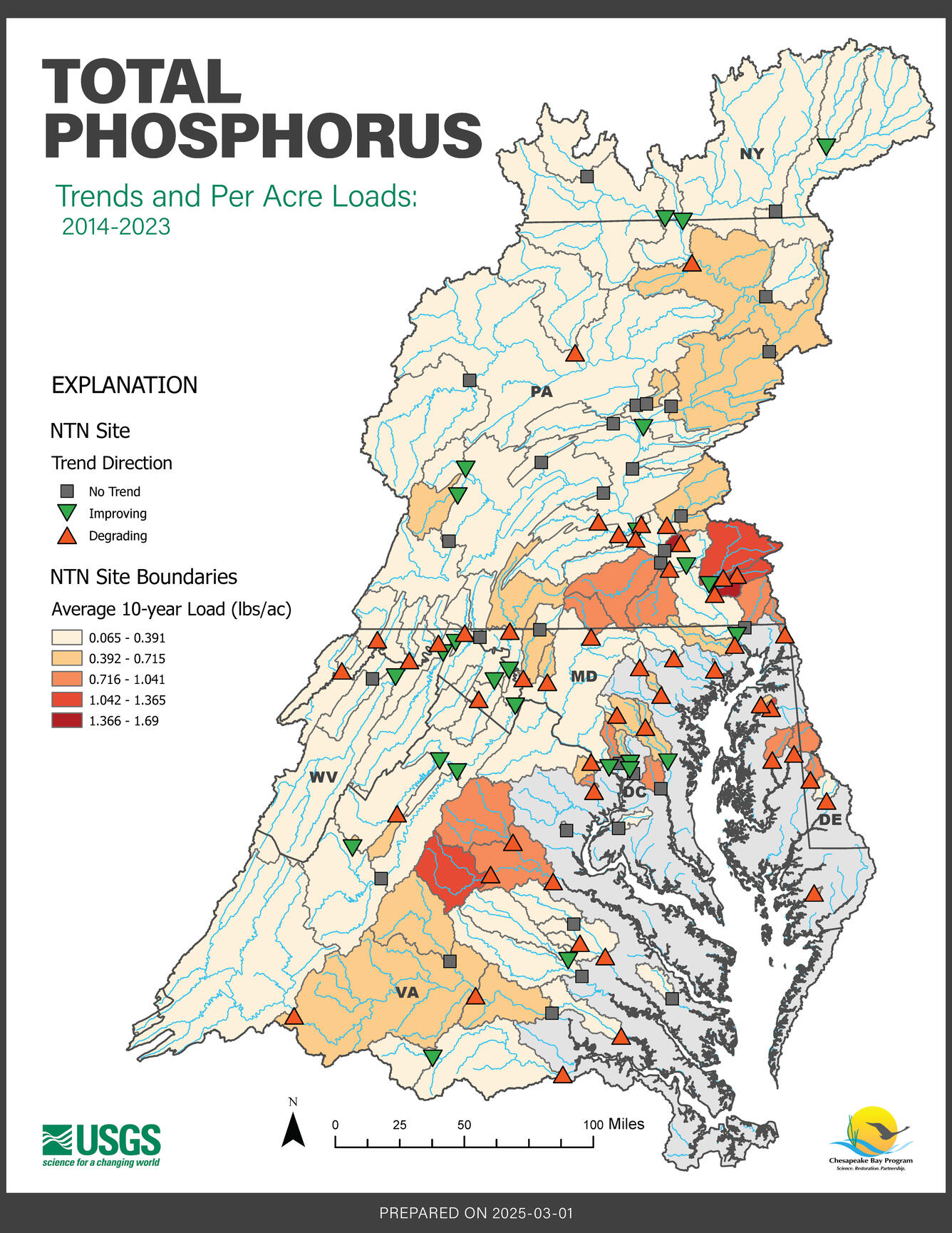
Chesapeake Bay Nontidal Network: 2014-2023 Total Phosphorus 10-year Trend and Per-Acre Load
Detailed Description
This map displays the average 10-year trends and per acre loads, also known as yields, of total phosphorus across the Chesapeake Bay Watershed from 2014 to 2023.
Learn more about Chesapeake Bay Water-Quality Loads and Trends and the USGS Nontidal Network.
Sources/Usage
Public Domain.
Related
Chesapeake Bay 2014-2023 Trend and Per Acre Loads
Chesapeake Bay 2014-2023 Trend and Per Acre Loads


Related
Chesapeake Bay 2014-2023 Trend and Per Acre Loads
Chesapeake Bay 2014-2023 Trend and Per Acre Loads