
Pecora 2022 award flyer announcing call for nominations. Nominations due April 15, 2022.
Images
Images intro.
Filter Total Items: 578

Pecora 2022 Award Call for Nominations
Pecora 2022 award flyer announcing call for nominations. Nominations due April 15, 2022.

Flyer 2 Pecora 2022 Award Call for Nominations
Description of the Pecora Award. This image details the procedure for nominations, eligibility, and privacy statement.
Description of the Pecora Award. This image details the procedure for nominations, eligibility, and privacy statement.

Fire near Uljin-eup, South Korea (Natural Color)
Landsat 9 captured this natural color image of the ongoing fire in Uljin county on South Korea’s west coast.
Landsat 9 captured this natural color image of the ongoing fire in Uljin county on South Korea’s west coast.

Fire near Uljin-eup, South Korea (False Color)
Landsat 9 captured an image of the ongoing fire in Uljin county on South Korea’s west coast. The false color image looks beneath the smoke and shows the burn scar as reddish-brown and the heat signature from the fire as bright red.
Landsat 9 captured an image of the ongoing fire in Uljin county on South Korea’s west coast. The false color image looks beneath the smoke and shows the burn scar as reddish-brown and the heat signature from the fire as bright red.
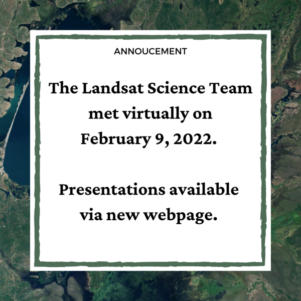
Landsat Science Team Meeting Presentations Available
The Landsat Science Team met virtually on February 9, 2022. Topics included, but were not limited to, Landsat 9 operations, calibration, and data release plans; Landsat 7 mission status; Landsat and Sentinel harmonization; and the future of land imaging.
The Landsat Science Team met virtually on February 9, 2022. Topics included, but were not limited to, Landsat 9 operations, calibration, and data release plans; Landsat 7 mission status; Landsat and Sentinel harmonization; and the future of land imaging.

Using Satellite-derived Maps in Rangeland Management
Rangeland management has used Landsat imagery for 50 years. Satellite imagery can provide a more comprehensive view of native pastures and prairies that cover swaths of Western America.
A new paper in Elsevier provides four guiding principles for ranges:
1. Use maps within a decision-making framework

topoBuilder Infographic
topoBuilder & OnDemand Topo Capabilities
topoBuilder & OnDemand Topo Capabilities

topoBuilder Infographic Smoothing Options
A comparison of low, medium (default), and high contour smoothing options available from the topoBuilder application.
A comparison of low, medium (default), and high contour smoothing options available from the topoBuilder application.

topoBuilder Infographic Flowchart
topoBuilder & OnDemand Topo Capabilities

Horseshoe Bend Topographic Map from topoBuilder
A topographic map of Horseshoe Bend, part of the Grand Canyon in Arizona, made with topoBuilder.
A topographic map of Horseshoe Bend, part of the Grand Canyon in Arizona, made with topoBuilder.
Horseshoe Bend Topographic Map from topoBuilder
A topographic map of Horseshoe Bend, part of the Grand Canyon in Arizona, made with topoBuilder. Custom topographic maps like this one can be made using topoBuilder.
A topographic map of Horseshoe Bend, part of the Grand Canyon in Arizona, made with topoBuilder. Custom topographic maps like this one can be made using topoBuilder.

Pecora Abstract & Special Session Deadline Extended
The deadline for Special Sessions and Abstracts has been extended to March 15, 2022.
The deadline for Special Sessions and Abstracts has been extended to March 15, 2022.

How Do You Landsat with Chinese Forests.png
Landscape ecologists are increasingly researching change processes with regards to spatial patterns.
Landscape ecologists are increasingly researching change processes with regards to spatial patterns.

TNMCorps Newsletter Black and White Carousel Option
Black and white screenshot of The National Map baselayer with structures points to be used as carousel for TNMCorps newsletter.
Black and white screenshot of The National Map baselayer with structures points to be used as carousel for TNMCorps newsletter.

Landsat 9 Image of Western Guinea-Bissau
The Geba River on the west coast of Guinea-Bissau is seen in this natural color Landsat 9 image from February 8, 2022. Silt carried by the river into the Atlantic Ocean creates intricate patterns as it moves around the Bissagos (or Bijagós) Islands. The country’s capital, Bissau, can be seen on the north side of the estuary and appears as light brown.
The Geba River on the west coast of Guinea-Bissau is seen in this natural color Landsat 9 image from February 8, 2022. Silt carried by the river into the Atlantic Ocean creates intricate patterns as it moves around the Bissagos (or Bijagós) Islands. The country’s capital, Bissau, can be seen on the north side of the estuary and appears as light brown.

TNMCorps Blue Block
Color block to be used as carousel in the newsletter content type. RGB values: 0, 38, 77
Color block to be used as carousel in the newsletter content type. RGB values: 0, 38, 77

TNMCorps Blue Block Badges
Blue block overlaid with all TNMCorps recognition badges graphic, for use as newsletter carousel.
Blue block overlaid with all TNMCorps recognition badges graphic, for use as newsletter carousel.

Landsat Collection 2 Fractional Snow Covered Area (fSCA) Grid Map
This map shows where Landsat Collection 2 fractional Snow Covered Area (fSCA) and Canopy Adjusted fSCA data is available for the conterminous United States (top) and Alaska (below). To learn more visit the Landsat Collection 2 fSCA science products web page.
This map shows where Landsat Collection 2 fractional Snow Covered Area (fSCA) and Canopy Adjusted fSCA data is available for the conterminous United States (top) and Alaska (below). To learn more visit the Landsat Collection 2 fSCA science products web page.

TNMCorps_Newsletter_Vol08Iss01_FireStationPts
Image showing several Kansas City, Missouri fire stations points in the TNMCorps map editor. Points are displayed on The National Map + Aerial Imagery baselayer.
Image showing several Kansas City, Missouri fire stations points in the TNMCorps map editor. Points are displayed on The National Map + Aerial Imagery baselayer.

TNMCorps_Newsletter_Vol08Iss01_ESPts2
Cluster of elementary school structures points with the elementary school structure type filter applied. Callout graphic says "Elementary school selected using the structure type filter; only elementary schools are visible". Also includes a screenshot of dropdown filters showing Elementary Schools Only and All Edits.
Cluster of elementary school structures points with the elementary school structure type filter applied. Callout graphic says "Elementary school selected using the structure type filter; only elementary schools are visible". Also includes a screenshot of dropdown filters showing Elementary Schools Only and All Edits.

TNMCorps_Newsletter_Vol08Iss01_PRPts3
Cluster of peer reviewed structures points with the peer reviewed edit status filter applied. Callout graphic says, "Peer Reviewed points selected using the edit status filter; only peer reviewed points are visible". Also includes a screenshot of dropdown filters showing All Points and Peer Reviewed only.
Cluster of peer reviewed structures points with the peer reviewed edit status filter applied. Callout graphic says, "Peer Reviewed points selected using the edit status filter; only peer reviewed points are visible". Also includes a screenshot of dropdown filters showing All Points and Peer Reviewed only.