USGS Geologist Robert Witter documenting tsunami scour features near Stardust Bay, Alaska. Conditions in the Aleutian Islands can be wet and windy for days on end.
Location: Stardust Bay, Sedanka Island, Alaska

Official websites use .gov
A .gov website belongs to an official government organization in the United States.
Secure .gov websites use HTTPS
A lock () or https:// means you’ve safely connected to the .gov website. Share sensitive information only on official, secure websites.

USGS Geologist Robert Witter documenting tsunami scour features near Stardust Bay, Alaska. Conditions in the Aleutian Islands can be wet and windy for days on end.
Location: Stardust Bay, Sedanka Island, Alaska
USGS Geologist Robert Witter documenting tsunami scour features near Stardust Bay, Alaska. Conditions in the Aleutian Islands can be wet and windy for days on end.
Location: Stardust Bay, Sedanka Island, Alaska

An outcrop composed of six tsunami deposits on the inland side of the lowland backing Stardust Bay over 0.5 miles from the sea. Brown soils developed into the top of each sand sheet and black tephra (air fall volcanic ash) layers between two of the sand deposits aided correlation of the six sand sheets across the study area.
An outcrop composed of six tsunami deposits on the inland side of the lowland backing Stardust Bay over 0.5 miles from the sea. Brown soils developed into the top of each sand sheet and black tephra (air fall volcanic ash) layers between two of the sand deposits aided correlation of the six sand sheets across the study area.

Three geologists scramble down a hillside on Sedanka Island that overlooks Stardust Bay. The geologists documented driftlogs stranded at elevations up to 60 ft above sea level and over 0.5 mile inland.
Three geologists scramble down a hillside on Sedanka Island that overlooks Stardust Bay. The geologists documented driftlogs stranded at elevations up to 60 ft above sea level and over 0.5 mile inland.

Geologist takes field notes to document the discovery of a 30-foot long driftlog stranded more than 0.5 mi inland at Stardust Bay on the remote Alaskan island of Sedanka. The log, stranded at an elevation of more than 60 feet above sea level, was carried inland and deposited in 1957 by a large tsunami generated by the magnitude 8.6 Andreanof Islands earthquake.
Geologist takes field notes to document the discovery of a 30-foot long driftlog stranded more than 0.5 mi inland at Stardust Bay on the remote Alaskan island of Sedanka. The log, stranded at an elevation of more than 60 feet above sea level, was carried inland and deposited in 1957 by a large tsunami generated by the magnitude 8.6 Andreanof Islands earthquake.

USGS scientist Thierry Work takes a sample from diseased coral at Tunnels Reef on the north shore of Kauai, Hawaii
USGS scientist Thierry Work takes a sample from diseased coral at Tunnels Reef on the north shore of Kauai, Hawaii

220 kV transmission lines running adjacent to Tongariro Volcano, New Zealand, two days after the 6 August 2012 Te MÄri crater eruption.
220 kV transmission lines running adjacent to Tongariro Volcano, New Zealand, two days after the 6 August 2012 Te MÄri crater eruption.

On a ridge behind Stardust Bay at an elevation of 46 feet above sea level, a shallow pit reveals five sand sheets deposited by tsunamis in the past 1700 years.
Location: Stardust Bay, Sendanka Island, Alaska
On a ridge behind Stardust Bay at an elevation of 46 feet above sea level, a shallow pit reveals five sand sheets deposited by tsunamis in the past 1700 years.
Location: Stardust Bay, Sendanka Island, Alaska

Hawaiian Volcano Observatory's Recent Earthquakes Web page from Tuesday, July 31, with earthquake shown as colored circles, according to their times of occurrence.
Hawaiian Volcano Observatory's Recent Earthquakes Web page from Tuesday, July 31, with earthquake shown as colored circles, according to their times of occurrence.

Photo taken north of Mount St. Helens; view is to the south.
Photo taken north of Mount St. Helens; view is to the south.

This image is a composite of a thermal image and a normal photograph, showing the coastal plain and pali. Red areas are warm portions of the flow field that were active in the past weeks or months, while yellow and white areas are areas of active breakouts.
This image is a composite of a thermal image and a normal photograph, showing the coastal plain and pali. Red areas are warm portions of the flow field that were active in the past weeks or months, while yellow and white areas are areas of active breakouts.

The lava pond in the northeast portion of Pu‘u ‘Ō‘ō crater remains active, though the level of lava was low in the pit today. Over this past weekend, a small collapse of the rim enlarged the pit slightly. The lava pond is about 30 meters (100 feet) wide.
The lava pond in the northeast portion of Pu‘u ‘Ō‘ō crater remains active, though the level of lava was low in the pit today. Over this past weekend, a small collapse of the rim enlarged the pit slightly. The lava pond is about 30 meters (100 feet) wide.

Andesite lava flow of Kerr Notch (near Sun Creek) developed columnar joints as it cooled after it was deposited, Crater Lake, Oregon.
Andesite lava flow of Kerr Notch (near Sun Creek) developed columnar joints as it cooled after it was deposited, Crater Lake, Oregon.

Debris flow damage following the 2012 Waldo Canyon fire, Colorado, U.S.
Debris flow damage following the 2012 Waldo Canyon fire, Colorado, U.S.

Lava fountains, occasionally surging to heights of 45-55 m (150-180 ft), erupted south and north of Keanakāko‘i Crater (top and middle fissures, respectively) and on the floor of Kīlauea Caldera (foreground fissure) in a spectacular summit eruption on July 19, 1974.
Lava fountains, occasionally surging to heights of 45-55 m (150-180 ft), erupted south and north of Keanakāko‘i Crater (top and middle fissures, respectively) and on the floor of Kīlauea Caldera (foreground fissure) in a spectacular summit eruption on July 19, 1974.

USGS scientist Deborah Bergfeld collects a gas sample from a fumarole on the flank of Akutan Volcano, Akutan Island, Alaska.
USGS scientist Deborah Bergfeld collects a gas sample from a fumarole on the flank of Akutan Volcano, Akutan Island, Alaska.

Steam rises from degassing fumaroles (middle right) and a boiling pool (middle left) on the flank of Akutan Volcano, Akutan Island, Alaska.
Steam rises from degassing fumaroles (middle right) and a boiling pool (middle left) on the flank of Akutan Volcano, Akutan Island, Alaska.

Exploring Mount Rainier: living near a volcano provides an opportunity for field-based learning.
Exploring Mount Rainier: living near a volcano provides an opportunity for field-based learning.
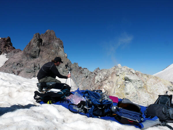
USGS geologist uses a UV spectrometer to detect gases from fumarole at Crater Rock, Mount Hood.
USGS geologist uses a UV spectrometer to detect gases from fumarole at Crater Rock, Mount Hood.

Surface flows remain active on the coastal plain, but have retreated inland compared to their position last week. The active front is now about 1.3 km (0.8 miles) from the ocean.
Surface flows remain active on the coastal plain, but have retreated inland compared to their position last week. The active front is now about 1.3 km (0.8 miles) from the ocean.

In addition to the active flows on the coastal plain, lava flows were also active on the pali and at the base of the pali. Pu‘u ‘Ō‘ō and the Halema‘uma‘u plume are visible near the top of the image.
In addition to the active flows on the coastal plain, lava flows were also active on the pali and at the base of the pali. Pu‘u ‘Ō‘ō and the Halema‘uma‘u plume are visible near the top of the image.

Several openings on the floor of the Pu‘u ‘Ō‘ō crater and along the Peace Day flow tube system continue to degas profusely. The only visible lava, however, is the small lava lake confined to a pit on the northeastern side of the crater floor. The lava lake has been present for the last several months.
Several openings on the floor of the Pu‘u ‘Ō‘ō crater and along the Peace Day flow tube system continue to degas profusely. The only visible lava, however, is the small lava lake confined to a pit on the northeastern side of the crater floor. The lava lake has been present for the last several months.