
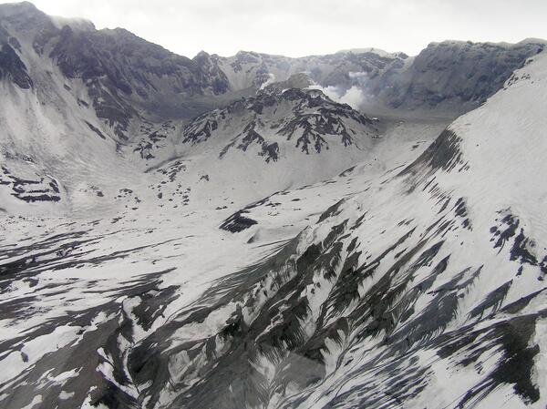
Aerial view, Mount St. Helens' crater and dome, as seen from the northeast. Note dusting of ash on Mount St. Helens' flank, left near rim.
Images
Images intro.
Filter Total Items: 7146

Aerial view, Mount St. Helens' crater and dome, as seen from NE. No...
Aerial view, Mount St. Helens' crater and dome, as seen from the northeast. Note dusting of ash on Mount St. Helens' flank, left near rim.

Aerial view, Mount St. Helens' crater and dome, as seen from NE.
Aerial view, Mount St. Helens' crater and dome, as seen from the northeast.
Aerial view, Mount St. Helens' crater and dome, as seen from the northeast.

Whaleback structure of dome withn Mount St. Helens' crater. Dome is...
Whaleback structure (center) of dome withn Mount St. Helens' crater. Dome is crumbling to right and glacier is uplifted to the left, view from the north. January 30, 2005.
Whaleback structure (center) of dome withn Mount St. Helens' crater. Dome is crumbling to right and glacier is uplifted to the left, view from the north. January 30, 2005.

Banda Aceh after the December 2004 Earthquake and Tsunami
An International Tsunami Survey Team studying the effects of the December 26, 2004 tsunami on Indonesia“‘’’s island of Sumatra documented wave heights of 20 to 30 m (65 to 100 ft) at the island's northwest end and found evidence suggesting that wave heights may have ranged from 15 to 30 m (50 to 100 ft) along at least a 100-km (60 mi) stretch of the northwest coast.
An International Tsunami Survey Team studying the effects of the December 26, 2004 tsunami on Indonesia“‘’’s island of Sumatra documented wave heights of 20 to 30 m (65 to 100 ft) at the island's northwest end and found evidence suggesting that wave heights may have ranged from 15 to 30 m (50 to 100 ft) along at least a 100-km (60 mi) stretch of the northwest coast.

Aerial view, Mount St. Helens' crater and dome
Aerial view, Mount St. Helens' crater and dome, as seen from the northwest.
Aerial view, Mount St. Helens' crater and dome, as seen from the northwest.

Lava domes within Mount St. Helens' crater, as seen from NW. The 19...
Lava domes within Mount St. Helens' crater, as seen from the northwest. The 1980-86 dome is in the crater on the left and the new 2004-05 dome is on the right.
Lava domes within Mount St. Helens' crater, as seen from the northwest. The 1980-86 dome is in the crater on the left and the new 2004-05 dome is on the right.

Mount St. Helens' crater and dome, as seen from NE.
Mount St. Helens' crater and dome, as seen from the northeast.
Mount St. Helens' crater and dome, as seen from the northeast.

Whaleback structure of dome withn Mount St. Helens' crater as seen ...
Whaleback structure (center) of dome withn Mount St. Helens' crater as seen from the northwest. January 24, 2005.
Whaleback structure (center) of dome withn Mount St. Helens' crater as seen from the northwest. January 24, 2005.

Crumbled sides of Mount St. Helens' dome, seen from NW. Jan 24, 2006
Crumbled sides of Mount St. Helens' dome, as seen from the northwest. January 24, 2005.
Crumbled sides of Mount St. Helens' dome, as seen from the northwest. January 24, 2005.

Glacier deformation, east side of Mount St. Helens' dome, as seen f...
Glacier deformation, east side of Mount St. Helens' dome, as seen from the northeast. Large crevasses within glacier covered with grey ash.
Glacier deformation, east side of Mount St. Helens' dome, as seen from the northeast. Large crevasses within glacier covered with grey ash.

Measuring tree heights and water depth
In Leupueng, Indonesia, on the island of Sumatra, Dr. Guy Gelfenbaum measures the height of snapped-off tree trunks and sea level changes shortly after the December 26, 2004 earthquake and tsunami in the Indian Ocean.
In Leupueng, Indonesia, on the island of Sumatra, Dr. Guy Gelfenbaum measures the height of snapped-off tree trunks and sea level changes shortly after the December 26, 2004 earthquake and tsunami in the Indian Ocean.

Measuring tsunami elevations in Sumatra in 2005
As part of an international tsunami survey team, Andy Moore of Kent State University takes measurement of a snapped-off tree trunk in Leupueng, Aceh in 2005, shortly after the deadly tsunami struck the island of Sumatra.
As part of an international tsunami survey team, Andy Moore of Kent State University takes measurement of a snapped-off tree trunk in Leupueng, Aceh in 2005, shortly after the deadly tsunami struck the island of Sumatra.

Aerial view, Mount St. Helens' crater and dome, as seen from NE. Th...
Aerial view, Mount St. Helens' crater and dome, as seen from the northeast. The new dome is just visible in the steam in the back of the crater.
Aerial view, Mount St. Helens' crater and dome, as seen from the northeast. The new dome is just visible in the steam in the back of the crater.

Aerial view, Mount St. Helens' crater and dome, as seen from NE
Aerial view, Mount St. Helens' crater and dome, as seen from the northeast.
Aerial view, Mount St. Helens' crater and dome, as seen from the northeast.

Vertical view, Mount St. Helens' crater and dome. North is to botto...
Vertical view, Mount St. Helens' crater and dome. North is to the bottom and south to the top.
Vertical view, Mount St. Helens' crater and dome. North is to the bottom and south to the top.

Heavily damaged home in Banda Aceh, Sumatra from the 2004 tsunami
A severely damaged home, or a portion of one, sits atop debris in Banda Aceh on the island of Sumatra. Damage was caused by a massive, highly destructive tsunami, triggered by a magnitude 9.1 earthquake just offshore of Sumatra, on December 26, 2004.
A severely damaged home, or a portion of one, sits atop debris in Banda Aceh on the island of Sumatra. Damage was caused by a massive, highly destructive tsunami, triggered by a magnitude 9.1 earthquake just offshore of Sumatra, on December 26, 2004.

Boat carried inland by 2004 Indian Ocean tsunami
Boat carried inland by tsunami that struck Sumatra on December 26, 2004.
Boat carried inland by tsunami that struck Sumatra on December 26, 2004.

Aerial view, Mount St. Helens' crater and dome, as seen from the north
Aerial view, Mount St. Helens' crater and dome, as seen from the north.
Aerial view, Mount St. Helens' crater and dome, as seen from the north.

Aerial view, Mount St. Helens' crater and dome, as seen from the no...
Aerial view, Mount St. Helens' crater and dome, as seen from the north-northeast. Ash covering is from event of January 16, 2005.
Aerial view, Mount St. Helens' crater and dome, as seen from the north-northeast. Ash covering is from event of January 16, 2005.
Mount St. Helens' crater and dome, as seen from NW. Ash covering is...
Mount St. Helens' crater and dome, as seen from the northwest. Ash covering is from event of January 16, 2005.
Mount St. Helens' crater and dome, as seen from the northwest. Ash covering is from event of January 16, 2005.

East side of Mount St. Helens' crater, glacier, and dome
East side of Mount St. Helens' crater and dome, as seen from the north.
East side of Mount St. Helens' crater and dome, as seen from the north.