Hawaiian Volcano Observatory
Find U.S. Volcano
Current Alerts
Kīlauea
yellow ADVISORY, 2024-10-18 17:38:41 UTC
HVO monitors earthquakes and the active volcanoes in Hawaii, assesses their hazards, issues warnings, and advances scientific understanding to reduce the impacts of volcanic eruptions. Communicating the results of our work to the public, emergency managers, and the scientific community is an important aspect of the HVO mission.
Active Volcanoes in Hawaii
Active Volcanoes in Hawaii
Very High Threat Potential
Kīlauea
Mauna Loa
High Threat Potential
Hualālai
Moderate Threat Potential
Haleakalā
Mauna Kea
Not Ranked
Kama‘ehuakanaloa (Lō‘ihi Seamount)
View the threat rankings of US Volcanoes.
News
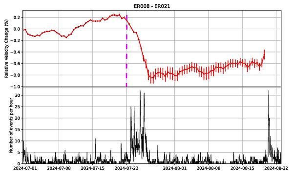
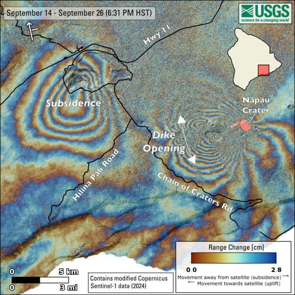
Volcano Watch — Potential long-term outcomes of recent intrusions in Kīlauea East Rift Zone
Volcano Watch — Potential long-term outcomes of recent intrusions in Kīlauea East Rift Zone
Volcano Watch — The 2024 Great Hawaii ShakeOut
Volcano Watch — The 2024 Great Hawaii ShakeOut
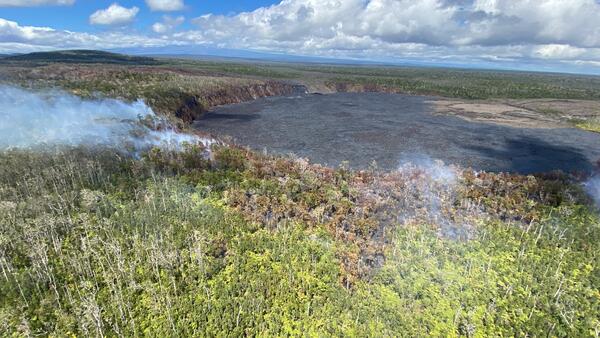
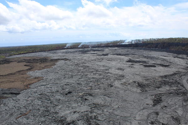
Photo and Video Chronology — Kīlauea East Rift Zone wildfire — October 7, 2024