
The lava lake within Halema‘uma‘u, a crater at the summit of Kīlauea, was about 30 m (98 ft) below the vent rim on the day of this photo (January 7, 2016).
Images
Total: 0
Settings
Total: 0
Explore our planet through photography and imagery, including climate change and water all the way back to the 1800s when the USGS was surveying the country by horse and buggy.
Filter Total Items: 21537

New USGS video about Kīlauea's summit eruption is now online
The lava lake within Halema‘uma‘u, a crater at the summit of Kīlauea, was about 30 m (98 ft) below the vent rim on the day of this photo (January 7, 2016).

Sunset lake in Black Sand Basin of Yellowstone National Park
Sunset lake in Black Sand Basin of Yellowstone National Park
Sunset lake in Black Sand Basin of Yellowstone National Park

View of the Silver Gate landslide complex from Bunsen Peak
View of the Silver Gate landslide complex from Bunsen Peak in Yellowstone National Park. The landslide originates from Terrace Mountain.
View of the Silver Gate landslide complex from Bunsen Peak in Yellowstone National Park. The landslide originates from Terrace Mountain.
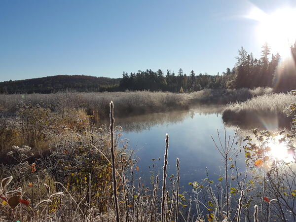
Boreal bog in the Adirondack Park, New York
Boreal bog in the Adirondack Park, New York
Boreal bog in the Adirondack Park, New York

Buffalo River - Water-quality sampling
Water-quality sampling on the Buffalo River, NY
Water-quality sampling on the Buffalo River, NY

Maumee River at Antwerp, OH - downstream
Maumee River at Antwerp, OH - looking downstream of the bridge
Maumee River at Antwerp, OH - looking downstream of the bridge

Maumee River at Antwerp, OH - low flow
Maumee River at Antwerp, OH - low flow
Maumee River at Antwerp, OH - low flow

Setting up to measure streamflow, Muddy Creek near Dad
Setting up to measure streamflow, Muddy Creek near Dad
Setting up to measure streamflow, Muddy Creek near Dad

White River at Hazelton IN - gage on the bridge
White River at Hazelton IN - gage on the bridge
White River at Hazelton IN - gage on the bridge

White River at Hazelton, IN - bridge located at the gage
White River at Hazelton, IN - bridge located at the gage
White River at Hazelton, IN - bridge located at the gage

Lava Bubbling in Kīlauea Hawaiʻi
Animated GIF of lava bubbling up from Kīlauea Volcano in Hawaiʻi Volcanoes National Park. The source of the GIF comes from footage found within the USGS video: Kīlauea Summit Eruption | Lava Returns to Halemaʻumaʻu.
Animated GIF of lava bubbling up from Kīlauea Volcano in Hawaiʻi Volcanoes National Park. The source of the GIF comes from footage found within the USGS video: Kīlauea Summit Eruption | Lava Returns to Halemaʻumaʻu.

Looking Back and Forth
Animated GIF of a scientist at Kīlauea Volcano in Hawaiʻi Volcanoes National Park looking back and forth using a range finder. Footage found in the USGS video: Kīlauea Summit Eruption | Lava Returns to Halemaʻumaʻu.
Animated GIF of a scientist at Kīlauea Volcano in Hawaiʻi Volcanoes National Park looking back and forth using a range finder. Footage found in the USGS video: Kīlauea Summit Eruption | Lava Returns to Halemaʻumaʻu.

Yellow Creek at Knox, IN - downstream view
Yellow Creek at Knox, IN - looking downstream of gage and bridge
Yellow Creek at Knox, IN - looking downstream of gage and bridge

Channel measurement section locations for Ruby River above Reservoir
Channel measurement section locations for Ruby River above Reservoir.
Channel measurement section locations for Ruby River above Reservoir.

Drone operations on Big Sur landslide, October 12, 2017
Josh Logan, a physical scientist at the USGS Pacific Coastal and Marine Science Center in Santa Cruz, California, operates an unmanned aerial system, or UAS, often called a "drone", that is equipped with a video camera.
Josh Logan, a physical scientist at the USGS Pacific Coastal and Marine Science Center in Santa Cruz, California, operates an unmanned aerial system, or UAS, often called a "drone", that is equipped with a video camera.

Earth movers on Big Sur landslide, October 12, 2017
View of the huge landslide at Mud Creek on the Big Sur coast, October 12, 2017. USGS is studying the landslide, collecting data and imagery that can be used to monitor changes. USGS provides the data to Caltrans, the California Department of Transportation, whose heavy equipment and earth movers are shown here.
View of the huge landslide at Mud Creek on the Big Sur coast, October 12, 2017. USGS is studying the landslide, collecting data and imagery that can be used to monitor changes. USGS provides the data to Caltrans, the California Department of Transportation, whose heavy equipment and earth movers are shown here.

Mud Creek – 3D Point Cloud – Oblique Perspective
Video shot from drones yields details about changing landslide on California’s Big Sur coast
Video shot from drones yields details about changing landslide on California’s Big Sur coast

Deploying equipment from small boat
Wayne Baldwin, USGS, deploys a sound velocity profiler off the stern of the R/V Stephens in Lake Powell, UT-AZ as part of a collaborative program with the Utah Water Science Center to map the depth and sediments within Lake Powell, UT-AZ.
Wayne Baldwin, USGS, deploys a sound velocity profiler off the stern of the R/V Stephens in Lake Powell, UT-AZ as part of a collaborative program with the Utah Water Science Center to map the depth and sediments within Lake Powell, UT-AZ.

USGS Scientist Preparing Samples in a Laboratory
U.S. Geological Survey (USGS) scientist preparing samples for analysis of protein levels to normalize results from oxidative stress bioassays.
U.S. Geological Survey (USGS) scientist preparing samples for analysis of protein levels to normalize results from oxidative stress bioassays.

Wildfires Devastate California Wine Country
Residents had little warning when wildfires that ignited late Sunday night, October 8, 2017, were fanned by wind gusts of 50 miles per hour and blasted across California's wine country. More than 100,000 acres have burned as of October 11, with less than 6 percent of the fires contained.
Residents had little warning when wildfires that ignited late Sunday night, October 8, 2017, were fanned by wind gusts of 50 miles per hour and blasted across California's wine country. More than 100,000 acres have burned as of October 11, with less than 6 percent of the fires contained.

Autumn colors reflected on Paradox Lake in the Adirondack Mountains
The Northeast Bedrock Mapping Project consists of scientists conducting geologic mapping and scientific research of complexly deformed crystalline igneous and metamorphic rocks in the Northeastern United States. Current mapping activities are focused in New Hampshire, Vermont, Connecticut, and New York.
The Northeast Bedrock Mapping Project consists of scientists conducting geologic mapping and scientific research of complexly deformed crystalline igneous and metamorphic rocks in the Northeastern United States. Current mapping activities are focused in New Hampshire, Vermont, Connecticut, and New York.