
Calm after the storm—a beautiful day on Kīlauea Volcano's East Rift Zone. Rain from Hurricane Madeline had little impact on Pu‘u ‘Ō‘ō, shown here, or lava flow 61g.
Images
Total: 0
Settings
Total: 0
Explore our planet through photography and imagery, including climate change and water all the way back to the 1800s when the USGS was surveying the country by horse and buggy.
Filter Total Items: 21537

Beautiful day on Kīlauea's ERZ
Calm after the storm—a beautiful day on Kīlauea Volcano's East Rift Zone. Rain from Hurricane Madeline had little impact on Pu‘u ‘Ō‘ō, shown here, or lava flow 61g.

Curious Black Sea Bass
Kevin Lafferty encounters a curious endangered black sea bass during field work. Taken at Channel Islands National Park.
Kevin Lafferty encounters a curious endangered black sea bass during field work. Taken at Channel Islands National Park.

Deadmans Road, Colorado
This photo was taken off of Deadmans Road in Red Feather Lakes, Colorado.
This photo was taken off of Deadmans Road in Red Feather Lakes, Colorado.

Dolly Varden and Arctic grayling in the Agashashok River
Underwater photo of a large school of Dolly Varden char and Arctic grayling in the Agashashok River. These fish were part of the Hydro-Ecology of Arctic Thawing (HEAT) project.
Underwater photo of a large school of Dolly Varden char and Arctic grayling in the Agashashok River. These fish were part of the Hydro-Ecology of Arctic Thawing (HEAT) project.

Fog on Yukon River
Fog along the Yukon River showing a Black Spruce dominated forest in the foreground, which is prone to wildfire. Photo by Bruce Wylie, USGS
Fog along the Yukon River showing a Black Spruce dominated forest in the foreground, which is prone to wildfire. Photo by Bruce Wylie, USGS

Franklin Mountains near the Hueco Bolson study area near El Paso, Tex.
Franklin Mountains near the Hueco Bolson study area near El Paso, Texas, September 2016. Photograph by Monica Langhorst, U.S. Geological Survey.
U.S. Geological Survey Scientific Investigations Report 2020–5056
Franklin Mountains near the Hueco Bolson study area near El Paso, Texas, September 2016. Photograph by Monica Langhorst, U.S. Geological Survey.
U.S. Geological Survey Scientific Investigations Report 2020–5056

Irma leaves beached boats and broken trees in Huricane Hole
Boat owners sought protection for their vessels in sheltered Hurricane Hole, but Hurricane Irma sunk and beached many boats, likely damaging corals. Photo: Caroline Rogers, USGS, 2017
Boat owners sought protection for their vessels in sheltered Hurricane Hole, but Hurricane Irma sunk and beached many boats, likely damaging corals. Photo: Caroline Rogers, USGS, 2017

OGRL Scientist in Lab
OGRL scientist running tests on samples of water in the lab at Kansas Water Science Center.
OGRL scientist running tests on samples of water in the lab at Kansas Water Science Center.

Radiocarbon lab at WHOI
During the symposium, participants could tour the facilities at Woods Hole Oceanographic Institution, such as this radiocarbon lab. Here scientists analyze the amount of radiocarbon in such material as coral or wood to help determine their age. Photo credit: Amy West, USGS Pacific Coastal and Marine Science Center
During the symposium, participants could tour the facilities at Woods Hole Oceanographic Institution, such as this radiocarbon lab. Here scientists analyze the amount of radiocarbon in such material as coral or wood to help determine their age. Photo credit: Amy West, USGS Pacific Coastal and Marine Science Center

Roosevelt National Forest Pano
Roosevelt National Forest, Colorado. Red Feather Lakes off of Deadman Road.
Roosevelt National Forest, Colorado. Red Feather Lakes off of Deadman Road.

Sampling crew arriving at a groundwater well in the Hueco Bolson area
U.S. Geological Survey field sampling crew arriving at a groundwater well that was sampled in the Hueco Bolson study area near El Paso, Texas, September 2016. Photograph by Chris Braun, U.S. Geological Survey.
U.S. Geological Survey Scientific Investigations Report 2020–5056
U.S. Geological Survey field sampling crew arriving at a groundwater well that was sampled in the Hueco Bolson study area near El Paso, Texas, September 2016. Photograph by Chris Braun, U.S. Geological Survey.
U.S. Geological Survey Scientific Investigations Report 2020–5056

A Researcher Assesses Wood Condition at an Ice Patch
Danny Stahle assesses the preservation of Whitebark Pine melting out of an ice patch.
Danny Stahle assesses the preservation of Whitebark Pine melting out of an ice patch.

A Researcher Sampling Ancient Trees Emerging from an Ice Patch
Danny Stahle catalogs a sample taken from a Whitebark Pine (Pinus albicalus) that died ~5,300 years before present as conditions cooled and the ice patch expanded.
Danny Stahle catalogs a sample taken from a Whitebark Pine (Pinus albicalus) that died ~5,300 years before present as conditions cooled and the ice patch expanded.

A Researcher Sampling Trees at an Ice Patch
Lucas watches Danny Stahle catalog a sample taken froma long frozen Whitebark Pine (Pinus albicalus).
Lucas watches Danny Stahle catalog a sample taken froma long frozen Whitebark Pine (Pinus albicalus).

Camera mount as scratching pole - the aftermath
Time-lapse cameras on Barter Island, North Slope of Alaska, incurred damage from polar bears who used the camera pole as a scratching post.
Time-lapse cameras on Barter Island, North Slope of Alaska, incurred damage from polar bears who used the camera pole as a scratching post.
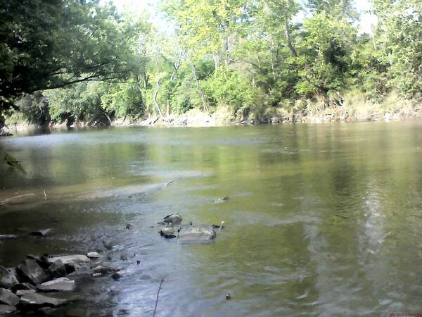
Cuyahoga River at Independence OH - downstream of gage
Cuyahoga River at Independence OH - downstream of gage
Cuyahoga River at Independence OH - downstream of gage

Before and after photos of Fourmile Creek near Ankeny, Iowa
Before and after photos of Fourmile Creek near Ankeny, Iowa, showing a wastewater outfall from a wastewater treatment facility (WWTF). The top photo is the creek before the WWTFwas closed, and the bottom photo is after the WWTF was shutdown. After the shutdown flow in the creek decreased significantly. Photo credits: Laura E.
Before and after photos of Fourmile Creek near Ankeny, Iowa, showing a wastewater outfall from a wastewater treatment facility (WWTF). The top photo is the creek before the WWTFwas closed, and the bottom photo is after the WWTF was shutdown. After the shutdown flow in the creek decreased significantly. Photo credits: Laura E.

Prepping the Drilling Location in an Ice Patch
Field assistants prepare the trail and drilling location.
Field assistants prepare the trail and drilling location.

Researchers Break Near the Ice Patch
Craig Lee and a group of archeologist take a break and enjoy the scenery while standing over the coolers (white boxes) containing the ice core samples.
Craig Lee and a group of archeologist take a break and enjoy the scenery while standing over the coolers (white boxes) containing the ice core samples.

Researchers Prepping the Drilling Location on the Ice Patch
Danny Stahle, Rachel Reckin, and Sari Dersam prepare the trail and drilling location.
Danny Stahle, Rachel Reckin, and Sari Dersam prepare the trail and drilling location.

Researchers Pulling a Deep Ice Core Segment
Mike Jayred, Nathan Challman, Rachel Reckin, and Danny Stahle work to lift an section of ice core from several meters deep in the ice patch.
Mike Jayred, Nathan Challman, Rachel Reckin, and Danny Stahle work to lift an section of ice core from several meters deep in the ice patch.