
Utuado, Puerto Rico Landslide Monitoring Station
The Utuado monitoring station is located directly upslope from the Lake Caonillas dam. It is vegetatively unique compared to the other stations in that the surrounding vegetation is mainly switchgrass, with sparse trees. The steep slopes at the station are underlain by Cretaceous granodiorite and quartz-diorite.


Rainfall | Soil-water content, soil suction, and groundwater pressure | Battery Voltage
Note: This site is currently experiencing sensor problems that cannot be repaired remotely so data are not available.
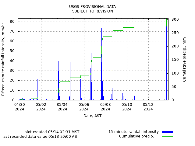
Rainfall
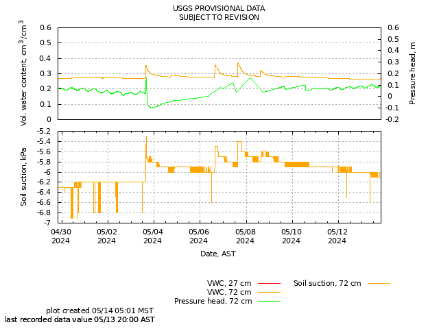
Soil-Water Content, Soil Suction, and Ground Water Pressure
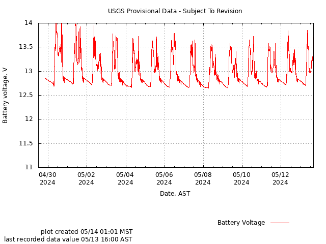
Battery Voltage
The Utuado monitoring station is located directly upslope from the Lake Caonillas dam. It is vegetatively unique compared to the other stations in that the surrounding vegetation is mainly switchgrass, with sparse trees. The steep slopes at the station are underlain by Cretaceous granodiorite and quartz-diorite.
Rainfall | Soil-water content, soil suction, and groundwater pressure | Battery Voltage
Note: This site is currently experiencing sensor problems that cannot be repaired remotely so data are not available.
Rainfall
Soil-Water Content, Soil Suction, and Ground Water Pressure
Battery Voltage