
Kennebec River in downtown Augusta, Maine during the normal flow. USGS streamgage 01049320 monitors the streamflow of this area.
Images
Images
Filter Total Items: 1954
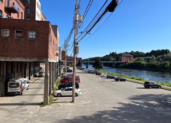
Kennebec River in downtown Augusta, Maine
Kennebec River in downtown Augusta, Maine during the normal flow. USGS streamgage 01049320 monitors the streamflow of this area.

Annual Groundwater-Transported Nitrogen Yield into Long Island Sound
A map of Connecticut showing the annual groundwater-transported nitrogen yield on the north shore of the Long Island Sound. Watersheds that have yields exceeding 500 kilograms of nitrogen per square kilometer per year are shown in yellow regardless of the magnitude of the yield.
A map of Connecticut showing the annual groundwater-transported nitrogen yield on the north shore of the Long Island Sound. Watersheds that have yields exceeding 500 kilograms of nitrogen per square kilometer per year are shown in yellow regardless of the magnitude of the yield.

Figure4SeismicCopper.png
World map of expected annual disruption of copper refinery production, in metric tons, from potential seismic activity.
World map of expected annual disruption of copper refinery production, in metric tons, from potential seismic activity.

NY Water Science Center Divers
Photograph taken during the 1st Annual NYWSC Dive Safety Day. The purpose of the safety day is to allow the NYWSC divers time to practice the skills they utilize during their routine dives, while also giving them a chance to work an any additional skills that might aid in dive safety and communication.
Photograph taken during the 1st Annual NYWSC Dive Safety Day. The purpose of the safety day is to allow the NYWSC divers time to practice the skills they utilize during their routine dives, while also giving them a chance to work an any additional skills that might aid in dive safety and communication.

USGS Geologist compare sediment core
USGS geologists at a site of new sediment core in a trans-disciplinary effort to reconstruct past climate change across the country near Hannah, Wyoming, on June 26, 2024. Pictured left to right: Marci Robinson and Jean Self-Trail both Research Geologist, Northeast Region; and Marieke Dechesne, Reasearch Geologist, Rocky Mountain Region.
USGS geologists at a site of new sediment core in a trans-disciplinary effort to reconstruct past climate change across the country near Hannah, Wyoming, on June 26, 2024. Pictured left to right: Marci Robinson and Jean Self-Trail both Research Geologist, Northeast Region; and Marieke Dechesne, Reasearch Geologist, Rocky Mountain Region.
Surveying the tidal at Boat Meadow River
Andy Massey, Physical Scientist at the New England Water Science Center, surveying the tidal Boat Meadow River in Eastham, Massachusetts on June 14, 2024.
Summer 2024 Photo Contest Winner: Shannon Fisher, USGS at Work
Andy Massey, Physical Scientist at the New England Water Science Center, surveying the tidal Boat Meadow River in Eastham, Massachusetts on June 14, 2024.
Summer 2024 Photo Contest Winner: Shannon Fisher, USGS at Work

Denis LeBlanc Presents Groundwater Research at Ashumet Pond
Research Hydrologist Emeritus Denis LeBlanc teaches the Gulf of Maine Council about Cape Cod hydrology in front of Ashumet Pond in Falmouth, Massachusetts.
Research Hydrologist Emeritus Denis LeBlanc teaches the Gulf of Maine Council about Cape Cod hydrology in front of Ashumet Pond in Falmouth, Massachusetts.

USGS Hydrologist Paul Barlow Retirement from New England Water Science Center
USGS Hydrologist Paul Barlow, who served as the Chief of the Hydrologic Interpretive Branch of the New England Water Science Center, retired at the end of May 2024. Director John Bumgarner presented Paul with a plaque at his retirement gathering at the center.
USGS Hydrologist Paul Barlow, who served as the Chief of the Hydrologic Interpretive Branch of the New England Water Science Center, retired at the end of May 2024. Director John Bumgarner presented Paul with a plaque at his retirement gathering at the center.

Hydrologic Technician Kim Campo deploys a buoy at Fresh Pond in Cambridge, MA with sensors to monitor water temperature, wind speed/direction, and blue-green algae
linkHydrologic Technician Kim Campo deploys a buoy at Fresh Pond in Cambridge, MA with sensors to monitor water temperature, wind speed/direction, and blue-green algae. Nearby continuous water quality monitoring station is 422302071083801.
Spring 2024 Photo Contest Winner: Meghan Santos, Where We Work category

Water-quality measurement
Field assistant Sean Mello takes a discrete WQ measurement on the Carman’s River in Yaphank, New York, on May 22, 2024.
Summer 2024 Photo Contest Winner: Emily Krsnak, Honorable Mention
Field assistant Sean Mello takes a discrete WQ measurement on the Carman’s River in Yaphank, New York, on May 22, 2024.
Summer 2024 Photo Contest Winner: Emily Krsnak, Honorable Mention

Elizabeth Mine, an Abandoned Copper Mine in Vermont
Elizabeth Mine was a copper mine in Strafford, Vermont, that was abandoned in 1957. It was added to the U.S. Environmental Protection Agency (EPA) Superfund Program’s National Priority List in 2001. Since then, EPA and USGS have cooperated to investigate the nature and extent of contamination from weathering of waste rock rich in metals and sulfides.
Elizabeth Mine was a copper mine in Strafford, Vermont, that was abandoned in 1957. It was added to the U.S. Environmental Protection Agency (EPA) Superfund Program’s National Priority List in 2001. Since then, EPA and USGS have cooperated to investigate the nature and extent of contamination from weathering of waste rock rich in metals and sulfides.

Streamgage at the Elizabeth Mine Site in Stratford, Vermont
Elizabeth Mine was added to the U.S. Environmental Protection Agency (EPA) Superfund Program’s National Priority List in 2001. Since then, EPA and USGS have cooperated to investigate the nature and extent of contamination from weathering of waste rock rich in metals and sulfides.
Elizabeth Mine was added to the U.S. Environmental Protection Agency (EPA) Superfund Program’s National Priority List in 2001. Since then, EPA and USGS have cooperated to investigate the nature and extent of contamination from weathering of waste rock rich in metals and sulfides.

Hydrologic Technicians at a Streamgage at Elizabeth Mine in Vermont
Hydrologic technicians Joel Kneisley and Alexander Kind installed a streamgage and precipitation gage at Elizabeth Mine in Strafford, Vermont. This copper mine was abandoned in 1957 and added to the EPA Superfund Program’s National Priority List in 2001.
Hydrologic technicians Joel Kneisley and Alexander Kind installed a streamgage and precipitation gage at Elizabeth Mine in Strafford, Vermont. This copper mine was abandoned in 1957 and added to the EPA Superfund Program’s National Priority List in 2001.

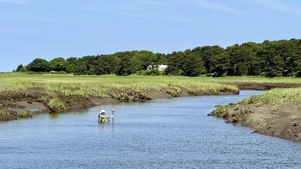
Salt marsh with ponding in coastal Connecticut.
Photograph of a salt marsh with ponding in coastal Connecticut taken during estuarine research field work.
Photograph of a salt marsh with ponding in coastal Connecticut taken during estuarine research field work.

Salt marsh behind impoundment in coastal Connecticut
Salt marsh behind impoundment in coastal Connecticut, taken during estuarine research field work.
Salt marsh behind impoundment in coastal Connecticut, taken during estuarine research field work.

Salt marsh with ponding in coastal Connecticut
Photograph of a salt marsh with ponding in coastal Connecticut taken during estuarine research field work.
Photograph of a salt marsh with ponding in coastal Connecticut taken during estuarine research field work.

Salt marsh with ponding in coastal Connecticut
Salt marsh with ponding in coastal Connecticut, with the sun shining brightly overhead.
Salt marsh with ponding in coastal Connecticut, with the sun shining brightly overhead.

Groundwater-monitoring well
The USGS installs a sensor to monitor groundwater levels in real time at a well located at the City University of New York, York College campus.
The USGS installs a sensor to monitor groundwater levels in real time at a well located at the City University of New York, York College campus.

Leveling a newly installed radar gage on the dock at Rye Playland, NY
Leveling a newly installed radar gage on the dock at Rye Playland, NY.
Spring 2024 Photo Contest Winner: Natalie Cheung, USGS at Work category
Leveling a newly installed radar gage on the dock at Rye Playland, NY.
Spring 2024 Photo Contest Winner: Natalie Cheung, USGS at Work category