
Prey Availability
Water Quantity
Remote Sensing
Saline Lake Ecosystems Integrated Water Availability Assessment
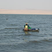
Increased water use, in addition to long-term drought conditions and a warming climate, has resulted in historic low water levels in terminal lakes across the Great Basin in California, Nevada, Oregon, and Utah. The Saline Lake Ecosystems IWAA project is using an integrated, inter-disciplinary scientific approach to monitor and assess water availability, waterbird movements and habitat suitability at selected focus lakes and across the entire Great Basin.
Saline Lake Ecosystems Integrated Water Availability Assessments
Saline Lake Ecosystems Integrated Water Availability Assessments

The loss of water has cascading impacts to habitats and birds. Read more about the interdisciplinary approach underway with the Saline Lake Ecosystems IWAA project to answering complex questions.
News
Saline Lake Ecosystems IWAA Spring 2026 Seminar
Saline Lake Ecosystems IWAA Spring 2026 Seminar
2025 in Review: The Saline Lake Ecosystems Integrated Water Availability Assessment
2025 in Review: The Saline Lake Ecosystems Integrated Water Availability Assessment
Saline Lake Ecosystems IWAA February 2025 Seminar
Saline Lake Ecosystems IWAA February 2025 Seminar
Publications
Imperiled Great Basin terminal lakes: Synthesizing ecological and hydrological science gaps and research needs for waterbird conservation Imperiled Great Basin terminal lakes: Synthesizing ecological and hydrological science gaps and research needs for waterbird conservation
Terminal lakes are declining globally because of human water demands, drought, and climate change. Through literature synthesis and feedback from the resource and conservation community, we review the state of research for terminal lakes in the Great Basin of the United States, which support millions of waterbirds annually, to prioritize ecological and hydrologic information needs. From...
By
Ecosystems Mission Area, Water Resources Mission Area, Species Management Research Program, Water Availability and Use Science Program, Forest and Rangeland Ecosystem Science Center, Fort Collins Science Center, Nevada Water Science Center, Oregon Water Science Center, Utah Water Science Center, Western Ecological Research Center (WERC), Saline Lake Ecosystems Integrated Water Availability Assessment
Integrated science strategy for assessing and monitoring water availability and migratory birds for terminal lakes across the Great Basin, United States Integrated science strategy for assessing and monitoring water availability and migratory birds for terminal lakes across the Great Basin, United States
Executive Summary In 2022, the U.S. Geological Survey (USGS) established the Saline Lake Ecosystems Integrated Water Availability Assessment (IWAAs) to monitor and assess the hydrology of terminal lakes in the Great Basin and the migratory birds and other wildlife dependent on those habitats. Scientists from across the USGS (with specialties in water quantity, water quality, limnology...
Nesting ecology of White-faced Ibis (Plegadis chihi) in Great Salt Lake, Utah Nesting ecology of White-faced Ibis (Plegadis chihi) in Great Salt Lake, Utah
We studied the nesting ecology of White-faced Ibis (Plegadis chihi) at 3 sites within the Bear River Migratory Bird Refuge, Great Salt Lake, Utah, USA. Ibises built nests in small mounds (mean height = 14.4 ± 4.3 cm) above shallow water (mean depth = 12.0 ± 6.6 cm) located within patchy vegetation (mean percent vegetative cover = 17.2 ± 17.8% vegetative cover) with mean vegetation height...
Science
Continuous water quality datasets
View continuous datasets collected by the Saline Lake Ecosystems Integrated Water Availability Assessment Water Quality Team. During the 2024 and 2025 field seasons, the Water Quality Team collected 63 datasets at saline lakes across the Great Basin. Each dataset is a single parameter recorded continuously during the field season - April through October - or until the lake levels became too...

Water Quality
The USGS, in partnership with multiple other groups, is learning about water-quality conditions across time and space in terminal lakes across the Great Basin. This effort is part of the Saline Lake Ecosystems Integrated Water Availability Assessment.

Waterbird Ecology and Movement in the Terminal Lakes Across the Great Basin
How do changing conditions in the terminal lakes of the Great Basin effect the migratory birds that depend on them? USGS scientists investigate bird movement and habitat use to find out.