
An example of repeat photography in action - A researcher, Jim Malusa of the University of Arizona School of Natural Resources and the Environment, holds a clipboard with a historic photograph captured right at the spot where the image was originally taken in the 1900s, with the same mountain landscape in view.
Images
Images intro.

Repeat photography matching in action
An example of repeat photography in action - A researcher, Jim Malusa of the University of Arizona School of Natural Resources and the Environment, holds a clipboard with a historic photograph captured right at the spot where the image was originally taken in the 1900s, with the same mountain landscape in view.

Repeat color photograph taken in 2011 of Glen Canyon Dam, a match to the 1889 Stanton Expedition & 1992 USGS images
linkA USGS repeat photograph of Glen Canyon Dam taken on April 20, 2011 as a match to the 1889 Franklin Nims image of the site before the dam was built, at Colorado River mile -14.7, during the Stanton Expedition. This view was also matched in 1992 by the USGS. The view is taken upstream from river left.

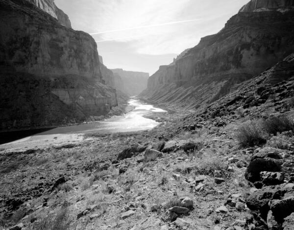
Colorado River, Grand Canyon, River Mile 52.8, Nankoweap, Downstream View from River Right, 2010
linkSeptember 18, 2010. Colorado River, Grand Canyon, River Mile 52.8, Nankoweap, Downstream View from River Right. Riparian vegetation continues to increase along the river, reducing the amount of sand that is visible at this distance. There has been a slight increase in the amount of mesquite, but overall it appears to be similar to that present 19 years before.
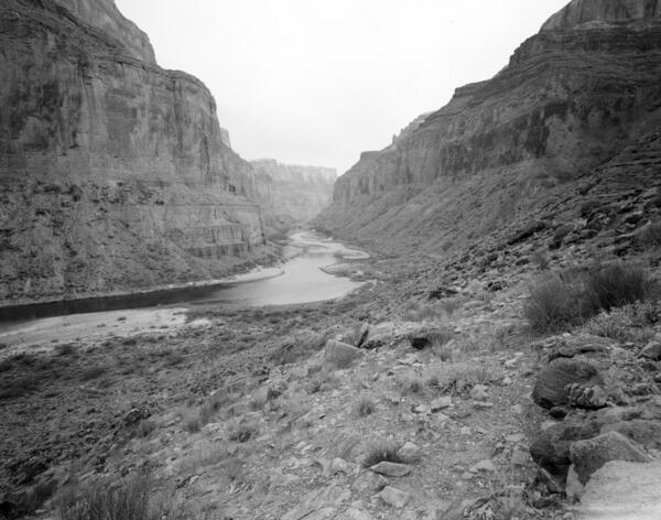
Colorado River, Grand Canyon, River Mile 52.8, Nankoweap, Downstream View from River Right, 1991
linkFebruary 5, 1991. Colorado River, Grand Canyon, River Mile 52.8, Nankoweap, Downstream View from River Right. The river level is higher than it was 1890, and overall the amount of sand lining the river has declined or is now covered with riparian vegetation. Some of the sand bars appear to have shifted and aggraded.
Colorado River, Grand Canyon, River Mile 52.8, Nankoweap, Downstream View from River Right, 1990
linkJanuary 22, 1990. Colorado River, Grand Canyon, River Mile 52.8, Nankoweap, Downstream View from River Right. Stake no. s1424a in the Southwest Repeat Photography Collection. Photo by Robert H. Webb, USGS.
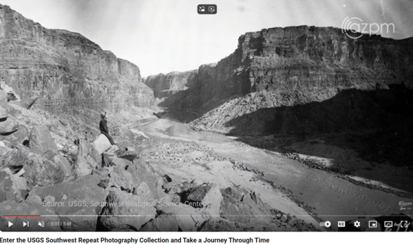
A screenshot of a scene in the AZ PBS video about the Southwest Biological Science Center Repeat Photography Collection
linkA screenshot of a scene in the AZ PBS video about the Southwest Biological Science Center Repeat Photography Collection. The scene depicts an old photograph taken in the early 1900s along the Colorado River in Grand Canyon. Public domain.

Lava Falls, Colorado River, Grand Canyon
A historic photo taken by EC LaRue showing the upstream view of the head of Lava Falls, Colorado River, Grand Canyon, "before the flood." The text next to the photos says, "All boats were portaged over the rocks in the foreground during the afternoon of September 18th. 9/18/1923, E.C. LaRue." This is Stake s1732 in the Southwest Repeat Photography Collection.
A historic photo taken by EC LaRue showing the upstream view of the head of Lava Falls, Colorado River, Grand Canyon, "before the flood." The text next to the photos says, "All boats were portaged over the rocks in the foreground during the afternoon of September 18th. 9/18/1923, E.C. LaRue." This is Stake s1732 in the Southwest Repeat Photography Collection.
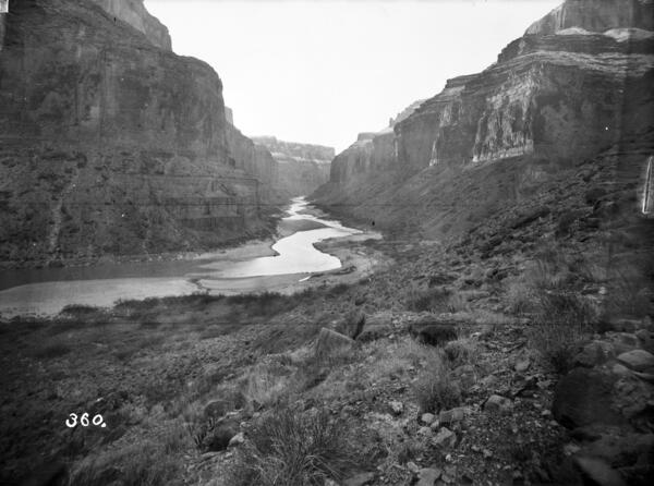
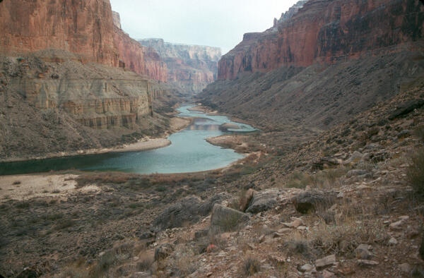
Colorado River, Grand Canyon, River Mile 52.8, Nankoweap, Downstream View from River Right, 1890
linkJanuary 18, 1890. Colorado River, Grand Canyon, River Mile 52.8, Nankoweap, Downstream View from River Right. Snow capped the cliffs when Stanton captured this image showing a bend in the river downstream from Nankoweap Creek, a view that is one of the most famous in Grand Canyon.

Historic photo by Nims on Stanton's Colorado River survey trip taken at Lees Ferry
This image was taken in 1889 by Nims on Stanton's Colorado River survey trip.
This image was taken in 1889 by Nims on Stanton's Colorado River survey trip.