
Mike Duniway, Ph.D.
Dr. Michael (Mike) Duniway is a soil scientist focused on soils and soil processes in dryland ecosystems and the interactions between environmental and land-use drivers, vegetation, soils, and geomorphology. His areas of focus include restoration, ecohydrology, effects of land-use (grazing, energy, and recreation), dust production, plant-soil feedbacks, and soil mapping and interpretations.
Drylands are highly vulnerable to climate and land use changes: what ecosystem changes are in store?

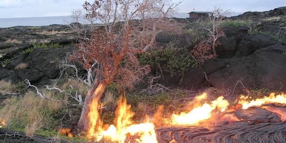
Learning From the Past and Planning for the Future: Experience-Driven Insight Into Managing for Ecosystem Transformations Induced by Drought and Wildfire
In his research and outreach activities, Dr. Duniway seeks to provide information for land managers and owners to facilitate sustainable land-use activities. He works closely with federal agency partners (Bureau of Land Management, National Park Service, National Resource Conservation Service, US Fish and Wildlife Service, and others such as The Nature Conservancy's Canyonlands Research Center) in designing research studies, conducting technology transfer, and outreach activities. Some primary current research focuses include understanding the impacts of drought on Colorado Plateau landscapes, evaluating the recovery of oil and gas pads on the Colorado Plateau and opportunities for improved restoration practices, developing novel restoration techniques for highly disturbed lands using biological soil crusts and physical barriers, and basic research into the importance of soils for dryland ecosystem processes.
Professional Experience
2011-Present: Research Ecologist, USGS Southwest Biological Science Center, Moab, UT
2010-2011: Research Soil Scientist, US Department of Agriculture Agricultural Research Service, Jornada, Las Cruces, NM
2006-2010: Research Soil Scientist (post doc), US Department of Agriculture Agricultural Research Service, Jornada, Las Cruces, NM
2012-Present: Adjunct Faculty, Utah State University, Logan, UT
2007-Present: Adjunct Faculty, NM State University, Las Cruces, NM
Education and Certifications
Ph.D., 2006 — Agronomy (Soil Science), New Mexico State University, Las Cruces, NM
B.S., 1994 — Environmental Resource Science, University of California, Davis, CA
Science and Products
Meteorological measurements from five locations within the Badger Wash study area near Mack, Colorado (ver. 3.0, September 2024)
Long-term precipitation reduction experiment in the Colorado Plateau - Survival and mortality data from 2010 to 2018
Predictive maps of 2D and 3D surface soil properties and associated uncertainty for the Upper Colorado River Basin, USA
Vegetation and Soils Data from Grazed and Ungrazed Watersheds in the Badger Wash Study Area, Colorado, USA
5-year Relative Fractional Vegetation Cover at Abandoned Energy Development Sites on the Colorado Plateau
Potential Land-use Intensity, Aridification Trends, Overlap, and Impact Scenarios, Geospatial Data, Colorado Plateau, USA
Rangeland Ecology Monitoring Data, Utah, 1967-2013
Automated Reference Toolset (ART)Data
Global temperate drylands climate change vulnerability
Evaluating rehabilitation efforts following the Milford Flat Fire: Successes, failures, and controlling factorsData
Southeast Utah Group climate and drought adaptation report: Exposure and perennial grass sensitivity
Supporting the development and use of native plant materials for restoration on the Colorado Plateau (Fiscal Year 2021 Report)
Soil depth and precipitation moderate soil textural effects on seedling survival of a foundation shrub species
Decline in biological soil crust N-fixing lichens linked to increasing summertime temperatures
Assessing vegetation recovery from energy development using a dynamic reference approach
Guiding principles for using satellite-derived maps in rangeland management
Using the TSS-RESTREND methodology to diagnose post-reclamation vegetation trends on the western slope of Colorado
A quantitative soil-geomorphic framework for developing and mapping ecological site groups
Parameterizing an aeolian erosion model for rangelands
What determines the effectiveness of Pinyon-Juniper clearing treatments? Evidence from the remote sensing archive and counter-factual scenarios
Oil and gas reclamation on US public lands: How it works and improving the process with land potential concepts
Sampling design workflows and tools to support adaptive monitoring and management
Non-USGS Publications**
**Disclaimer: The views expressed in Non-USGS publications are those of the author and do not represent the views of the USGS, Department of the Interior, or the U.S. Government.