


Coloring page for geoscience careers. This page highlights those who want to become an archeologist.
Steven Sobieszćzyk
Steven Sobieszćzyk is a scientist and spokesperson. While "Sobie" spent most of his career researching landslide hazards, flooding, sediment transport, and stream ecosystems, he now focuses on science communication and promoting scientific literacy. Steve is a multihazard first responder and has spoken extensively about seismic, wildfire, landslide, flooding, and volcanic hazards.
CURRENT WORK
- Media Lead for the USGS Natural Hazards Mission Area
- Public Information Officer for DOI Office of Wildland Fire
- Hydrologist for National DOI Burned Area Emergency Response (BAER) Team
Science and Products
Filter Total Items: 18
2024 Hurricane Helene Landslide Hazards
Hurricane Helene produced widespread and damaging landslides. The USGS is mapping landslides to support our partners. This page provides information about the extent and severity of landslide impacts. Hurricane Helene made landfall in Florida as a Category 4 storm on Thursday, September 26th, 2024. The hurricane continued across the southern Appalachian Mountains producing record rainfall. This...
Hazards in Alaska
A major goal of the U.S. Geological Survey (USGS) is to reduce the vulnerability of the people and areas most at risk from natural hazards. Working with partners throughout all sectors of society, the USGS provides information, products, and knowledge to help build more resilient communities. This site provides important links to a number of hazard related internet sites that provide important...
Wildland Fire Science - Media Kit
The U.S. Geological Survey’s Wildland Fire Science Program produces information to identify the causes of wildfires, understand the impacts and benefits of both wildfires and prescribed fires, and help manage larger, catastrophic events.
I Am A...Natural Resource Economist
Welcome to the "The I Am A..." series, a whiteboard animation video series highlighting USGS careers. The concept is to show whimsically "what society (or my mom) thinks I do" compared with "what I really do." This video is about a natural resource economist (i.e. someone who studies the value of features in the natural world).
I Am An...Ecotoxicologist
Welcome to the "The I Am A..." series. This is the tenth video in a series of USGS whiteboard animations that highlight USGS careers. The concept is to show "what society (or my mom) thinks I do" compared with "what I really do." One image captures a more whimsical representation of a "scientist" and the second demonstrates a more accurate representation of
I Am A...Climate Modeler
Welcome to the "The I Am A(n)..." series. This is the seventh video in a series of USGS whiteboard animations that highlight USGS careers. The concept is to show "what society (or my mom) thinks I do" compared with "what I really do." One image captures a more whimsical representation of a "scientist" and the second demonstrates a more accurate representation of what we really look like in the field.
In this episode, we explore a Climate Modeler (i.e., a person who forecasts future climate scenarios).
Below we feature the animated video and a coloring page.
I Am A...Wildlife Biologist
Welcome to the "The I Am A(n)..." series. This is the seventh video in a series of USGS whiteboard animations that highlight USGS careers. The concept is to show "what society (or my mom) thinks I do" compared with "what I really do." One image captures a more whimsical representation of a "scientist" and the second demonstrates a more accurate representation of what we really look like in the field.
In this episode, we explore a Wildlife Biologist (i.e., person who studies animals in the wild).
Below we feature the animated video and a coloring page.
I Am A...Wetland Ecologist
Welcome to the "The I Am A(n)..." series. This is the seventh video in a series of USGS whiteboard animations that highlight USGS careers. The concept is to show "what society (or my mom) thinks I do" compared with "what I really do." One image captures a more whimsical representation of a "scientist" and the second demonstrates a more accurate representation of what we really look like in the field.
In this episode, we explore a Wetland Ecologist (i.e., person who studies wetland plants and animals).
Below we feature the animated video and a coloring page.
I Am A...Malacologist
Welcome to the "The I Am A(n)..." series. This is the sixth video in a series of USGS whiteboard animations that highlight USGS careers. The concept is to show "what society (or my mom) thinks I do" compared with "what I really do." One image captures a more whimsical representation of a "scientist" and the second demonstrates a more accurate representation of what we really look like in the field.
In this episode, we explore a Malacologist who is someone who studies mollusks, the most diverse group of animals on the planets and includes mussels, snails, octopuses, clams, scallops, oysters, and MANY more (like tens of thousands of organisms).
Below we feature the animated video and a coloring page.
I Am A...
Welcome to the "I Am A(n)..." series - a collection of USGS whiteboard animations that highlight USGS careers. The concept is to show whimsically "what society (or my mom) thinks I do" compared with "what I really do." Check out our full series below! Or, click below to order or download our FREE coloring book!
I Am A(n)...Ichthyologist
I Am A(n) ... Ichthyologist is part of our "I Am A..." series of USGS whiteboard animations that highlight USGS careers. The concept is to show "what society (or my mom) thinks I do" compared with "what I really do." One image captures a more whimsical representation of a "scientist" in the field and the second demonstrates a more accurate representatio
I Am A...Chiropterologist
I Am A ... Chiropterologist is part of our "I Am A..." series of USGS whiteboard animations that highlight USGS careers. The concept is to show "what society (or my mom) thinks I do" compared with "what I really do." One image captures a more whimsical representation of a "scientist" in the field and the second demonstrates a more accurate represen
When it comes to talking to others, especially when explaining science, the key is consequences outweigh precision. You should always be honest, tell the truth, but don't sweat the small stuff. People care about relatability, not the mundane. Knowing what information isn't worth sharing is hard. There are professionals out there who can help. Like me.
Filter Total Items: 201

I Am An...Archeologist
Coloring page for geoscience careers. This page highlights those who want to become an archeologist.

I Am A...Geographer
Coloring page for geoscience careers. This page highlights those who want to become a geographer.
Coloring page for geoscience careers. This page highlights those who want to become a geographer.

I Am A...Volcanologist
Coloring page for geoscience careers. This page highlights those who want to become a volcanologist.
Coloring page for geoscience careers. This page highlights those who want to become a volcanologist.

I Am A...Geodesist
Coloring page for geoscience careers. This page highlights those who want to become a geodesist.
Coloring page for geoscience careers. This page highlights those who want to become a geodesist.
I Am A...Hydrologist
Coloring page for geoscience careers. This page highlights those who want to become a hydrologist.
Coloring page for geoscience careers. This page highlights those who want to become a hydrologist.
 Assembly Required: HT Sign up for Great ShakeOut")
(Some) Assembly Required: HT Sign up for Great ShakeOut
Did you feel that?
The annual Great ShakeOut Earthquake Drill is coming on Thursday, Oct. 17, 2024, at 10:17 a.m. (local time, wherever you are). We never know where or when an earthquake may happen, but preparing is easier than assembling a piece of Scandinavian furniture.
Don’t believe us? Take a look at this step-by-step guide.
Page 5 of fictional Great ShakeOut instruction manual
[Page 5]
Did you feel that? The annual Great ShakeOut Earthquake Drill is coming on Thursday, Oct. 17, 2024, at 10:17 a.m. (local time, wherever you are). We never know where or when an earthquake may happen, but preparing is easier than assembling a piece of Scandinavian furniture.
[Page 5]
Did you feel that? The annual Great ShakeOut Earthquake Drill is coming on Thursday, Oct. 17, 2024, at 10:17 a.m. (local time, wherever you are). We never know where or when an earthquake may happen, but preparing is easier than assembling a piece of Scandinavian furniture.

Page 6 of fictional Great ShakeOut instruction manual
[Page 6]
Did you feel that? The annual Great ShakeOut Earthquake Drill is coming on Thursday, Oct. 17, 2024, at 10:17 a.m. (local time, wherever you are). We never know where or when an earthquake may happen, but preparing is easier than assembling a piece of Scandinavian furniture.
[Page 6]
Did you feel that? The annual Great ShakeOut Earthquake Drill is coming on Thursday, Oct. 17, 2024, at 10:17 a.m. (local time, wherever you are). We never know where or when an earthquake may happen, but preparing is easier than assembling a piece of Scandinavian furniture.

Page 3 of fictional Great ShakeOut instruction manual
[Page 3]
Did you feel that? The annual Great ShakeOut Earthquake Drill is coming on Thursday, Oct. 17, 2024, at 10:17 a.m. (local time, wherever you are). We never know where or when an earthquake may happen, but preparing is easier than assembling a piece of Scandinavian furniture.
[Page 3]
Did you feel that? The annual Great ShakeOut Earthquake Drill is coming on Thursday, Oct. 17, 2024, at 10:17 a.m. (local time, wherever you are). We never know where or when an earthquake may happen, but preparing is easier than assembling a piece of Scandinavian furniture.

Page 8 of fictional Great ShakeOut instruction manual
[Page 8]
Did you feel that? The annual Great ShakeOut Earthquake Drill is coming on Thursday, Oct. 17, 2024, at 10:17 a.m. (local time, wherever you are). We never know where or when an earthquake may happen, but preparing is easier than assembling a piece of Scandinavian furniture.
[Page 8]
Did you feel that? The annual Great ShakeOut Earthquake Drill is coming on Thursday, Oct. 17, 2024, at 10:17 a.m. (local time, wherever you are). We never know where or when an earthquake may happen, but preparing is easier than assembling a piece of Scandinavian furniture.
Page 2 of fictional Great ShakeOut instruction manual
[Page 2]
Did you feel that? The annual Great ShakeOut Earthquake Drill is coming on Thursday, Oct. 17, 2024, at 10:17 a.m. (local time, wherever you are). We never know where or when an earthquake may happen, but preparing is easier than assembling a piece of Scandinavian furniture.
[Page 2]
Did you feel that? The annual Great ShakeOut Earthquake Drill is coming on Thursday, Oct. 17, 2024, at 10:17 a.m. (local time, wherever you are). We never know where or when an earthquake may happen, but preparing is easier than assembling a piece of Scandinavian furniture.

Page 4 of fictional Great ShakeOut instruction manual
[Page 4]
Did you feel that? The annual Great ShakeOut Earthquake Drill is coming on Thursday, Oct. 17, 2024, at 10:17 a.m. (local time, wherever you are). We never know where or when an earthquake may happen, but preparing is easier than assembling a piece of Scandinavian furniture.
[Page 4]
Did you feel that? The annual Great ShakeOut Earthquake Drill is coming on Thursday, Oct. 17, 2024, at 10:17 a.m. (local time, wherever you are). We never know where or when an earthquake may happen, but preparing is easier than assembling a piece of Scandinavian furniture.

Cover of fictional Great ShakeOut instruction manual.
[Cover]
Did you feel that? The annual Great ShakeOut Earthquake Drill is coming on Thursday, Oct. 17, 2024, at 10:17 a.m. (local time, wherever you are). We never know where or when an earthquake may happen, but preparing is easier than assembling a piece of Scandinavian furniture.
[Cover]
Did you feel that? The annual Great ShakeOut Earthquake Drill is coming on Thursday, Oct. 17, 2024, at 10:17 a.m. (local time, wherever you are). We never know where or when an earthquake may happen, but preparing is easier than assembling a piece of Scandinavian furniture.

Page 7 of fictional Great ShakeOut instruction manual
[Page 7]
Did you feel that? The annual Great ShakeOut Earthquake Drill is coming on Thursday, Oct. 17, 2024, at 10:17 a.m. (local time, wherever you are). We never know where or when an earthquake may happen, but preparing is easier than assembling a piece of Scandinavian furniture.
[Page 7]
Did you feel that? The annual Great ShakeOut Earthquake Drill is coming on Thursday, Oct. 17, 2024, at 10:17 a.m. (local time, wherever you are). We never know where or when an earthquake may happen, but preparing is easier than assembling a piece of Scandinavian furniture.

Protecting People with Natural Hazards Research and Monitoring
Natural hazards like earthquakes, volcanoes, landslides, and floods impact millions of Americans every year. The U.S. Geological Survey monitors these hazards in realtime, giving communities early warnings and critical information. In some cases, forecasting where the threat is greatest and helping reduce the risk to people, homes, and infrastructure.
Natural hazards like earthquakes, volcanoes, landslides, and floods impact millions of Americans every year. The U.S. Geological Survey monitors these hazards in realtime, giving communities early warnings and critical information. In some cases, forecasting where the threat is greatest and helping reduce the risk to people, homes, and infrastructure.

¿Dónde Ocurren los Deslizamientos de Tierra?
¿Dónde Ocurren los Deslizamientos de Tierra?
(Mapa Nacional de Susceptibilidad a Deslizamientos de Tierra, 2024)
¿Dónde Ocurren los Deslizamientos de Tierra?
(Mapa Nacional de Susceptibilidad a Deslizamientos de Tierra, 2024)

Where Do Landslides Occur?
A map of the United States including Hawaii, Alaska, and Puerto Rico shows landslide susceptibility from yellow (low) to red (high), where the areas without shading represent negligible potential for landslides.
A map of the United States including Hawaii, Alaska, and Puerto Rico shows landslide susceptibility from yellow (low) to red (high), where the areas without shading represent negligible potential for landslides.

Meet a Fire Scientist: Steven Sobieszczyk
MEET A FIRE SCIENTIST: Steven Sobieszczyk.
I fill two roles with wildfires. I go out after a fire to look at values at risk to postfire flooding or I respond during a fire as public information officer.
MEET A FIRE SCIENTIST: Steven Sobieszczyk.
I fill two roles with wildfires. I go out after a fire to look at values at risk to postfire flooding or I respond during a fire as public information officer.

Red Flag Warning
Red flag warnings are issued when weather conditions become hot, dry, and windy. These conditions are ideal for wildfires to start or grow.
Red flag warnings are issued when weather conditions become hot, dry, and windy. These conditions are ideal for wildfires to start or grow.

fireForecast.jpg
Fire Danger Forecast Viewer
3 Fire-related Maps
- Wildfire Potential
- Probability of Large Fire
- Probability of Fire Spread
Fire Danger Forecast Viewer
3 Fire-related Maps
- Wildfire Potential
- Probability of Large Fire
- Probability of Fire Spread

Multi-scale fire triangle: Fire growth and complexity (Simplified)
There are three fire-related triangles used to explain fire growth and expansion. The smallest scale "Fire Triangle" factors in oxygen, heat, and fuel. The "Fire Behavior Triangle" factors in topography, fuel, and weather. While the large-scale "Fire Regime Triangle" factors in ignition source, vegetation, and climate.
There are three fire-related triangles used to explain fire growth and expansion. The smallest scale "Fire Triangle" factors in oxygen, heat, and fuel. The "Fire Behavior Triangle" factors in topography, fuel, and weather. While the large-scale "Fire Regime Triangle" factors in ignition source, vegetation, and climate.
Science and Products
Filter Total Items: 18
2024 Hurricane Helene Landslide Hazards
Hurricane Helene produced widespread and damaging landslides. The USGS is mapping landslides to support our partners. This page provides information about the extent and severity of landslide impacts. Hurricane Helene made landfall in Florida as a Category 4 storm on Thursday, September 26th, 2024. The hurricane continued across the southern Appalachian Mountains producing record rainfall. This...
Hazards in Alaska
A major goal of the U.S. Geological Survey (USGS) is to reduce the vulnerability of the people and areas most at risk from natural hazards. Working with partners throughout all sectors of society, the USGS provides information, products, and knowledge to help build more resilient communities. This site provides important links to a number of hazard related internet sites that provide important...
Wildland Fire Science - Media Kit
The U.S. Geological Survey’s Wildland Fire Science Program produces information to identify the causes of wildfires, understand the impacts and benefits of both wildfires and prescribed fires, and help manage larger, catastrophic events.
I Am A...Natural Resource Economist
Welcome to the "The I Am A..." series, a whiteboard animation video series highlighting USGS careers. The concept is to show whimsically "what society (or my mom) thinks I do" compared with "what I really do." This video is about a natural resource economist (i.e. someone who studies the value of features in the natural world).
I Am An...Ecotoxicologist
Welcome to the "The I Am A..." series. This is the tenth video in a series of USGS whiteboard animations that highlight USGS careers. The concept is to show "what society (or my mom) thinks I do" compared with "what I really do." One image captures a more whimsical representation of a "scientist" and the second demonstrates a more accurate representation of
I Am A...Climate Modeler
Welcome to the "The I Am A(n)..." series. This is the seventh video in a series of USGS whiteboard animations that highlight USGS careers. The concept is to show "what society (or my mom) thinks I do" compared with "what I really do." One image captures a more whimsical representation of a "scientist" and the second demonstrates a more accurate representation of what we really look like in the field.
In this episode, we explore a Climate Modeler (i.e., a person who forecasts future climate scenarios).
Below we feature the animated video and a coloring page.
I Am A...Wildlife Biologist
Welcome to the "The I Am A(n)..." series. This is the seventh video in a series of USGS whiteboard animations that highlight USGS careers. The concept is to show "what society (or my mom) thinks I do" compared with "what I really do." One image captures a more whimsical representation of a "scientist" and the second demonstrates a more accurate representation of what we really look like in the field.
In this episode, we explore a Wildlife Biologist (i.e., person who studies animals in the wild).
Below we feature the animated video and a coloring page.
I Am A...Wetland Ecologist
Welcome to the "The I Am A(n)..." series. This is the seventh video in a series of USGS whiteboard animations that highlight USGS careers. The concept is to show "what society (or my mom) thinks I do" compared with "what I really do." One image captures a more whimsical representation of a "scientist" and the second demonstrates a more accurate representation of what we really look like in the field.
In this episode, we explore a Wetland Ecologist (i.e., person who studies wetland plants and animals).
Below we feature the animated video and a coloring page.
I Am A...Malacologist
Welcome to the "The I Am A(n)..." series. This is the sixth video in a series of USGS whiteboard animations that highlight USGS careers. The concept is to show "what society (or my mom) thinks I do" compared with "what I really do." One image captures a more whimsical representation of a "scientist" and the second demonstrates a more accurate representation of what we really look like in the field.
In this episode, we explore a Malacologist who is someone who studies mollusks, the most diverse group of animals on the planets and includes mussels, snails, octopuses, clams, scallops, oysters, and MANY more (like tens of thousands of organisms).
Below we feature the animated video and a coloring page.
I Am A...
Welcome to the "I Am A(n)..." series - a collection of USGS whiteboard animations that highlight USGS careers. The concept is to show whimsically "what society (or my mom) thinks I do" compared with "what I really do." Check out our full series below! Or, click below to order or download our FREE coloring book!
I Am A(n)...Ichthyologist
I Am A(n) ... Ichthyologist is part of our "I Am A..." series of USGS whiteboard animations that highlight USGS careers. The concept is to show "what society (or my mom) thinks I do" compared with "what I really do." One image captures a more whimsical representation of a "scientist" in the field and the second demonstrates a more accurate representatio
I Am A...Chiropterologist
I Am A ... Chiropterologist is part of our "I Am A..." series of USGS whiteboard animations that highlight USGS careers. The concept is to show "what society (or my mom) thinks I do" compared with "what I really do." One image captures a more whimsical representation of a "scientist" in the field and the second demonstrates a more accurate represen
When it comes to talking to others, especially when explaining science, the key is consequences outweigh precision. You should always be honest, tell the truth, but don't sweat the small stuff. People care about relatability, not the mundane. Knowing what information isn't worth sharing is hard. There are professionals out there who can help. Like me.
Filter Total Items: 201
I Am An...Archeologist
Coloring page for geoscience careers. This page highlights those who want to become an archeologist.
Coloring page for geoscience careers. This page highlights those who want to become an archeologist.
I Am A...Geographer
Coloring page for geoscience careers. This page highlights those who want to become a geographer.
Coloring page for geoscience careers. This page highlights those who want to become a geographer.
I Am A...Volcanologist
Coloring page for geoscience careers. This page highlights those who want to become a volcanologist.
Coloring page for geoscience careers. This page highlights those who want to become a volcanologist.
I Am A...Geodesist
Coloring page for geoscience careers. This page highlights those who want to become a geodesist.
Coloring page for geoscience careers. This page highlights those who want to become a geodesist.
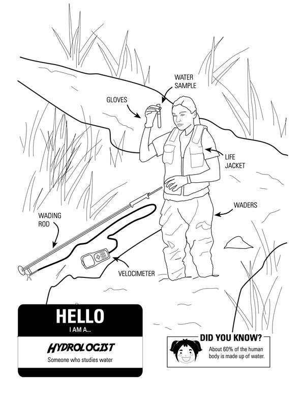
I Am A...Hydrologist
Coloring page for geoscience careers. This page highlights those who want to become a hydrologist.
Coloring page for geoscience careers. This page highlights those who want to become a hydrologist.
(Some) Assembly Required: HT Sign up for Great ShakeOut
Did you feel that?
The annual Great ShakeOut Earthquake Drill is coming on Thursday, Oct. 17, 2024, at 10:17 a.m. (local time, wherever you are). We never know where or when an earthquake may happen, but preparing is easier than assembling a piece of Scandinavian furniture.
Don’t believe us? Take a look at this step-by-step guide.
Did you feel that?
The annual Great ShakeOut Earthquake Drill is coming on Thursday, Oct. 17, 2024, at 10:17 a.m. (local time, wherever you are). We never know where or when an earthquake may happen, but preparing is easier than assembling a piece of Scandinavian furniture.
Don’t believe us? Take a look at this step-by-step guide.
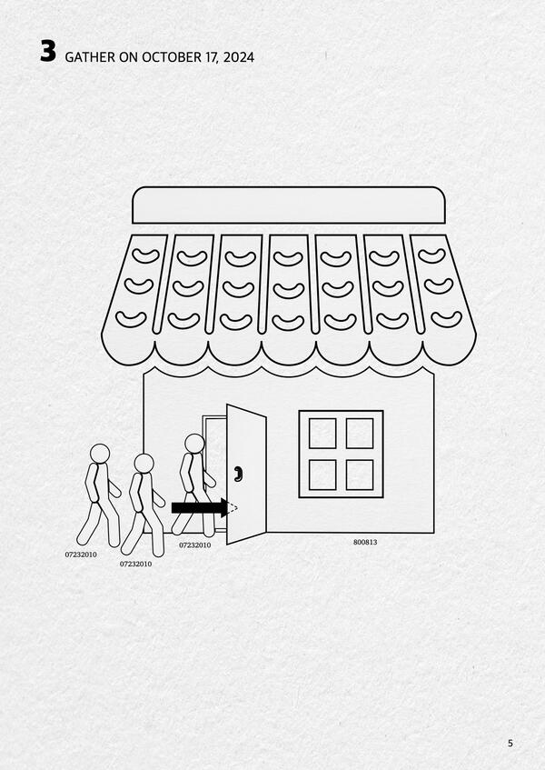
Page 5 of fictional Great ShakeOut instruction manual
[Page 5]
Did you feel that? The annual Great ShakeOut Earthquake Drill is coming on Thursday, Oct. 17, 2024, at 10:17 a.m. (local time, wherever you are). We never know where or when an earthquake may happen, but preparing is easier than assembling a piece of Scandinavian furniture.
[Page 5]
Did you feel that? The annual Great ShakeOut Earthquake Drill is coming on Thursday, Oct. 17, 2024, at 10:17 a.m. (local time, wherever you are). We never know where or when an earthquake may happen, but preparing is easier than assembling a piece of Scandinavian furniture.
Page 6 of fictional Great ShakeOut instruction manual
[Page 6]
Did you feel that? The annual Great ShakeOut Earthquake Drill is coming on Thursday, Oct. 17, 2024, at 10:17 a.m. (local time, wherever you are). We never know where or when an earthquake may happen, but preparing is easier than assembling a piece of Scandinavian furniture.
[Page 6]
Did you feel that? The annual Great ShakeOut Earthquake Drill is coming on Thursday, Oct. 17, 2024, at 10:17 a.m. (local time, wherever you are). We never know where or when an earthquake may happen, but preparing is easier than assembling a piece of Scandinavian furniture.
Page 3 of fictional Great ShakeOut instruction manual
[Page 3]
Did you feel that? The annual Great ShakeOut Earthquake Drill is coming on Thursday, Oct. 17, 2024, at 10:17 a.m. (local time, wherever you are). We never know where or when an earthquake may happen, but preparing is easier than assembling a piece of Scandinavian furniture.
[Page 3]
Did you feel that? The annual Great ShakeOut Earthquake Drill is coming on Thursday, Oct. 17, 2024, at 10:17 a.m. (local time, wherever you are). We never know where or when an earthquake may happen, but preparing is easier than assembling a piece of Scandinavian furniture.
Page 8 of fictional Great ShakeOut instruction manual
[Page 8]
Did you feel that? The annual Great ShakeOut Earthquake Drill is coming on Thursday, Oct. 17, 2024, at 10:17 a.m. (local time, wherever you are). We never know where or when an earthquake may happen, but preparing is easier than assembling a piece of Scandinavian furniture.
[Page 8]
Did you feel that? The annual Great ShakeOut Earthquake Drill is coming on Thursday, Oct. 17, 2024, at 10:17 a.m. (local time, wherever you are). We never know where or when an earthquake may happen, but preparing is easier than assembling a piece of Scandinavian furniture.
Page 2 of fictional Great ShakeOut instruction manual
[Page 2]
Did you feel that? The annual Great ShakeOut Earthquake Drill is coming on Thursday, Oct. 17, 2024, at 10:17 a.m. (local time, wherever you are). We never know where or when an earthquake may happen, but preparing is easier than assembling a piece of Scandinavian furniture.
[Page 2]
Did you feel that? The annual Great ShakeOut Earthquake Drill is coming on Thursday, Oct. 17, 2024, at 10:17 a.m. (local time, wherever you are). We never know where or when an earthquake may happen, but preparing is easier than assembling a piece of Scandinavian furniture.
Page 4 of fictional Great ShakeOut instruction manual
[Page 4]
Did you feel that? The annual Great ShakeOut Earthquake Drill is coming on Thursday, Oct. 17, 2024, at 10:17 a.m. (local time, wherever you are). We never know where or when an earthquake may happen, but preparing is easier than assembling a piece of Scandinavian furniture.
[Page 4]
Did you feel that? The annual Great ShakeOut Earthquake Drill is coming on Thursday, Oct. 17, 2024, at 10:17 a.m. (local time, wherever you are). We never know where or when an earthquake may happen, but preparing is easier than assembling a piece of Scandinavian furniture.
Cover of fictional Great ShakeOut instruction manual.
[Cover]
Did you feel that? The annual Great ShakeOut Earthquake Drill is coming on Thursday, Oct. 17, 2024, at 10:17 a.m. (local time, wherever you are). We never know where or when an earthquake may happen, but preparing is easier than assembling a piece of Scandinavian furniture.
[Cover]
Did you feel that? The annual Great ShakeOut Earthquake Drill is coming on Thursday, Oct. 17, 2024, at 10:17 a.m. (local time, wherever you are). We never know where or when an earthquake may happen, but preparing is easier than assembling a piece of Scandinavian furniture.
Page 7 of fictional Great ShakeOut instruction manual
[Page 7]
Did you feel that? The annual Great ShakeOut Earthquake Drill is coming on Thursday, Oct. 17, 2024, at 10:17 a.m. (local time, wherever you are). We never know where or when an earthquake may happen, but preparing is easier than assembling a piece of Scandinavian furniture.
[Page 7]
Did you feel that? The annual Great ShakeOut Earthquake Drill is coming on Thursday, Oct. 17, 2024, at 10:17 a.m. (local time, wherever you are). We never know where or when an earthquake may happen, but preparing is easier than assembling a piece of Scandinavian furniture.
Protecting People with Natural Hazards Research and Monitoring
Natural hazards like earthquakes, volcanoes, landslides, and floods impact millions of Americans every year. The U.S. Geological Survey monitors these hazards in realtime, giving communities early warnings and critical information. In some cases, forecasting where the threat is greatest and helping reduce the risk to people, homes, and infrastructure.
Natural hazards like earthquakes, volcanoes, landslides, and floods impact millions of Americans every year. The U.S. Geological Survey monitors these hazards in realtime, giving communities early warnings and critical information. In some cases, forecasting where the threat is greatest and helping reduce the risk to people, homes, and infrastructure.
¿Dónde Ocurren los Deslizamientos de Tierra?
¿Dónde Ocurren los Deslizamientos de Tierra?
(Mapa Nacional de Susceptibilidad a Deslizamientos de Tierra, 2024)
¿Dónde Ocurren los Deslizamientos de Tierra?
(Mapa Nacional de Susceptibilidad a Deslizamientos de Tierra, 2024)
Where Do Landslides Occur?
A map of the United States including Hawaii, Alaska, and Puerto Rico shows landslide susceptibility from yellow (low) to red (high), where the areas without shading represent negligible potential for landslides.
A map of the United States including Hawaii, Alaska, and Puerto Rico shows landslide susceptibility from yellow (low) to red (high), where the areas without shading represent negligible potential for landslides.
Meet a Fire Scientist: Steven Sobieszczyk
MEET A FIRE SCIENTIST: Steven Sobieszczyk.
I fill two roles with wildfires. I go out after a fire to look at values at risk to postfire flooding or I respond during a fire as public information officer.
MEET A FIRE SCIENTIST: Steven Sobieszczyk.
I fill two roles with wildfires. I go out after a fire to look at values at risk to postfire flooding or I respond during a fire as public information officer.
Red Flag Warning
Red flag warnings are issued when weather conditions become hot, dry, and windy. These conditions are ideal for wildfires to start or grow.
Red flag warnings are issued when weather conditions become hot, dry, and windy. These conditions are ideal for wildfires to start or grow.
fireForecast.jpg
Fire Danger Forecast Viewer
3 Fire-related Maps
- Wildfire Potential
- Probability of Large Fire
- Probability of Fire Spread
Fire Danger Forecast Viewer
3 Fire-related Maps
- Wildfire Potential
- Probability of Large Fire
- Probability of Fire Spread
Multi-scale fire triangle: Fire growth and complexity (Simplified)
There are three fire-related triangles used to explain fire growth and expansion. The smallest scale "Fire Triangle" factors in oxygen, heat, and fuel. The "Fire Behavior Triangle" factors in topography, fuel, and weather. While the large-scale "Fire Regime Triangle" factors in ignition source, vegetation, and climate.
There are three fire-related triangles used to explain fire growth and expansion. The smallest scale "Fire Triangle" factors in oxygen, heat, and fuel. The "Fire Behavior Triangle" factors in topography, fuel, and weather. While the large-scale "Fire Regime Triangle" factors in ignition source, vegetation, and climate.