U.S. flag

An official website of the United States government

Chesapeake Bay Activities

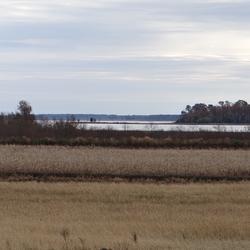
The Chesapeake Bay is our Nation’s largest estuary and provides over $100 billion in annual economic value. The USGS works with Federal, State, local, and academic partners to provide research and monitoring and to communicate results to inform management for the Chesapeake and other important landscapes across the Nation.

News

Summer 2025 Newsletter - In The Flow

Summer 2025 Newsletter - In The Flow

Chesapeake Bay Program releases most detailed data on the Chesapeake’s lands and waters to date

Chesapeake Bay Program releases most detailed data on the Chesapeake’s lands and waters to date

EESC in the News: PFAS in Blue Catfish

EESC in the News: PFAS in Blue Catfish

Publications

Over, under, and through: Hydrologic connectivity and the future of coastal landscape salinization Over, under, and through: Hydrologic connectivity and the future of coastal landscape salinization

Seawater intrusion (SWI) affects coastal landscapes worldwide. Here we describe the hydrologic pathways through which SWI occurs - over land via storm surge or tidal flooding, under land via groundwater transport, and through watersheds via natural and artificial surface water channels—and how human modifications to those pathways alter patterns of SWI. We present an approach to advance...
Authors
Ashley Helton, James Dennedy-Frank, Ryan Emanuel, Scott C Neubauer, Kyra Adams, Marcelo Ardon, Lawrence Band, Kevin A. Befus, Hanne Borstlap, Jamie Duberstein, Adam Gold, Kominoski John, Alex Manda, Holly A. Michael, Stephen Moysey, Allison Myers-Pigg, Justine Annaliese Neville, Gregory Noe, Jeeban Panthi, Elnaz Pezeshki, Matthew Sirianni, Ward.Nicolas

The nonpoint source challenge: Obstacles and opportunities for meeting nutrient reduction goals in the Chesapeake Bay watershed The nonpoint source challenge: Obstacles and opportunities for meeting nutrient reduction goals in the Chesapeake Bay watershed

This document examines the Chesapeake Bay watershed response to nutrient and sediment reduction efforts under the Clean Water Act's total maximum daily load (TMDL) regulation. As the 2025 Chesapeake Bay TMDL deadline approaches, water quality goals remain unmet, primarily because of nonpoint source pollution, the largest remaining source of nutrients and sediment, and the primary...
Authors
Zachary M. Easton, Kurt Stephenson, Brian Benhem, J.K. Böhlke, Anthony R Buda, Amy S. Collick, Lara Fowler, Ellen Gilinsky, Andrew Miller, Gregory Noe, Leah Palm-Forster, Leonard Shabman, Tess Wynn-Thompson

Multi-model comparison of salt marsh longevity under relative sea-level rise Multi-model comparison of salt marsh longevity under relative sea-level rise

Understanding salt marsh resilience under increasing sea levels can inform for management decisions. We compared temporal projections from various wetland process-based models and a geospatially derived metric (i.e., marsh lifespan) to understand key considerations and uncertainties about salt marsh resilience when using these products for decision-making. The influences of lidar...
Authors
Melinda Martinez, Kevin Buffington, Neil K. Ganju, Zafer Defne, Kate Ackerman, Karen M. Thorne, Glenn R. Guntenspergen, Joel A. Carr

Science

Applying Multiple Tools to Inform Management of Per- and Polyfluoroalkyl Substances (PFAS) in the Potomac River Watershed

The reuse of municipal wastewater provides multiple benefits, including maintaining stream flow, recharging aquifers, and providing public water supply. However, along with the benefits are concerns related to the presence of ‘forever’ chemicals, like per- and polyfluoroalkyl substances (PFAS) in wastewater discharge. Managing PFAS in waterways is challenging because there are many potential PFAS...
Applying Multiple Tools to Inform Management of Per- and Polyfluoroalkyl Substances (PFAS) in the Potomac River Watershed

Applying Multiple Tools to Inform Management of Per- and Polyfluoroalkyl Substances (PFAS) in the Potomac River Watershed

The reuse of municipal wastewater provides multiple benefits, including maintaining stream flow, recharging aquifers, and providing public water supply. However, along with the benefits are concerns related to the presence of ‘forever’ chemicals, like per- and polyfluoroalkyl substances (PFAS) in wastewater discharge. Managing PFAS in waterways is challenging because there are many potential PFAS...
Learn More

Artificial Intelligence in the USGS Ecosystems Mission Area

As a data-driven bureau, the USGS Ecosystem Mission Area (EMA) relies on artificial intelligence (AI) to efficiently gather, analyze, and deliver natural resource information to Federal, State, Tribal, academic, and industry partners. USGS EMA scientists are developing and testing innovative uses of AI, including machine learning, deep neural network models, and photogrammetry, to streamline the...
Artificial Intelligence in the USGS Ecosystems Mission Area

Artificial Intelligence in the USGS Ecosystems Mission Area

As a data-driven bureau, the USGS Ecosystem Mission Area (EMA) relies on artificial intelligence (AI) to efficiently gather, analyze, and deliver natural resource information to Federal, State, Tribal, academic, and industry partners. USGS EMA scientists are developing and testing innovative uses of AI, including machine learning, deep neural network models, and photogrammetry, to streamline the...
Learn More

Using Global Telemetry to Understand Avian Movement and Migration

USGS researchers are collaborating with partners around the globe to leverage new and existing telemetry data to answer broad scale questions about factors influencing avian movement and migration.
Using Global Telemetry to Understand Avian Movement and Migration

Using Global Telemetry to Understand Avian Movement and Migration

USGS researchers are collaborating with partners around the globe to leverage new and existing telemetry data to answer broad scale questions about factors influencing avian movement and migration.
Learn More
Was this page helpful?