U.S. flag

An official website of the United States government

Land Management Research Program

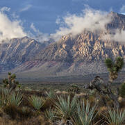
The Land Management Research Program conducts research to improve the effectiveness of land management and inform restoration of priority ecosystems on millions of acres including public lands such as National Parks, refuges, and other critical landscapes that support the biodiversity of fish, wildlife, and plant species, as well as thriving economies.

News

New study on the economics of public land treatments reveals treatment characteristics influence costs

New study on the economics of public land treatments reveals treatment characteristics influence costs

Long-term drought assessment:  hydrologic, ecological, and social impacts

Long-term drought assessment:  hydrologic, ecological, and social impacts

USGS EcoNews - Vol. 6 | Issue 1

Publications

Think regionally, act locally: Perspectives on co-design of spatial conservation prioritization tools and why end-user engagement altered our approach

Coproduction represents an inclusive approach for developing decision-support resources because it seeks to integrate scientific knowledge and end-user needs. Unfortunately, spatial decision support systems (SDSS) coproduction has sometimes resulted in limited utility for end-users, partially due to scarce SDSS coproduction guidance. To initiate coproduction, we held a series of...
Authors
Nicholas J. Van Lanen, Jessica E. Shyvers, Bryan C. Tarbox, Adrian P. Monroe, Patrick J. Anderson, Daniel K. Jones, Katharine G. Dahm, Cameron L. Aldridge

Carbon isotope trends across a century of herbarium specimens suggest CO2 fertilization of C4 grasses.

Increasing atmospheric CO2 is changing the dynamics of tropical savanna vegetation. C3 trees and grasses are known to experience CO2 fertilization, whereas responses to CO2 by C4 grasses are more ambiguous.Here, we sample stable carbon isotope trends in herbarium collections of South African C4 and C3 grasses to reconstruct 13C discrimination.We found that C3 grasses showed no trends in...
Authors
Isa del Toro, Madelon Florence Case, Allison Karp, Jasper Slingsby, A. Carla Staver

Structural heterogeneity predicts ecological resistance and resilience to wildfire in arid shrublands

ContextDynamic feedbacks between physical structure and ecological function drive ecosystem productivity, resilience, and biodiversity maintenance. Detailed maps of canopy structure enable comprehensive evaluations of structure–function relationships. However, these relationships are scale-dependent, and identifying relevant spatial scales to link structure to function remains...
Authors
Andrii Zaiats, Megan E Cattau, David Pilliod, Rongsong Liu, Patricia Kaye T. Dumandan, Ahmad Hojatimalekshah, Donna M. Delparte, Trevor Caughlin

Science

Southwest Fire Innovation Landscape Network: Advanced tools for fuel monitoring and assessment of wildfire risk

The USGS Southwest Biological Science Center is coordinating the Southwest Fire Innovation Landscape Network to prepare fire and natural resource managers for rapidly changing fire landscapes by conducting research and building science-management partnerships. The network develops advanced tools and technologies to assess fuel loads and the effectiveness of fuel treatments, understand wildfire...
link

Southwest Fire Innovation Landscape Network: Advanced tools for fuel monitoring and assessment of wildfire risk

The USGS Southwest Biological Science Center is coordinating the Southwest Fire Innovation Landscape Network to prepare fire and natural resource managers for rapidly changing fire landscapes by conducting research and building science-management partnerships. The network develops advanced tools and technologies to assess fuel loads and the effectiveness of fuel treatments, understand wildfire...
Learn More

WebDART: A Cutting-edge Web Tool that Evaluates Land Condition

WebDART is an online ecological assessment tool available to a wide audience that incorporates Landsat satellite remote sensing imagery, topography, geology, soil conditions, and rangeland geospatial and vegetation mapping to compare altered terrain with an unspoiled area that has similar characteristics in the same region. The tool gives resource managers, landowners, companies, and other...
link

WebDART: A Cutting-edge Web Tool that Evaluates Land Condition

WebDART is an online ecological assessment tool available to a wide audience that incorporates Landsat satellite remote sensing imagery, topography, geology, soil conditions, and rangeland geospatial and vegetation mapping to compare altered terrain with an unspoiled area that has similar characteristics in the same region. The tool gives resource managers, landowners, companies, and other...
Learn More

Environmental Health: Science to Support Natural Resource Use

The Environmental Health Program integrates multi-disciplinary research to tackle the environmental challenges that impact the nation's natural resource assets. By providing comprehensive research and data, the program assesses both actual and perceived risks associated with environmental contaminants and pathogens while supporting variety of uses of our natural resources.
link

Environmental Health: Science to Support Natural Resource Use

The Environmental Health Program integrates multi-disciplinary research to tackle the environmental challenges that impact the nation's natural resource assets. By providing comprehensive research and data, the program assesses both actual and perceived risks associated with environmental contaminants and pathogens while supporting variety of uses of our natural resources.
Learn More
Was this page helpful?