


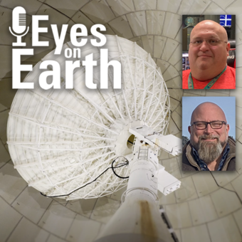
Working with film has always been part of EROS’ 50-year history. How did EROS end up with an extensive film archive, and how are we making that data available to users? In this episode of Eyes on Earth, we talk about the custom scanners built in-house from discarded parts to digitally capture historical aerial photos and declassified spy satellite images.
Eyes on Earth
Eyes on Earth is a podcast on remote sensing, Earth observation, land change and science, brought to you by the USGS Earth Resources Observation and Science (EROS) Center.
YouTube Podcasts
YouTube Podcasts
Apple Podcasts
Apple Podcasts
RSS Feed
RSS Feed
Click on an episode title below to visit the episode page. Episode pages include related content, transcript access, and full episode credits.
Search the podcast archive by topic here.
The Eyes on Earth podcast is currently hosted by Tom Adamson, Jane Lawson, and Sheri Levisay (contractors for USGS EROS). Episodes are produced by Tom Adamson. Past hosts include John Hult and Steve Young (contractors for USGS EROS). Past producers include John Hult and Brian Hauge (contractors for USGS EROS).
Latest Episodes
Episode 134 – Data Accuracy: The Calibration and Validation of Landsat
Media

Sources/Usage: Public Domain. View Media Details
Landsat is the longest-running, continuously operating record of Earth observations, and it’s the gold standard reference point that other civil and commercial satellite programs trust. If a researcher is studying multiple Landsat images of the same spot on Earth, and there is something in those images that suggests a change, that researcher needs to have the confidence that that change is a real change on the landscape and not because of something that changed or degraded in the sensor. Think of it this way. We are using a system to quantify changes on the Earth—we need to make sure the system itself is not changing.
Guest: Cody Anderson, USGS EROS
Episode 133 – Vietnam War Bomb Craters
Media

Sources/Usage: Public Domain. View Media Details
Declassified spy satellite imagery, distributed by the USGS EROS Center, is finding fascinating uses since being made available to the public starting in the 1990s. In this episode, we talk with Philipp Barthelme from the University of Edinburgh, who used imagery from the declassified HEXAGON and CORONA satellites to map bomb craters and herbicide spray lines from the Vietnam War. These features appear in the black and white photos quite clearly, so Barthelme worked out machine learning methods to automatically detect them. This method can help narrow down where to search for unexploded weapons and focus on the areas that are most contaminated.
Guest: Philipp Barthelme, University of Edinburgh, Edinburgh, United Kingdom
Episode 132 – Moving Forward with AI at EROS
Media

Sources/Usage: Public Domain. View Media Details
Eyes on Earth tackles artificial intelligence (AI) in a 2-part episode. AI is quickly becoming a necessary part of geospatial work at EROS, helping us efficiently do science to better manage our world. In Part 1, we talked about AI’s current and upcoming impact on our work at EROS and clarified some of the AI jargon. The successful use of AI to make NLCD an annual product was a key example.
In Part 2, we discuss another potential application of AI—keeping Landsat satellites safe and healthy in orbit. Additionally, guests comment on how readily staff are adapting to using this rapidly evolving technology. They discuss the biggest benefits and challenges we face in using AI. Among the benefits are making EROS data products more accurate and reliable and getting them to the public in a more timely fashion.
Guests:
Pete Doucette, USGS EROS
Terry Sohl, USGS EROS
Neal Pastick, USGS EROS
Rylie Fleckenstein, contractor for USGS EROS
Episode 131 – Using AI in Geospatial Work
Media

Sources/Usage: Public Domain. View Media Details
Eyes on Earth tackles artificial intelligence (AI) in a 2-part episode. AI is quickly becoming a necessary part of geospatial work at EROS, helping us efficiently do science to better manage our world. In Part 1, EROS Director Pete Doucette discusses AI and its current and upcoming impact on our work at EROS. To help clarify AI terminology such as machine learning, deep learning, neural networks, transformers, and foundation models, we also talk to scientists who are using AI. And we learn about how AI enabled the National Land Cover Database (NLCD) to become an annual product.
Part 2 will discuss one more potential application of AI—keeping Landsat satellites safe and healthy in orbit. We also have all of our guests comment on AI’s challenges and benefits.
Guests:
Pete Doucette, USGS EROS
Terry Sohl, USGS EROS
Neal Pastick, USGS EROS
Rylie Fleckenstein, contractor for USGS EROS
Episode 130 – NLCD Accuracy
Media

Sources/Usage: Public Domain. View Media Details
Every pixel has a story. At least that’s how land remote sensing scientist Jo Horton sees it. The new Annual National Land Cover Database (NLCD) was just released in October 2024. NLCD is widely used for land cover and change research in the U.S. That’s why the Reference and Validation team provides accuracy metrics to users, and this work allows EROS to move land cover mapping science forward. Learn about what the Reference and Validation team does and what they are looking for when they closely examine thousands of Landsat sample pixels across the conterminous U.S. It sometimes involves some detective work as they figure out the stories of each pixel across time.
Guest: Jo Horton (contractor for USGS EROS)
Episode 129 – What Happens During a Landsat Pass?
Media
Sources/Usage: Public Domain. View Media Details
In this episode, we talk to ground station technicians to find out how Landsat satellite data gets from the spacecraft to EROS and then to the archive. We see what it’s like in EROS’s Landsat operations room and what the technicians do before, during, and after a Landsat pass. The task of making sure those bits of data make their way to the archive so it can be used for land change science occurs for them several times a day. As routine as it might be sometimes, they are a small but important part of a large mission that is documenting global land change.
Guests:
Aaron Hensley (contractor for USGS EROS)
Eric Gaspar (contractor for USGS EROS)
Episode 128 – 2024 EROS Fall Poster Session
Media

Sources/Usage: Public Domain. View Media Details
In this episode, we mingle at the 2024 EROS Fall Poster Session. A poster session is essentially a way for scientists to share their work with their colleagues in a public forum. About 30 posters were on display in the EROS atrium from EROS staff and several students from South Dakota State University and the University of South Dakota. We talked to a few of them to get quick summaries of their research.
Guests:
Natalie Liberati (South Dakota State University)
Brenden Elwer (South Dakota State University)
Madison DeJarlais (South Dakota State University)
Abhinav Chandel (University of South Dakota)
Jo Horton (KBR, contractor for USGS EROS)
Hua Shi (ASRC Federal Data Solutions, contractor for USGS EROS)
Lei Ji (ASRC Federal Data Solutions, contractor for USGS EROS)
Tim Smith (KBR, contractor for USGS EROS)
Brent Nelson (KBR, contractor for USGS EROS)
Brent Johnson (KBR, contractor for USGS EROS)
Related
Find past episodes and their episode pages below.
Click on an episode title to visit the episode page. Episode pages include related content, transcript access, and full episode credits.
Filter Total Items: 134
Eyes on Earth Episode 110 – Geospatial Information Response Team
When nature unleashes its fury, whether in an earthquake or storm, the Geospatial Information Response Team ensures data gets to responders quickly.
Eyes on Earth Episode 109 – Fall 2023 EROS Poster Session
If you’ve never been to a scientific poster session, this episode will provide a taste of what it’s like.
Eyes on Earth Episode 108 – Landsat 8’s 100th Drag Make-Up Maneuver
The USGS EROS Landsat Flight Operations Team recently completed the 100th Drag Make-Up maneuver for Landsat 8.
Eyes on Earth Episode 107 – EROS 50th: Land Cover, Part 2
The next step for two strong land cover products at USGS EROS is to combine them to create something even better.
Eyes on Earth Episode 106 – EROS 50th: Land Cover, Part 1
USGS EROS contributed to a better understanding of the Earth’s surface by leading early land cover mapping efforts.
Eyes on Earth Episode 105 – Imagery Challenges of Alaska
Remote sensing is the best way to observe Alaska, but our largest state also presents unique challenges for scientists to get clear imagery.
Eyes on Earth Episode 104 – EROS 50th: Alumni and Friends, Part 2
This second special alumni edition of the Eyes on Earth podcast features stories told by former employees and others about science, technology and the international outlook at EROS.
Eyes on Earth Episode 103 – EROS 50th: Alumni and Friends, Part 1
This special alumni edition of the Eyes on Earth podcast features stories told by former employees and others about the history and people at EROS.
Eyes on Earth Episode 102 – LANDFIRE 2022 Update
LANDFIRE, a trusted source for fire-related data, has started releasing key information even faster.
Eyes on Earth Episode 101 – EROS 50th: Director Pete Doucette Looks Ahead
In its 50th anniversary year, EROS received a new leader who celebrates the past while embracing the future.
Eyes on Earth Episode 100 – EROS 50th: Our Legacy
Join us for a special 100th episode of Eyes on Earth as we bring back the past!
Eyes on Earth Episode 99 – EROS 50th: Interns Who Stayed
EROS has always welcomed interns to work and learn at the center—and many of them have stayed on over the years, some for decades!
Eyes on Earth audio archive
Filter Total Items: 135
Eyes on Earth Episode 93 – EROS 50th: Film Scanning
Working with film has always been part of EROS’ 50-year history. How did EROS end up with an extensive film archive, and how are we making that data available to users? In this episode of Eyes on Earth, we talk about the custom scanners built in-house from discarded parts to digitally capture historical aerial photos and declassified spy satellite images.

Eyes on Earth Episode 92 – EROS 50th: The Library and Science Support
The Don Lee Kulow Library has been supporting scientific research at EROS since before the facility opened its doors in 1973.
The Don Lee Kulow Library has been supporting scientific research at EROS since before the facility opened its doors in 1973.

Eyes on Earth Episode 91 – Intro to AmericaView
AmericaView aims to advance Earth observation education through a network of programs based at universities in more than 40 states.
AmericaView aims to advance Earth observation education through a network of programs based at universities in more than 40 states.

Eyes on Earth Episode 90 – Landsat 8 Turns 10
Originally called the Landsat Data Continuity Mission, Landsat 8 launched on February 11, 2013. In this episode of Eyes on Earth, we talk about the 10^th^ anniversary of Landsat 8 being in orbit and its value to the remote sensing community.
Originally called the Landsat Data Continuity Mission, Landsat 8 launched on February 11, 2013. In this episode of Eyes on Earth, we talk about the 10^th^ anniversary of Landsat 8 being in orbit and its value to the remote sensing community.

Eyes on Earth Episode 89 - EROS Workers and Weather
When the snow gets deep and the wind blows, it can be challenging for workers to travel to the USGS EROS Center, located several miles north of Sioux Falls, SD, on what used to be farmland.
When the snow gets deep and the wind blows, it can be challenging for workers to travel to the USGS EROS Center, located several miles north of Sioux Falls, SD, on what used to be farmland.

Eyes on Earth Episode 88 – Landsat 5’s Significance, Part 2
Designed to last three years, Landsat 5 was launched in 1984 and transmitted data until the launch of Landsat 8 in 2013.
Designed to last three years, Landsat 5 was launched in 1984 and transmitted data until the launch of Landsat 8 in 2013.

Eyes on Earth Episode 87 - Landsat 5's Significance, Part 1
Designed to last three years, Landsat 5 launched in 1984 and transmitted data until the launch of Landsat 8 in 2013.
Designed to last three years, Landsat 5 launched in 1984 and transmitted data until the launch of Landsat 8 in 2013.

Eyes on Earth Episode 86 - Tours at EROS
The USGS EROS Center is the home of the Landsat satellite archive. This data center and science center located on a former farm near Sioux Falls, SD, is one of the largest civilian archives of land imaging in the world.
The USGS EROS Center is the home of the Landsat satellite archive. This data center and science center located on a former farm near Sioux Falls, SD, is one of the largest civilian archives of land imaging in the world.

Eyes on Earth Episode 85 - Landsat 7 Extended Science Mission
Landsat 7’s nominal science mission ended in April 2022 after nearly 23 years of acquiring Earth imagery from 705 kilometers above the Earth. Landsat 7 is now in an extended science mission after having its orbit lowered by about 8 kilometers to make way for Landsat 9.
Landsat 7’s nominal science mission ended in April 2022 after nearly 23 years of acquiring Earth imagery from 705 kilometers above the Earth. Landsat 7 is now in an extended science mission after having its orbit lowered by about 8 kilometers to make way for Landsat 9.

Eyes on Earth Episode 84 - Hurricane Disturbance Mapping
When disaster strikes, near-real-time images of its effects can be invaluable. In this episode of Eyes on Earth, we learn about how a newly developed system using the Harmonized Landsat Sentinel-2 dataset and artificial intelligence was put to the test when Hurricane Ian tore through Florida in late September 2022.
When disaster strikes, near-real-time images of its effects can be invaluable. In this episode of Eyes on Earth, we learn about how a newly developed system using the Harmonized Landsat Sentinel-2 dataset and artificial intelligence was put to the test when Hurricane Ian tore through Florida in late September 2022.

Eyes on Earth Episode 83 - ECOSTRESS and Burn Severity
ECOSTRESS, or ECOsystem Spaceborne Thermal Radiometer Experiment on Space Station, data provides variables related to plant water stress, including evapotranspiration, evaporative stress index and water use efficiency. The NASA Land Processes Distributed Active Archive Center (LP DAAC) at EROS provides storage and distribution of ECOSTRESS data.
ECOSTRESS, or ECOsystem Spaceborne Thermal Radiometer Experiment on Space Station, data provides variables related to plant water stress, including evapotranspiration, evaporative stress index and water use efficiency. The NASA Land Processes Distributed Active Archive Center (LP DAAC) at EROS provides storage and distribution of ECOSTRESS data.

Eyes on Earth Episode 82 - Introduction to GEDI
The Global Ecosystem Dynamics Investigation, or GEDI, instrument on the International Space Station acquires lidar waveforms to observe the Earth’s surface in 3D. The GEDI lidar measures the height and density of objects, so it provides information such as surface elevation and tree canopy height and cover.
The Global Ecosystem Dynamics Investigation, or GEDI, instrument on the International Space Station acquires lidar waveforms to observe the Earth’s surface in 3D. The GEDI lidar measures the height and density of objects, so it provides information such as surface elevation and tree canopy height and cover.

Eyes on Earth Episode 81 - Tour of the EROS Radome
The Landsat satellites have been collecting Earth imagery for more than 50 years. A key piece of equipment that moves the data from the spacecraft to the archive so researchers can use it is the antenna at the EROS Center. The antenna and its radome have a fascinating history of their own that adds to the overall Landsat story.
The Landsat satellites have been collecting Earth imagery for more than 50 years. A key piece of equipment that moves the data from the spacecraft to the archive so researchers can use it is the antenna at the EROS Center. The antenna and its radome have a fascinating history of their own that adds to the overall Landsat story.

Eyes on Earth Episode 80 - ECOSTRESS and Carbon
ECOSTRESS, which stands for the ECOsystem Spaceborne Thermal Radiometer Experiment on Space Station, collects land surface temperatures in an effort to answer questions about plants’ use of water. The NASA Land Processes Distributed Active Archive Center (LP DAAC) at EROS has provided storage and distribution of ECOSTRESS data for four years now and counting.
ECOSTRESS, which stands for the ECOsystem Spaceborne Thermal Radiometer Experiment on Space Station, collects land surface temperatures in an effort to answer questions about plants’ use of water. The NASA Land Processes Distributed Active Archive Center (LP DAAC) at EROS has provided storage and distribution of ECOSTRESS data for four years now and counting.

Eyes on Earth Episode 79 – Landsat Global Archive Consolidation
The Landsat archive at EROS contains an unparalleled 50 years of Earth observation data. But with earlier technologies, some Landsat scenes were collected and stored only by international ground receiving stations rather than in the central archive at EROS.
The Landsat archive at EROS contains an unparalleled 50 years of Earth observation data. But with earlier technologies, some Landsat scenes were collected and stored only by international ground receiving stations rather than in the central archive at EROS.

Eyes on Earth Episode 78 - Landsat 50 Lookback
Government officials and scientists had high hopes for Landsat when the first experimental satellite launched July 23, 1972. Those hopes were soon realized when imagery came back depicting features never before seen. Since then, an archive of imagery surpassing 10 million scenes has amassed at EROS, collected from eight different Landsat satellites.
Government officials and scientists had high hopes for Landsat when the first experimental satellite launched July 23, 1972. Those hopes were soon realized when imagery came back depicting features never before seen. Since then, an archive of imagery surpassing 10 million scenes has amassed at EROS, collected from eight different Landsat satellites.

Eyes on Earth Episode 77 – ECOSTRESS and Urban Heat
We don't need a scientist to tell us that city streets catch and hold heat. Anyone who's walked barefoot from a parking lot to a beach can tell you that. What scientists can help us understand, particularly scientists who work with spaceborne, remotely sensed data, is just how big a difference there is between cities and the countryside.
We don't need a scientist to tell us that city streets catch and hold heat. Anyone who's walked barefoot from a parking lot to a beach can tell you that. What scientists can help us understand, particularly scientists who work with spaceborne, remotely sensed data, is just how big a difference there is between cities and the countryside.

Eyes on Earth Episode 76 – ECOSTRESS and Disease Risk
Spaceborne sensors orbit hundreds of miles over our heads. Even the most advanced among them struggle to capture high-resolution imagery of individual human beings. Mosquitos, of course, are far smaller than we are. Clearly, sensors on a satellite or space station can’t see them.
Spaceborne sensors orbit hundreds of miles over our heads. Even the most advanced among them struggle to capture high-resolution imagery of individual human beings. Mosquitos, of course, are far smaller than we are. Clearly, sensors on a satellite or space station can’t see them.

Eyes on Earth Episode 75 – Mapping Dust Sources Worldwide
Clouds of dust kicked up in places like the Sahara can travel thousands of miles across the planet. We can see those clouds in satellite imagery, but we don’t typically know much about the composition of that dust. That’s a huge blind spot, because those unknown characteristics—such as the particles’ lightness or darkness—have an impact on what they do.
Clouds of dust kicked up in places like the Sahara can travel thousands of miles across the planet. We can see those clouds in satellite imagery, but we don’t typically know much about the composition of that dust. That’s a huge blind spot, because those unknown characteristics—such as the particles’ lightness or darkness—have an impact on what they do.

Eyes on Earth Episode 74 – A Satellite Cross Calibration Mission
When the first Landsat satellite launched 50 years ago, it was the only game in town in terms of civilian land remote sensing. In the years that followed, a host of satellites have launched to serve similar purposes. But that data doesn't always play well together.
When the first Landsat satellite launched 50 years ago, it was the only game in town in terms of civilian land remote sensing. In the years that followed, a host of satellites have launched to serve similar purposes. But that data doesn't always play well together.

Eyes on Earth Episode 73 – Global Water Use
Some plants are simply better at making use of their water supply than others. More efficient plants can capture more carbon with less water, which has implications for carbon sequestration and ultimately for climate change modeling. In other words, the more we understand about water use efficiency, the more reliable our climate change models can be.
Some plants are simply better at making use of their water supply than others. More efficient plants can capture more carbon with less water, which has implications for carbon sequestration and ultimately for climate change modeling. In other words, the more we understand about water use efficiency, the more reliable our climate change models can be.
Related
Find past episodes and their episode pages below.
Click on an episode title to visit the episode page. Episode pages include related content, transcript access, and full episode credits.
Filter Total Items: 134
Eyes on Earth Episode 110 – Geospatial Information Response Team
When nature unleashes its fury, whether in an earthquake or storm, the Geospatial Information Response Team ensures data gets to responders quickly.
Eyes on Earth Episode 109 – Fall 2023 EROS Poster Session
If you’ve never been to a scientific poster session, this episode will provide a taste of what it’s like.
Eyes on Earth Episode 108 – Landsat 8’s 100th Drag Make-Up Maneuver
The USGS EROS Landsat Flight Operations Team recently completed the 100th Drag Make-Up maneuver for Landsat 8.
Eyes on Earth Episode 107 – EROS 50th: Land Cover, Part 2
The next step for two strong land cover products at USGS EROS is to combine them to create something even better.
Eyes on Earth Episode 106 – EROS 50th: Land Cover, Part 1
USGS EROS contributed to a better understanding of the Earth’s surface by leading early land cover mapping efforts.
Eyes on Earth Episode 105 – Imagery Challenges of Alaska
Remote sensing is the best way to observe Alaska, but our largest state also presents unique challenges for scientists to get clear imagery.
Eyes on Earth Episode 104 – EROS 50th: Alumni and Friends, Part 2
This second special alumni edition of the Eyes on Earth podcast features stories told by former employees and others about science, technology and the international outlook at EROS.
Eyes on Earth Episode 103 – EROS 50th: Alumni and Friends, Part 1
This special alumni edition of the Eyes on Earth podcast features stories told by former employees and others about the history and people at EROS.
Eyes on Earth Episode 102 – LANDFIRE 2022 Update
LANDFIRE, a trusted source for fire-related data, has started releasing key information even faster.
Eyes on Earth Episode 101 – EROS 50th: Director Pete Doucette Looks Ahead
In its 50th anniversary year, EROS received a new leader who celebrates the past while embracing the future.
Eyes on Earth Episode 100 – EROS 50th: Our Legacy
Join us for a special 100th episode of Eyes on Earth as we bring back the past!
Eyes on Earth Episode 99 – EROS 50th: Interns Who Stayed
EROS has always welcomed interns to work and learn at the center—and many of them have stayed on over the years, some for decades!
Eyes on Earth audio archive
Filter Total Items: 135
Eyes on Earth Episode 93 – EROS 50th: Film Scanning
Working with film has always been part of EROS’ 50-year history. How did EROS end up with an extensive film archive, and how are we making that data available to users? In this episode of Eyes on Earth, we talk about the custom scanners built in-house from discarded parts to digitally capture historical aerial photos and declassified spy satellite images.
Working with film has always been part of EROS’ 50-year history. How did EROS end up with an extensive film archive, and how are we making that data available to users? In this episode of Eyes on Earth, we talk about the custom scanners built in-house from discarded parts to digitally capture historical aerial photos and declassified spy satellite images.
Eyes on Earth Episode 92 – EROS 50th: The Library and Science Support
The Don Lee Kulow Library has been supporting scientific research at EROS since before the facility opened its doors in 1973.
The Don Lee Kulow Library has been supporting scientific research at EROS since before the facility opened its doors in 1973.
Eyes on Earth Episode 91 – Intro to AmericaView
AmericaView aims to advance Earth observation education through a network of programs based at universities in more than 40 states.
AmericaView aims to advance Earth observation education through a network of programs based at universities in more than 40 states.
Eyes on Earth Episode 90 – Landsat 8 Turns 10
Originally called the Landsat Data Continuity Mission, Landsat 8 launched on February 11, 2013. In this episode of Eyes on Earth, we talk about the 10^th^ anniversary of Landsat 8 being in orbit and its value to the remote sensing community.
Originally called the Landsat Data Continuity Mission, Landsat 8 launched on February 11, 2013. In this episode of Eyes on Earth, we talk about the 10^th^ anniversary of Landsat 8 being in orbit and its value to the remote sensing community.
Eyes on Earth Episode 89 - EROS Workers and Weather
When the snow gets deep and the wind blows, it can be challenging for workers to travel to the USGS EROS Center, located several miles north of Sioux Falls, SD, on what used to be farmland.
When the snow gets deep and the wind blows, it can be challenging for workers to travel to the USGS EROS Center, located several miles north of Sioux Falls, SD, on what used to be farmland.
Eyes on Earth Episode 88 – Landsat 5’s Significance, Part 2
Designed to last three years, Landsat 5 was launched in 1984 and transmitted data until the launch of Landsat 8 in 2013.
Designed to last three years, Landsat 5 was launched in 1984 and transmitted data until the launch of Landsat 8 in 2013.
Eyes on Earth Episode 87 - Landsat 5's Significance, Part 1
Designed to last three years, Landsat 5 launched in 1984 and transmitted data until the launch of Landsat 8 in 2013.
Designed to last three years, Landsat 5 launched in 1984 and transmitted data until the launch of Landsat 8 in 2013.
Eyes on Earth Episode 86 - Tours at EROS
The USGS EROS Center is the home of the Landsat satellite archive. This data center and science center located on a former farm near Sioux Falls, SD, is one of the largest civilian archives of land imaging in the world.
The USGS EROS Center is the home of the Landsat satellite archive. This data center and science center located on a former farm near Sioux Falls, SD, is one of the largest civilian archives of land imaging in the world.
Eyes on Earth Episode 85 - Landsat 7 Extended Science Mission
Landsat 7’s nominal science mission ended in April 2022 after nearly 23 years of acquiring Earth imagery from 705 kilometers above the Earth. Landsat 7 is now in an extended science mission after having its orbit lowered by about 8 kilometers to make way for Landsat 9.
Landsat 7’s nominal science mission ended in April 2022 after nearly 23 years of acquiring Earth imagery from 705 kilometers above the Earth. Landsat 7 is now in an extended science mission after having its orbit lowered by about 8 kilometers to make way for Landsat 9.
Eyes on Earth Episode 84 - Hurricane Disturbance Mapping
When disaster strikes, near-real-time images of its effects can be invaluable. In this episode of Eyes on Earth, we learn about how a newly developed system using the Harmonized Landsat Sentinel-2 dataset and artificial intelligence was put to the test when Hurricane Ian tore through Florida in late September 2022.
When disaster strikes, near-real-time images of its effects can be invaluable. In this episode of Eyes on Earth, we learn about how a newly developed system using the Harmonized Landsat Sentinel-2 dataset and artificial intelligence was put to the test when Hurricane Ian tore through Florida in late September 2022.
Eyes on Earth Episode 83 - ECOSTRESS and Burn Severity
ECOSTRESS, or ECOsystem Spaceborne Thermal Radiometer Experiment on Space Station, data provides variables related to plant water stress, including evapotranspiration, evaporative stress index and water use efficiency. The NASA Land Processes Distributed Active Archive Center (LP DAAC) at EROS provides storage and distribution of ECOSTRESS data.
ECOSTRESS, or ECOsystem Spaceborne Thermal Radiometer Experiment on Space Station, data provides variables related to plant water stress, including evapotranspiration, evaporative stress index and water use efficiency. The NASA Land Processes Distributed Active Archive Center (LP DAAC) at EROS provides storage and distribution of ECOSTRESS data.
Eyes on Earth Episode 82 - Introduction to GEDI
The Global Ecosystem Dynamics Investigation, or GEDI, instrument on the International Space Station acquires lidar waveforms to observe the Earth’s surface in 3D. The GEDI lidar measures the height and density of objects, so it provides information such as surface elevation and tree canopy height and cover.
The Global Ecosystem Dynamics Investigation, or GEDI, instrument on the International Space Station acquires lidar waveforms to observe the Earth’s surface in 3D. The GEDI lidar measures the height and density of objects, so it provides information such as surface elevation and tree canopy height and cover.
Eyes on Earth Episode 81 - Tour of the EROS Radome
The Landsat satellites have been collecting Earth imagery for more than 50 years. A key piece of equipment that moves the data from the spacecraft to the archive so researchers can use it is the antenna at the EROS Center. The antenna and its radome have a fascinating history of their own that adds to the overall Landsat story.
The Landsat satellites have been collecting Earth imagery for more than 50 years. A key piece of equipment that moves the data from the spacecraft to the archive so researchers can use it is the antenna at the EROS Center. The antenna and its radome have a fascinating history of their own that adds to the overall Landsat story.
Eyes on Earth Episode 80 - ECOSTRESS and Carbon
ECOSTRESS, which stands for the ECOsystem Spaceborne Thermal Radiometer Experiment on Space Station, collects land surface temperatures in an effort to answer questions about plants’ use of water. The NASA Land Processes Distributed Active Archive Center (LP DAAC) at EROS has provided storage and distribution of ECOSTRESS data for four years now and counting.
ECOSTRESS, which stands for the ECOsystem Spaceborne Thermal Radiometer Experiment on Space Station, collects land surface temperatures in an effort to answer questions about plants’ use of water. The NASA Land Processes Distributed Active Archive Center (LP DAAC) at EROS has provided storage and distribution of ECOSTRESS data for four years now and counting.
Eyes on Earth Episode 79 – Landsat Global Archive Consolidation
The Landsat archive at EROS contains an unparalleled 50 years of Earth observation data. But with earlier technologies, some Landsat scenes were collected and stored only by international ground receiving stations rather than in the central archive at EROS.
The Landsat archive at EROS contains an unparalleled 50 years of Earth observation data. But with earlier technologies, some Landsat scenes were collected and stored only by international ground receiving stations rather than in the central archive at EROS.
Eyes on Earth Episode 78 - Landsat 50 Lookback
Government officials and scientists had high hopes for Landsat when the first experimental satellite launched July 23, 1972. Those hopes were soon realized when imagery came back depicting features never before seen. Since then, an archive of imagery surpassing 10 million scenes has amassed at EROS, collected from eight different Landsat satellites.
Government officials and scientists had high hopes for Landsat when the first experimental satellite launched July 23, 1972. Those hopes were soon realized when imagery came back depicting features never before seen. Since then, an archive of imagery surpassing 10 million scenes has amassed at EROS, collected from eight different Landsat satellites.
Eyes on Earth Episode 77 – ECOSTRESS and Urban Heat
We don't need a scientist to tell us that city streets catch and hold heat. Anyone who's walked barefoot from a parking lot to a beach can tell you that. What scientists can help us understand, particularly scientists who work with spaceborne, remotely sensed data, is just how big a difference there is between cities and the countryside.
We don't need a scientist to tell us that city streets catch and hold heat. Anyone who's walked barefoot from a parking lot to a beach can tell you that. What scientists can help us understand, particularly scientists who work with spaceborne, remotely sensed data, is just how big a difference there is between cities and the countryside.
Eyes on Earth Episode 76 – ECOSTRESS and Disease Risk
Spaceborne sensors orbit hundreds of miles over our heads. Even the most advanced among them struggle to capture high-resolution imagery of individual human beings. Mosquitos, of course, are far smaller than we are. Clearly, sensors on a satellite or space station can’t see them.
Spaceborne sensors orbit hundreds of miles over our heads. Even the most advanced among them struggle to capture high-resolution imagery of individual human beings. Mosquitos, of course, are far smaller than we are. Clearly, sensors on a satellite or space station can’t see them.
Eyes on Earth Episode 75 – Mapping Dust Sources Worldwide
Clouds of dust kicked up in places like the Sahara can travel thousands of miles across the planet. We can see those clouds in satellite imagery, but we don’t typically know much about the composition of that dust. That’s a huge blind spot, because those unknown characteristics—such as the particles’ lightness or darkness—have an impact on what they do.
Clouds of dust kicked up in places like the Sahara can travel thousands of miles across the planet. We can see those clouds in satellite imagery, but we don’t typically know much about the composition of that dust. That’s a huge blind spot, because those unknown characteristics—such as the particles’ lightness or darkness—have an impact on what they do.
Eyes on Earth Episode 74 – A Satellite Cross Calibration Mission
When the first Landsat satellite launched 50 years ago, it was the only game in town in terms of civilian land remote sensing. In the years that followed, a host of satellites have launched to serve similar purposes. But that data doesn't always play well together.
When the first Landsat satellite launched 50 years ago, it was the only game in town in terms of civilian land remote sensing. In the years that followed, a host of satellites have launched to serve similar purposes. But that data doesn't always play well together.
Eyes on Earth Episode 73 – Global Water Use
Some plants are simply better at making use of their water supply than others. More efficient plants can capture more carbon with less water, which has implications for carbon sequestration and ultimately for climate change modeling. In other words, the more we understand about water use efficiency, the more reliable our climate change models can be.
Some plants are simply better at making use of their water supply than others. More efficient plants can capture more carbon with less water, which has implications for carbon sequestration and ultimately for climate change modeling. In other words, the more we understand about water use efficiency, the more reliable our climate change models can be.