The volcanic activity of Kilauea continues on the island of Hawaii. The latest eruption began within Halema'uma'u Crater on September 29. The previous eruption just ended in May 2021. Before that, major lava flows covered the eastern tip of Hawaii's Big Island in 2018. This latest eruption included vigorous fountaining up to 50-60m high.
Videos
Explore your world through the lens of our remote sensing and Earth science videos.
At EROS, we highlight new satellite images that feature striking changes to the Earth's surface. Our images come from locations around the world.
The volcanic activity of Kilauea continues on the island of Hawaii. The latest eruption began within Halema'uma'u Crater on September 29. The previous eruption just ended in May 2021. Before that, major lava flows covered the eastern tip of Hawaii's Big Island in 2018. This latest eruption included vigorous fountaining up to 50-60m high.
 Image of the Week - Volcano on Spain's La Palma Island
Fissures opened on the Cumbre Vieja volcano on September 19. It's the first time it has erupted since 1971.
Fissures opened on the Cumbre Vieja volcano on September 19. It's the first time it has erupted since 1971.
Landsat 9 Launch from Vandenberg: 3 Views
Landsat 9 Launch from Vandenberg: 3 Views
A short look back at the the history of Landsat launches through the historic articles of the Lompoc Record publication.
A short look back at the the history of Landsat launches through the historic articles of the Lompoc Record publication.
[Audio Descriptions]
A short look back at the the history of Landsat launches through the historic articles of the Lompoc Record publication.
[Audio Descriptions]
A short look back at the the history of Landsat launches through the historic articles of the Lompoc Record publication.
When #Landsat9 is launched from Lompoc, CA, a ULA Atlas V booster will lift it out over the Pacific Ocean, over 2,500 miles away in the first 15 minutes, rising quickly. If all goes as expected, about an hour later Landsat 9 will be in orbit, 438 miles high, falling around the Earth at 16,760 miles per hour, positioned to capture years of imagery.
When #Landsat9 is launched from Lompoc, CA, a ULA Atlas V booster will lift it out over the Pacific Ocean, over 2,500 miles away in the first 15 minutes, rising quickly. If all goes as expected, about an hour later Landsat 9 will be in orbit, 438 miles high, falling around the Earth at 16,760 miles per hour, positioned to capture years of imagery.
Social scientists at the U.S. Geological Survey (USGS) Fort Collins Science Center – in collaboration with the USGS National Land Imaging Program – conduct Earth observation user case studies using qualitative research methods.
Social scientists at the U.S. Geological Survey (USGS) Fort Collins Science Center – in collaboration with the USGS National Land Imaging Program – conduct Earth observation user case studies using qualitative research methods.
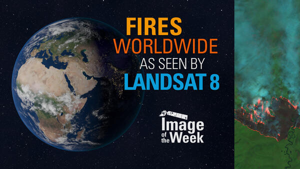
 Image of the Week - Fires Worldwide as Seen by Landsat 8
Landsat satellites acquire useful data on wildfires around the world. Their near infrared and shortwave infrared imaging allows for detection and mapping of fire, smoke, and burn scars often in remote areas.
In California: the Dixie Fire near Lake Almanor and the Caldor Fire near Lake Tahoe.
Landsat satellites acquire useful data on wildfires around the world. Their near infrared and shortwave infrared imaging allows for detection and mapping of fire, smoke, and burn scars often in remote areas.
In California: the Dixie Fire near Lake Almanor and the Caldor Fire near Lake Tahoe.
 Image of the Week - Ida Rains on Eastern Pennsylvania
The remnants of Hurricane Ida dumped several inches of rain on eastern Pennsylvania.
These Landsat images show the Schuylkill River west of Philadelphia where muddied waters rose in several communities.
This image from August 26th shows typical river levels in the Phoenixville area.
The remnants of Hurricane Ida dumped several inches of rain on eastern Pennsylvania.
These Landsat images show the Schuylkill River west of Philadelphia where muddied waters rose in several communities.
This image from August 26th shows typical river levels in the Phoenixville area.
 Image of the Week - Caldor Fire Expands Toward Lake Tahoe
The Caldor fire in California started on August 14, 2021 and quickly spread in high winds.
The fire continues to expand toward the Lake Tahoe area as residents evacuate.
This image was captured on August 21, the 8th day.
Landsat 8's near infrared and shortwave infrared bands reveal active fire, burn scars, and smoke.
 Earth Observation User Case: Speaking a New Language of Landsat
Social scientists at the U.S. Geological Survey (USGS) Fort Collins Science Center – in collaboration with the USGS National Land Imaging Program – conduct Earth observation user case studies using qualitative research methods.
Social scientists at the U.S. Geological Survey (USGS) Fort Collins Science Center – in collaboration with the USGS National Land Imaging Program – conduct Earth observation user case studies using qualitative research methods.
Harmonized Landsat and Sentinel-2 (HLS) data are here!
Harmonized Landsat and Sentinel-2 (HLS) data are here!
Harmonized Landsat and Sentinel-2 (HLS) data are here!
Harmonized Landsat and Sentinel-2 (HLS) data are here!
Harmonized Landsat and Sentinel-2 (HLS) data are here!
Harmonized Landsat and Sentinel-2 (HLS) data are here!
Harmonized Landsat and Sentinel-2 (HLS) version 2 data are here!
Harmonized Landsat and Sentinel-2 (HLS) version 2 data are here!
 Image of the Week - Dixie Fire Ravages Northern California
The Dixie Fire has become the largest single fire in California's recorded history. State fire officials don't list it at the top, however. The record is held by the massive August Complex fire of 2020 which burned over one million acres. The term "complex" is used when multiple fires in the same area ignite separately.
The Dixie Fire has become the largest single fire in California's recorded history. State fire officials don't list it at the top, however. The record is held by the massive August Complex fire of 2020 which burned over one million acres. The term "complex" is used when multiple fires in the same area ignite separately.
The Earth As Art project began in the early 2000s, and its original intent remains the same: to produce images that do not look like satellite images at first glance.
The Earth As Art project began in the early 2000s, and its original intent remains the same: to produce images that do not look like satellite images at first glance.
The Earth As Art project began in the early 2000s, and its original intent remains the same: to produce images that do not look like satellite images at first glance.
The Earth As Art project began in the early 2000s, and its original intent remains the same: to produce images that do not look like satellite images at first glance.
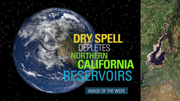
 Image of the Week - Dry Spell Depletes Northern California Reservoirs
A prolonged dry spell has sparked woes over water availability and wildfire in the western United States.
A prolonged dry spell has sparked woes over water availability and wildfire in the western United States.
Meet GEDI! The Global Ecosystem Dynamics Investigation sensor aboard the ISS!
Meet GEDI! The Global Ecosystem Dynamics Investigation sensor aboard the ISS!
One of the most cratered landscapes on Earth is part of the Nevada Desert called Yucca Flat. Landsat 8's near-infrared and short wave infrared imaging shows the pockmarked surface perhaps more reminiscent of other planetary bodies than Earth.
One of the most cratered landscapes on Earth is part of the Nevada Desert called Yucca Flat. Landsat 8's near-infrared and short wave infrared imaging shows the pockmarked surface perhaps more reminiscent of other planetary bodies than Earth.


